


May 19 Weather Sunday Starts Foggy The Warming With Sun And Summer Heat On The Way
Sunday May 19 Morning Report The aftermath of the rainy Saturday is plenty of leftover moisture. This has left us with a bit of humidity and areas of thick fog…
February 6 2024
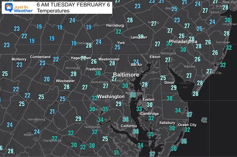
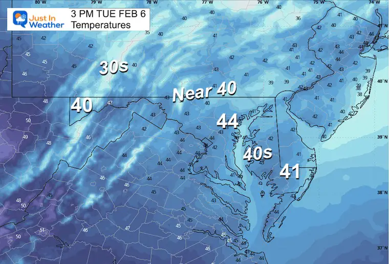
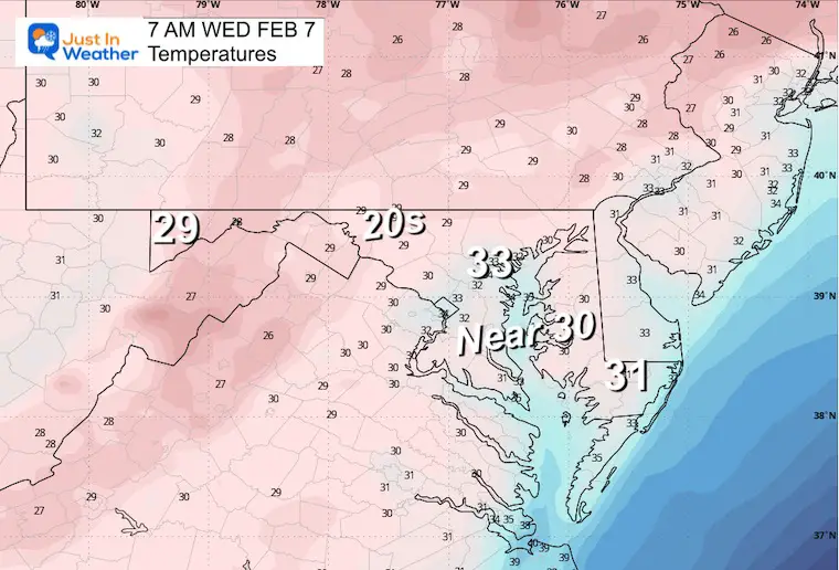
Tuesday Morning Update
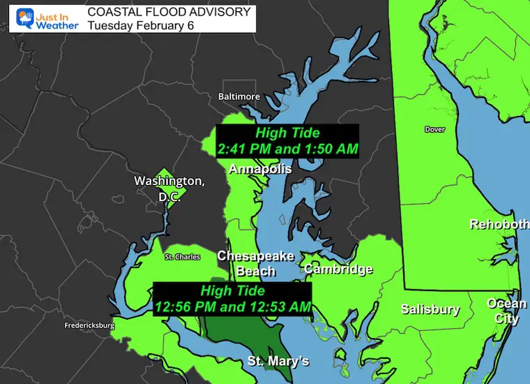
This week will remain quiet for us, with the exception of high water and some flooding along the Western Shore of the Chesapeake Bay.
Next weekend’s rain has appeared in the latest plots to break up and shoot south for Sunday. It is important to keep this change in mind because just farther out we will see a snow event plotted for next Tuesday. I am showing this to give some hope to snow lovers that winter will return this month. However, I DO NOT subscribe to believing a storm forecast eight days away. You may see it on other social media pages… I simply want to throw in my hope AND doubt for the specifics at the same time.
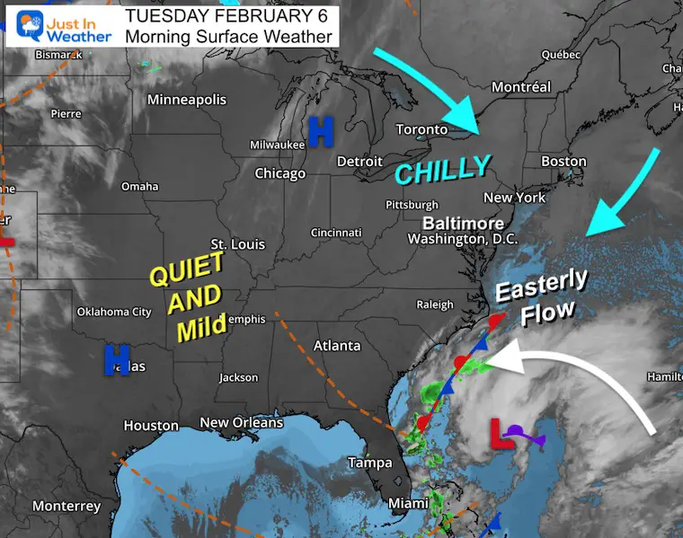
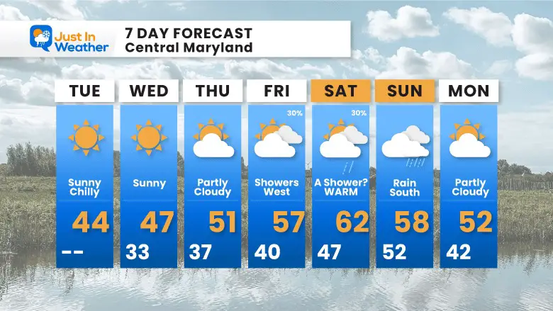
High Pressure is in control! This will set us up for much of this week with sunshine.
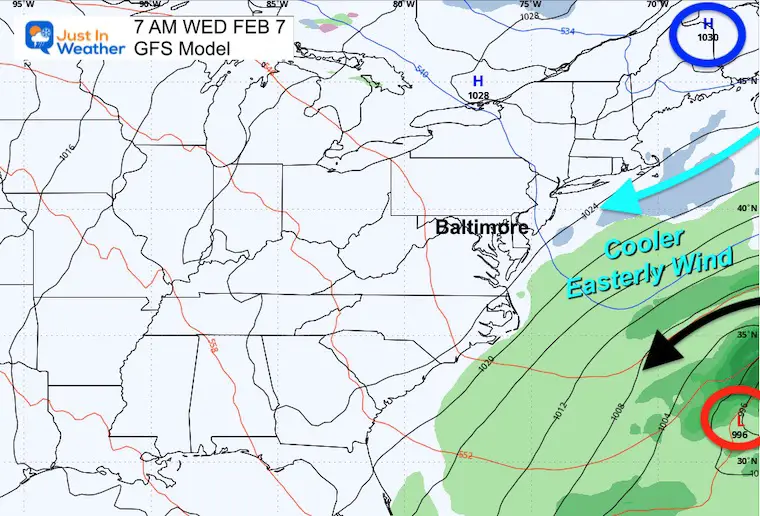
An onshore flow continues off the East Coast. This is why the coastal waters remain high with the risk of shoreline flooding.
Water Levels may produce flooding for the Annapolis Docks through Monday. The high water may also produce light to moderate flooding across Southern Maryland and parts of the Lower Eastern Shore.
Sunrise at 7:09 AM
Sunset at 5:33 PM
Normal Low in Baltimore: 25ºF
Record +1ºF in 1895
Normal High in Baltimore: 45ºF
Record 72ºF 1991
SEASONAL SNOW at BWI
9.1 inches
Click here for the maps and full report
Click here or the map to see: The Snow Report Ending Jan 16

The combination of High Pressure in Eastern Canada and Low Pressure off the Southeast US Coast will keep the onshore flow and high water.
The weather itself will be quiet and dry for us.
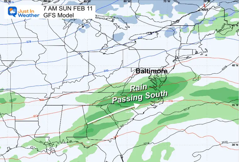
We will get more clouds, but at this time, it appears we will NOT get organized rain from this storm. The latest suggestion from the GFS Model is that the rain will break up over the mountains… the more organized Low may pass to our south on Sunday.
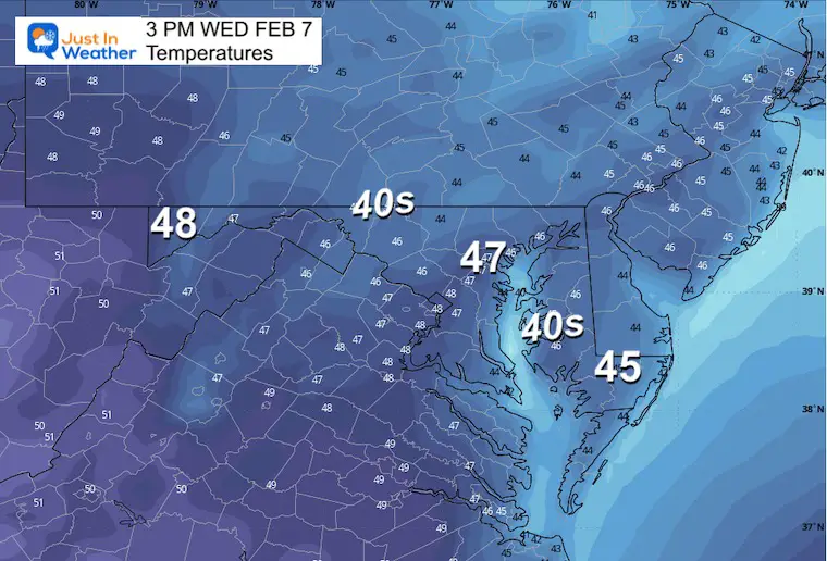
This will, however push in warmer temperatures and could get us into the 60s.
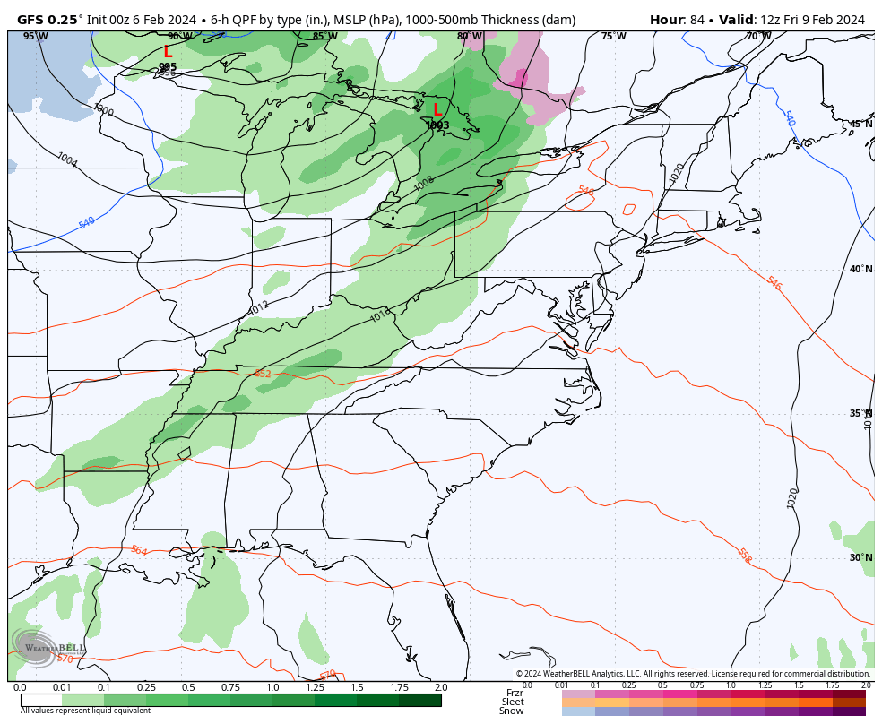
We might miss the rain in metro areas, with this plot showing it focused from Salisbury and southward.
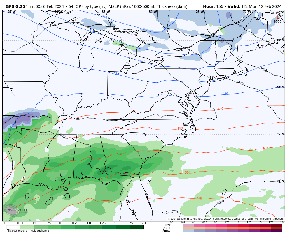
I’ve been showing a flip in the jet stream around Valentine’s Day. Here we see a SUGGESTION for the next storm system to bring us snow the day before on February 13.
This is 8 days away and something I would NOT play up. I am only showing this as a hint that we will get back into winter weather this month.
Please note that in the last two days, our weekend ahead looked wet. Now, that storm appears to break up. So long-range forecasting is still unreliable beyond 4 or 5 days with any winter storm.

Temperatures will remain seasonably cool for a few days, then warm up with the broken storm system this weekend.
I showed a chance for snow above… that is OUT OF THIS OUTLOOK. We shall see if it holds tomorrow.

Click to see more and ‘Book’ a visit to your school


Computer Models Support East Coast Storm Track

The latest NOAA report is confident in a Very Strong event. Possibly HISTORIC! This refers to the temperatures in the Pacific, with impacts on the US Winter Storm Track.

Winter Weather Folklore: Top 20 and more signals from nature for snow.
Winter Outlook 2024 From Two Farmers Almanacs Return to Cold and Snow
I am aware there are some spelling and grammar typos and occasional other glitches. I take responsibility for my mistakes and even the computer glitches I may miss. I have made a few public statements over the years, but if you are new here, you may have missed it: I have dyslexia and found out during my second year at Cornell University. It didn’t stop me from getting my meteorology degree and being the first to get the AMS CBM in the Baltimore/Washington region. One of my professors told me that I had made it that far without knowing and to not let it be a crutch going forward. That was Mark Wysocki, and he was absolutely correct! I do miss my mistakes in my own proofreading. The autocorrect spell check on my computer sometimes does an injustice to make it worse. I also can make mistakes in forecasting. No one is perfect at predicting the future. All of the maps and information are accurate. The ‘wordy’ stuff can get sticky. There has been no editor who can check my work when I need it and have it ready to send out in a newsworthy timeline. Barbara Werner is a member of the web team that helps me maintain this site. She has taken it upon herself to edit typos when she is available. That could be AFTER you read this. I accept this and perhaps proves what you read is really from me… It’s part of my charm. #FITF