


May 10 Chilly With More Rain Showers Today And Into Mothers Day Weekend
Friday May 10 Morning Report Today is the second day of the year, with sunrise before 6 AM in Baltimore, but like yesterday, we won’t see it. After a high…
Monday January 15, 2024
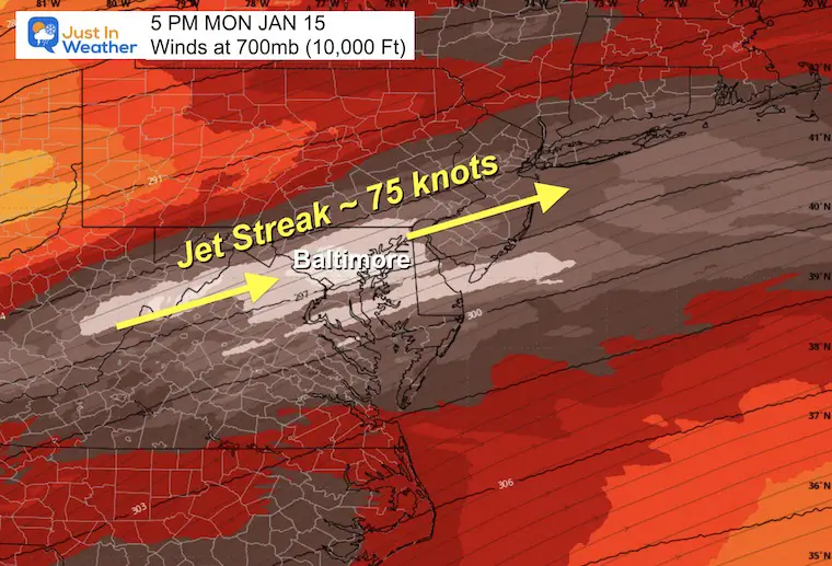
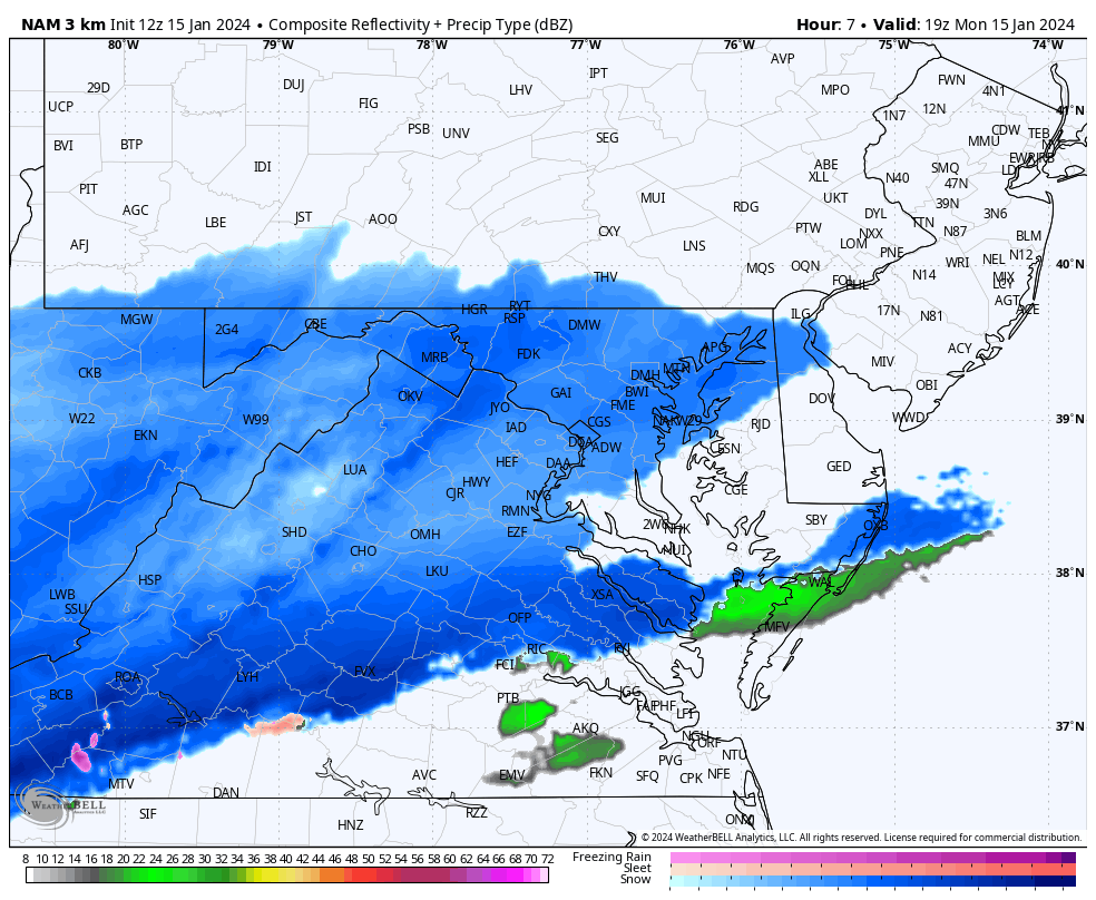
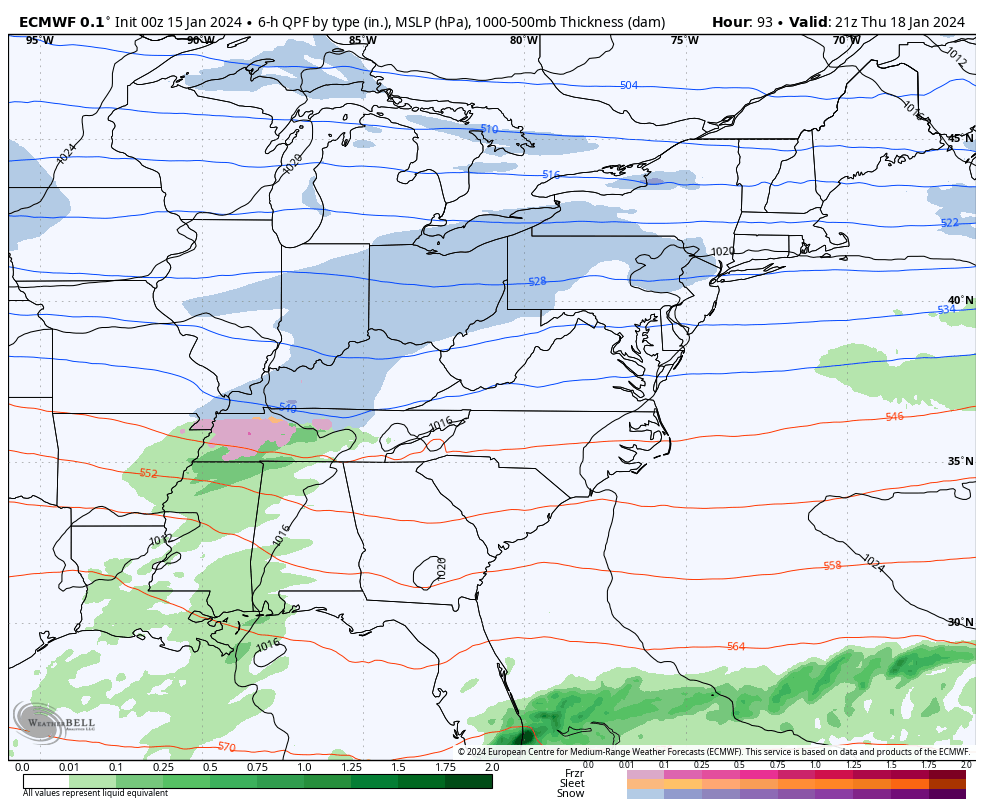
The hardest thing about this weather event has been the dynamics which are not a typical surface Low Pressure. There is one on the map, but the driving force is related to a pocket of fast winds, a jet steak, roughly 10,000 Ft aloft that will help enhance the snow we see this afternoon and tonight.
The air is cold enough for pure snow and stickage. We are watching that evolve this afternoon, which shows how the computer modeling is having a tough time with this.
What I can suggest is this:
Roads will be getting slick, and worse as the sun angle gets lower after 3 or 4 PM, and continue through this evening.
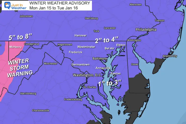
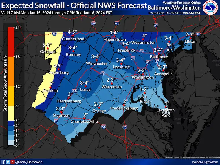
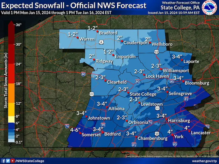
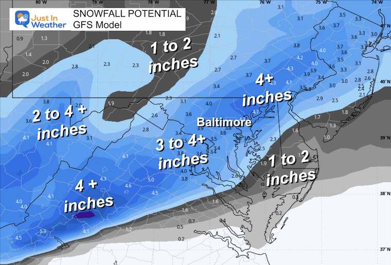
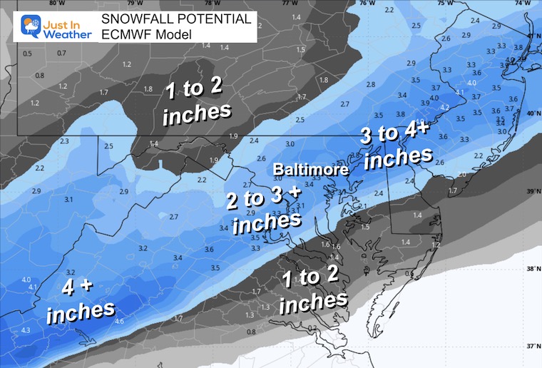
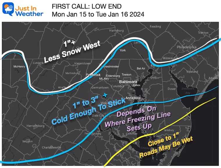
The snow will be steady at a light to moderate clip. Most areas will be in the 2 or 3 inch range. Farther south in the 1 to 2 inch category, but parts of central Maryland to the PA line may get close to 4 inches or so….
Tuesday Morning: Most taper off to showers by morning. Schools may be affected by delays or closings. I CANNOT confirm for you because each district or county will be determined by how well they can handle the cleanup.
I suggested snowfall. New Snow Maps are below.
This has been expanded farther down Maryland’s Eastern Shore and all of Pennsylvania.
Western Maryland’s Garrett County is under a Winter Storm Warning.
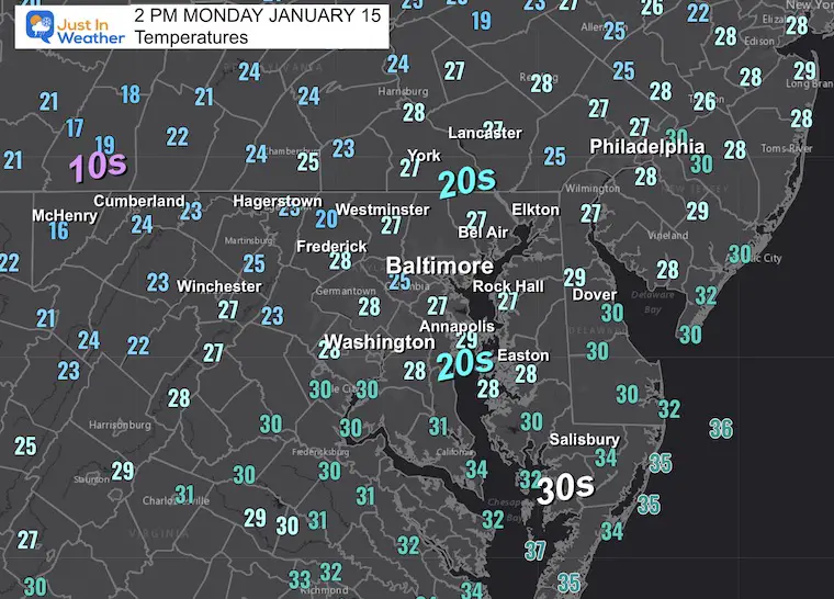
In the 20s, it means a lighter snowflake that blows around easier in the wind.
10s in the mountains may be for snow ratios 15 or 20 to 1″. So, less moisture can fluff up to result in higher snow amounts.
This is not showing winter mode, but it is mostly snow. Compare to the forecast maps below.
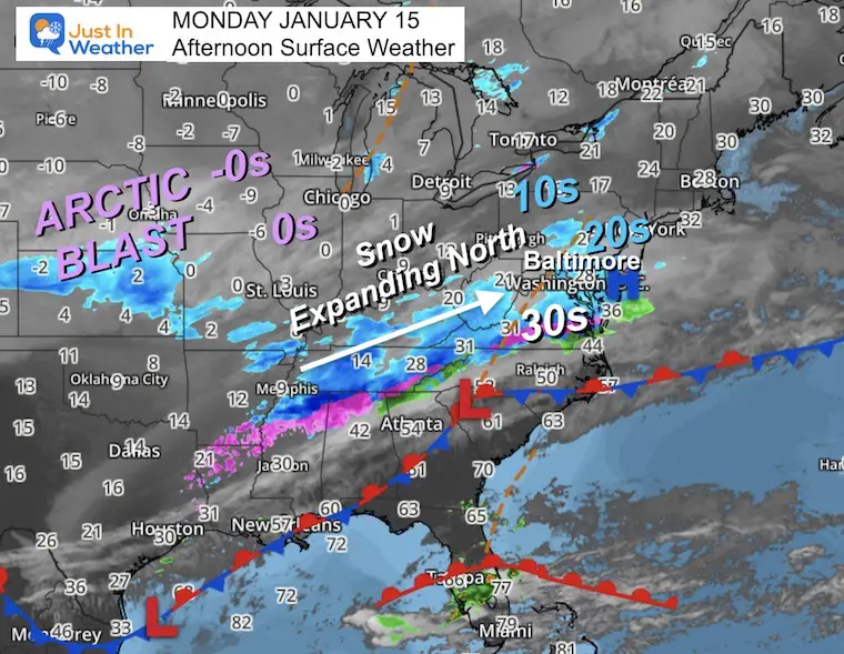
The steak of snow moving Northeast into our cold air is the main story. I’ve added the temps for context to the arctic air!
This Low Pressure on the surface is a reflection, but not the primary force.
The winds at 700mb or around 10,000 Ft are the force that will enhance the developing snow for the rest of the day!
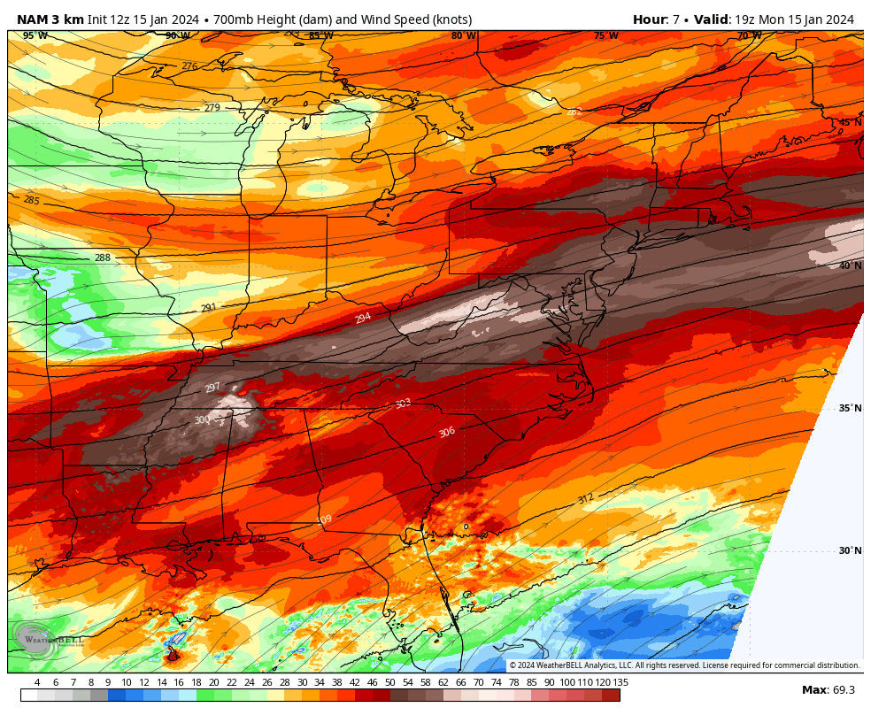
Here we see the Jet Streak that should enhance the snowfall.
This brings in the snow faster…
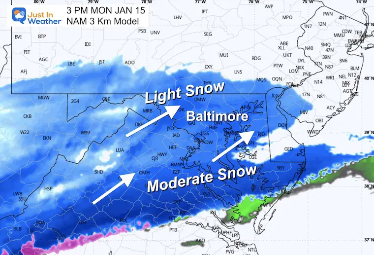
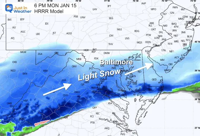
Here, we see the development of the snow through the night.
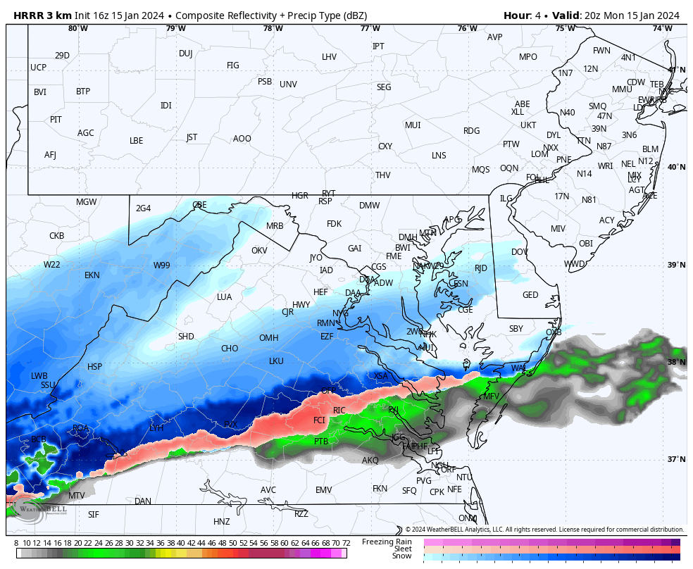
It suggests some sleet into metro Baltimore by morning… and lingering snow showers during the morning.
Still has many in the 2 to 4-inch range.
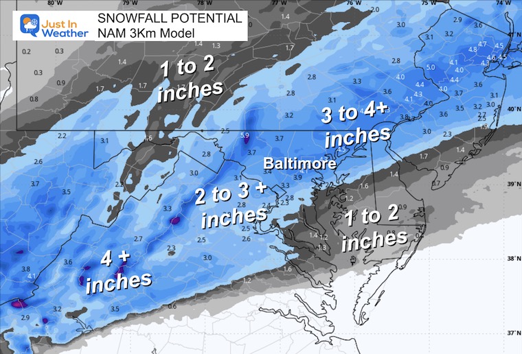
I will update this by evening if need be to increase the totals.
To be honest, I have low confidence in the modeling for two reasons:
We do tend to get into patterns with arctic air masses that follow this trend. So that is why I have shown it here. There is a tendency for the system to trend closer or (Northwest) of what we see plotted here… That may introduce a rain/mix line. Stay tuned. FITF
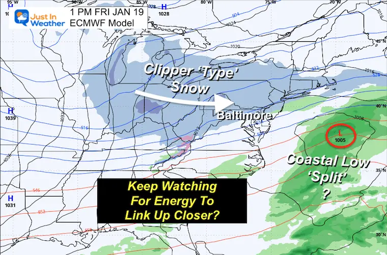
NOTE: The tendency is for the upper-level energy to speed up and pull back west/north. So, I think in a day or two, we may see this system come back together and keep snow on the outlook for Friday.
Remaining COLD! Wind Chill on Wednesday might be near zero!


Computer Models Support East Coast Storm Track

The latest NOAA report is confident in a Very Strong event. Possibly HISTORIC! This refers to the temperatures in the Pacific, with impacts on the US Winter Storm Track.

Winter Weather Folklore: Top 20 and more signals from nature for snow.
Winter Outlook 2024 From Two Farmers Almanacs Return to Cold and Snow


Click to see more and ‘Book’ a visit to your school

I am aware there are some spelling and grammar typos and occasional other glitches. I take responsibility for my mistakes and even the computer glitches I may miss. I have made a few public statements over the years, but if you are new here, you may have missed it: I have dyslexia and found out during my second year at Cornell University. It didn’t stop me from getting my meteorology degree and being the first to get the AMS CBM in the Baltimore/Washington region. One of my professors told me that I had made it that far without knowing and to not let it be a crutch going forward. That was Mark Wysocki, and he was absolutely correct! I do miss my mistakes in my own proofreading. The autocorrect spell check on my computer sometimes does an injustice to make it worse. I also can make mistakes in forecasting. No one is perfect at predicting the future. All of the maps and information are accurate. The ‘wordy’ stuff can get sticky. There has been no editor who can check my work when I need it and have it ready to send out in a newsworthy timeline. Barbara Werner is a member of the web team that helps me maintain this site. She has taken it upon herself to edit typos when she is available. That could be AFTER you read this. I accept this and perhaps proves what you read is really from me… It’s part of my charm.
#FITF