November 30, 2023
Thursday Morning Update
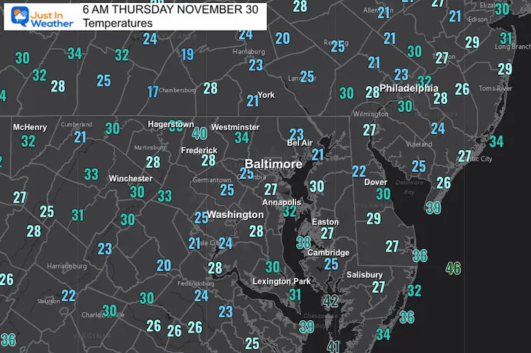
We are turning the corner on this last day of November. Yesterday was the coldest in many months, but the temperature at BWI reached 40ºF, keeping the trend that the weather station is warmer than all surroundings.
The streak continues with the last day in the 30s (there) on February 25. We may make a run for it later next week.
Morning Temperatures
Another chilly start but the afternoon will warm up.
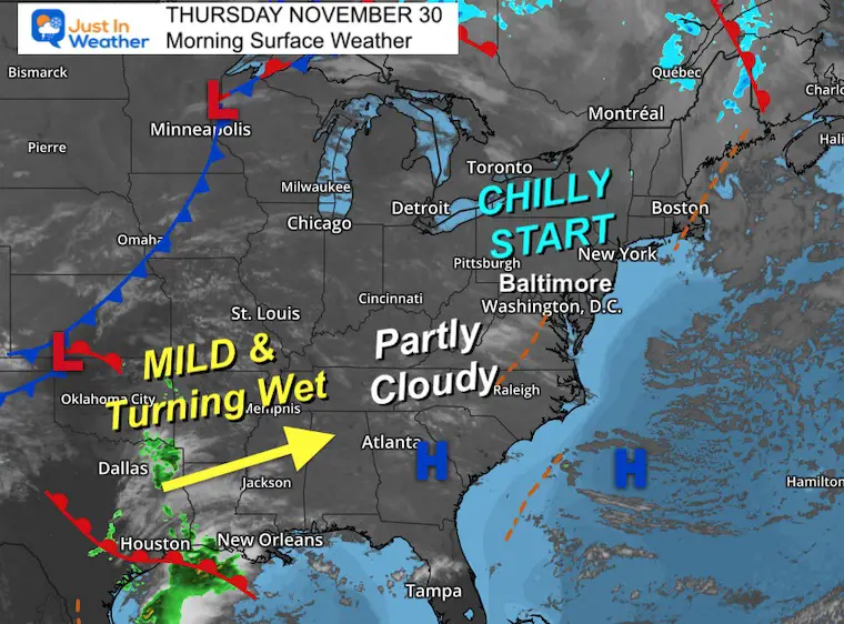
Morning Surface Weather
High Pressure is still in control and shifting off the coast. After our chilly start, the winds (light) from the south will help bring temps back to the 50s for a few days.
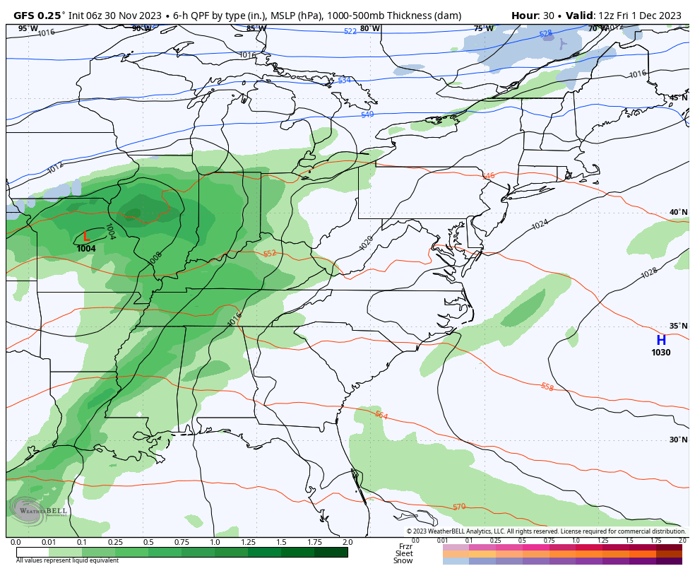
A developing storm will begin to expand rain from Lower Mississippi River Valley our way on Friday.
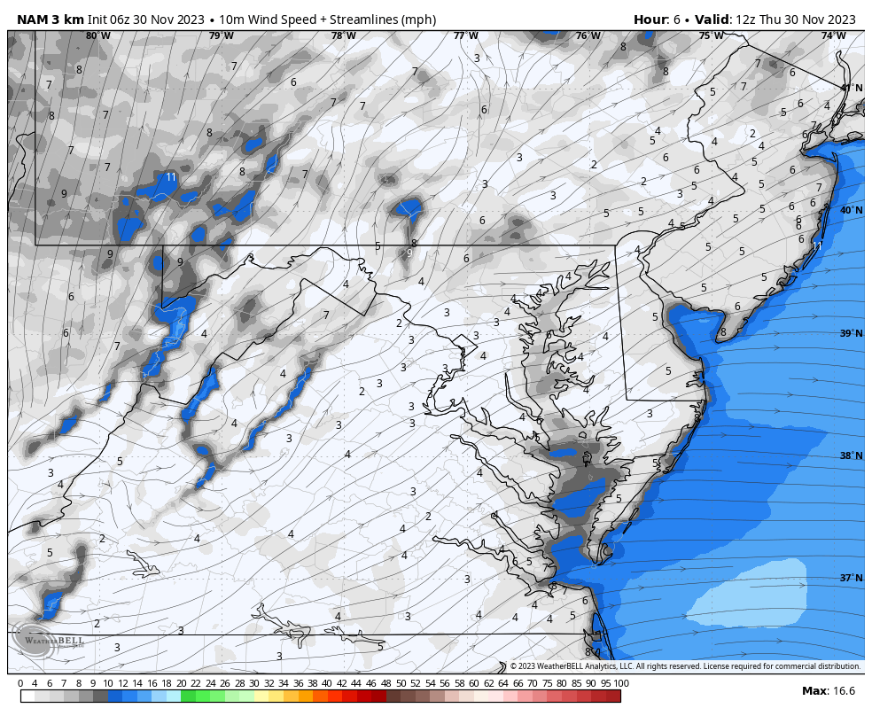
Wind Forecast 7 AM to 7 PM
The airflow will be light but will be shifting FROM the South.
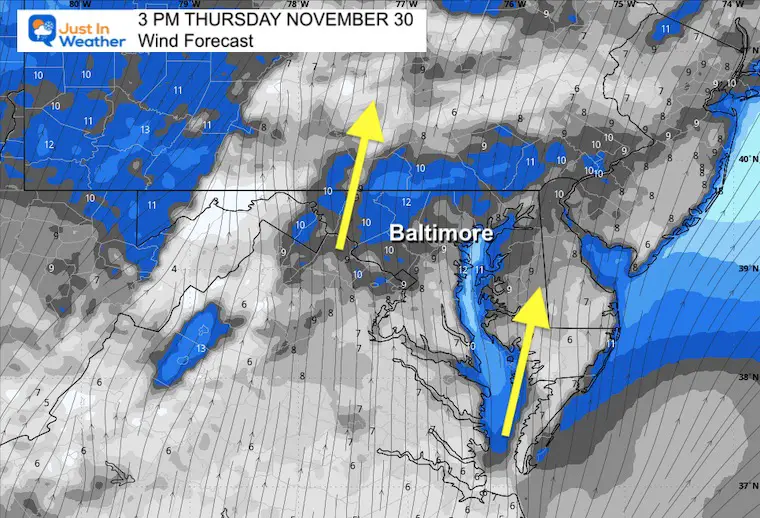
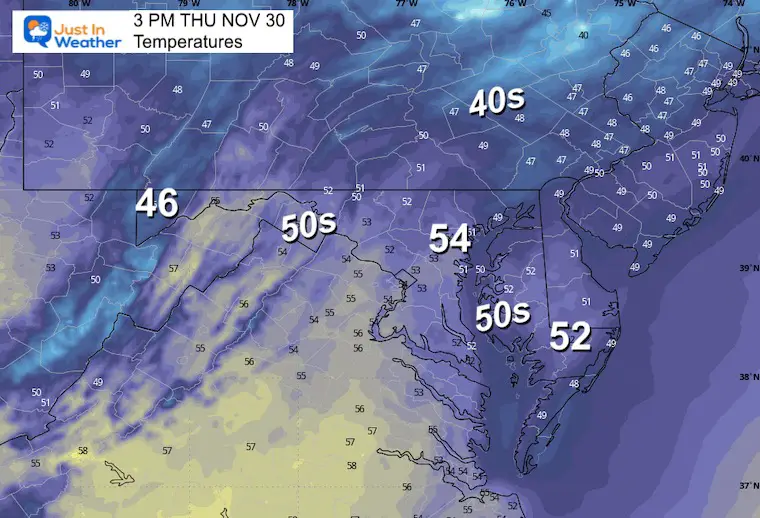
Snapshot at 3 PM
A light southerly wind will help to bring temperatures back to the 50s.
Afternoon Temperatures
CLIMATE DATA: Baltimore
TODAY November 30
Sunrise at 7:06 AM
Sunset at 4:45 PM
Normal Low in Baltimore: 33ºF
Record 12ºF in 1929
Normal High in Baltimore: 52ºF
Record 74ºF 1933
Winter Outlook Reports:
Winter Outlook Reports:

El Niño Winter Updates

Computer Models Support East Coast Storm Track

El Niño Advisory
The latest NOAA report is confident in a Very Strong event. Possibly HISTORIC! This refers to the temperatures in the Pacific, with impacts on the US Winter Storm Track.

Winter Weather Folklore: Top 20 and more signals from nature for snow.
NOAA’s Winter Outlook 2024
Winter Outlook 2024 From Two Farmers Almanacs Return to Cold and Snow
Subscribe for eMail Alerts
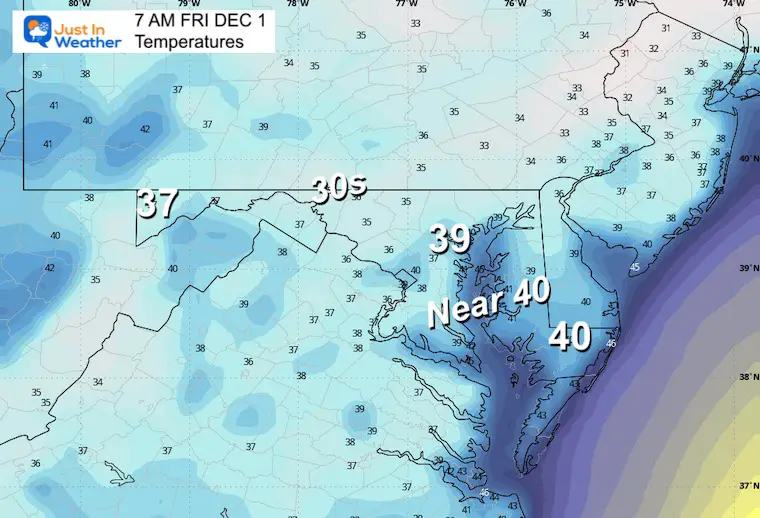
Friday Morning Temperatures
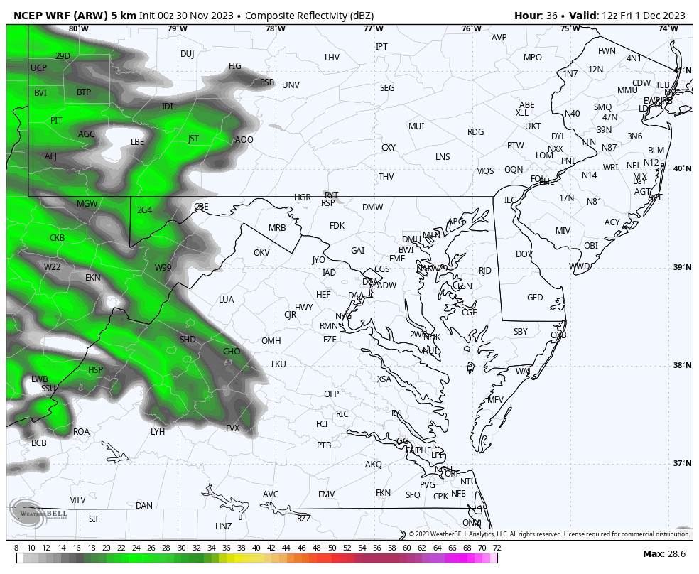
Radar Simulation: 7 AM to 7 PM
The morning may start wet in the mountains, then expand to metro areas by lunchtime. The afternoon may be soggy at times. The best description I can give you is: Showers with periods of rain that may last a few hours.
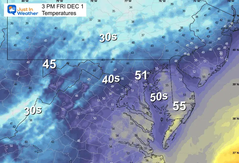
Afternoon Temperatures
Storm Simulation: Friday Morning To Monday Morning
Not a major storm, but the showers will build in from the south on Friday, and then another storm system will bring us rain on Sunday with showers into Monday.
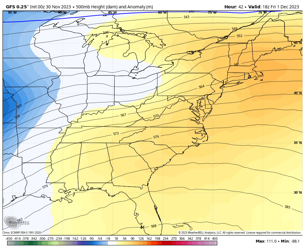
Jet Stream Simulation: Friday To Wednesday
After the mild weekend, colder air will arrive on Monday and will be reinforced on Wednesday.
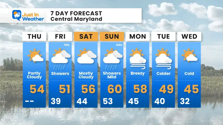
7 Day Forecast
Mild temperatures take us into the weekend. The rain will not be heavy or all day washouts. There will be showers and periods of rain that may last a few hours.
Colder air returns next week.
Explore More
Maryland Snow Climate History And Other Winter Pages

Faith in the Flakes Gear

STEM Assemblies/In School Fields Trips Are Back
Click to see more and ‘Book’ a visit to your school

Subscribe for eMail Alerts
Please share your thoughts and best weather pics/videos, or just keep in touch via social media
RESTATING MY MESSAGE ABOUT DYSLEXIA
I am aware there are some spelling and grammar typos and occasional other glitches. I take responsibility for my mistakes and even the computer glitches I may miss. I have made a few public statements over the years, but if you are new here, you may have missed it: I have dyslexia and found out during my second year at Cornell University. It didn’t stop me from getting my meteorology degree and being the first to get the AMS CBM in the Baltimore/Washington region. One of my professors told me that I had made it that far without knowing and to not let it be a crutch going forward. That was Mark Wysocki, and he was absolutely correct! I do miss my mistakes in my own proofreading. The autocorrect spell check on my computer sometimes does an injustice to make it worse. I also can make mistakes in forecasting. No one is perfect at predicting the future. All of the maps and information are accurate. The ‘wordy’ stuff can get sticky. There has been no editor who can check my work when I need it and have it ready to send out in a newsworthy timeline. Barbara Werner is a member of the web team that helps me maintain this site. She has taken it upon herself to edit typos when she is available. That could be AFTER you read this. I accept this and perhaps proves what you read is really from me… It’s part of my charm.
#FITF


