


May 9 Cooler With Rain And Severe Storm Risk Tonight South
Thursday May 9 Morning Report Today is the first day of the year with sunrise before 6 AM in Baltimore, but we won’t see it. After a high temperature of…
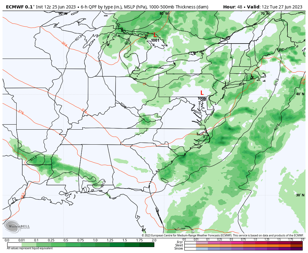
June 25 2023
Sunday Night Update
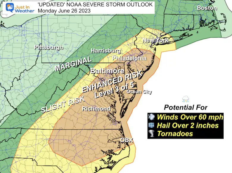
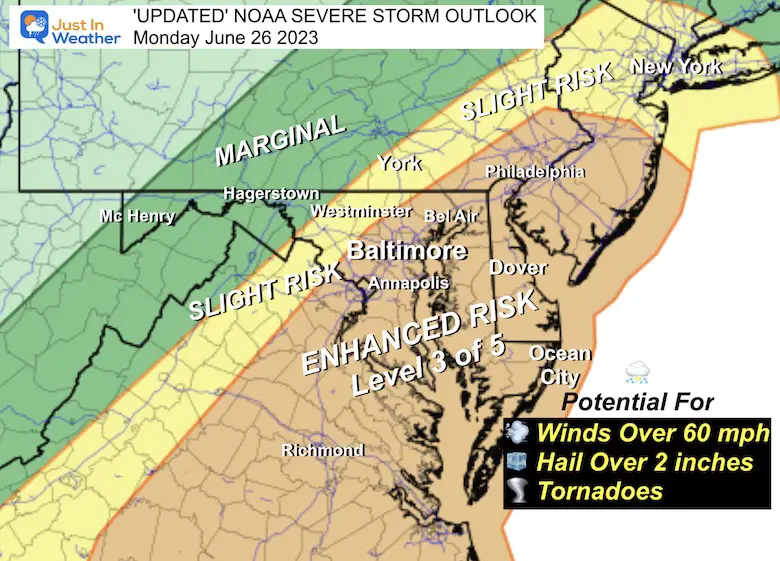
Severe weather has made quite a few headlines this past week. On Monday, it will be our turn in the Mid Atlantic region. The set up has increased the likelihood for impactful dangerous weather. NOAA has expanded their upgraded Enhanced Risk, level 3 of 5 on the scale, to include the big cities along I-95 and towards the coast.
A closer look at this map and the radar simulation is below.
Supercell thunderstorms may contain winds well over 60 mph, hail larger than 2 inches in diameter, and a few tornadoes with the capacity to exceed EF-2 intensity.
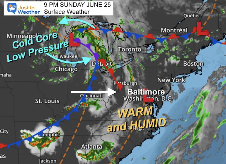
The set up is based around Low Pressure in the Great Lakes. This is the source of upper level winds and a cold core system. As this encounters the higher heat and humidity during Monday afternoon, there will be an eruption of severe weather across our region.
The Slight Risk (yellow) will be where the storms develop, but while they are still growing. This may include Winchester, VA, Frederick to Westminster in MD, and York/Lancaster in PA to metro New York.
Enhanced Risk (orange) is where the storms will encounter the max heat and humidity to reach a peak between 5 PM and 9 PM. This includes Richmond, Washington, Annapolis, Baltimore Philadelphia, and all of Delmarva to the beaches.
Individual hourly snapshots are below.
Watch the flare up of storms along a line that expands as it pushes farther east.
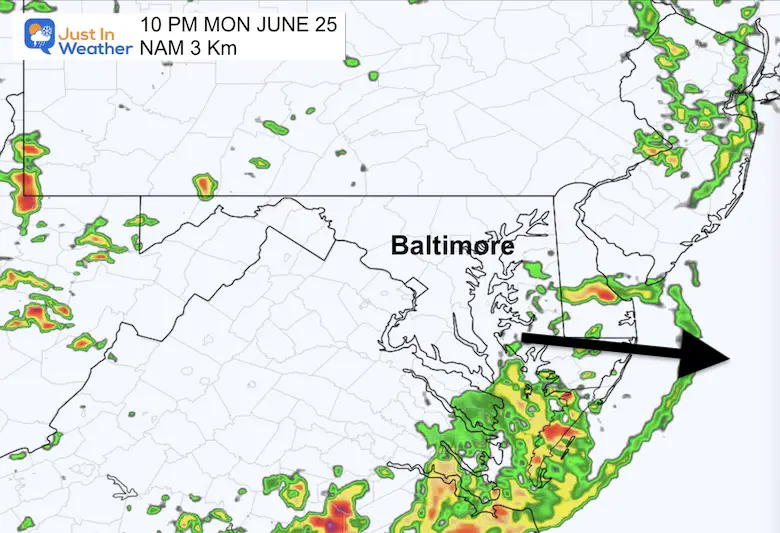
This will pulse after 4 PM, and settle down after dark.
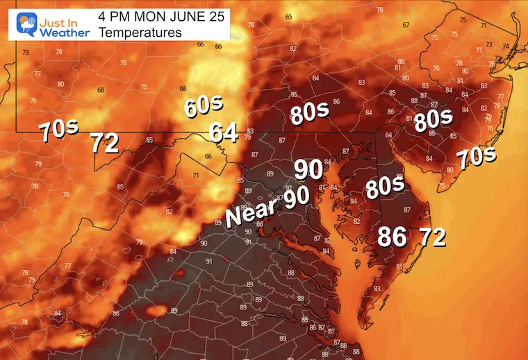
The high temperatures of the day will reach nearly 90ºF in metro areas. But that is only part of the story. Notice after the storms pass, temps will drop into the 60s.
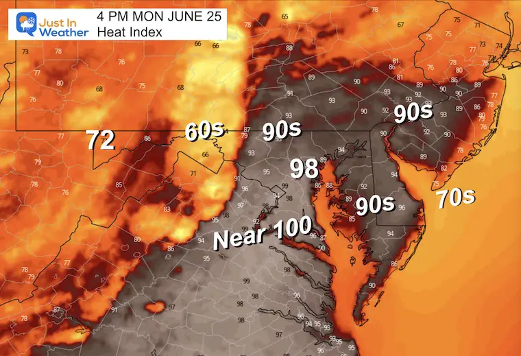
This is a function of the higher humidity. While this shows what it will feel like into the upper 90s, that is also additional energy that will be released when a building storm line works on it.
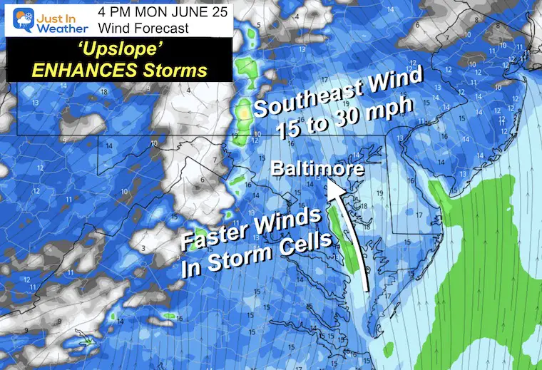
For most of my 25 years of forecasting in central Maryland I have highlighted one thing ahead of severe weather days: When the wind is FROM the Southeast, that often enhances the severe storm risk. This brings in moisture from the Bay and gets pushed inland up in elevations.
Winds will average from 15 to 30 mph, but storm cells may push over 60 mph.
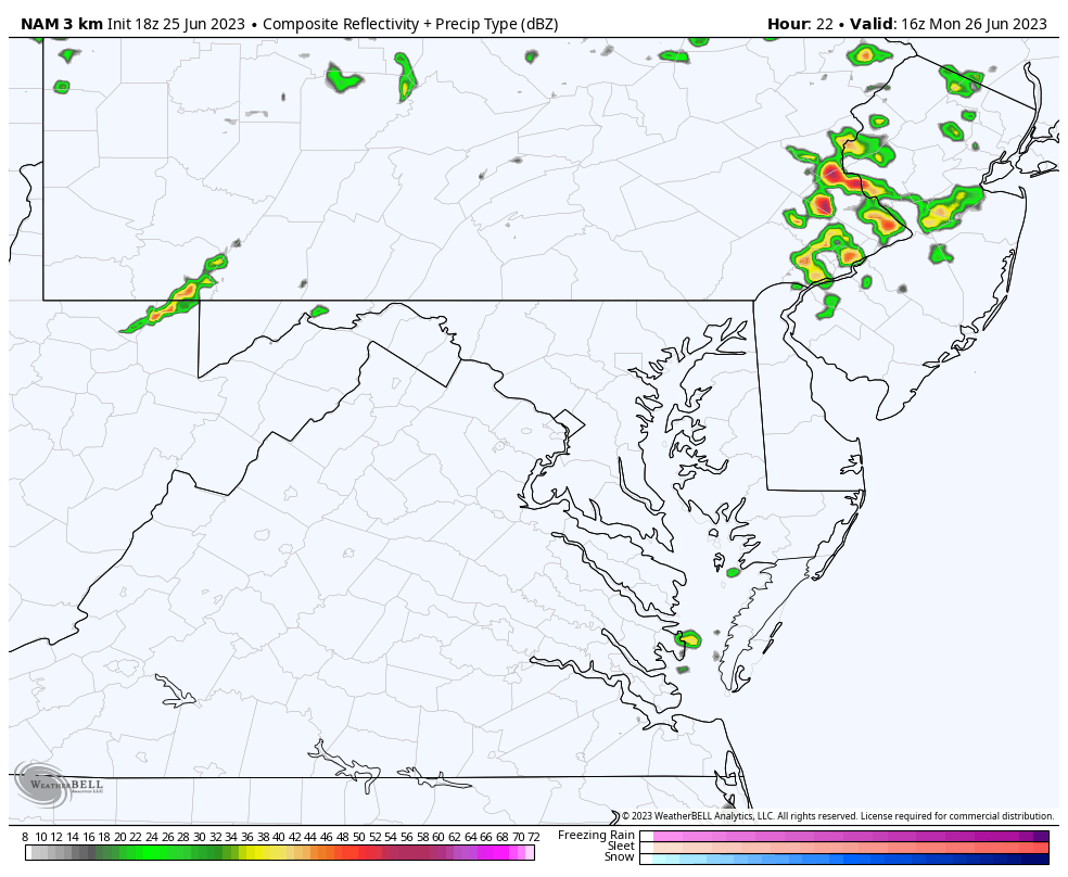
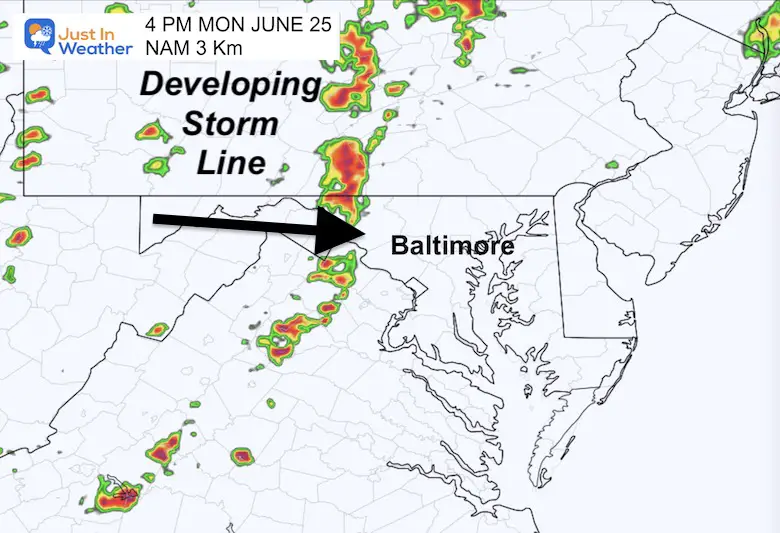
At this time the storm line is expected to be developing and pushing across I-81 to include Winchester, Hagerstown, and Chambersburg. However, this product has a tendency to be a little slower and less active than what we may really see.
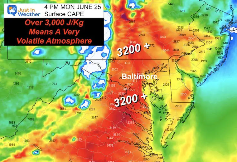
This measure is Convective Available Potential Energy. When it is over 1000 J/Kg we can expect widespread thunderstorms.
When over 3,000 J/Kg there is a greater risk for very volatile severe storm outbreaks.
Here we see values OVER 3,200 spawning the concern for what may develop in the few hours ahead.
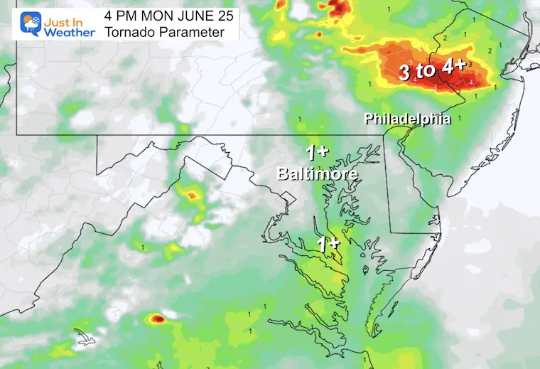
This is not extreme locally, but with a value of 1 or higher, we do raise the threat for wind sheer to produce a few spin ups. There is potential for stronger than EF-2 events.
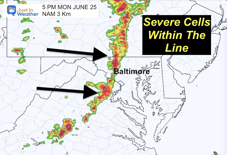
Note: This NAM 3 Km Model is helpful but not perfect. I have noticed it tends to be as much as 1 hour too slow AND underplays the activity. So what we may actually see could be up to 1 hour earlier than shown below and busier radars.
The storm line grows stronger and moves farther east. At this time severe storms may reach Harrisburg to Frederick and Dulles in VA.
Metro Baltimore and Washington prime time! This expands up to York and Southern PA.
I’ve highlighted an outflow boundary in central Maryland near Annapolis. This suggests severe winds blowing out the storm lines with over 60 mph bursts. Downburst AND straight line winds will lead to some damage in addition to individual tornado cells.
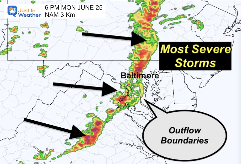
One of the issues with multiple outflow boundaries is that they may enhance the spin of mesoscale Lows. These can spawn supercells with more large hail and tornadoes. The energy supports hail over 2 inches in diameter and tornadoes at EF-2 (111 mph to 135 mph) or higher.
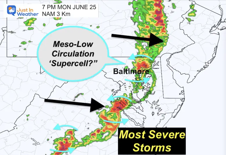
We may still be watching a few super-cells spin up and move east. Not all will produce a tornado, but they do enhance the lifespan of the storm cells to go beyond the source of surface heating. So that can last for a few hours.
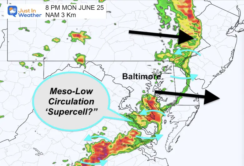
The energy will be focused across Southern Maryland, Delaware, and Southeast Virginia.
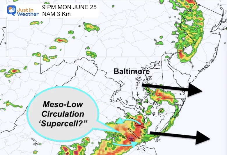
The main threat of severe weather will fade as the storm cluster pushes farther south and east.
We may have another active storm day Tuesday, then less on Wednesday. We could break the pattern to only isolated showers by Thursday.

I am aware there are some spelling and grammar typos, and occasional other glitches. I take responsibility for my mistakes, and even the computer glitches I may miss. I have made a few public statements over the years, but if you are new here you may have missed it: I have dyslexia, and found out during my second year at Cornell University. It didn’t stop me from getting my meteorology degree, and being first to get the AMS CBM in the Baltimore/Washington region. One of my professors told me that I had made it that far without knowing, and to not let it be a crutch going forward. That was Mark Wysocki and he was absolutely correct! I do miss my mistakes in my own proofreading. The autocorrect spell check on my computer sometimes does an injustice to make it worse. I also can make mistakes in forecasting. No one is perfect predicting the future. All of the maps and information are accurate. The ‘wordy’ stuff can get sticky. There has been no editor that can check my work when I needed it and have it ready to send out in a newsworthy timeline. Barbara Werner is a member of the web team that helps me maintain this site. She has taken it upon herself to edit typos, when she is able. That could be AFTER you read this. I accept this and perhaps proves what you read is really from me… It’s part of my charm.
#FITF