


Soggy Saturday Update: Rain Timeline Through Preakness In Baltimore
Friday, May 17, 2024 As we approach another weekend, we have yet another weather system bringing us rain. This will make 16 of 20 weekends this year with some wet…
June 25, 2023
Sunday Morning Update
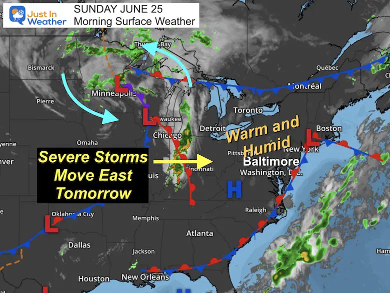
Yesterday proved once again that in this hit or miss pattern, some will get clobbered and others will miss out. Today looks to be like that again, with a little more heat and humidity.
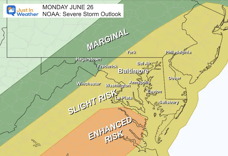
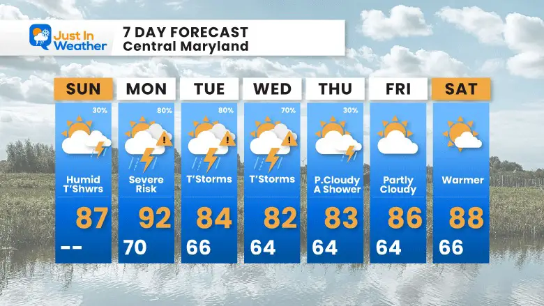
The concern builds tomorrow as the set up combines temps into the 90s for some and upper-level energy to produce widespread storms. NOAA has increased our Severe Storm Outlook and this is something worth paying close attention to. While there will be less heat, we could have more severe storms into Wednesday. Then improvement by the start of the holiday weekend.
A Warm and Humid air mass is in place and the heat will crank up today through tomorrow.
A large cold core Low located over Minnesota is the reason for very active storms along that boundary. While a few pop-up showers will develop this afternoon, the severe storm risk will reach us Monday. This is a slow moving pattern, so it may stay with us for a few days.
Most of today will be dry. However, there will be some pop-up showers and a few stronger thunderstorms in the afternoon and evening.
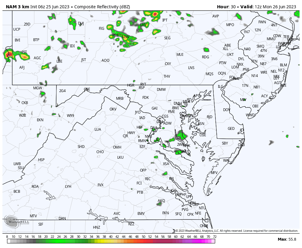
This product is NOT perfect, so use it as a guide.
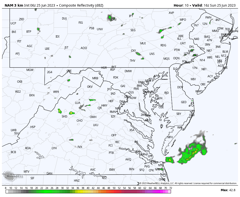
Scattered showers will develop near metro Baltimore. A stronger cluster of storms is expected south of Washington into southern Maryland.
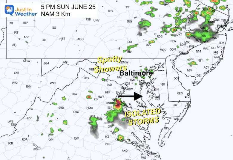
Regardless of how active these storms get, temperatures will be closer to average along with more humidity.
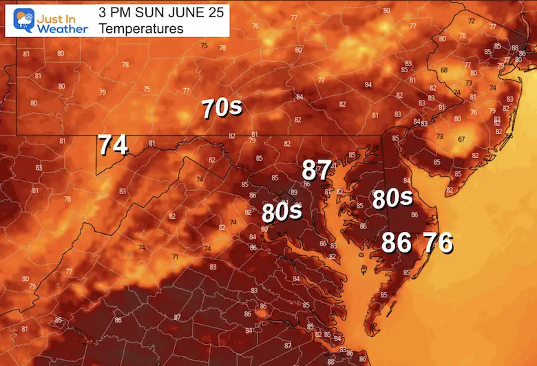
Normal Low in Baltimore: 65ºF
Record 53ºF in 1979
Normal High in Baltimore: 87ºF
Record 99ºF 1997
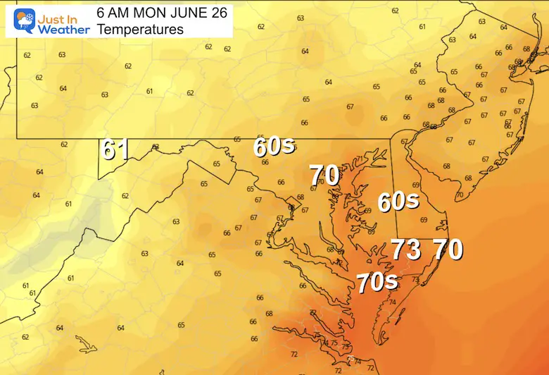
A very warm and muggy start near 70ºF. This will be fuel for the storms in the afternoon and evening.
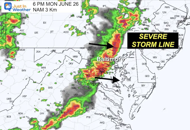
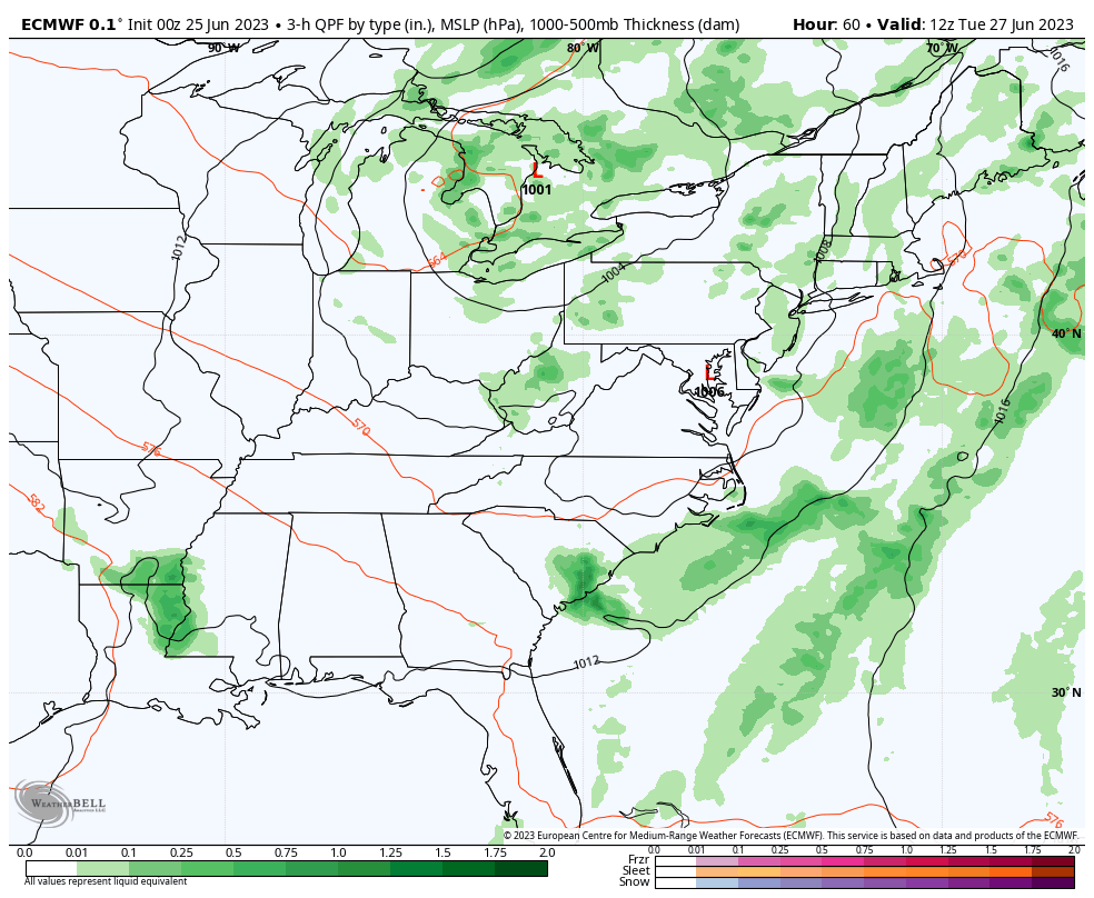
This may be a more active day than just the late day storm line shown. Scattered showers are possible in spots late morning. However, the main event will be the line of strong to severe storms that erupt and swing through mid-afternoon to evening.
This product has a tendency to be a little slow. I would plan for the severe storm window in metro areas to be between 4 PM and 8 PM.
This is the line that will contain the potential for wind damage, large hail, and isolated tornadoes.
Please take this seriously if you have plans for camping, boating, or any outdoor sports. etc.
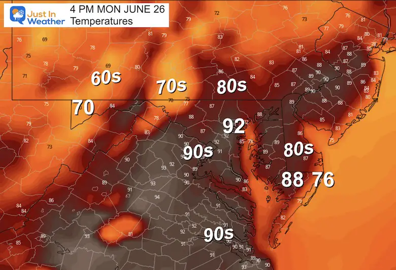
These are the expected peak temps before the storms roll in. Notice the drop into the 70s and 60s where the storms would have passed.
The continued ‘pulsing’ of storms each afternoon and evening will persist Tuesday and Wednesday. This is expected to settle back to scattered showers and more dry days toward the end of the week.
We will have a few days of very active, stormy weather. The peak of the severe risk may be on Monday with the highest temperatures. However, the unsettled pattern aloft may bring more severe storms through Wednesday.
The end of the week and holiday weekend seem to settle back to a more typical summer pattern.

I am aware there are some spelling and grammar typos, and occasional other glitches. I take responsibility for my mistakes, and even the computer glitches I may miss. I have made a few public statements over the years, but if you are new here you may have missed it: I have dyslexia, and found out during my second year at Cornell University. It didn’t stop me from getting my meteorology degree, and being first to get the AMS CBM in the Baltimore/Washington region. One of my professors told me that I had made it that far without knowing, and to not let it be a crutch going forward. That was Mark Wysocki and he was absolutely correct! I do miss my mistakes in my own proofreading. The autocorrect spell check on my computer sometimes does an injustice to make it worse. I also can make mistakes in forecasting. No one is perfect predicting the future. All of the maps and information are accurate. The ‘wordy’ stuff can get sticky. There has been no editor that can check my work when I needed it and have it ready to send out in a newsworthy timeline. Barbara Werner is a member of the web team that helps me maintain this site. She has taken it upon herself to edit typos, when she is able. That could be AFTER you read this. I accept this and perhaps proves what you read is really from me… It’s part of my charm.
#FITF