June 24, 2023
Saturday Morning Update
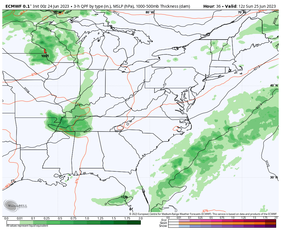
Very beneficial rain has fallen this week, and yesterday brought heavy downpours to our official weather station at BWI. So using that for reference, 0.98 inches of rain fell on Friday. However, the deficit on the year is still quite large at 8.72 inches below ‘normal’.
This morning, there is a band of rain, mainly north of Baltimore with some thunder. The live radar and lightning widget is below.
More rain is on the way, but I need to reinforce the details for this weekend. Many have seen the rain and lightning bolt icons on their apps suggesting more stormy days. I had them on my forecast as well. The fact is that while we have morning showers on the north end, and thundershowers that will pop up this afternoon and evening, much of the day will be dry. In fact, warmer and more humid.
Below I will compare three short-range computer models that highlight how difficult it is to pin down specific times and locations of pop-up showers that have not formed yet. Simply put, have a plan to get indoors, but there will be many hours of dry weather to enjoy outside. Our rain risk will increase a lot during the work week ahead.
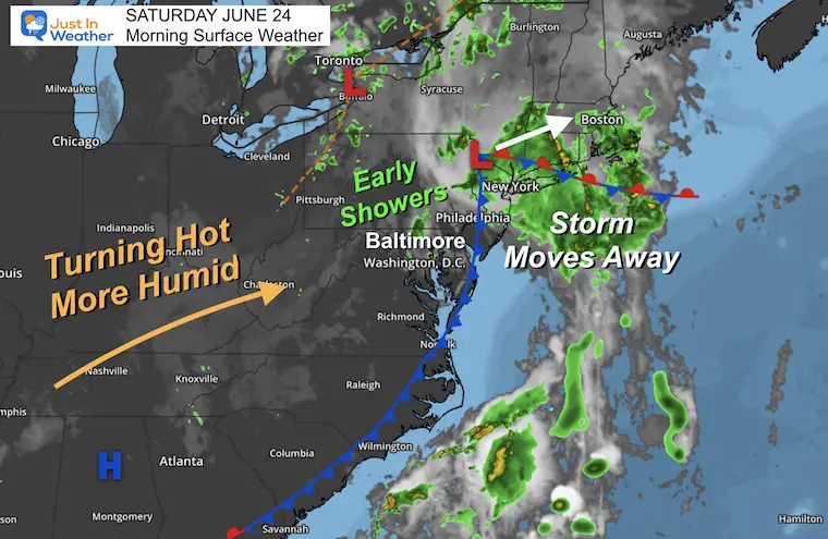
Morning Surface Weather
A band of rain has been passing north of Baltimore. This is the back edge of the storm system departing to New England. We will get a break in this pattern for the weekend.
High Pressure from the Southeast US will pump in more heat and humidity over the next few days. It will feel a bit sticky, and like summer again. This is what will also allow for late-day storms to pop up this weekend.
Live Radar Widget
Use the controls to pan or zoom the map.
Rain Forecast Simulations
I want to compare model snapshots, then look at the animations below.
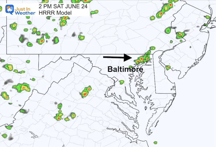
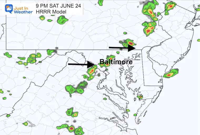
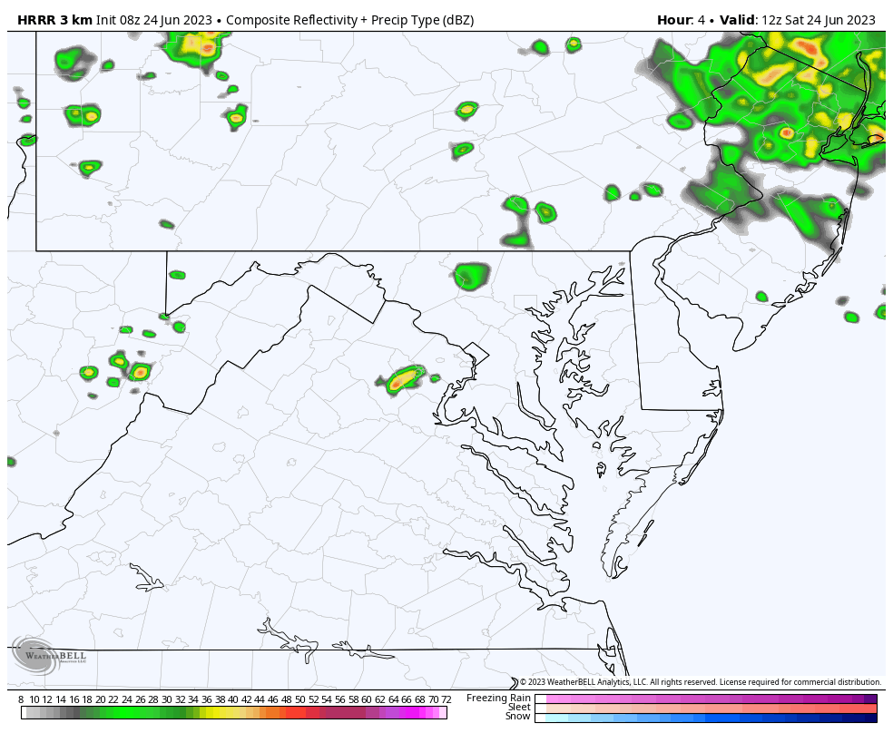
HRRR Model
2 PM Suggestion:
A cluster of showers/storms in Northeastern Maryland’s Harford and Cecil Counties. Much of the region will be dry.
9 PM Suggestion:
A line of showers and storms reaching the western and northern suburbs of Baltimore.
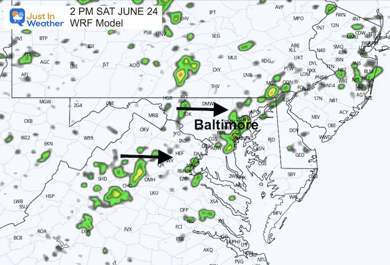
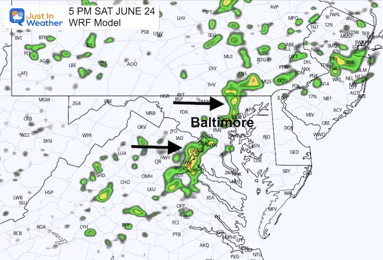
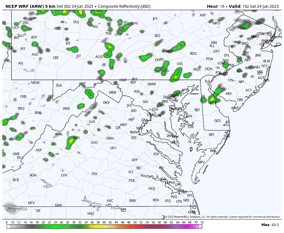
WRF Model – Much More Active
2 PM Suggestion
A wider region of showers and storms just east of I-95 along the northern Chesapeake Bay between Annapolis and Baltimore to Philadelphia. Also pockets of storms in the mountains.
5 PM Suggestion
More widespread coverage of showers and storms across metro Washington and Baltimore.
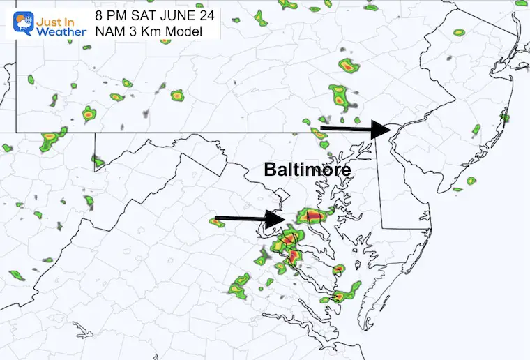
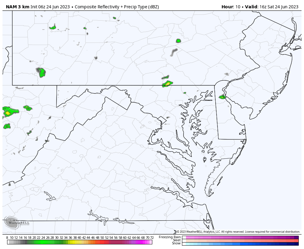
NAM 3 Km Model – Much LESS Active
8 PM Suggestion
Scattered showers broken up across the region, with much more activity in southern Maryland.
Animations (to compare)
HRRR Model 8 AM to 10 PM
Mid-range activity
WRF Model Noon to 10 PM
Most Active
NAM 3 Km Model Noon to 10 PM
Least Active
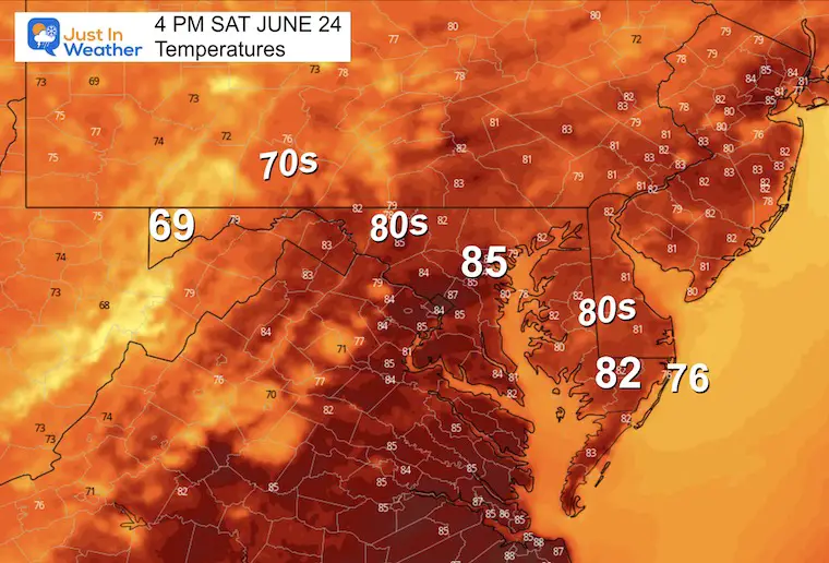
4 PM Temperatures
Regardless of how active these storms get, temperatures will be closer to average along with more humidity.
EXPLORE MORE
Subscribe for eMail Alerts
CLIMATE DATA
TODAY June 24
Normal Low in Baltimore: 65ºF
Record 50ºF in 1992
Normal High in Baltimore: 87ºF
Record 100ºF 2010
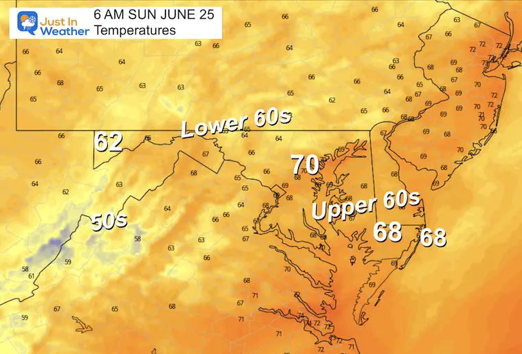
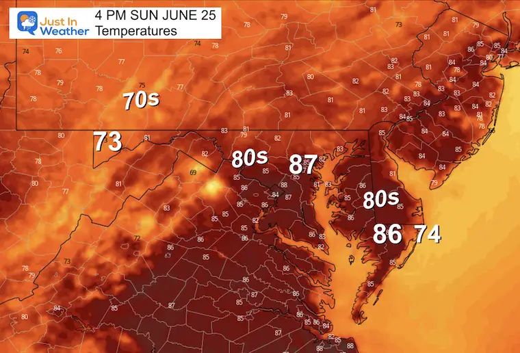
Sunday Weather
Morning Temperatures
Warm and muggy morning. If you have rain showers Saturday, there is a better chance for morning fog.
Afternoon Temperatures
Even warmer and more humid.
Rain Forecast Sunday Through Thursday
I am going with the wider view because I do not trust the local radar simulations. It can be misleading given the wide range we see this afternoon.
The pattern here is the pulsing or flare-up of rain and storms each afternoon and evening.
- Sunday: Scattered Showers
- Monday through Wednesday: More widespread showers and thunderstorms, with local downpours in the afternoons and evenings.
- Thursday: Decreased showers as dryer weather and a cooler air mass arrive.
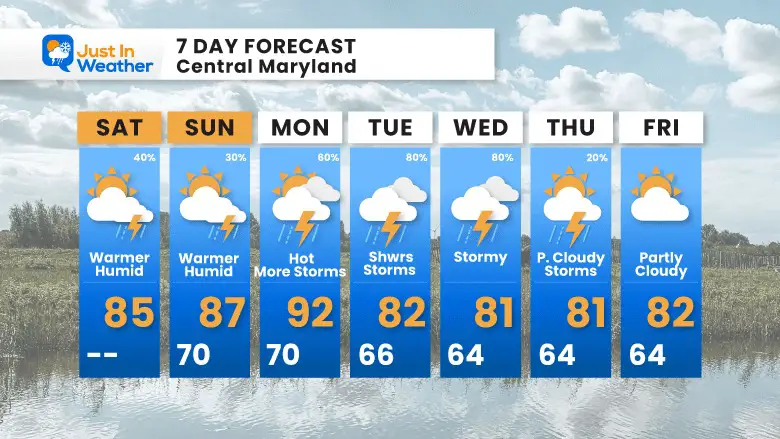
7 Day Forecast
The risk of rain almost every day does NOT mean all-day washouts.
Rain chances will increase Monday through Wednesday.
Temps will peak Monday, then trend cooler.
The end of the work week looks much better as we approach the Independence Holiday weekend.
Subscribe for eMail Alerts
EXPLORE MORE

Please share your thoughts, and best weather pics/videos, or just keep in touch via social media
RESTATING MY MESSAGE ABOUT DYSLEXIA
I am aware there are some spelling and grammar typos, and occasional other glitches. I take responsibility for my mistakes, and even the computer glitches I may miss. I have made a few public statements over the years, but if you are new here you may have missed it: I have dyslexia, and found out during my second year at Cornell University. It didn’t stop me from getting my meteorology degree, and being first to get the AMS CBM in the Baltimore/Washington region. One of my professors told me that I had made it that far without knowing, and to not let it be a crutch going forward. That was Mark Wysocki and he was absolutely correct! I do miss my mistakes in my own proofreading. The autocorrect spell check on my computer sometimes does an injustice to make it worse. I also can make mistakes in forecasting. No one is perfect predicting the future. All of the maps and information are accurate. The ‘wordy’ stuff can get sticky. There has been no editor that can check my work when I needed it and have it ready to send out in a newsworthy timeline. Barbara Werner is a member of the web team that helps me maintain this site. She has taken it upon herself to edit typos, when she is able. That could be AFTER you read this. I accept this and perhaps proves what you read is really from me… It’s part of my charm.
#FITF


