


May 19 Weather Sunday Starts Foggy The Warming With Sun And Summer Heat On The Way
Sunday May 19 Morning Report The aftermath of the rainy Saturday is plenty of leftover moisture. This has left us with a bit of humidity and areas of thick fog…
June 23 2023
Friday Evening Update
It has been quite a day with locally heavy downpours in spots while others missed out. I got caught in a few during my activities along I-95 in Harford Couty this morning, and even in southern Carroll County. I posted a video this afternoon from Sykesville on my Facebook page. The storm drains were getting a workout, but working. It has been a while.
I am sitting waiting for the start of my son’s baseball game, and we will be playing in the rain… It is tournament season. I am tasked with watching for lighting as it is the main thing that will cause a delay for safety. So I wanted to put together a quick report on the rain and what to expect tonight, this weekend, and into next week.
This is a quick look.
The region has roughly a 9-inch deficit in rainfall for the year. Some more, some less. Even with the downpours, we made a small dent in that. We do not want to make that up all at once for sure. We will have more opportunities into the middle of next week.
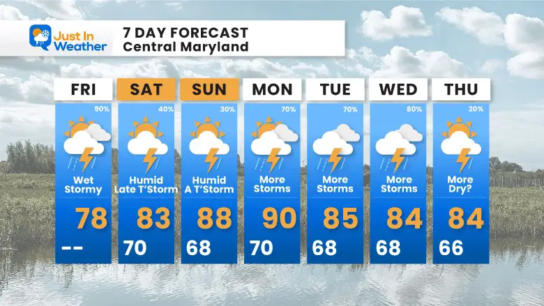
This report will highlight the weekend rain as mostly being afternoon and evening showers. Then more rain widespread next week.
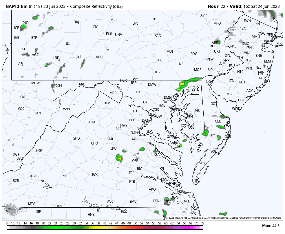
Flash Flood Warnings were issued earlier today. This was due to slow moving storm cells, which included the pulse of over 5 inches of rain shown over Crofton.
Note: This is from the radar site in Dover, DE. It may be missing some of the activity over Washington, DC. Our normal radar located in Sterling, VA has been down for maintenance.
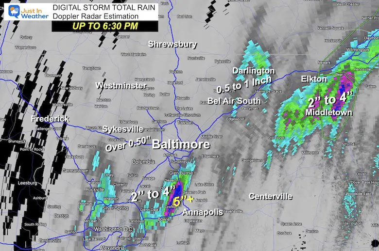
Notice the slow moving heavy rain bands nearly stuck over parts of metro Washington and central Maryland.
Use the controls to pan or zoom the map.
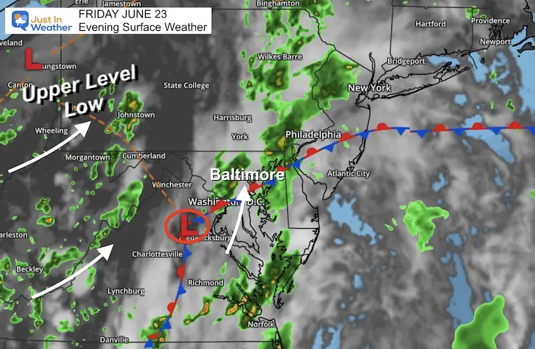
There are two areas of Low Pressure worth noting. The larger circulation has been around the Upper Low in Northeast Ohio. That is pushing the flow from the south and southwest.
A Surface Low over central Virginia has been responsible for igniting the local bands of slow moving rain into central Maryland.
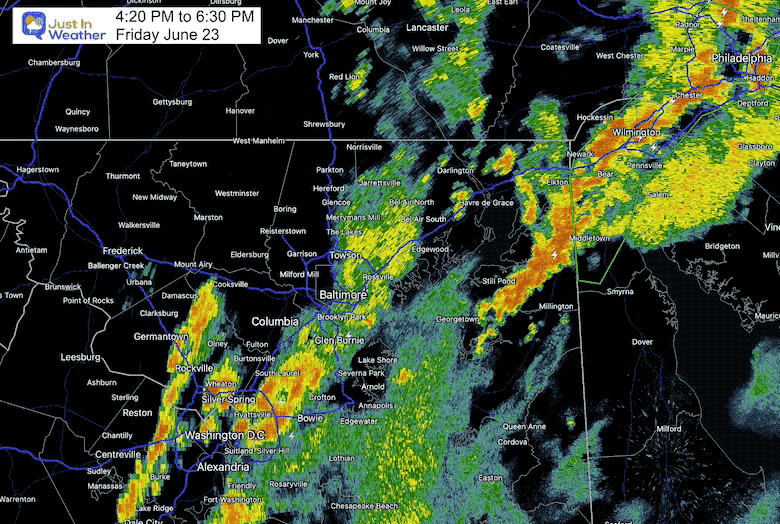
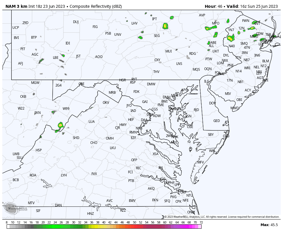
The heavy rain activity will shift north and fade, but more patchy areas of rain will continue overnight. While this may fade into the morning on Saturday, there will be widespread areas of fog and drizzle not shown on the radar.
Mainly dry with scattered showers or storm cells in the afternoon and evening.
Once again, mainly dry with scattered showers or storm cells in the afternoon and evening.
This may be tough to follow, however, the pulsing is more prominent later in this period.
Sunday will be mostly dry, with some afternoon showers.
Monday through Wednesday look wetter with more widespread rain. Most of which will develop during the afternoon and into each evening.
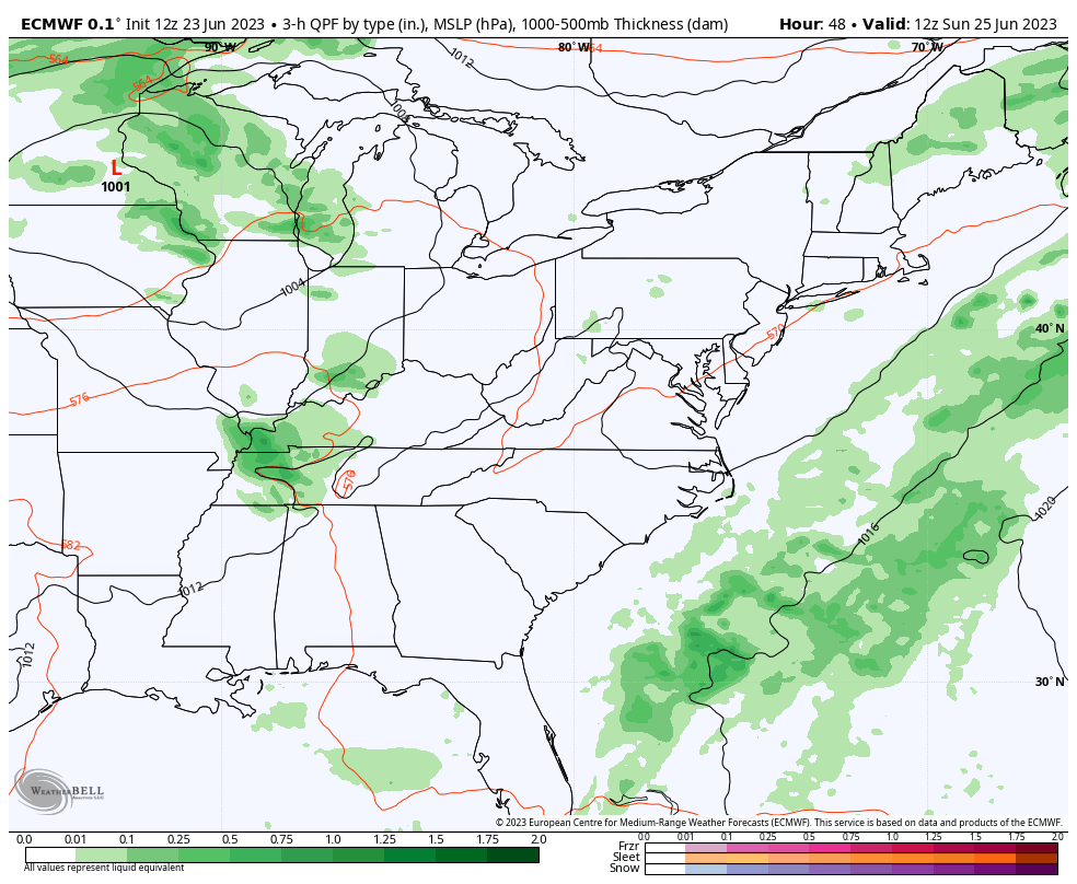
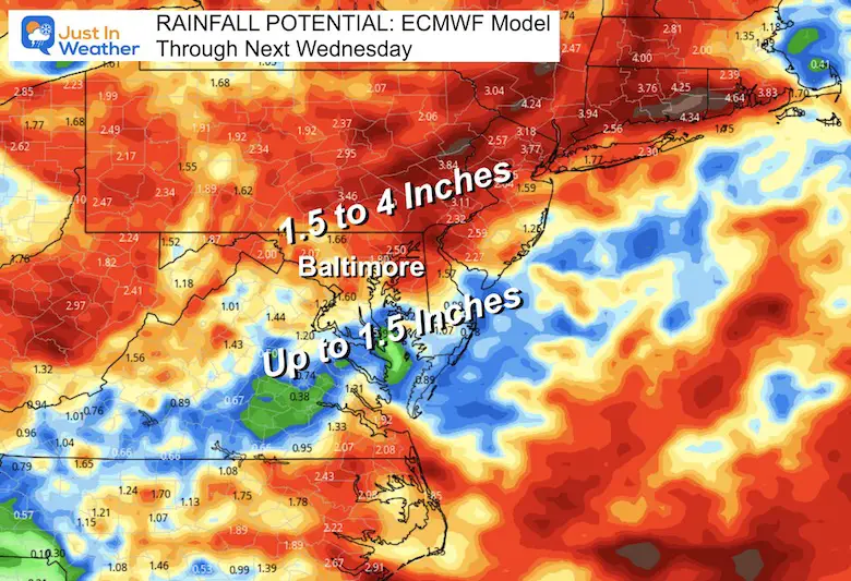
From the ECMWF Model… It looks like heavier rain will be north of Baltimore, with central Maryland getting up to 1.5 inches. This is a loose call as individual storm cells can dump a lot more. But with Baltimore sitting at more than 9-inch deficit for the year, this is still not enough to help our drought. But it might help the lawns and crops.
The risk of rain almost every day does NOT mean all-day washouts.
This weekend will have dry periods, with storms mainly popping up in the afternoon or evening. It will be very warm and humid. More rain will be likely during next week.
I can not suggest how to prepare for your plans. This pattern will mean mostly afternoon and evening storms, but they will be scattered. I do not trust any model to be precise with tracking the location of storm cells that far away.
Again, please just have a plan B for indoor options of your plans.

I am aware there are some spelling and grammar typos, and occasional other glitches. I take responsibility for my mistakes, and even the computer glitches I may miss. I have made a few public statements over the years, but if you are new here you may have missed it: I have dyslexia, and found out during my second year at Cornell University. It didn’t stop me from getting my meteorology degree, and being first to get the AMS CBM in the Baltimore/Washington region. One of my professors told me that I had made it that far without knowing, and to not let it be a crutch going forward. That was Mark Wysocki and he was absolutely correct! I do miss my mistakes in my own proofreading. The autocorrect spell check on my computer sometimes does an injustice to make it worse. I also can make mistakes in forecasting. No one is perfect predicting the future. All of the maps and information are accurate. The ‘wordy’ stuff can get sticky. There has been no editor that can check my work when I needed it and have it ready to send out in a newsworthy timeline. Barbara Werner is a member of the web team that helps me maintain this site. She has taken it upon herself to edit typos, when she is able. That could be AFTER you read this. I accept this and perhaps proves what you read is really from me… It’s part of my charm.
#FITF