


May 5 Soggy And Chilly Start With More Rain During The Week Ahead
Sunday May 5 Morning Report We are stuck in this muck! The wet weather pattern continues with a soggy start this Sunday morning. The rain will try to break up…
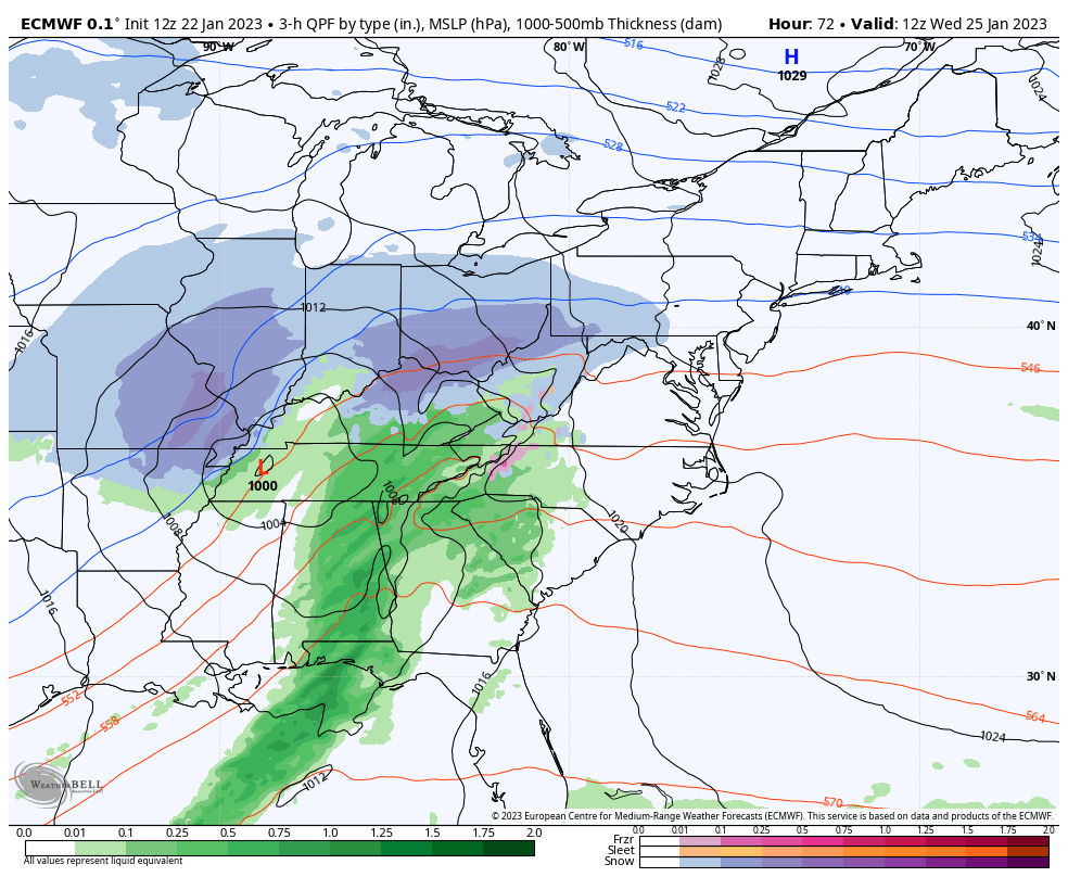
January 22 2023
Sunday Night Update
If this was a normal winter, we would be talking about this coastal storm as a snow maker. I have been challenged by a few people mentioning this as a pattern change, but that is exactly what we are seeing. However, the cold air and winter as a whole have been a challenge!
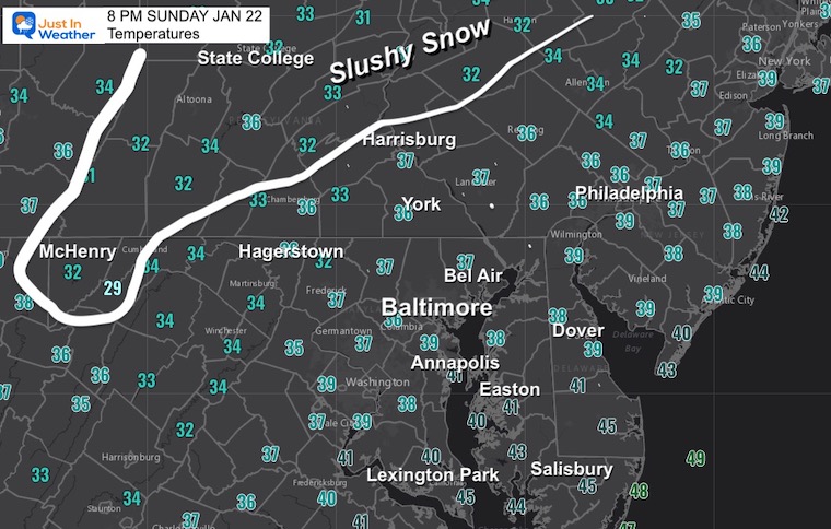
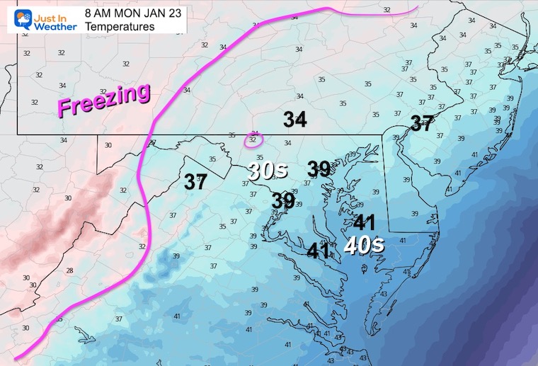
There is snow in central Pennsylvania around State College into New York. This has been a chilly rain, and what is interesting is that cold enough air will try to catch up at the very end on Monday morning. This is NOT for central Maryland, but rather NORTH OF BALTIMORE. If you saw sleet or snow mixed in with the start on Sunday, then you may also see snow as this ends Monday morning. I do NOT expect stickage, simply falling flakes and a signal of the atmosphere attempting to behave with normalcy. That will bring in a colder start to the next storm on Wednesday and perhaps snow with some substance.
This has been a colder event than the computer model guidance, but still just on the mild side above freezing. The freezing air is in central PA, and has a chance to move in at the end of this event.
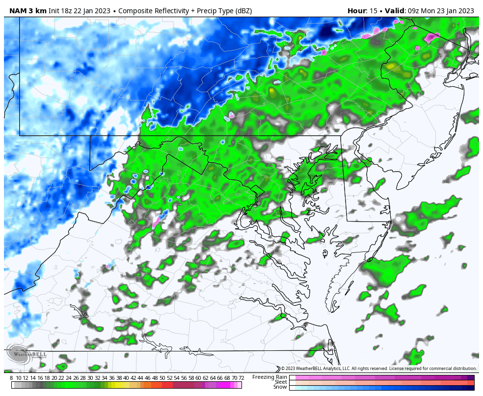
Low Pressure focused around coastal Georgia and South Carolina will ride along the front up the coast tonight. While snow is falling in central PA to New York, it extends back to the Ohio Valley and Great Lakes. That source of cold air will try to catch up aloft to change over the tail end to snow along the Maryland and Pennsylvania line.
Tracking the coastal storm with mostly rain for our region, while slushy snow is falling in central Pennsylvania and some mixing in western Maryland.
The freezing line is closer, but the ground is still holding some heat. Travel locally should be OK.
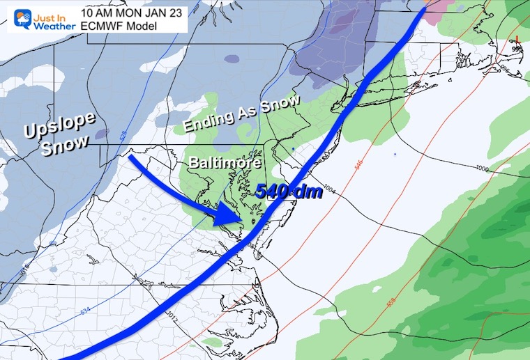
The European Model has been showing the 540 dm line (a measure of atmospheric thickness that indicated potential freezing at cloud level) near the coast.
The surface temps will struggle, but there is support aloft for snow to form and fall from cloud level. This has the best chance to reach the ground in the higher elevations north of Baltimore. I do not expect road stickage in these areas.
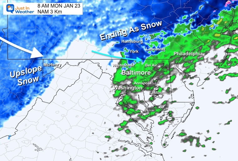
I backed this up on the NAM Model to show the more likely areas NORTH of Baltimore.
This MAY INCLUDE: Westminster, Hereford, Jarrettsville, York, Lancaster, and Harrisburg. The northern part of these counties in Maryland:
Frederick, Carroll, Baltimore, and Harford.
All of southern Pennsylvania has a better chance to also get in on brief snow.
This will be a quick hour or two of falling flakes at best.
High Pressure north of Maine will be a strong force for colder air, and we could end up with a longer period of snow at the start.
The daybreak timing will be critical, and here we see it edging close to the Frederick Mountains, but not in the metro areas.
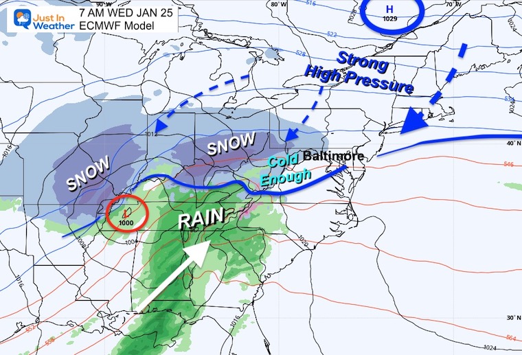
A band of light snow extending across the hills just west and north of Baltimore. I’ve seen this set up with winter events delaying the start in metro/central Maryland a few hours.
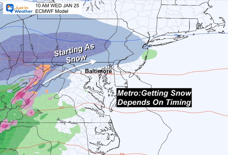
I must add the model error: Running too slow. If this verifies earlier, then we could be looking at a start with wintry weather before sunrise and will need to keep a close eye on any impact. Yes, this will turn to rain, but the first few hours are a change in our weather for sure.
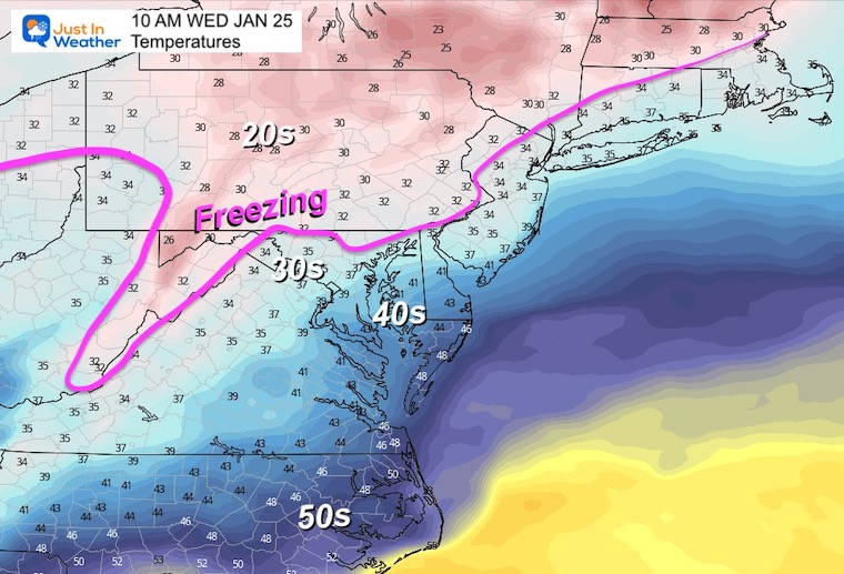
The freezing line is marginal AND TIMING IS KEY!
If this arrives earlier (as has been the case with most recent events) we can tap into colder air for more areas. A later start allows from some moderation and then little to no impact and a DUD of an event for the complaint department.
Latest Measurable Snow In Baltimore
This is is now 5th latest. I will have a detailed report on this for you on Monday.

Click to see more and ‘Book’ a visit to your school

I see many factors to support colder influence with multiple systems. Early and later in winter. Check it out.
Winter Outlook 2023 For Snow Not Typical La Niña Plus Polar Vortex Disruption
Atmospheric Memory Suggests Active Winter Storm Pattern Outlook
Winter Outlook 2023 From NOAA Very Different Than Farmers Almanacs
Winter Outlook 2023 Early Look At Snow From Two Farmers Almanacs
If you want a snowy winter, this is what you might want to look for in the rest of the tropical season. (You might be seeing a lot of commercial snow removal people out this Winter).
Record August For No Named Tropical Storms: Closer Look At Snow Following
Winter Weather Folklore Top 20 And More Outlook Signals From Nature For Cold And Snow
