January 22 2023
Sunday Morning Report
The weather event today is the closest to a winter storm we have had since just before Christmas. The timing is off. We begin this morning with many stations below freezing. However, temps will warm as the system arrives midday and this afternoon. The observation map was made at 7 AM, and some light snow (flurries) were marked in southern Virginia. The computer guidance is having trouble with this, so please keep an open mind for what may fall at the start between 10 AM and 2 PM. I don’t expect stickage, just curious as to what may fall as this arrives.
There still may be a brief period of sleet or snow, especially north. If you are traveling into central PA, slushy snow will accumulate around State College to the Poconos and into New York.
This storm may end with some snow showers Monday morning, followed by more wind.
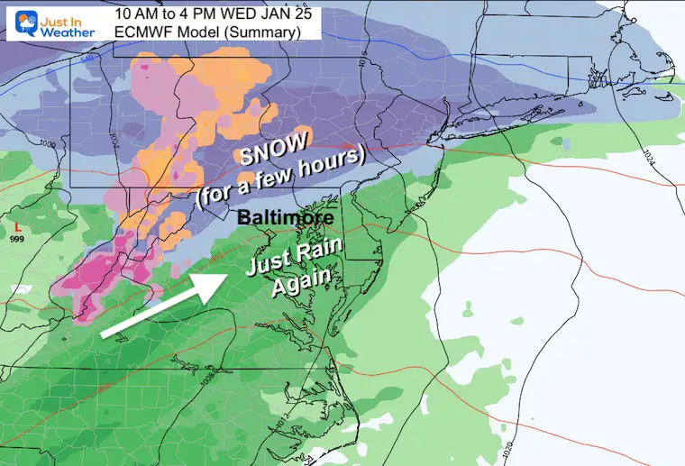
Wednesday is the next system that will have colder air and a few hours of snow. This is our pattern change and it will get colder into next weekend.
Headlines
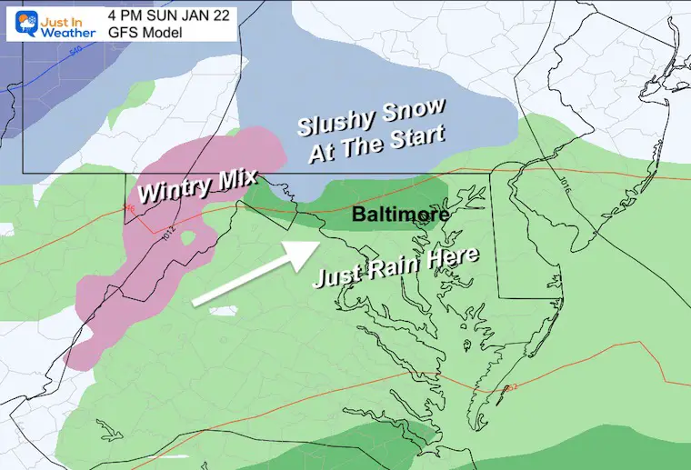
- Today: Rain may begin with brief snow or sleet NORTH, Slushy Snow in Central PA.
- Monday: May End With Snow Showers, Windy.
- Wednesday: A Few Hours Of Snow: NEAR AND NORTH of Baltimore (not SOUTH).
Climate Trivia
Latest Measurable Snow In Baltimore
Today Ties For 5th Latest
- Feb 21 in 1973 (50 years ago)
- Feb 6 in 1914 (109 years ago)
- Jan 25 in 1992 (31 years ago)
- Jan 25 in 1901 (122 years ago)
- Jan 22 in 1966 (57 years ago) – TIED TODAY
- Jan 21 in 1907 (116 years ago)
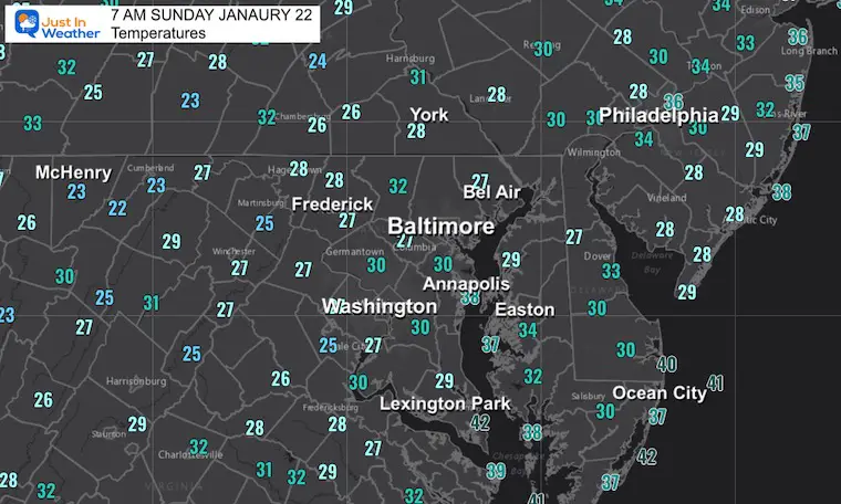
Morning Temperatures
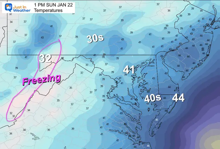
Plenty of below freezing readings, but this is well before the storm arrives. Temps below 32ºF have been observed into southern Maryland away from the water.
There is plenty of cold air now, but the timing with the approaching event is just off by a few hours (for winter lovers).
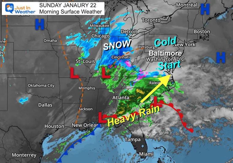
Morning Surface Weather
A complex Low Pressure system is shifting the focus to the Southeast US Coast. Heavy rain in Georgia and South Carolina is heading our way.
The cold air ahead of this may be enough to kick off the start with brief snow or sleet falling. This observation map was made at 7 AM, and we see some of that ‘mix’ into southern Virginia. I think the models are having trouble identifying this, so keep an open mind with ‘stuff” falling’ when this begins between 10 AM and 2 PM.
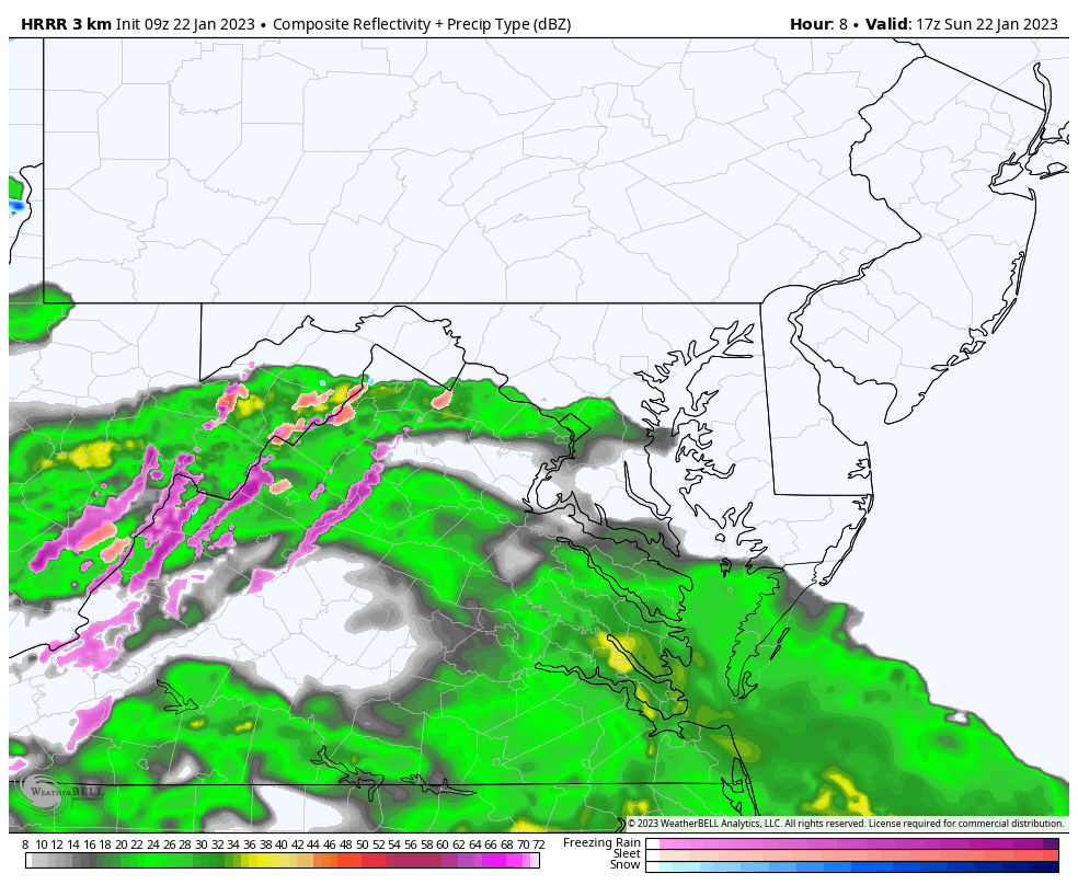
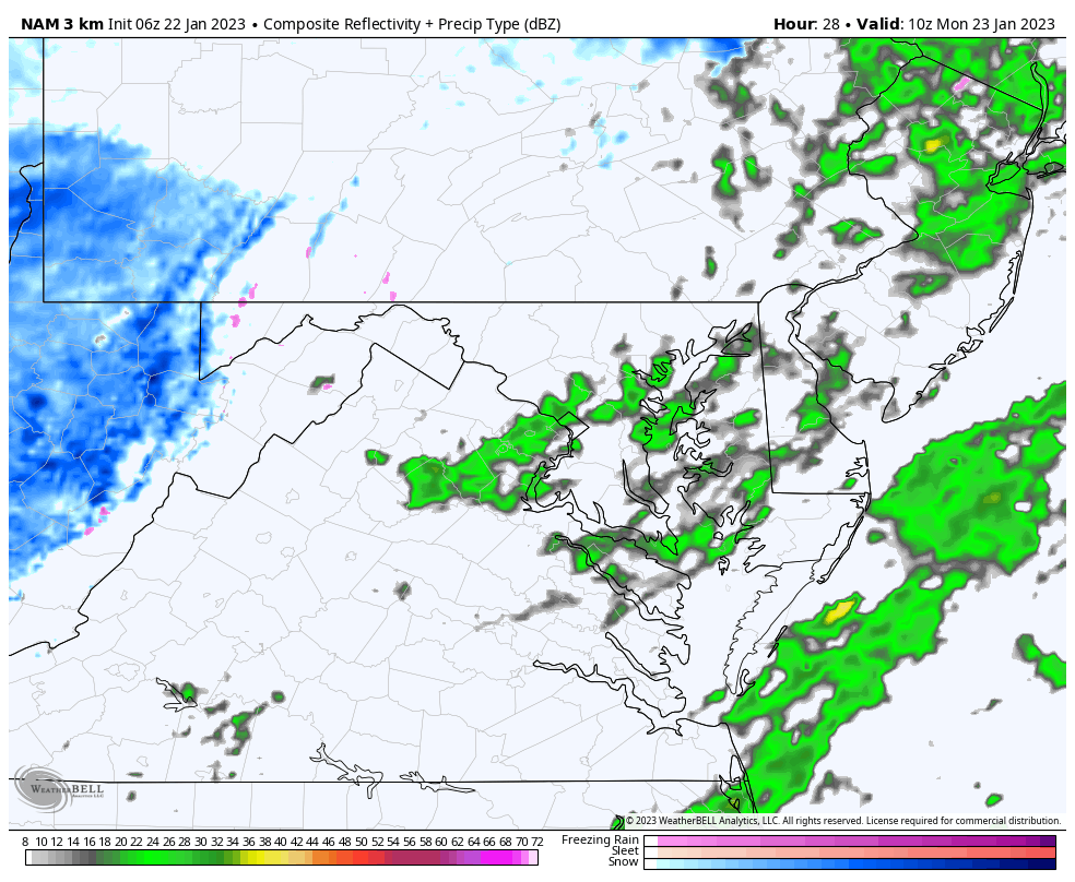
Radar Simulation: 12 PM to 10 PM
This HRRR Model is not showing much mix nearby. We will focus on the rain and that will fall most of the afternoon and tonight. A total of around 1/2″ of liquid is expected.
Snapshots
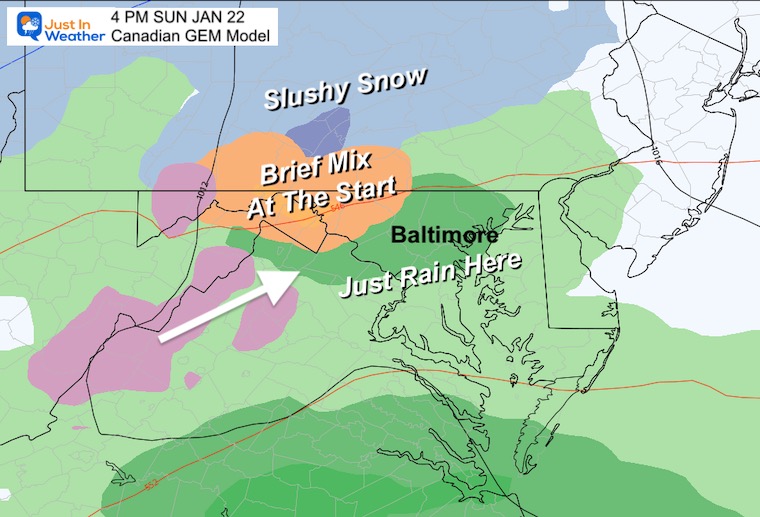
Canadian GEM Model
Here we still see the more likely areas to ‘start as a mix’ west and north of Baltimore. NOT around or south of the city.
GFS Model
This was the warmer plot, now showing some brief snow near the Maryland and Pennsylvania line. Again. Not for impact, simply to see snow or sleet falling at the start.
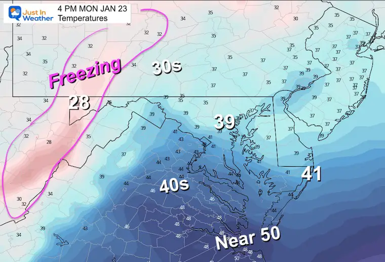
Afternoon Temperatures
I want to point out that temps may actually drop a few degrees with the rain, with many in the upper 30s. Again, we are just missing the wintry part of this storm.
In Case You Missed This:
Here is my Forecast Region Description
Subscribe for eMail Alerts
CLIMATE DATA
TODAY January 22
Normal Low in Baltimore: 25ºF
Record -7ºF in 1984
SNOW: 12.3” 1987
Normal High in Baltimore: 43ºF
Record 69ºF 1927
Monday Weather
Radar Simulation 5 AM to 12 PM
There will be one last batch of precipitation in the morning. This model is only showing rain for central Maryland, but there may be colder air catching up, to end this with some snow showers. No stickage expected.
The higher mountains will have another light fresh coating of snow.
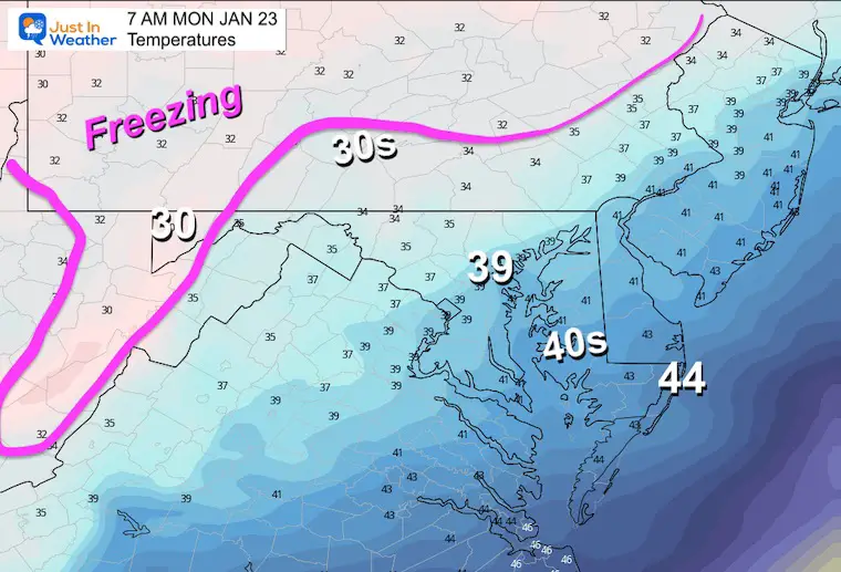
Morning Temperatures
Chilly as this storm departs, but the freezing air worth noting will be NORTH of Harrisburg PA. So traveling I-81, I-78, and The Pennsylvania Turnpike maybe impacted. Also, a fresh coating of snow WEST of Cumberland in Maryland.
Afternoon Temperatures
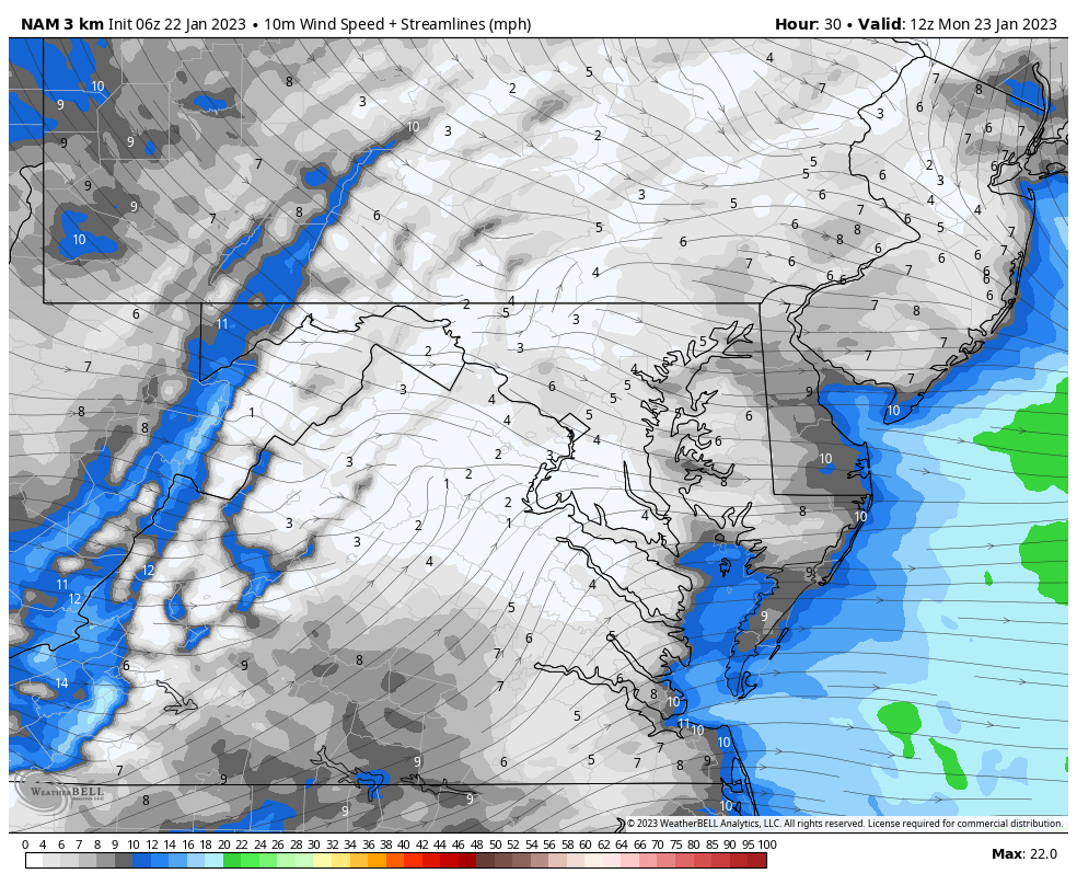
Wind Forecast
Winds will increase midday and afternoon.
- Steady: 15 to 20 mph
- Gusts: Over 30 mph
Scanning The Next Storm
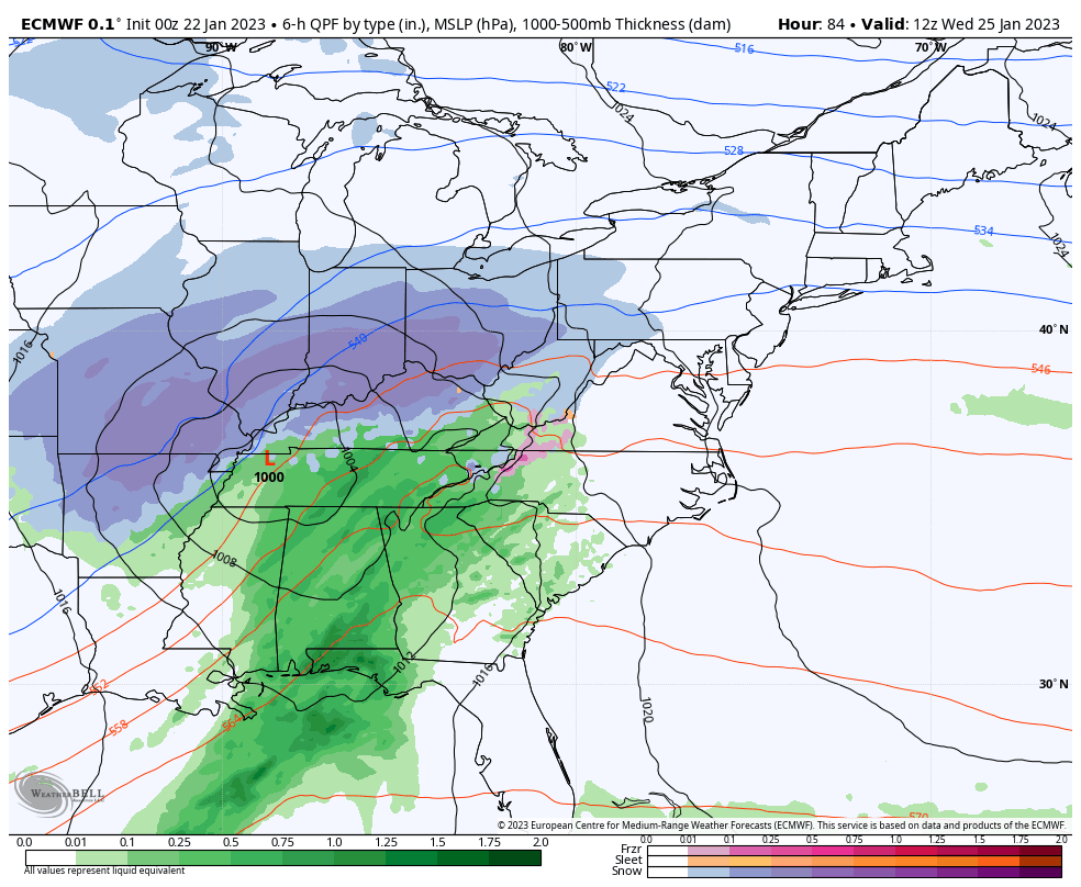
The Wednesday Event will interact with Strong High Pressure sending Cold Air farther south from New England. It looks like we may see snow (near and inland from Baltimore) late morning, and last into the afternoon.
Storm Animation
ECMWF Model 7 AM WED to 7 PM THU
7 Day Forecast
This is the pattern change, however we are lacking arctic air. Some of that will show up later in the week and next weekend. This has been a challenging winter pattern, but there is still some winter left. I am taking this in one week blocks of time, as the modeling has not been reliable beyond that time frame.

SNOWSTIX – Available Now

STEM Assemblies/In School Fields Trips Are Back
Click to see more and ‘Book’ a visit to your school

My Winter Outlook: Not A Typical La Niña!
I see many factors to support colder influence with multiple systems. Early and later in winter. Check it out.
Winter Outlook 2023 For Snow Not Typical La Niña Plus Polar Vortex Disruption
Also See The Winter Outlook Series:
Atmospheric Memory Suggests Active Winter Storm Pattern Outlook
Winter Outlook 2023 From NOAA Very Different Than Farmers Almanacs
Farmer’s Almanac Comparison
Winter Outlook 2023 Early Look At Snow From Two Farmers Almanacs
Triple Dip La Niña Winter
Winter Outlook 2023 La Niña Triple Dip Expectations
CONNECTION TO WINTER?
If you want a snowy winter, this is what you might want to look for in the rest of the tropical season. (You might be seeing a lot of commercial snow removal people out this Winter).
Record August For No Named Tropical Storms: Closer Look At Snow Following
Wooly Bear Caterpillars
Winter Weather Outlook From The Wooly Bear Caterpillar
Persimmon Seeds
Winter Weather Outlook: Persimmon Seeds And Snow Folklore
Click to see Top 20 and MORE
Winter Weather Folklore Top 20 And More Outlook Signals From Nature For Cold And Snow
Normals And Records: Maryland and Baltimore Climate History

Please share your thoughts, best weather pics/videos, or just keep in touch via social media


