


Average Last Frost or Freeze Dates And Map For Maryland
There is a good reason why many gardeners suggest NOT to plan tomatoes until after Mother’s Day. Early surges of warm air in spring can be deceiving. Just because the…
January 23 2023
Monday Morning Report
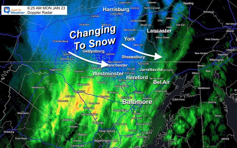
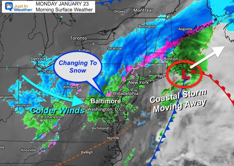
The coastal storm is definitely an adjustment to our weather pattern. In a normal winter, we would have had more snow, but the cold air has been limited. It is trying to follow in on the back end, and already a change over to snow is showing up in the mountains of western Maryland and central Pennsylvania.
As mentioned in prior reports, there will be a brief period of snow for the COLDER INLAND AREAS NORTH OF BALTIMORE. This will not include all of central Maryland, but many will see snow falling for an hour or two. Perhaps even a coating on the grass.
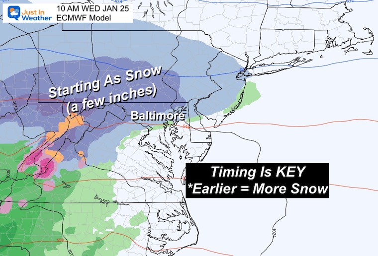
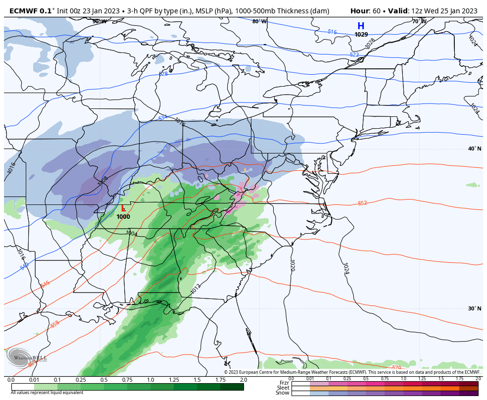
The next storm will have colder air and a morning arrival on Wednesday to perhaps provide our first real chance for snow and stickage this winter.
Snow is mixing over near the Maryland and Pennsylvania state line.
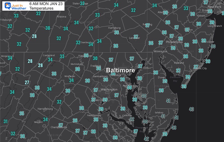
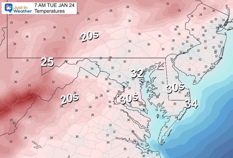
Temps are dropping a little.
Morning Surface Weather
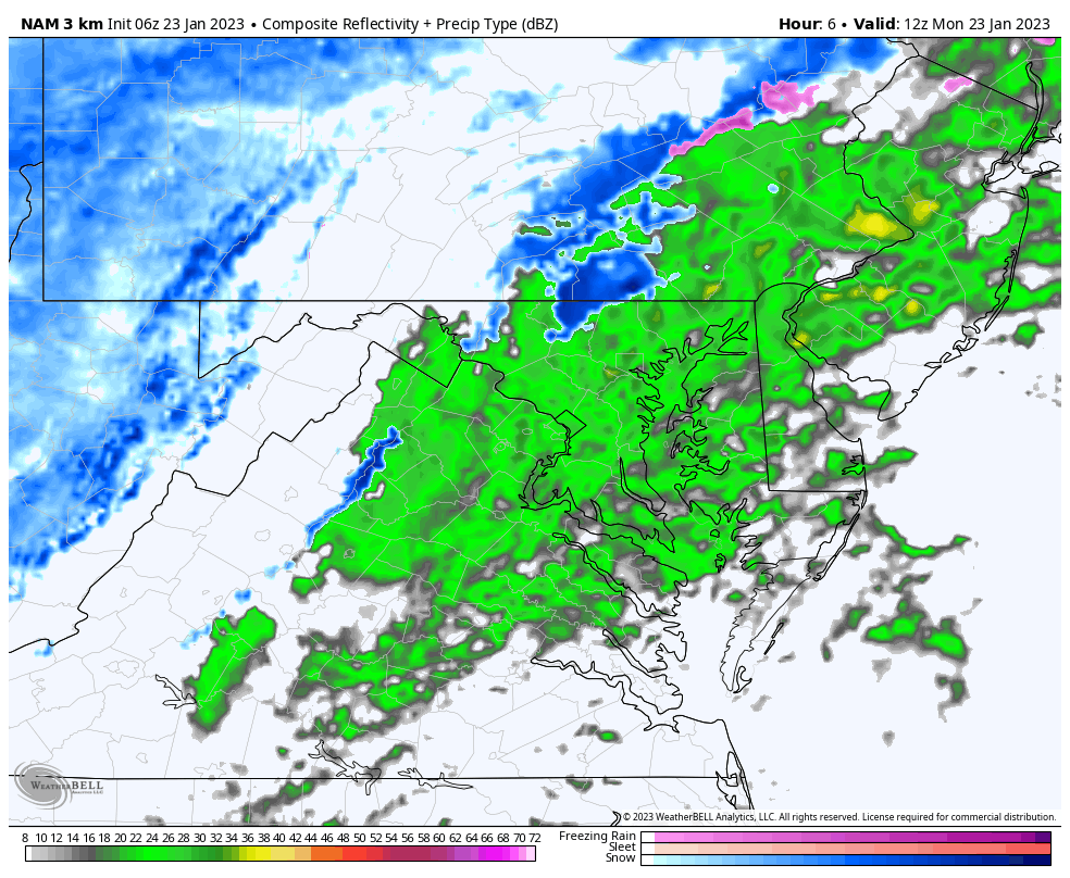
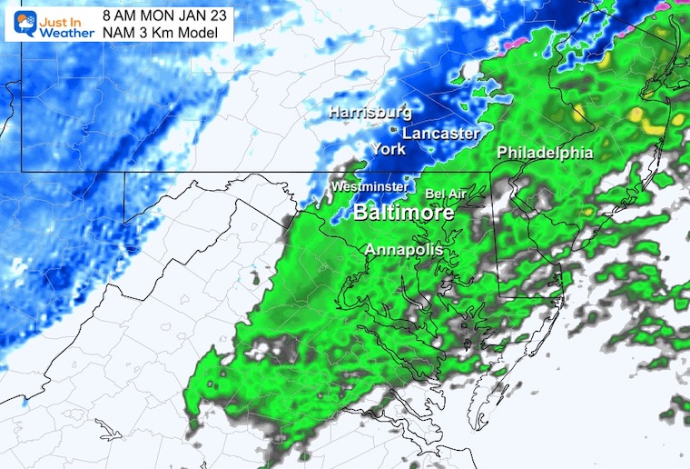
This NAM 3 Km Model shows the brief change to snow for hills NORTH of Baltimore.
Another band of flurries (NORTH) around lunchtime.
Snow falling and perhaps laying on the grass may INCLUDE: Westminster, Hereford, Jarrettsville, York, Lancaster, and Harrisburg.
This will be a quick hour or two of falling flakes, roads remains wet.
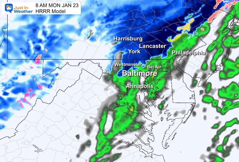
This is a similar plot to the NAM 3 Km adding more confidence of the change over.
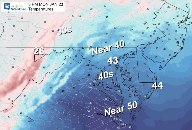
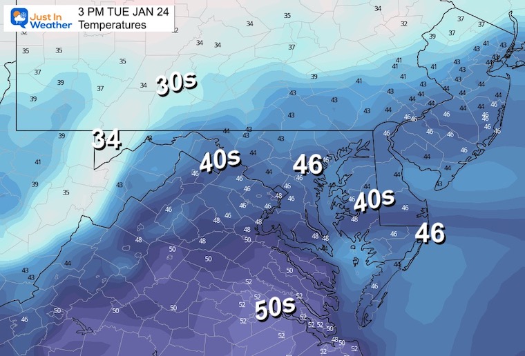
Briefly reaching the 40s, then dropping off. It will feel colder with the wind.
Normal Low in Baltimore: 25ºF
Record 0ºF in 1936
SNOW: 25.5” 2016
Normal High in Baltimore: 43ºF
Record 73ºF 1967
Latest Measurable Snow In Baltimore
Today Tied For 5th Latest
Feb 21 in 1973 (50 years ago)
Feb 6 in 1914 (109 years ago)
Jan 25 in 1992 ( 31 years ago)
Jan 25 in 1901 ( 122 years ago)
Jan 22 in 1966 (57 years ago)
Jan 21 in 1907 (116 years ago)
The Wednesday Event will interact with Strong High Pressure sending Cold Air farther south from New England. It looks like we may see snow (near and inland from Baltimore) late morning, and last into the afternoon.
Timing the arrival will make or break who can get in on the accumulating snow. There is work to be done on this one, but there is a chance for Baltimore City to break the snow drought!
I ran into a glitch in my graphic program this morning.
Monday: Ending As a mix of snow North of Baltimore
Tuesday: Partly Cloudy, Windy
Wednesday: Snow To Rain
Thursday: Breezy, A Flurry
Friday: Partly Cloudy, Breezy

Click to see more and ‘Book’ a visit to your school

I see many factors to support colder influence with multiple systems. Early and later in winter. Check it out.
Winter Outlook 2023 For Snow Not Typical La Niña Plus Polar Vortex Disruption
Atmospheric Memory Suggests Active Winter Storm Pattern Outlook
Winter Outlook 2023 From NOAA Very Different Than Farmers Almanacs
Winter Outlook 2023 Early Look At Snow From Two Farmers Almanacs
If you want a snowy winter, this is what you might want to look for in the rest of the tropical season. (You might be seeing a lot of commercial snow removal people out this Winter).
Record August For No Named Tropical Storms: Closer Look At Snow Following
Winter Weather Folklore Top 20 And More Outlook Signals From Nature For Cold And Snow
