


May 1 Weather Gradual Cooling Trend Will Bring Rain Into The Weekend
Wednesday, May 1 Morning Report One of the marks of May Day is an ancient European holiday celebrating the start of summer. It feels like we have had our taste…
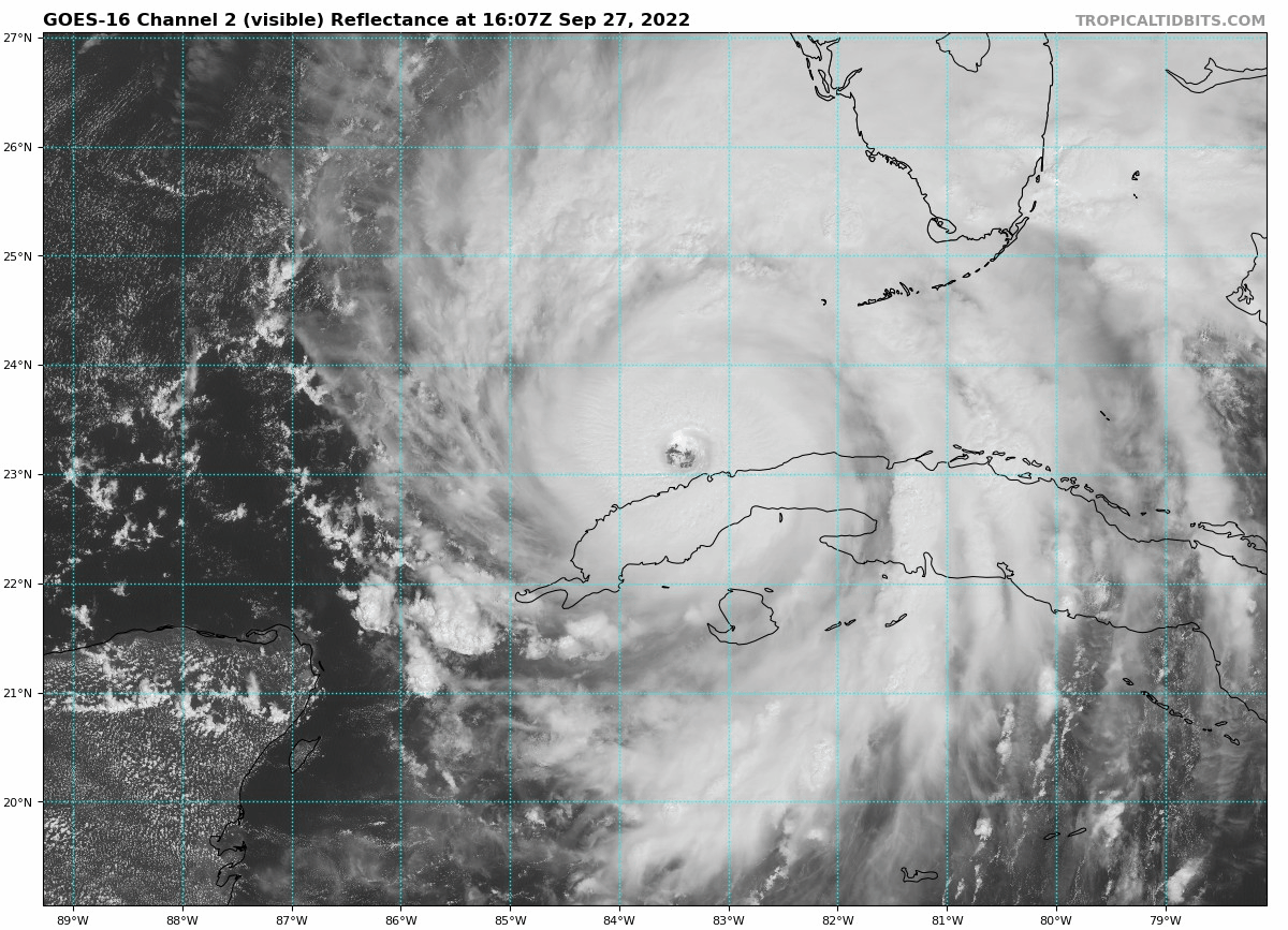
Tuesday Afternoon September 27
Hurricane Ian is gearing up for a powerful impact on Florida. As we have noticed, slight changes in the forward speed and direction have resulted in a dramatic shift in the projection for landfall. It will be devastating there, and we must look ahead to the impacts farther up the coast.
I am writing this with respect to my home region of the Mid Atlantic and the focus specifically on the Chesapeake Bay and Delmarva Beaches. Even with a diminished low and post tropical cyclone when it reaches us, the results can last a few days.
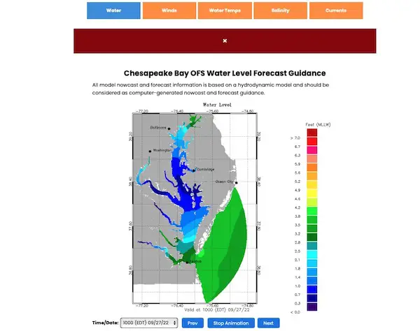
It is important to note that Sloshing on the Chesapeake Bay is like moving water in a bathtub. The Bay is shallow. However, we do not anticipate a full storm surge at this time. But flooding for some is likely. This is what I will address below.
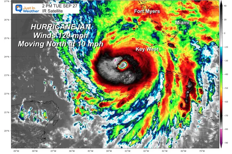
Click here to see my latest full report on Hurricane Ian can be found here.
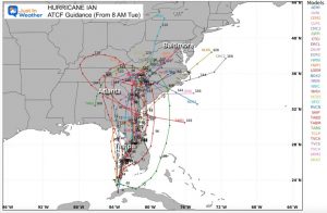
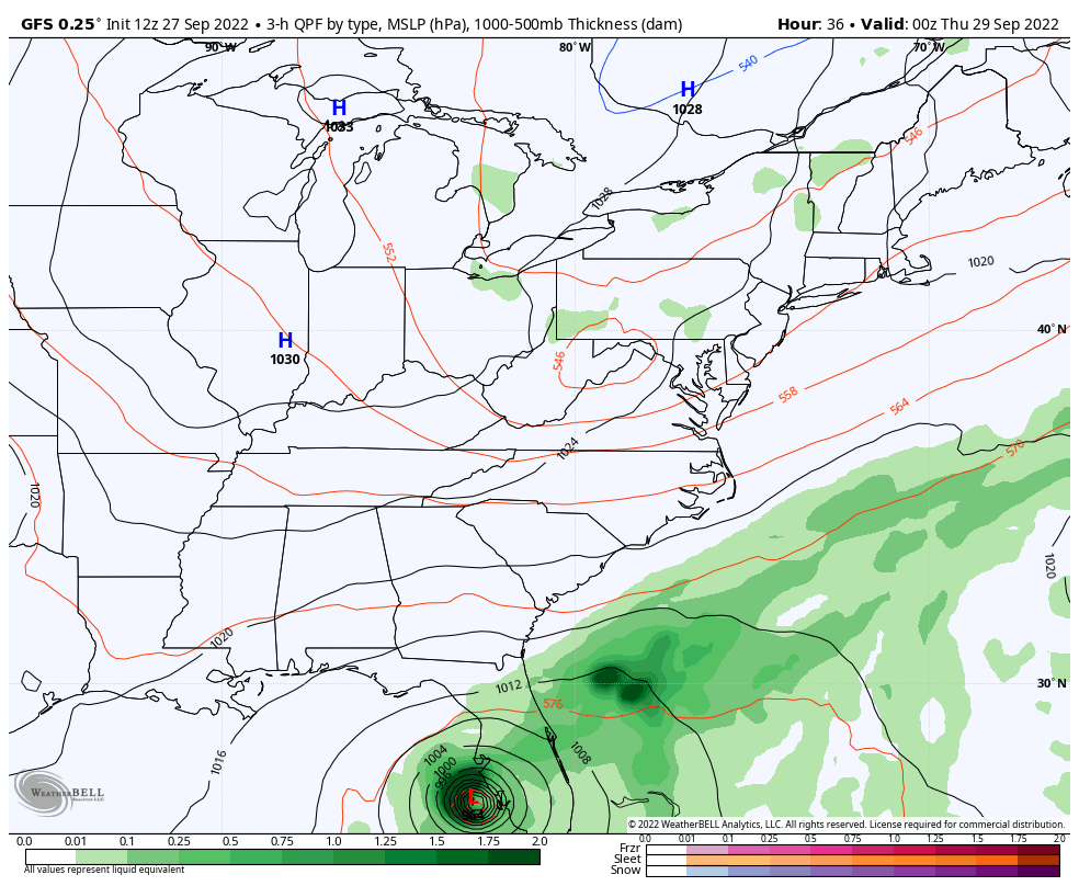
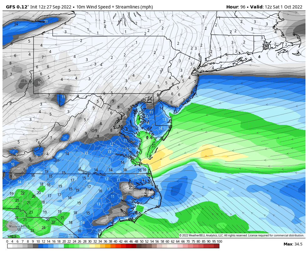
GFS Model 8 PM Wed Sep 28 to 8 PM Tue Oct 4
This is one solution (NOT GUARANTEED). This shows the Florida track, then a curve into Georgia, and redeveloping Low off the Mid Atlantic coast next week.
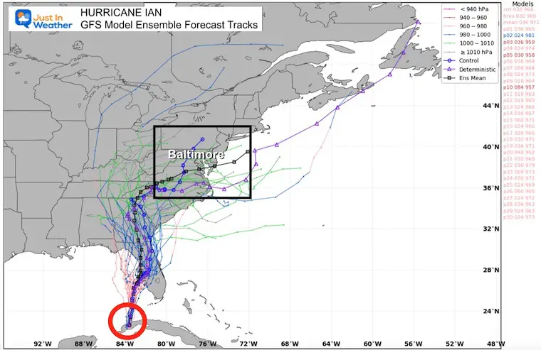
GFS Model
These are all the ensemble members, with the consensus plot highlighted black. That tracks directly through Central Maryland including metro Baltimore.
Mid Atlantic Region
Notice the persistent wind FROM the East and Northeast.
Atlantic Coast: Beach Erosion
Chesapeake Bay: Sloshing high water/flooding on the Western Shore. This will include Bowley’s Quarters and Annapolis which are subject to flooding. It will behave like a strong slow moving Nor’easter.
Eastern Shore: The wind will push the water away from you… So lower tides are expected.
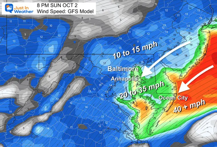
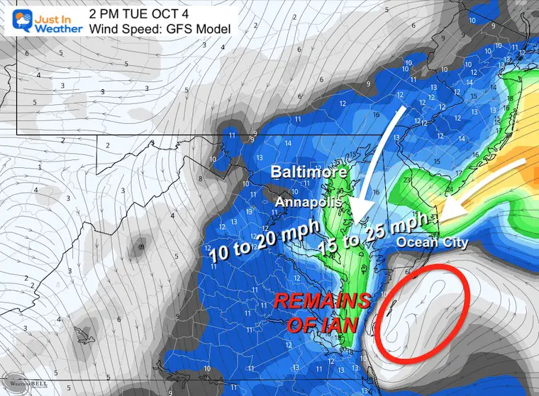
By the end of the period. The winds will be FROM the North, helping to drain water outside of the bay.
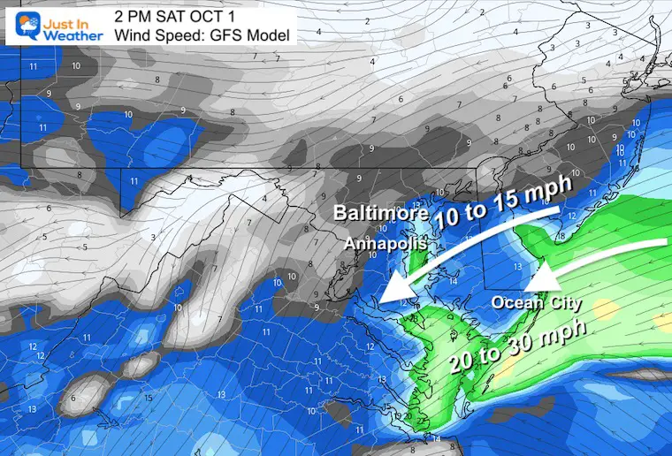
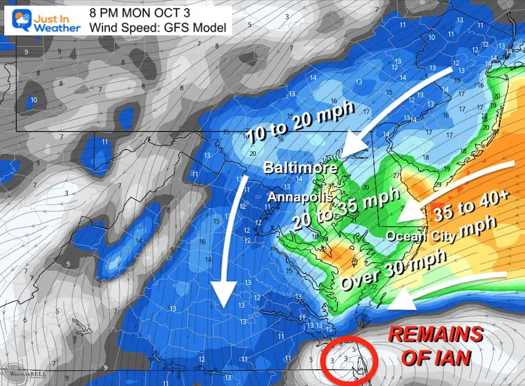
Winds will be increasing up to 35 mph on the central and southern Chesapeake Bay.
The ocean side may have winds over 40 mph = Tropical Storm Force.
The remnant Low of Ian will be trying to cross the Lower Chesapeake Bay!
The remnant Low of Ian will still be trying to cross the Lower Chesapeake Bay and reorganize to a new Surface Low.
Hurricane Ian May Help Cooler Pattern Change: Monitor For Atmospheric Memory This Winter
If you want a snowy winter, this is what you might want to look for in the rest of the tropical season.
Record August For No Named Tropical Storms: Closer Look At Snow Following
NOAA 2022 Hurricane Forecast- Above Normal Again

NOAA Study: Reducing Air Pollution INCREASED Tropical Storms

Atlantic Tropical History: Maps of Origin Regions Every 10 Days


Click to see more and ‘Book’ a visit to your school
