September 27, 2022
Tuesday Morning Update
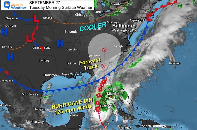
We are in a cooler and drier weather pattern. The complication is that High Pressure to our north will try to hold off Hurricane Ian as it tracks this way after making landfall.
This is very complicated as Hurricane Ian itself has slight changes that can have big impacts later in the week for us. This morning it is a Major Category 3 Hurricane hitting Cuba with 125 mph winds. The track has changed for Florida, and if it slows down there, it will delay when it may reach us.
Morning Surface Weather
Variable clouds are across our sky this morning.
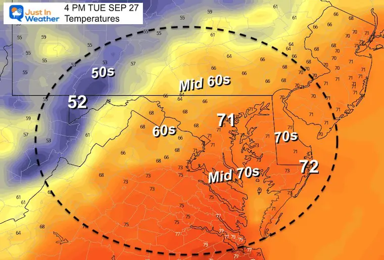
Afternoon Temperatures
We should remain partly to mostly sunny into the afternoon. Today may be the warmest day of the week.
CLIMATE DATA
TODAY September 27
Normal Low in Baltimore: 55ºF
Record 39ºF in 1957
Normal High in Baltimore: 76ºF
Record 95ºF 1998
When Is The First Frost?
Average Frost And Freeze Dates in Maryland and Pennsylvania
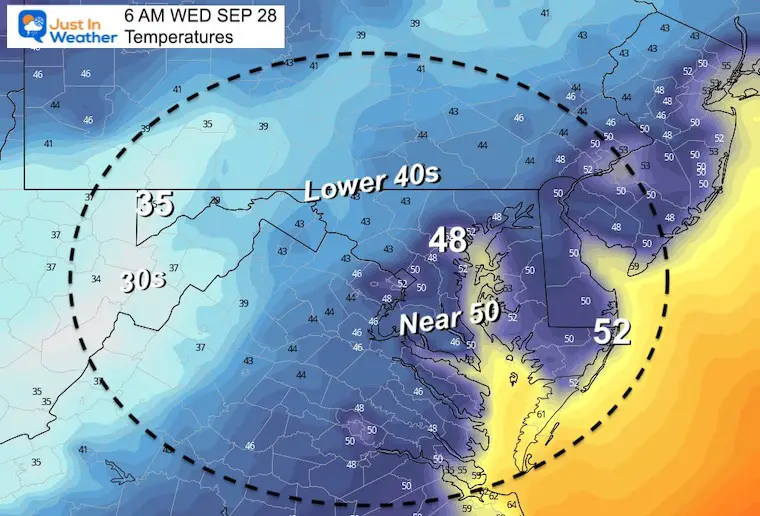
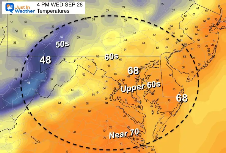
Wednesday Temperatures
Morning
Afternoon
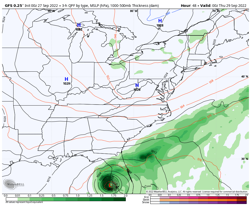
Hurricane Ian Morning Update
Click the image for the full report

Long Range Forecast For Ian
GFS Model
Wednesday Evening to Monday Morning
The track keeps adjusting. The GFS is in better agreement with the European and tropical models, but there is still some variation. One of which is the potential for slowing down or stalling by Florida. That will increase the rainfall there and delay the arrival for us.
Wild Card: Saturday could bring in the rain or remain dry depending on Ian’s behavior. Sunday is more likely to be wet, with rain lasting in to Monday.
Also note: We will be in a chilly air mass, so despite the remains of a tropical system, we should get a chilly rain.
I will have an update on the local rainfall expectation in my afternoon report.
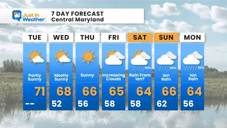
7 Day Forecast
Most of next week will be dry and seasonal, trending cooler. Rainfall next weekend will depend on how Ian behaves. Slight adjustment to the track up to landfall will determine how strong and how much moisture it can push inland.
COMPARE TO THE PAST
If you want a snowy winter, this is what you might want to look for in the rest of the tropical season.
Record August For No Named Tropical Storms: Closer Look At Snow Following
Hurricane Ian May Help Cooler Pattern Change: Monitor For Atmospheric Memory This Winter
Also See:
Hurricane Ian Flooding May Reach Maryland This Weekend
Hurricane Season Forecast: June 1 Through November 30
NOAA 2022 Hurricane Forecast- Above Normal Again

Related Posts
NOAA Study: Reducing Air Pollution INCREASED Tropical Storms

Atlantic Tropical History: Maps of Origin Regions Every 10 Days


Please share your thoughts, best weather pics/videos, or just keep in touch via social media
STEM Assemblies/In School Fields Trips Are Back
Click to see more and ‘Book’ a visit to your school


