


May 12 Mothers Day Showers And Another Aurora Viewing Tonight May Be Better
Sunday May 12 Mother's Day Morning Report Today, we focus on the all-important Mother’s Day weather and the ongoing impact of the latest Solar Storm. We have been stuck in…
July 10 2022
Sunday Evening Report
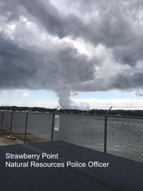
All was supposed to be quiet today as the latest storm system was moving out and allowing for cooler and dryer air to settle in. But a funnel cloud broke the quiet for many long the Chesapeake Bay today.
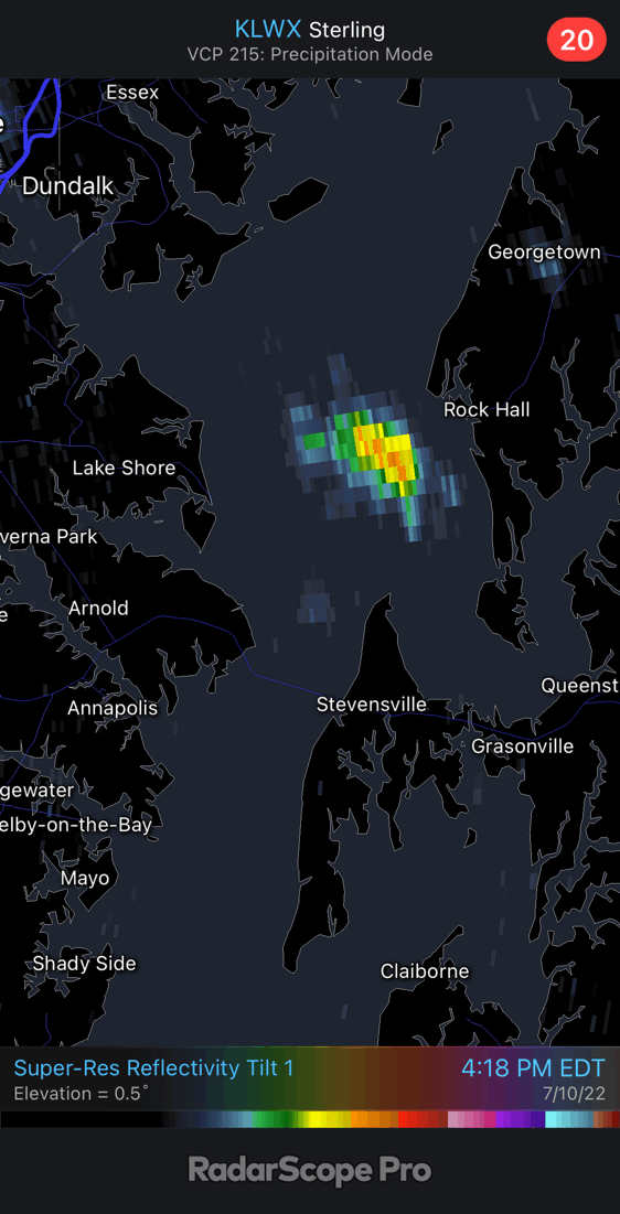
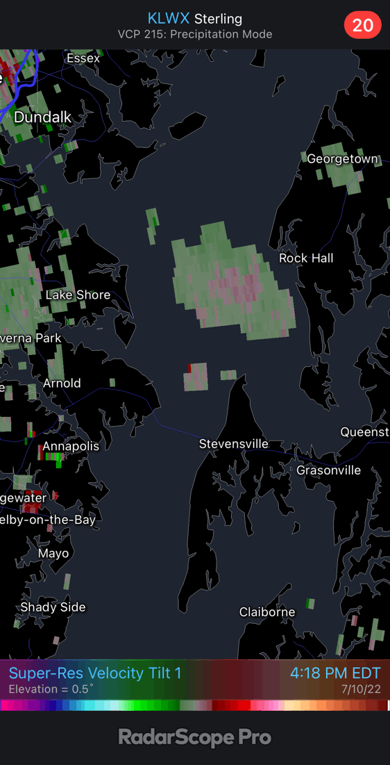
The perfect conditions set up with a Northeasterly wind to develop a lone storm cell near Rock Hall and move westward over the Chesapeake Bay. This had just the right amount of spin, captured on Doppler Radar, to allow the cell to rotate and produce a little funnel from the cloud base. It remained over the water of the Chester River and north of Kent Island.
Cooler air can produce funnels, and that may have been the case today.
I have received many photos and reports, but none seemed to show any touchdown.
Let’s take a look at photos and the Doppler Radar loops. The best image may be the last in the sequence below. Let me know what you think.
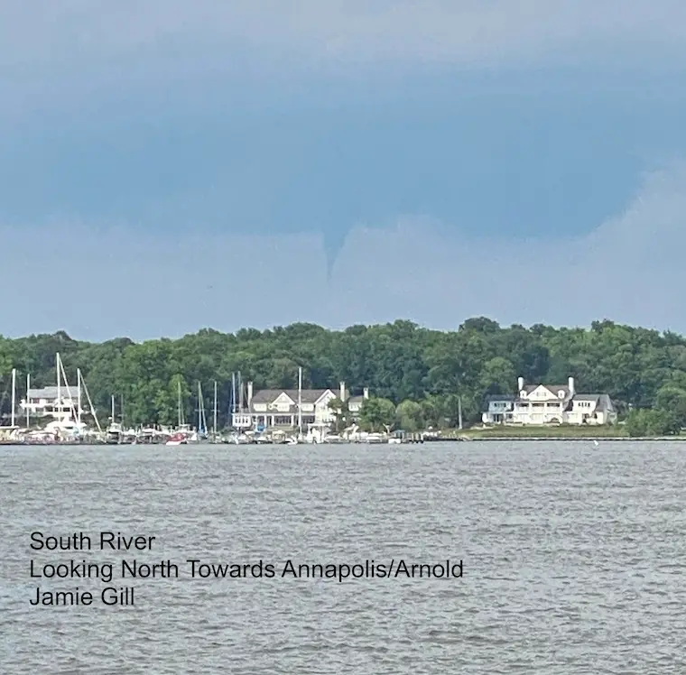
Jamie Gill saw this around 4:45 PM.
Located in the South River looking North towards Annapolis/Arnold.
It lasted about 5 minutes.
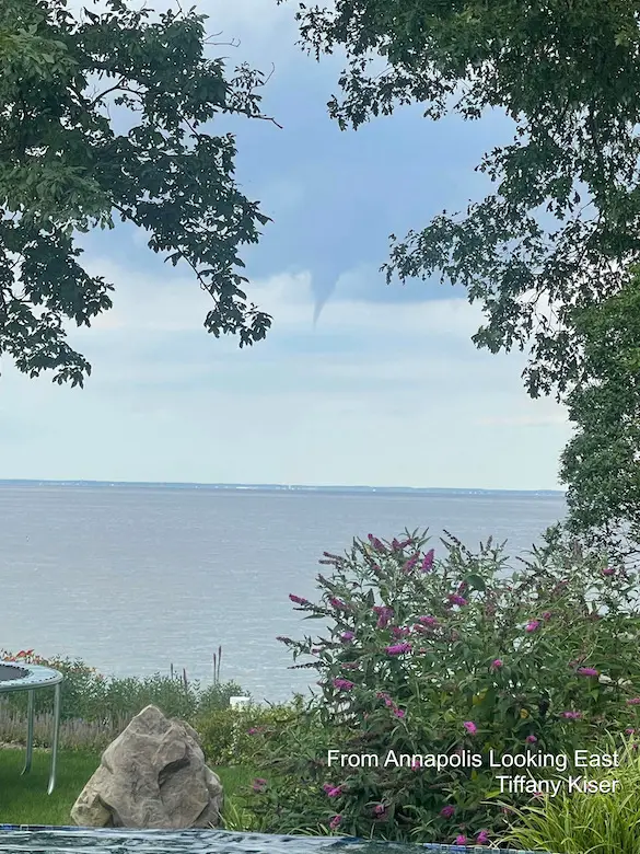
Adam Kiser got these two pics from his daughter Tiffany Kiser
She said this was around 5:11 PM
“We are in Annapolis. It’s on the bay just before Sandy Point and the Bay Bridge”

This funnel cloud seemed to be framed perfectly between the trees and above the water. I think this view would be great without the cool cloud as well.
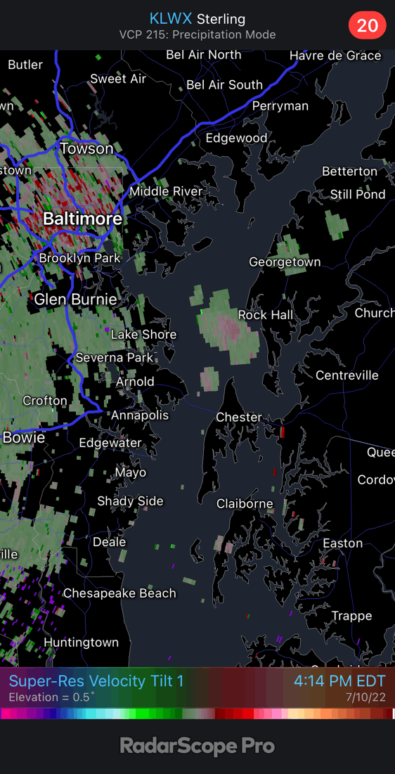
4:14 PM to 5:18 PM
We can see this little cell get a spin between Rock Hall and the north side of Kent Island.
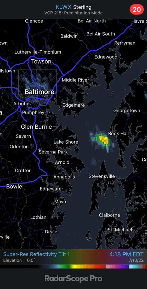
This shows the wind flow, and looking closely we can see some circulation dropping southwest from Rock Hall.
It appears this remained over the water the entire time and little more than 1/2 hour.
While this seemed to run its course shortly after 5 PM, that is when most eyewitnesses (reported below) spotted the funnel.
That might be due to the location closer to land… at least with view from the more densely populated western side of the Bay near Arnold and Annapolis.
More Photos and Eyewitness Reports
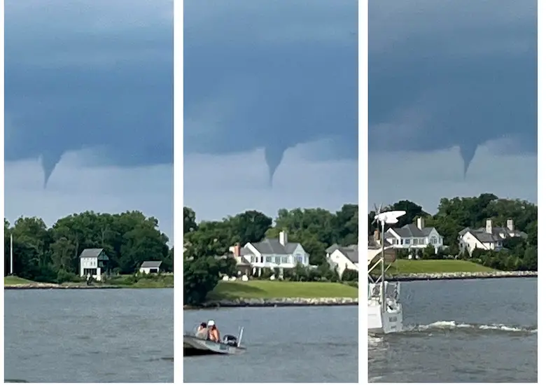
Veronica said this was leaving White Hall Bay, south of the Bay Bridge looking north back towards Podickory Point.
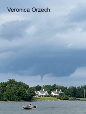
Veronica Orzech also captured this three photo sequence with backdrop of shoreline homes and some quiet and cautious boats in the foreground.
Jim Hookey saw this around 5:10 PM
Location: Magothy Marina in Severna Park looking East.

Tammy Lettie Brashear —-> slider
Time: Around 5:15 PM
“We had just left The Jetty. Heading to and across Bay Bridge then it was gone.”


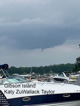
Katy ZuWallack Taylor’s view from Gibson Island
Carolyn Brown saw this from Stevensville

Morgan Dailidenas saw this on Rt 50 near Annapolis

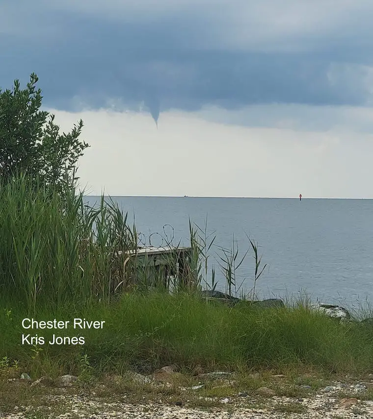
The best view is the latest in the timeline…
At 5:17 PM on the Chester River, Kris Jones Captured this view!
Shout out to Mallory Brower for being in the right place at the right time-watching @Joeyharkum at @Nicksfishhs
Look to the left of the picture. She captured this Funnel Cloud that may or may not have ended in a water spout.
📸: Mallory Brower@JustinWeather #AnnapolisMusic pic.twitter.com/4JopmmrkTi
— BeeprBuzz (@BeeprBuzz) July 10, 2022
October 16 Waterspout Among Top 10 Chesapeake Bay Storm Photos
April 9 2020: Was That A Waterspout On The Bay?
NOAA 2022 Hurricane Forecast- Above Normal Again


NOAA Study: Reducing Air Pollution INCREASED Tropical Storms

Atlantic Tropical History: Maps of Origin Regions Every 10 Days


May 16 Large Hail Videos And Storm Tracking Map


*Disclaimer due to frequent questions:
I am aware there are some spelling and grammar typos. I have made a few public statements over the years, but if you are new here you may have missed it:
I have dyslexia, and found out at my second year at Cornell. I didn’t stop me from getting my meteorology degree, and being first to get the AMS CBM in the Baltimore/Washington region.
I do miss my mistakes in my own proofreading. The autocorrect spell check on my computer sometimes does an injustice to make it worse.
All of the maps and information are accurate. The ‘wordy’ stuff can get sticky.
There is no editor that can check my work when I need it and have it ready to send out in a newsworthy timeline.
I accept this and perhaps proves what you read is really from me…
It’s part of my charm.