


July 18 Flood Watch In The Mountains Then Storms Expand Back This Weekend
Friday, July 18 2025 Morning Report There is some relief in sight, but I remain cautious. For the short term, today remains muggy, while the focus of strong storms and…
July 5 2022
Tuesday Morning Update
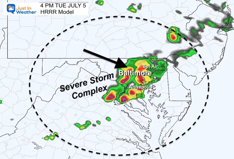
We can be grateful for the beautiful weather we had yesterday, because today will feel more humid with developing storms. A storm complex moving out of the Great Lakes will arrive during the peak afternoon will allow it to reach top potential when crossing central Maryland. This brings the potential for destructive weather.
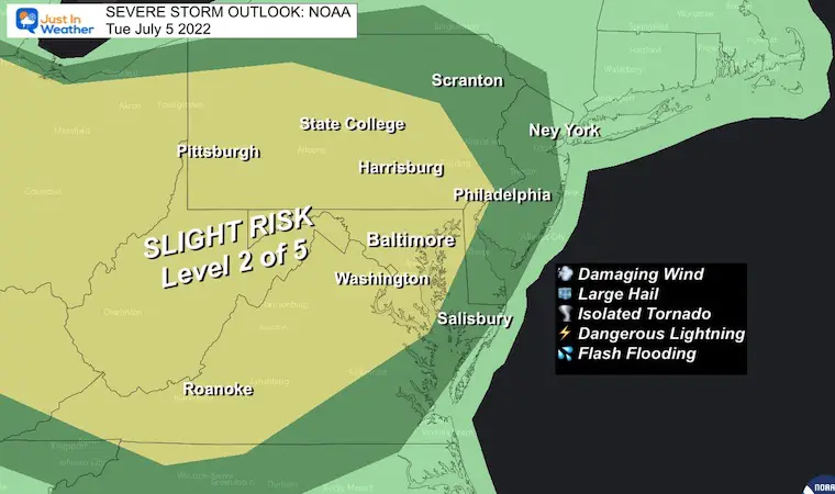
The Slight Risk for Severe Storms means about 15% chance of any storm turning severe. That could bring damming winds over 58 mph, large hail over 1” diameter, and even an isolated tornado.
Any storm can bring dangerous lighting and flash flooding.
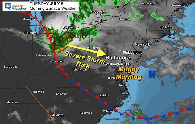
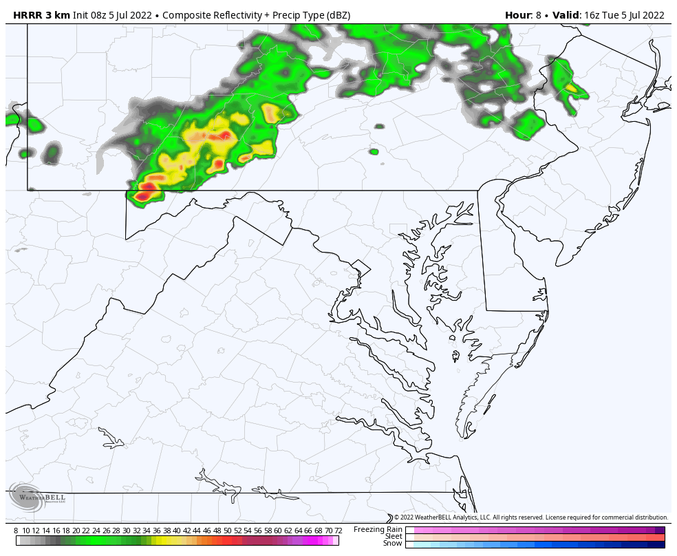
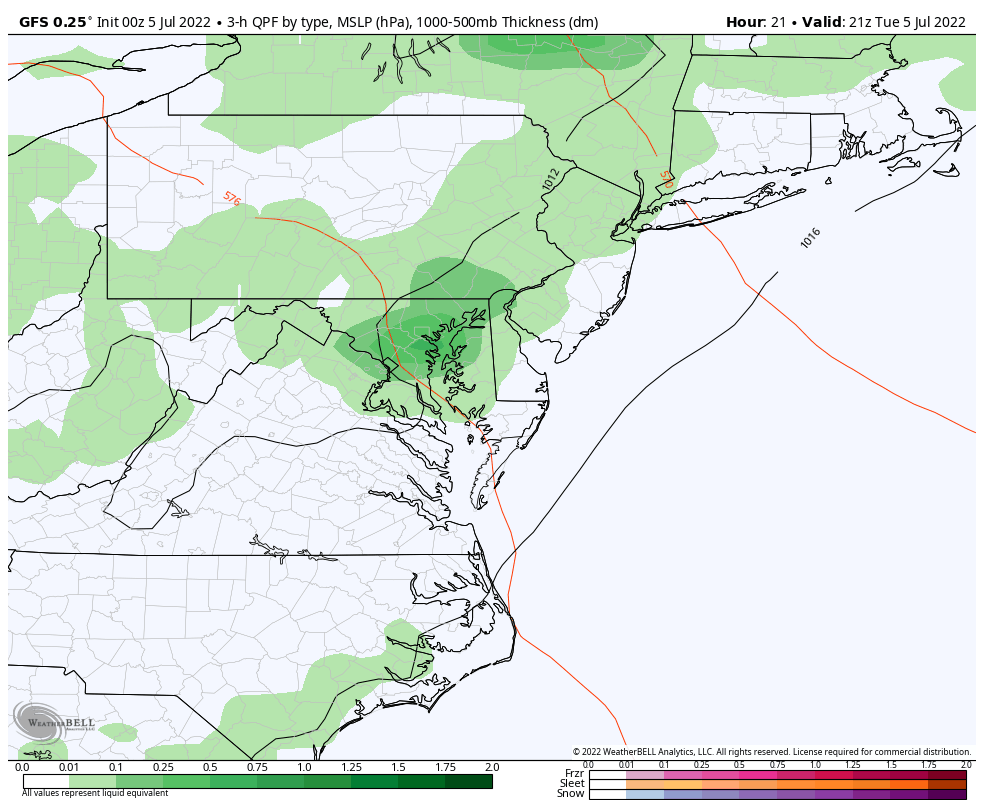
Here we can see the complex crossing Lower Michigan, which will then dive southeast in our direction later today.
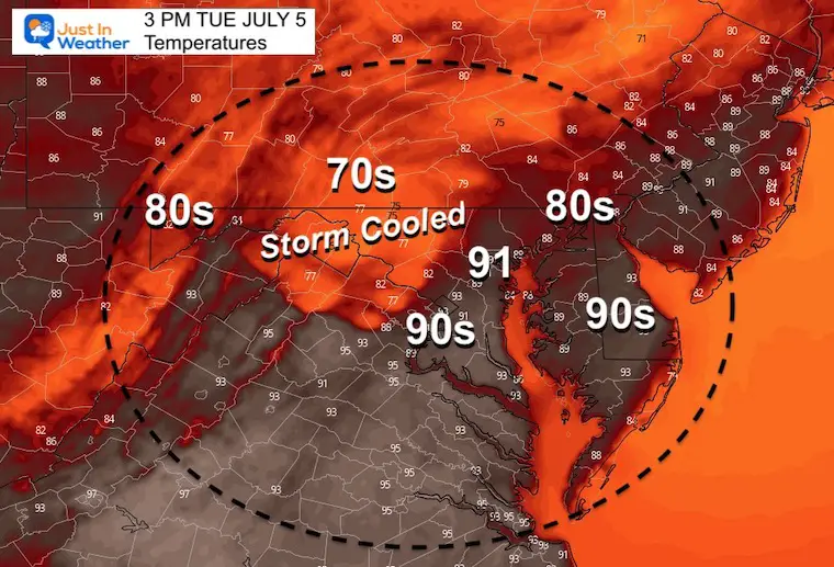
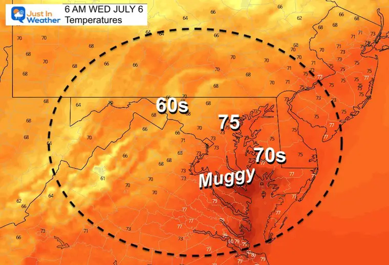
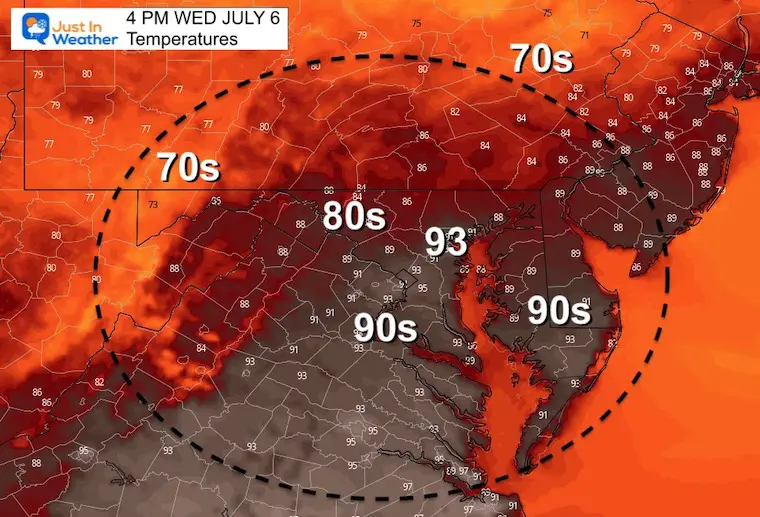
I picked this snapshot to show the contrast of 90s in metro areas to 70s just inland cooled from the storms.
This particular HRRR Model suggest the peak complex reaching central Maryland and metro Baltimore. I will again suggest a 1 hour buffer, so consider the region to be impacted between 3 PM and 5 PM.
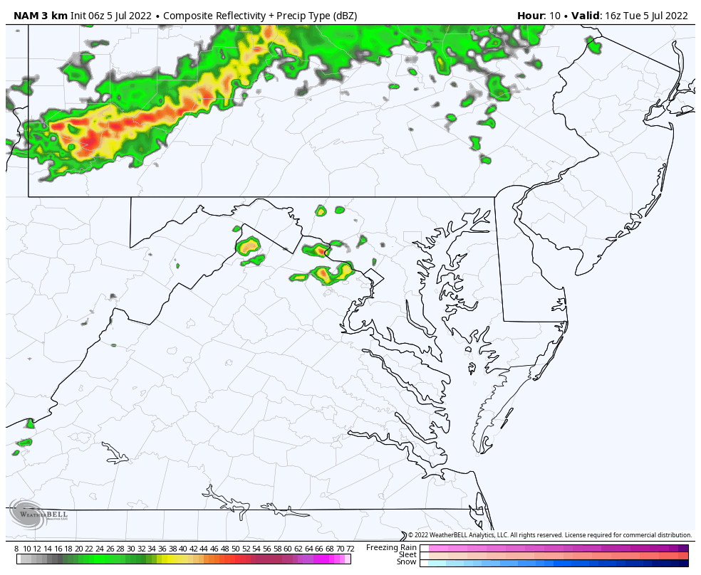
Comparing two models, but this will likely play out between the two suggestions.
This model focuses on one main cluster of storms mid afternoon. This behaves like a Meso-Low with potential for widespread severe storm behavior. Multiple warnings may possibly be issued.
This model shows more activity earlier in the afternoon, but less intense complex at the 4 PM time frame…
TODAY July 5th
Normal Low in Baltimore: 66ºF
Record 55ºF in 2014
Normal High in Baltimore: 89ºF
Record 102ºF 1999
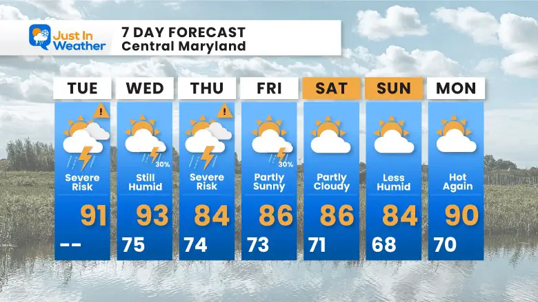
We will get into the pattern of scattered showers and storms just about each day. This does NOT promise you will get hit as many of these will be scattered showers, and like we saw over the weekend, those can dump on some areas while leave others out.

NOAA 2022 Hurricane Forecast- Above Normal Again


NOAA Study: Reducing Air Pollution INCREASED Tropical Storms

Atlantic Tropical History: Maps of Origin Regions Every 10 Days


May 16 Large Hail Videos And Storm Tracking Map


*Disclaimer due to frequent questions:
I am aware there are some spelling and grammar typos. I have made a few public statements over the years, but if you are new here you may have missed it:
I have dyslexia, and found out at my second year at Cornell. I didn’t stop me from getting my meteorology degree, and being first to get the AMS CBM in the Baltimore/Washington region.
I do miss my mistakes in my own proofreading. The autocorrect spell check on my computer sometimes does an injustice to make it worse.
All of the maps and information are accurate. The ‘wordy’ stuff can get sticky.
There is no editor that can check my work when I need it and have it ready to send out in a newsworthy timeline.
I accept this and perhaps proves what you read is really from me…
It’s part of my charm.