


May 5 Soggy And Chilly Start With More Rain During The Week Ahead
Sunday May 5 Morning Report We are stuck in this muck! The wet weather pattern continues with a soggy start this Sunday morning. The rain will try to break up…
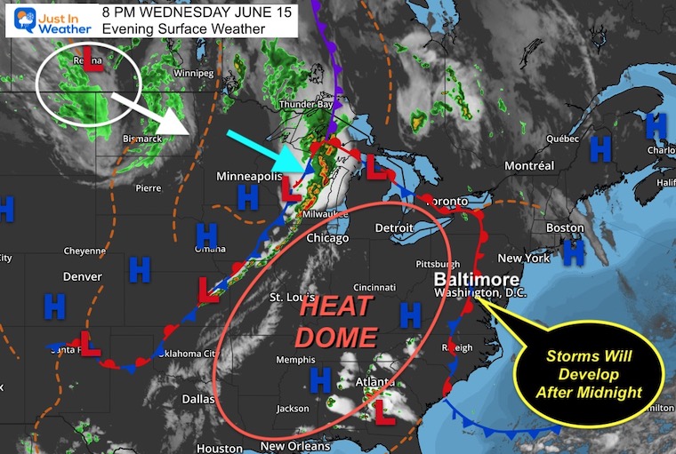
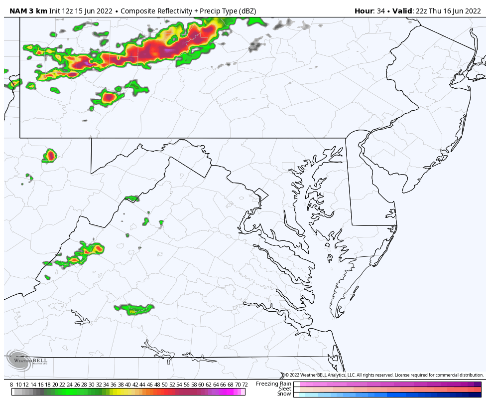
9 PM June 15 2022
Wednesday Evening Update
Well, here we go again. Sometimes we get into a pattern with similar weather events at similar times. You might have noticed that with winter snow or ice events arriving at the same time of day order of the week.
This time we have energy in the atmosphere that wants to develop before sunrise. This one is a little different than the last event, as a boundary over the middle of our region will help storms form overnight. These may produce locally heavy rain and flooding. It may also ‘pop’ some lighting with loud thunder to shake and wake some out of bed. So hopefully you will not be surprised if it happens.
We will have another from the Great Lakes we can track to push through at night.
This is actually a very impressive Larger Circulation entering North Dakota. That pool of cool air bumping into the Heat Dome in the Southern US is the main reason for the eruption of severe storms.
The two I want to focus on:
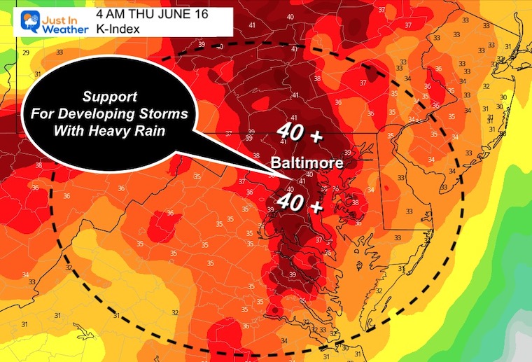
Here is a look at one storm identifier called the This K-Index. It’s a measure of potential thunderstorm development.
This is best used when the numbers bump into the upper 30s and over 40. Here we see that before sunrise, which supports heavy rain in whatever showers form.
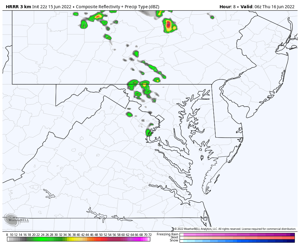
HRRR Model 2 AM to Noon
Here we can see the development of heavy rain along that same K-Index 40+ region. It will be followed by a line of thunderstorms in what appears to be a mesoscale Low…
Similar to the last event, this will be a morning time frame.
Metro areas can see that between 4 AM and 10 AM. These may contain heavy rain and storms, with local flooding through the morning commute.
This one moves beyond Southern Maryland by noon.
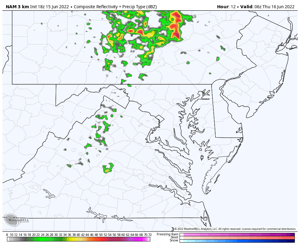
This is the same product as above, but you can control it…
Note: As before, the timing is NOT perfect. Please consider there may be as much as a 1 to 2 hour buffer (arriving earlier).


2 AM to Noon
This is the same time frame as above, and the result is similar.
The afternoon will be quiet… But temps are the wild card.
If more clouds remain, we may say in the 70s. If we get sun and into the mid 80s, then we fuel the next event at night.
NAM 3Km 6 PM Thursday to 4 AM Friday
This will be a more distinct line of storms we will see moving out of the Great Lakes through NW Pennsylvania… and track into our region at night.
A cluster of storms that may be severe could be tracking through southern PA at this time.
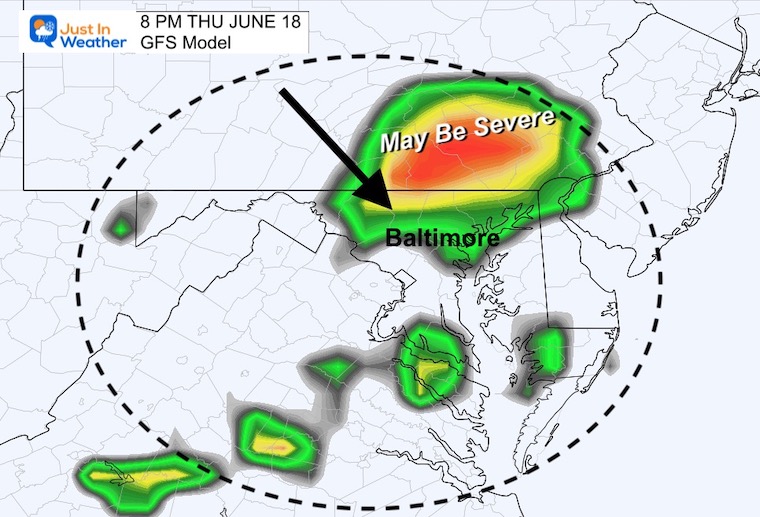
This older version still showed a more pronounced cold front arriving after dark.
I must confess that the interim (18Z) model run had this line breaking up a bit. But I do not trust those off hour model plots for big changes. So I am holding off any any judgment dropping this evening or night risk yet. We will see any adjustment with the overnight models, which I will address in the morning.
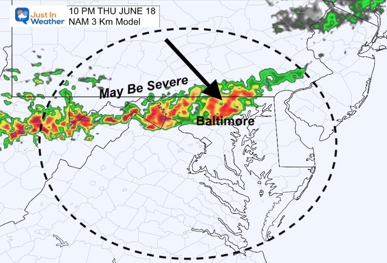
I will be up again early to post an update in the 5 AM hour…

NOAA 2022 Hurricane Forecast- Above Normal Again


NOAA Study: Reducing Air Pollution INCREASED Tropical Storms

Atlantic Tropical History: Maps of Origin Regions Every 10 Days


May 16 Large Hail Videos And Storm Tracking Map


*Disclaimer due to frequent questions:
I am aware there are some spelling and grammar typos. I have made a few public statements over the years, but if you are new here you may have missed it:
I have dyslexia, and found out at my second year at Cornell. I didn’t stop me from getting my meteorology degree, and being first to get the AMS CBM in the Baltimore/Washington region.
I do miss my mistakes in my own proofreading. The autocorrect spell check on my computer sometimes does an injustice to make it worse.
All of the maps and information are accurate. The ‘wordy’ stuff can get sticky.
There is no editor that can check my work when I need it and have it ready to send out in a newsworthy timeline.
I accept this and perhaps proves what you read is really from me…
It’s part of my charm.