


April 24 Weather: Some Showers Then Another Push Of Cold Air Followed By Summer Heat Sunday
Wednesday, April 24 Morning Report A milder start today with most areas in the 50s to near 60ºF along parts of the Bay. There is a push of colder air…
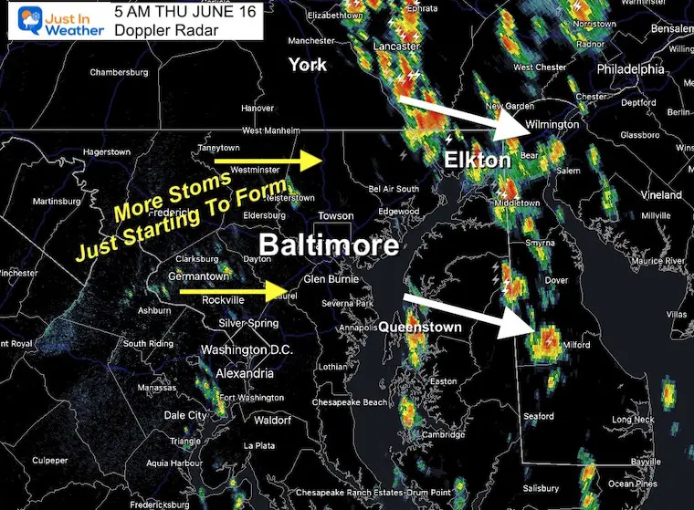
5 AM June 16 2022
Thursday Morning Update
Watching storms develop rather than move in from another location is alway tacky business. The forecast lat night held up, with the exception that the storm formation was a little later and a little farther east.
Not that they have ‘popped’, we can watch Harford and Cecil Counties through Delmarva for this burst… Plus morning on the way.
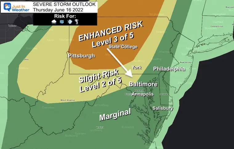
We are still expecting 2 Rounds: One this morning, then again this evening with a severe risk.
3 AM to 5 AM
Click here for the full morning update
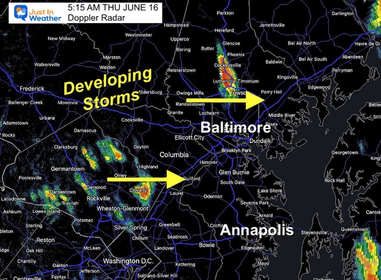
Quick development with this cell along I-83 centered on Cockeysville.
More in Montgomery County will track east. Columbia, Laurel, Glen Burnie, and maybe Annapolis could get in on this in the next hour.
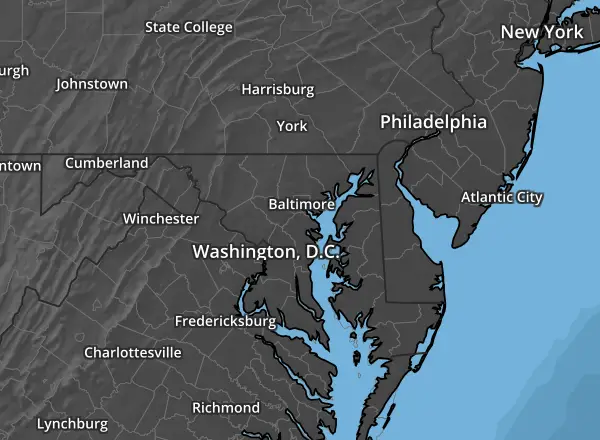


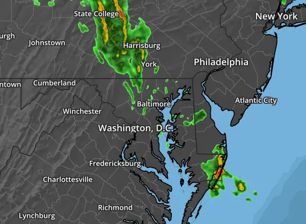


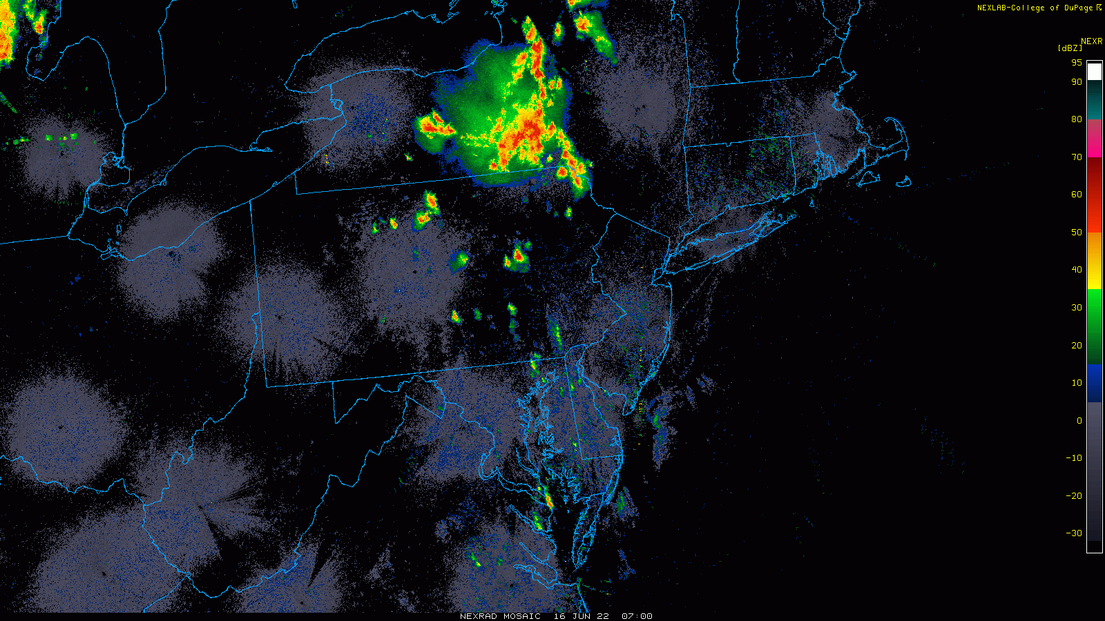
Here we can see the development of heavy rain along the Chesapeake with reinforcements from Pennsylvania to pull through the rest of the region.
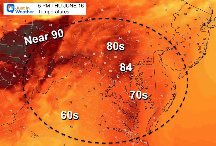
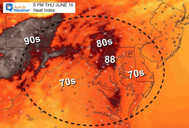
After the storms depart and the sun comes out, temps will jump with higher humidity. This will bring back the heat index.
Temperatures
Heat Index
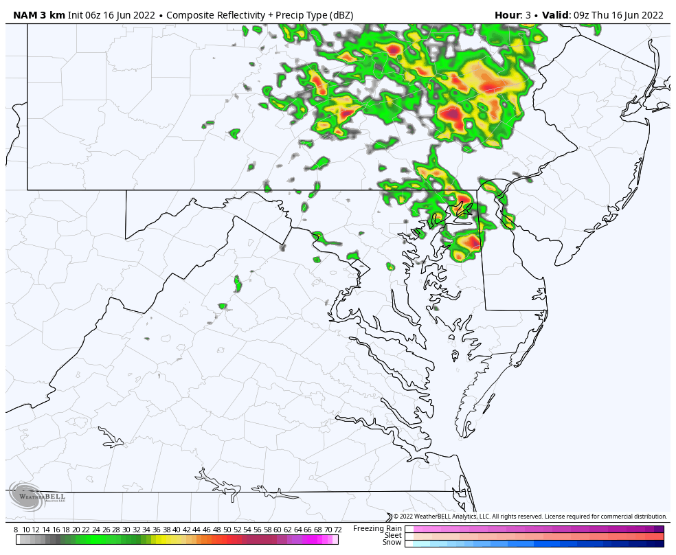
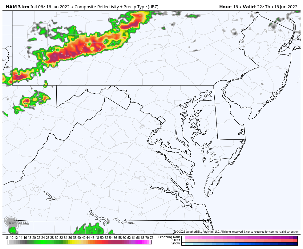
Round 2 At Night
NAM 3Km 6 PM Thursday to Midnight
This will be a more distinct line of storms we will see moving out of the Great Lakes through NW Pennsylvania… and track into our region at night.
There is a risk for these to turn severe. I will have more on this in my update (aiming to be published around 6:30 AM)

NOAA 2022 Hurricane Forecast- Above Normal Again


NOAA Study: Reducing Air Pollution INCREASED Tropical Storms

Atlantic Tropical History: Maps of Origin Regions Every 10 Days


May 16 Large Hail Videos And Storm Tracking Map


*Disclaimer due to frequent questions:
I am aware there are some spelling and grammar typos. I have made a few public statements over the years, but if you are new here you may have missed it:
I have dyslexia, and found out at my second year at Cornell. I didn’t stop me from getting my meteorology degree, and being first to get the AMS CBM in the Baltimore/Washington region.
I do miss my mistakes in my own proofreading. The autocorrect spell check on my computer sometimes does an injustice to make it worse.
All of the maps and information are accurate. The ‘wordy’ stuff can get sticky.
There is no editor that can check my work when I need it and have it ready to send out in a newsworthy timeline.
I accept this and perhaps proves what you read is really from me…
It’s part of my charm.