


May 7 Warming Up With Only Isolated Showers And Thunderstorms
Tuesday, May 7 Morning Report We are entering a period of warming with less rain for a few days. We will still see some isolated showers and thunderstorms pop up…
June 13 2022
Monday Morning Update
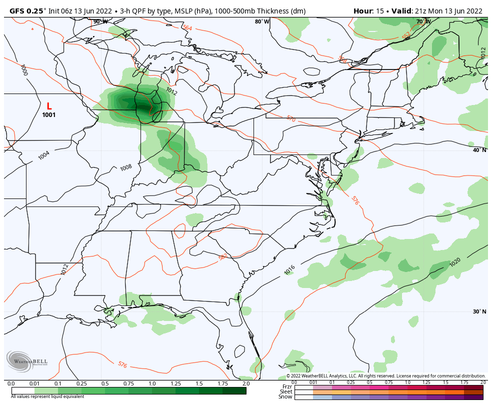
For the past two days I have mentioned a Mesoscale Convective Complex. That MCC is a hyper energized Low Pressure system that is common in summer patterns. This is when an organized area of severe storms develops on the north side of a Heat Dome or Ridge of High Pressure, which can hold together overnight as it dives around that Ridge to the Southeast.
In today’s case, that is located in the Northern Plains entering the Great Lakes, and will be diving into the Mid Atlantic Tuesday Morning.
The MCC is developing between Minneapolis and Chicago today.
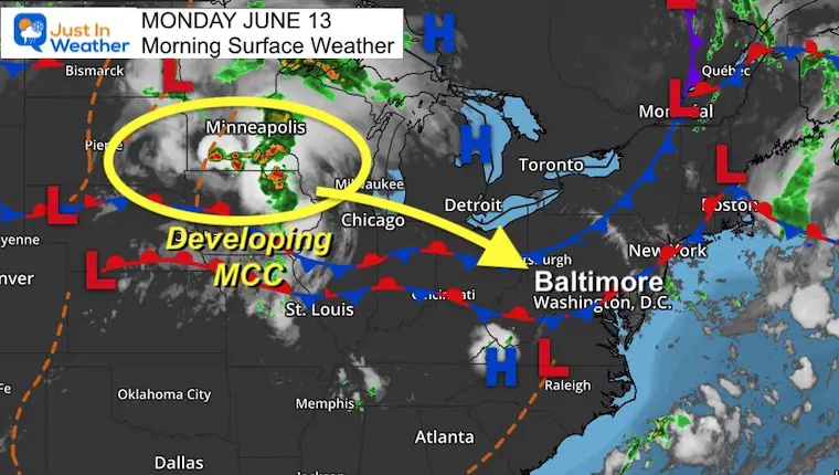
That cluster of storms is the focus for severe storms today, which will will track our way overnight. This will surge with intensity this afternoon and evening.
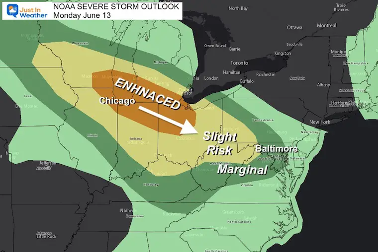
Chicago to central Ohio is the focus for Enhanced Severe Storm Risk.
Damaging Winds, Large Hail are likely with a fe tornadoes possible.
Ive annotated the movement to give the hint ho advisories and the outlook should shift into tomorrow..
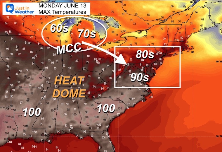
Here are the forecast high temperatures today, plus where this MCC will be forming and moving.
Not necessarily. We can have an MCC complex without being labeled a Derecho- which is classified when 240 miles of continuous wind damage path with a minimum of 58 mph winds. Often exceeding 70 mph. These produce straight line winds over a large area rather than a confined tornado path.
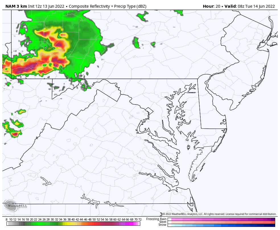
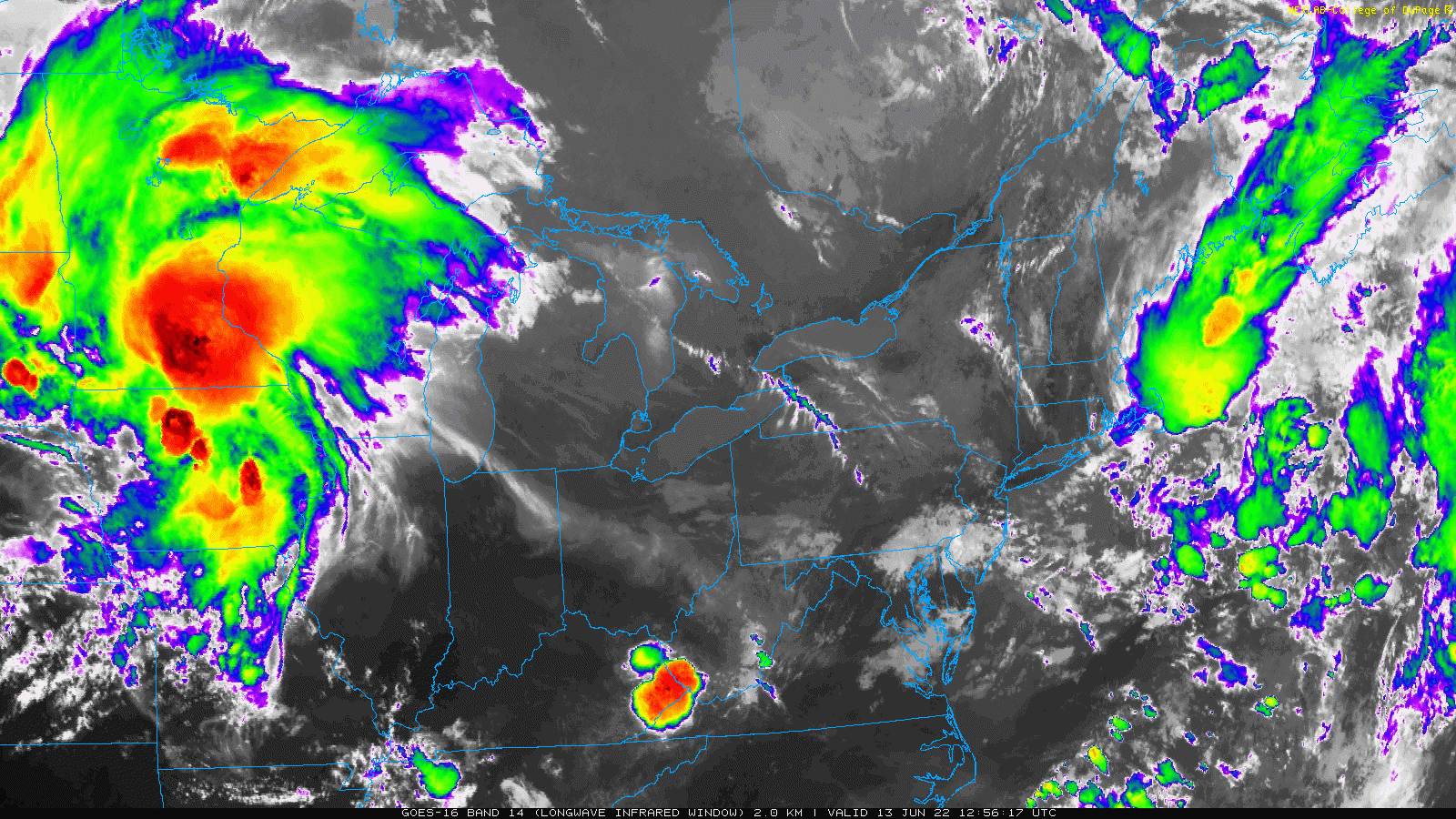
I’ve annotated the core circulation to show where this is likely to track. The line may break up over the mountains, with elements retaining intensity near metro Baltimore and Delmarva.


I will continue to track the short-range models for timing and location. There has been a slight variation in how this will track, which I will get into more detail later.
For now, let’s focus on the expectation for Tuesday Morning arrival with potential severe parameter.

NOAA 2022 Hurricane Forecast- Above Normal Again


NOAA Study: Reducing Air Pollution INCREASED Tropical Storms

Atlantic Tropical History: Maps of Origin Regions Every 10 Days


May 16 Large Hail Videos And Storm Tracking Map


*Disclaimer due to frequent questions:
I am aware there are some spelling and grammar typos. I have made a few public statements over the years, but if you are new here you may have missed it:
I have dyslexia, and found out at my second year at Cornell. I didn’t stop me from getting my meteorology degree, and being first to get the AMS CBM in the Baltimore/Washington region.
I do miss my mistakes in my own proofreading. The autocorrect spell check on my computer sometimes does an injustice to make it worse.
All of the maps and information are accurate. The ‘wordy’ stuff can get sticky.
There is no editor that can check my work when I need it and have it ready to send out in a newsworthy timeline.
I accept this and perhaps proves what you read is really from me…
It’s part of my charm.