June 13 2022
Monday Morning Report
We seem to be in a pattern with morning thunderstorms. We have some this morning on the north end among the Maryland and Pennsylvania line. There will be a much larger cluster tomorrow (Tuesday) that is worth tracking for severe weather. This will be on the edge of a Heat Dome that is dominating much of the nation.
We get in on some of that heat today, and flirt with it and more storms most of the week. The outlook for Father’s Day weekend gets us back to cooler than pleasant weather.
Morning Set Up
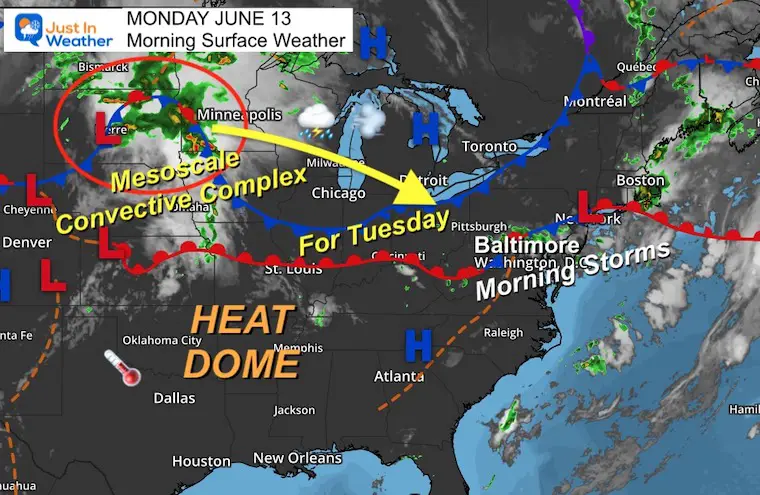
Surface Weather
The front responsible for this morning’s showers will actually open us up for hotter temps.. for a day. The true heat will be to our south and west where many areas will top 100ºF! But on the edge of the Heat Dome is where a destructing Mesoscale Convective Complex is expected to form. This is a hyper focused circulation with potent winds that an be destructive overnight. It is NOT necessarily a Derecho, but can lead to one…
That is what we expect for us on Tuesday…
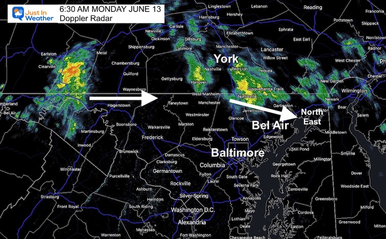
Doppler Radar at 6:30 AM
Morning heavy rain bands and some thunders… this should fade as it passes into Maryland… But that is the flow we need to keep watching..
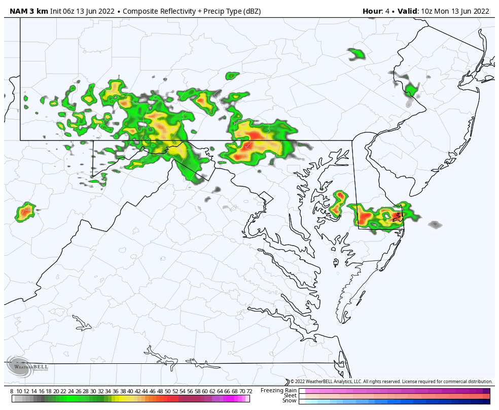
Radar Simulation at 6 AM to 10 PM
After the morning cluster falls apart, most should remain quiet, with some storms south of Washington DC later today…
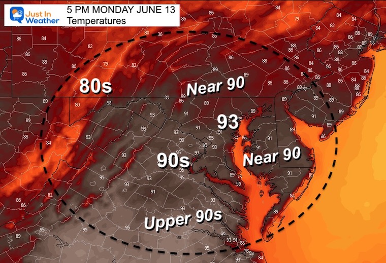
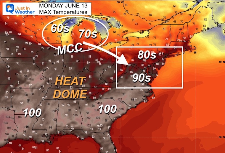
Afternoon High Temperatures
CLIMATE DATA
TODAY June 12th
Normal Low in Baltimore: 61ºF
Record 46ºF in 1972
Normal High in Baltimore: 82ºF
Record 96ºF 1986
Wider View
High Temperatures
Here is a taste of the HEAT that will push 90s and 100s for much of the deep south. Meanwhile, 60s and 70s across the Great Lakes. That is where the complex of storms (MCC) is expected to crank up today and tonight.
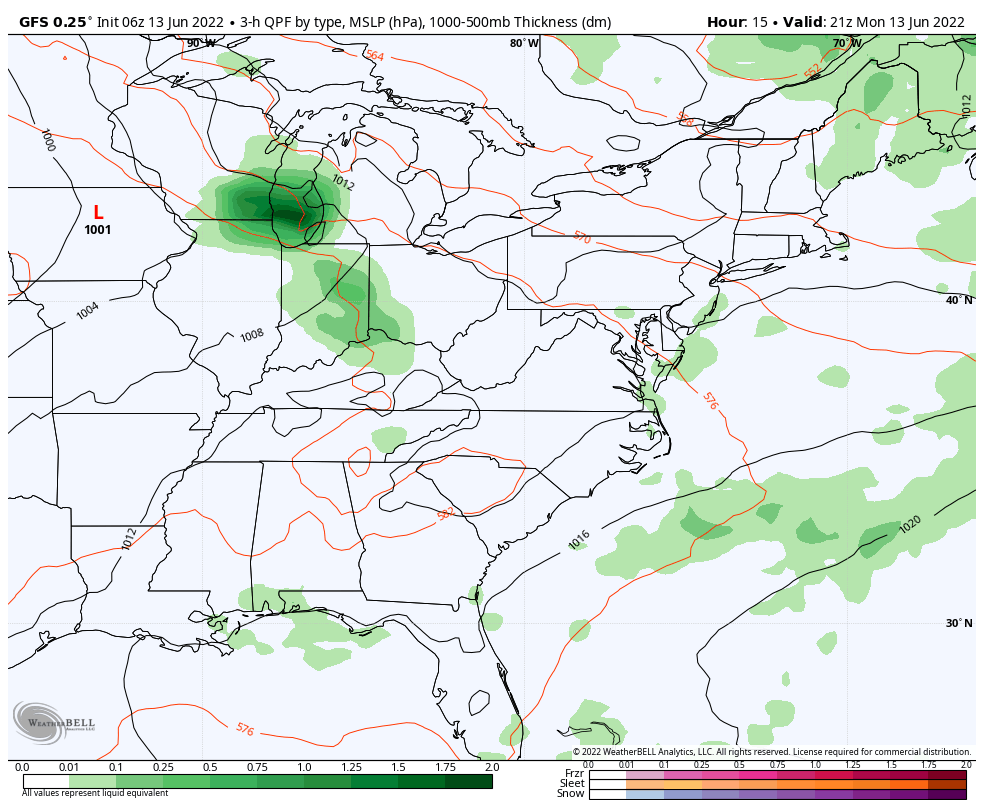
GFS Forecast Animation:
5 PM Monday to 5 PM Tuesday
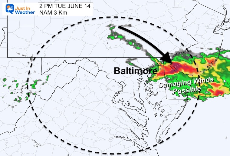
Here we can see the MCC forming and riding southeast around that Heat Dome. The GFS Forecast has it reaching central Maryland Tuesday Morning…
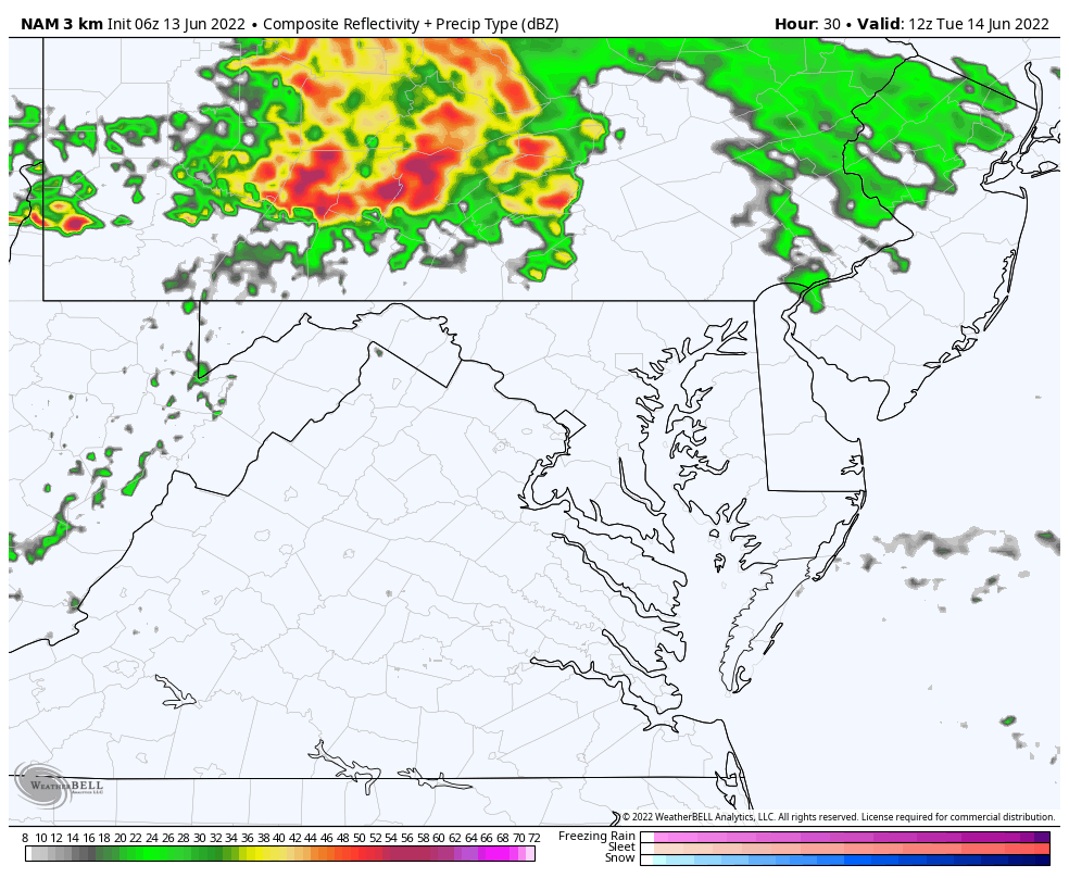
Closer Look- NAM 3 Km Forecast
Tuesday 8 AM to 4 PM
This model is a little later, and as we saw over the weekend may be behind by 1 to 2 hours…
Snapshots:
Morning (this may verify a little earlier)
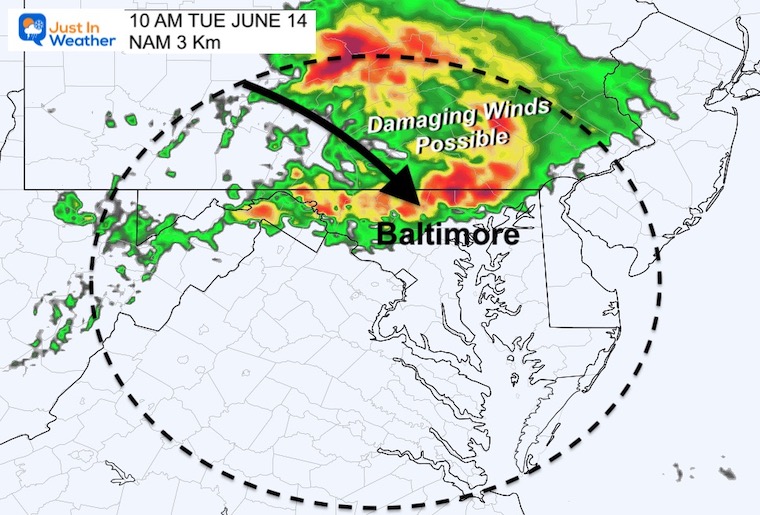
Afternoon (this may verify a little earlier)
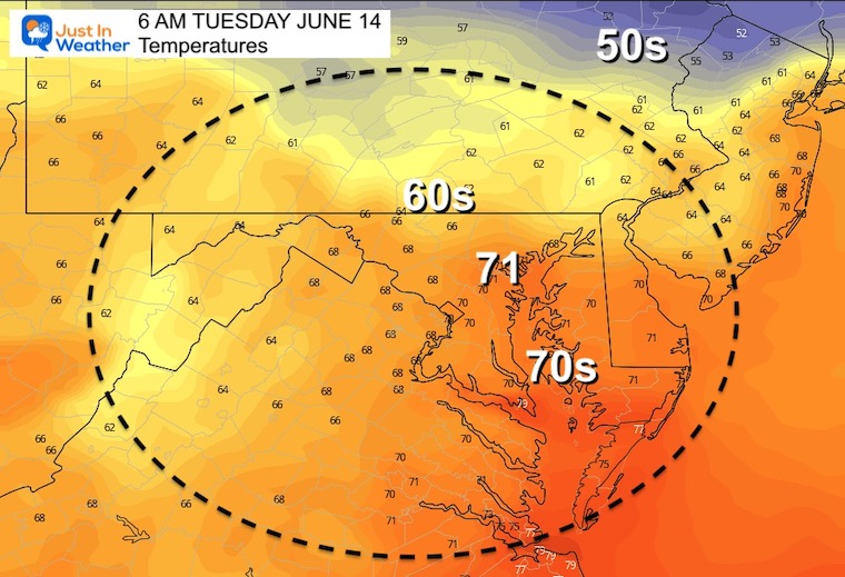
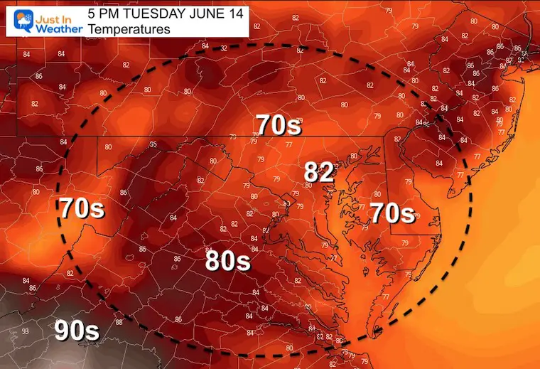
Tuesday Temperatures
Morning
Afternoon
Looking Ahead…
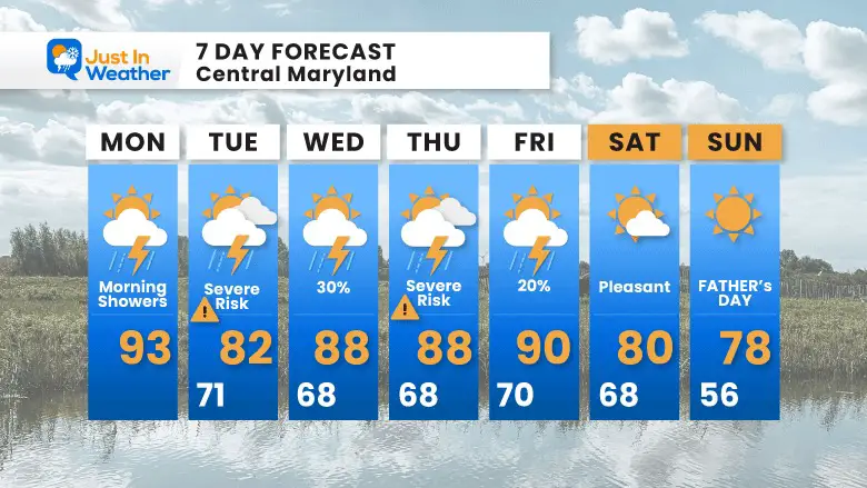
The culmination of this pattern will erupt with another set of severe storms on Thursday, then setting up another pleasant weather stretch through Father’s Day Weekend
7 Day Forecast

Book Your Kayak or Paddle Boat Adventure On The North Chesapeake Bay
Hurricane Season Forecast: June 1 Through November 30
NOAA 2022 Hurricane Forecast- Above Normal Again

Forecast From Colorado State University
Atlantic Hurricane Forecast

Related Posts
NOAA Study: Reducing Air Pollution INCREASED Tropical Storms

Atlantic Tropical History: Maps of Origin Regions Every 10 Days


Recent Storm Reports
May 22 Hail And Wind Damage

May 16 Large Hail Videos And Storm Tracking Map


Please share your thoughts, best weather pics/video, or just keep in touch via social media
*Disclaimer due to frequent questions:
I am aware there are some spelling and grammar typos. I have made a few public statements over the years, but if you are new here you may have missed it:
I have dyslexia, and found out at my second year at Cornell. I didn’t stop me from getting my meteorology degree, and being first to get the AMS CBM in the Baltimore/Washington region.
I do miss my mistakes in my own proofreading. The autocorrect spell check on my computer sometimes does an injustice to make it worse.
All of the maps and information are accurate. The ‘wordy’ stuff can get sticky.
There is no editor that can check my work when I need it and have it ready to send out in a newsworthy timeline.
I accept this and perhaps proves what you read is really from me…
It’s part of my charm.


