April 6 Tornado Videos From Outbreak And Rain Forecast Through Tomorrow
Monday Morning Report
We are in the middle of a severe storm pattern for the southern US. Here in the Mid Atlantic, we stay on the cooler but rainy side. We will get into a warm up in our forecast below.
Tornado Outbreak Tuesday
54 Tornado reports across the southern US. This was destructive and also produce a bonanza of videos from chasers and home owners. See the amazing videos below. There could be a repeat today…
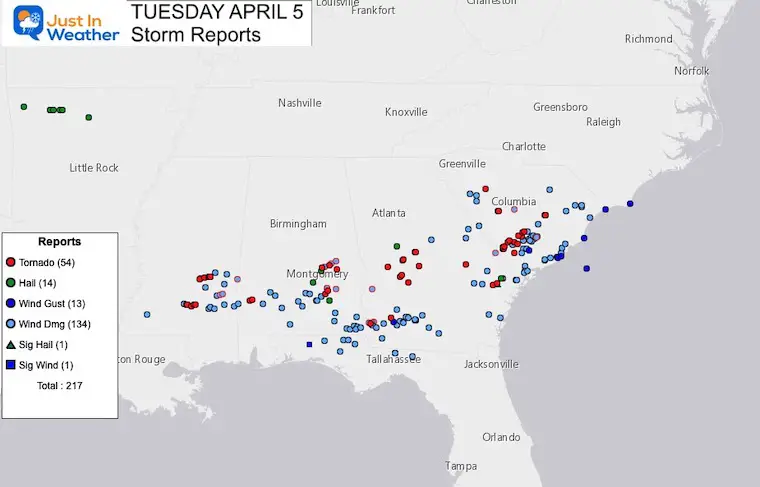
Tornado Videos From April 5 2022
Roof Ripped Of A House At Golf Course: Owner Is Amazingly OK
#Tornado ripped the roof right off the Black Creek Golf clubhouse. Cliff Horton was lucky he didn’t blow away too! @NWSCharlestonSC @WTOC11 pic.twitter.com/0IKijwy44X
— WTOC Jamie Ertle (@wtocjamie) April 6, 2022
Tornado Crossing Highway
Tornado crossed just in front of me on highway 78, 6 miles east of Bamberg, #SouthCarolina, 6:35pm. Bamberg county. #scwx pic.twitter.com/zcRmXBe0Kn
— Palmetto State Chasers (@PalmettoChasers) April 5, 2022
Tornado In Pembroke, GA
Crazy video as a tornado hits Pembroke, GA late Tuesday afternoon. Video courtesy of Kent. #gawx #Tesla pic.twitter.com/Yynajx1mNh
— Jeremy Nelson (@jnelsonWJCL) April 6, 2022
Wednesday Set Up
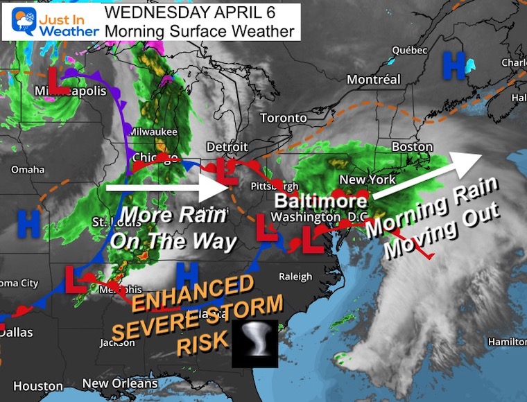
Surface Weather
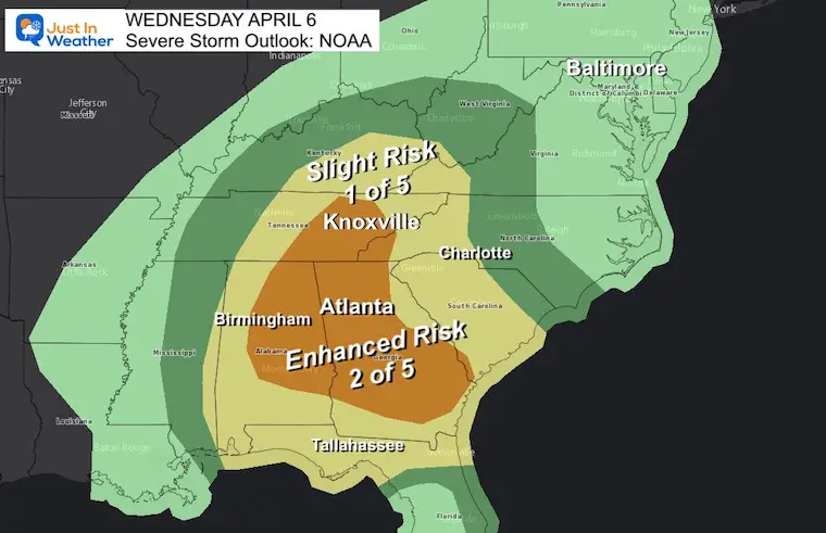
Another severe outbreak day in the Southeast US. We stay on the colder, but rainy track. As this mornig system departs, the next one will arrive tomorrow.
Severe Storm Risk
Some of the same ares today are under the Enhanced Risk, including Alabama and Georgia. This will remain tracking south.
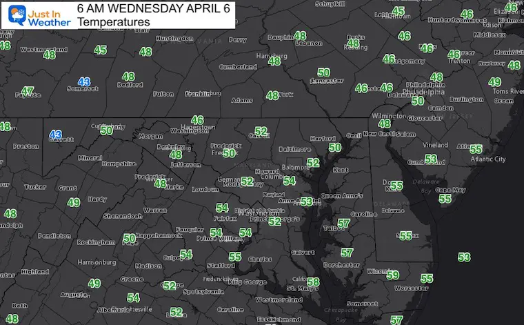
Morning Temperatures
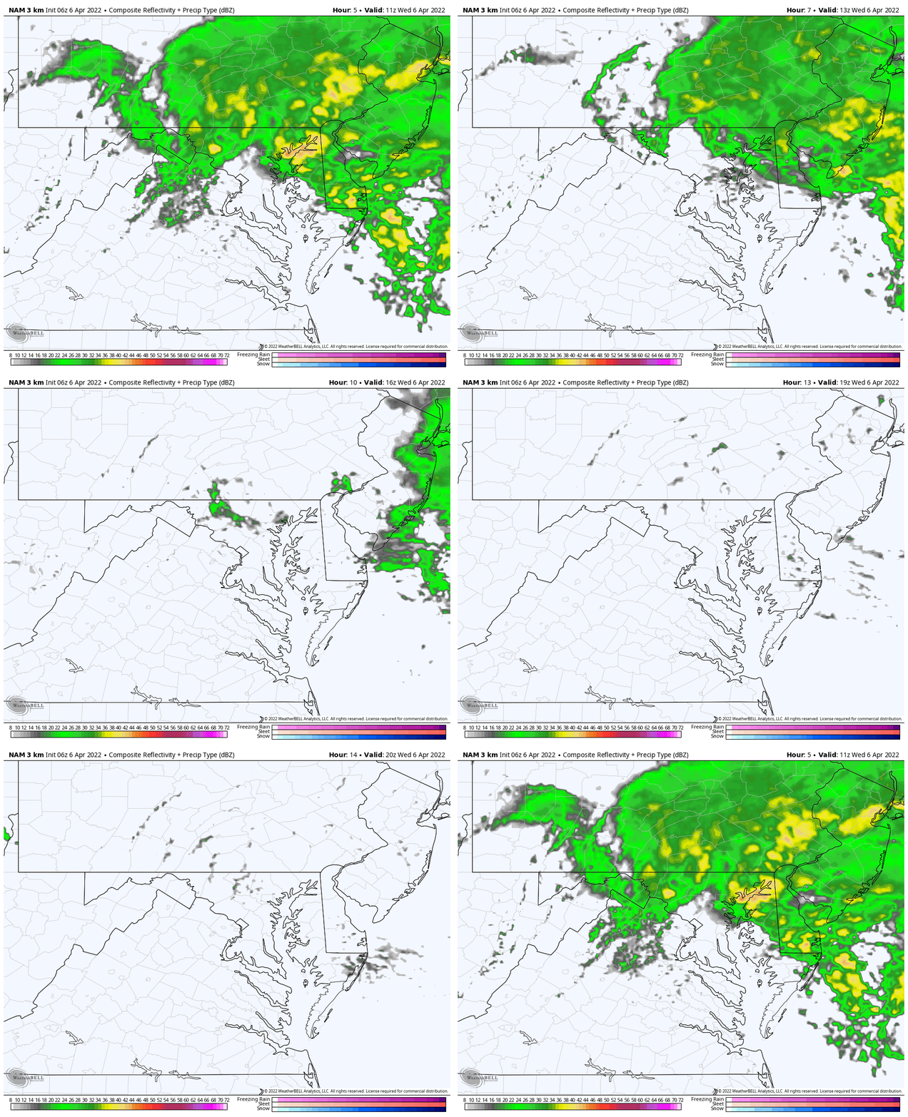
Rain Animation: 7 AM to 4 PM
Morning rain will depart but an east wind will keep us with some drizzle and spotty showers.
Fields may struggle to dry out for after school sports.
Afternoon Temperatures
CLIMATE DATA
TODAY April 6
Seasonal Snow: 14.4”
Normal Low in Baltimore: 40ºF
Record 24º F in 2016
Normal High in Baltimore: 61ºF
Record 90ºF 2010
Thursday Rain Animation 6 AM to 6 PM
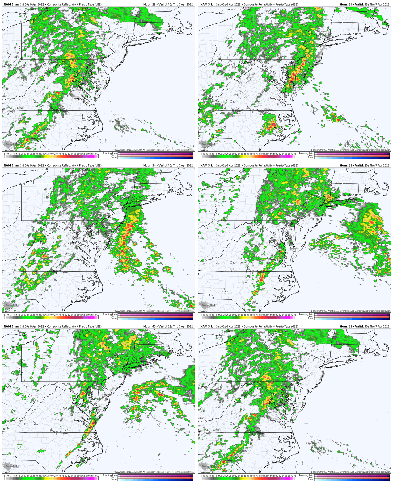
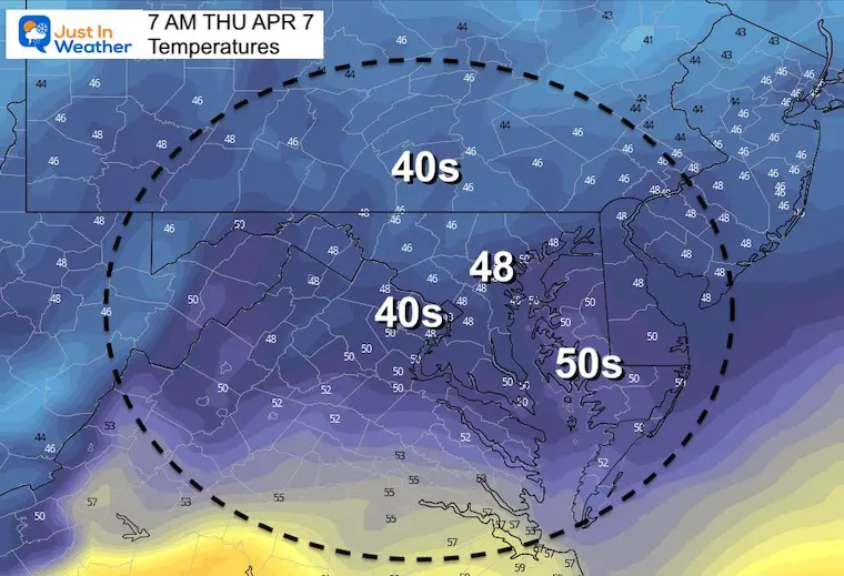
Thursday Morning Temperatures
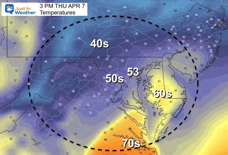
Thursday Afternoon Temperatures
Looking Ahead:
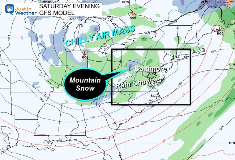
Saturday
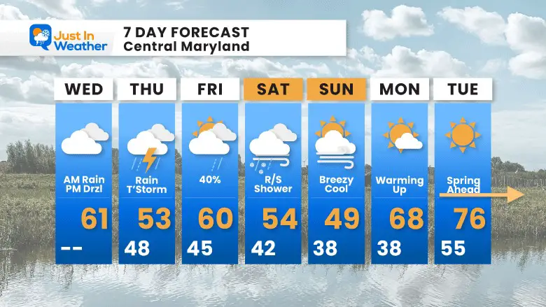
A large pool of chilly air will spark more afternoon showers. Snow will fall over the mountains, and a few flakes may mix in locally in the afternoon.
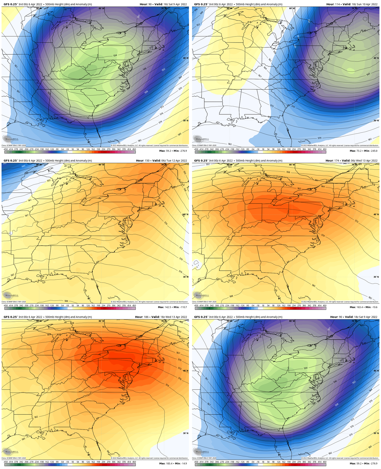
Jet Stream: 500mb Height Anomaly
Saturday to Tuesday – Flip from chilly to very warm in a hurry!
7 Day Forecast
Weather posts straight to your inbox
Sign up and be the first to know!
ALSO SEE
What is Faith in the Flakes: History of December 5th Snow
ALL FITF GEAR
FITF THUNDERSNOW
Winter Outlook Series:
Last Winter Recap: My Old Outlook And Your Grades Of My Storm Forecasts
Winter Weather Page – Lots of resources
Solar Cycle Increasing Sunspots Suggests More Snow
Comparing 4 Different Farmer’s Almanacs: Majority colder winter outlook than NOAA
NOAA Winter Outlook- But Read The Fine Print
Signals For Early Start To Winter In November
Winter Outlook Series: La Nina Double Dip
Nor’easters May Give Hint For Winter La Nina Pattern
Winter Folklore Checklist
Please share your thoughts, best weather pics/video, or just keep in touch via social media
Facebook: Justin Berk, Meteorologist
Twitter: @JustinWeather
Instagram: justinweather
*Disclaimer due to frequent questions:
I am aware there are some spelling and grammar typos. I have made a few public statements over the years, but if you are new here you may have missed it:
I have dyslexia, and found out at my second year at Cornell. I didn’t stop me from getting my meteorology degree, and being first to get the AMS CBM in the Baltimore/Washington region.
I do miss my mistakes in my own proofreading. The autocorrect spell check on my computer sometimes does an injustice to make it worse.
All of the maps and information are accurate. The ‘wordy’ stuff can get sticky.
There is no editor that can check my work when I need it and have it ready to send out in a newsworthy timeline.
I accept this and perhaps proves what you read is really from me…
It’s part of my charm.
#FITF


