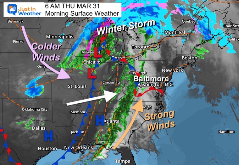
March is definitely trying to roar out like a lion.The back end of the wild weather pattern will bring strong winds and a risk for storms to turn severe this afternoon and evening.This all depends on if we can push the warmer air in place in time.
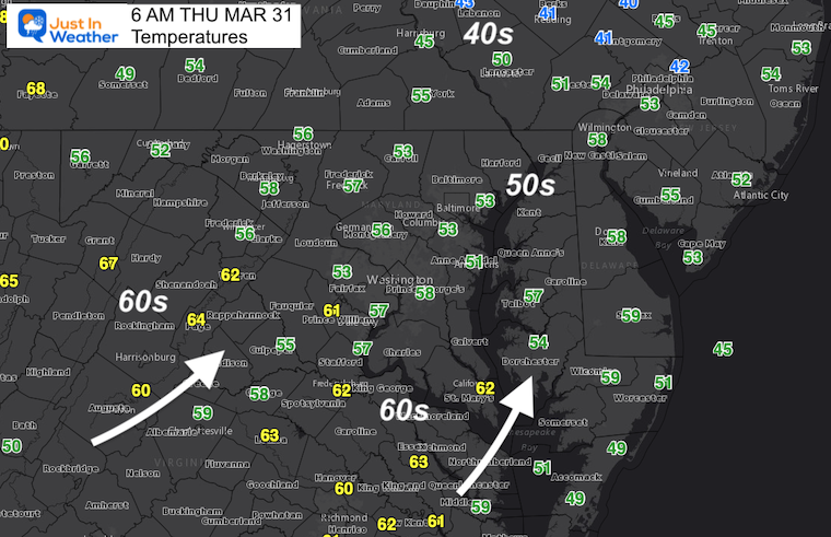
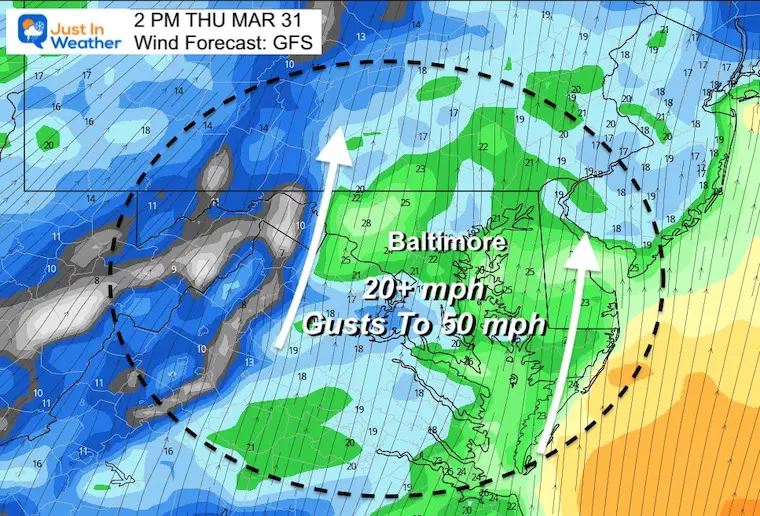
The largest concern I have received lately has been about the winds. We have two more days, including gusts today to 50 mph, which will try to bring in the warmer air.
Monday Morning Set Up
Surface Weather
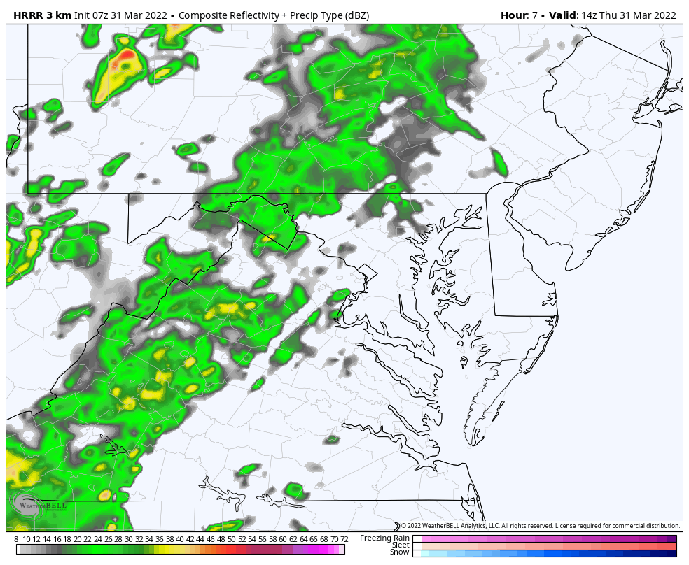
This complex storm is the same system that produced a severe weather outbreak in the Southern US and Winter Storm across the Northern Plains and Great Lakes.
Rain showers will develop this morning, and winds will increase trying to pump in warmer air.But it will have some work to do.
Morning Temperatures
Afternoon Wind Forecast
Steady winds will be 20 to 30 mph, with gusts UP TO 50 mph.
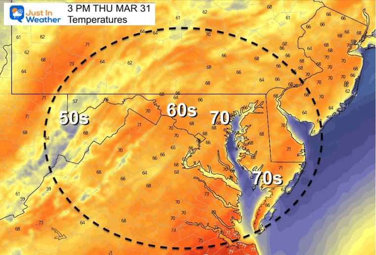
Afternoon Temperatures
Radar Simulation Animation 10 AM to 8 PM
The slider you can control is below…
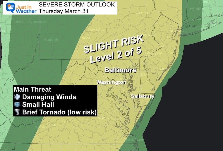
Severe Storm Risk
We have a Level 2 or 5 chance for storms to turn severe.
Main risk will be damming winds.
Hail is more likely to be small.
Tornado threat is low, but a brief spin up is possible based in hodograph analysis of wind sheer.
Radar Simulation Timeline —-> slider
12 PM to 8 PM
march-31-weather-storm-radar-pm-12
march-31-weather-storm-radar-pm-2
march-31-weather-storm-radar-pm-3
march-31-weather-storm-radar-pm-4
march-31-weather-storm-radar-pm-6
march-31-weather-storm-radar-pm-5
march-31-weather-storm-radar-pm-7
march-31-weather-storm-radar-pm-8
CLIMATE DATA
TODAY March 31
Seasonal Snow: 14.4”
Normal Low in Baltimore:38ºF
Record 20º F in1964
Normal High in Baltimore: 59ºF
Record 86ºF 1998
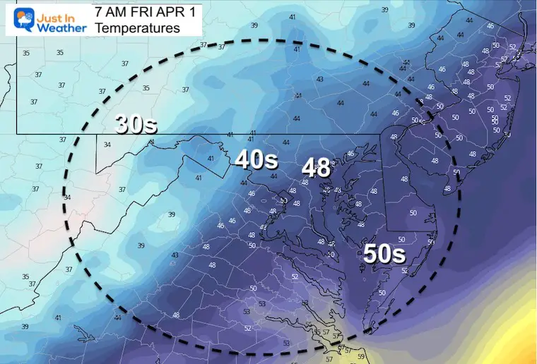
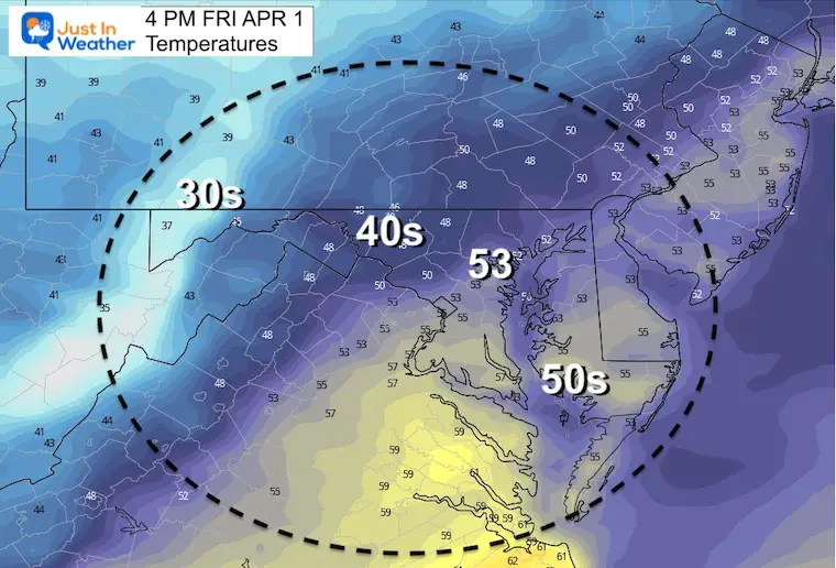
Friday
MorningTemperatures
Afternoon
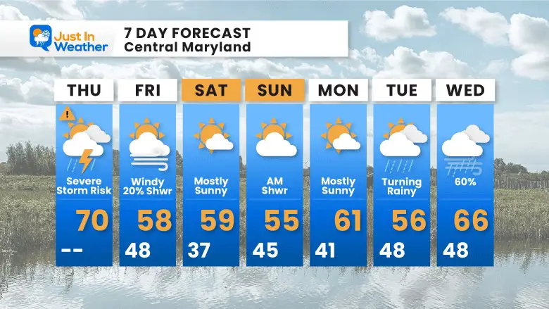
7 Day Forecast
Winds continue Friday…
Weekend back to bear normal…
Next week we watch another storm arrive Tuesday into Wednesday
I am aware there are some spelling and grammar typos. I have made a few public statements over the years, but if you are new here you may have missed it:
I have dyslexia, and found out at my second year at Cornell. I didn’t stop me from getting my meteorology degree, and being first to get the AMS CBM in the Baltimore/Washington region.
I do miss my mistakes in my own proofreading. The autocorrect spell check on my computer sometimes does an injustice to make it worse.
All of the maps and information are accurate. The ‘wordy’ stuff can get sticky.
There is no editor that can check my work when I need it and have it ready to send out in a newsworthy timeline.
I accept this and perhaps proves what you read is really from me…