Snow Squall Warnings In PA From Polar Vortex Crossing Metro New York
Monday March 28 2022
Afternoon Update
This afternoon is the main event. All that talk bout The Polar Vortex making a visit in the US, and it is now being plotted on the hourly observations. This is responsible for our unstable air mass, developing snow showers and squalls, and near record cold,. I will address each one here, along with. Short term forecast.
I want to note that IF this was December or January, we would be talking about epic cold, and the snow would be sticking. But the contrast with the higher early Spring sun angle has modified the air quite a bit.
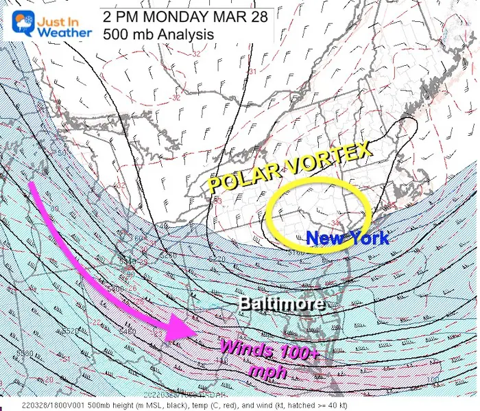
Polar Vortex Plot
This is the Mesoscale Analysis at 2 PM, showing the Jet Stream at 500mb (18,000 Ft).
The jet stream winds are over 100 mph. This is screaming instability.
Compare To The Forecast Plot
Reminder that this has been trending farther south each day I have been tracking it. This worked out from the morning report.

Backtracking The Source Of Air
This morning I showed this map, which The National Weather Service in Mount Holly NJ developed. This product tracked the source of air for 5 days (120 hour) to the forecast position at 2 PM today.
We can see this began at the North Pole.
![]()
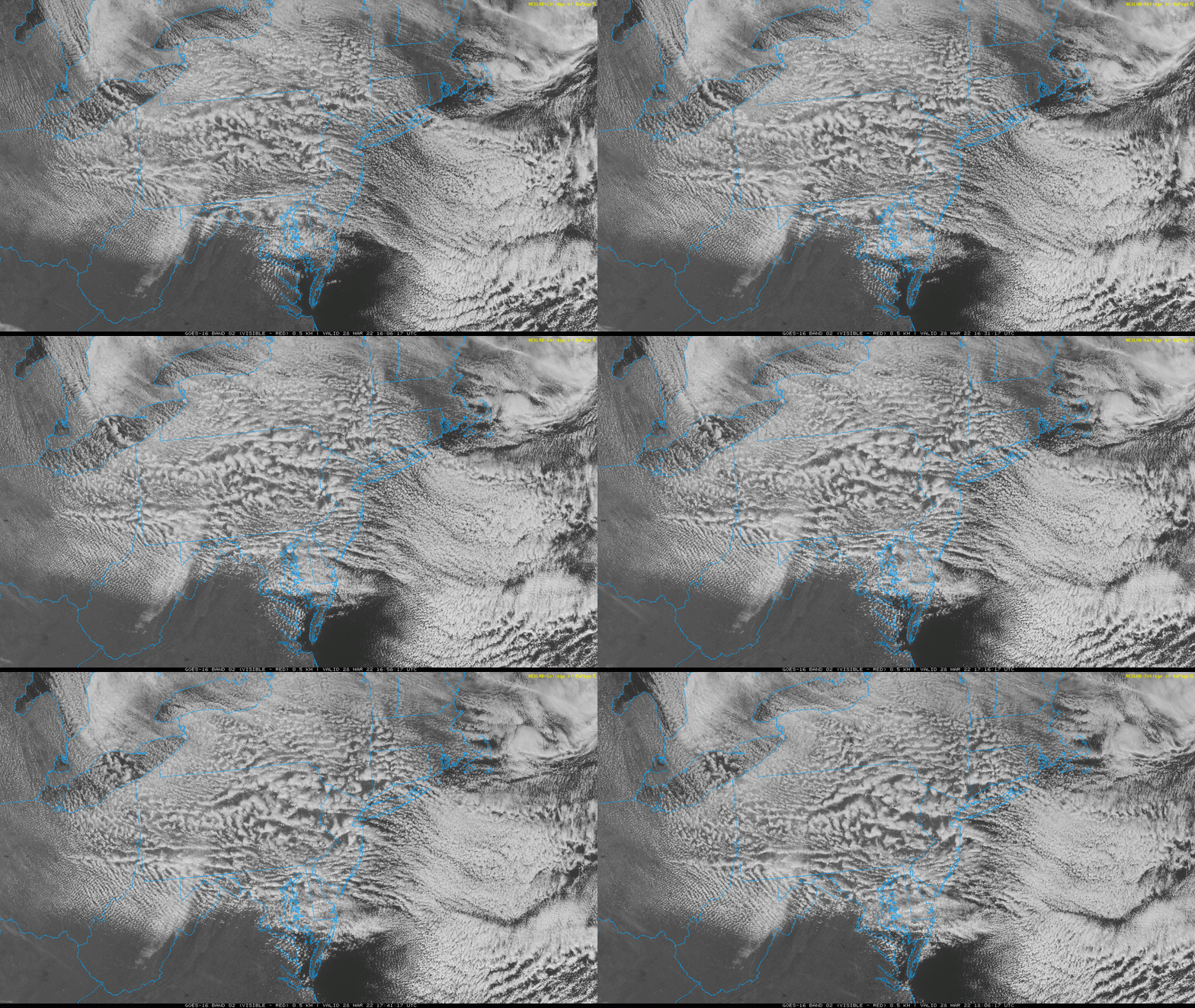
Visible Satellite Loop
12 PM to 2 PM
Here we can see the wind flow crossing The Great Lakes. The result has been streamers of clouds off of the Great Lakes. That is the source of enough moisture to produce the snow bands and intense squalls.
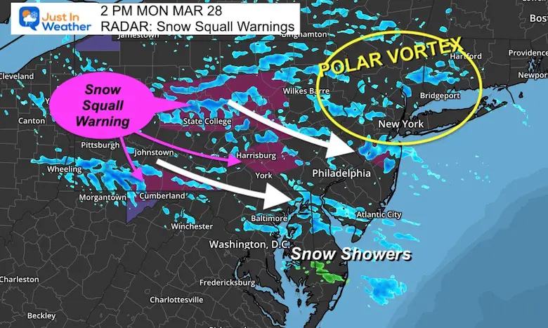
Snow Squall Warnings In PA
The latest Snow Squall Warning includes I-83 to I-81 in York County and around Harrisburg- Until 3:15 PM
- Just north in Pennsylvania the snow bands have been more intense.
- Localized brief blizzard conditions and white outs have been scattered widely.
If you have any travel please take this seriously:
- Snow has been sticking on roads, and sadly there have been multiple accidents.
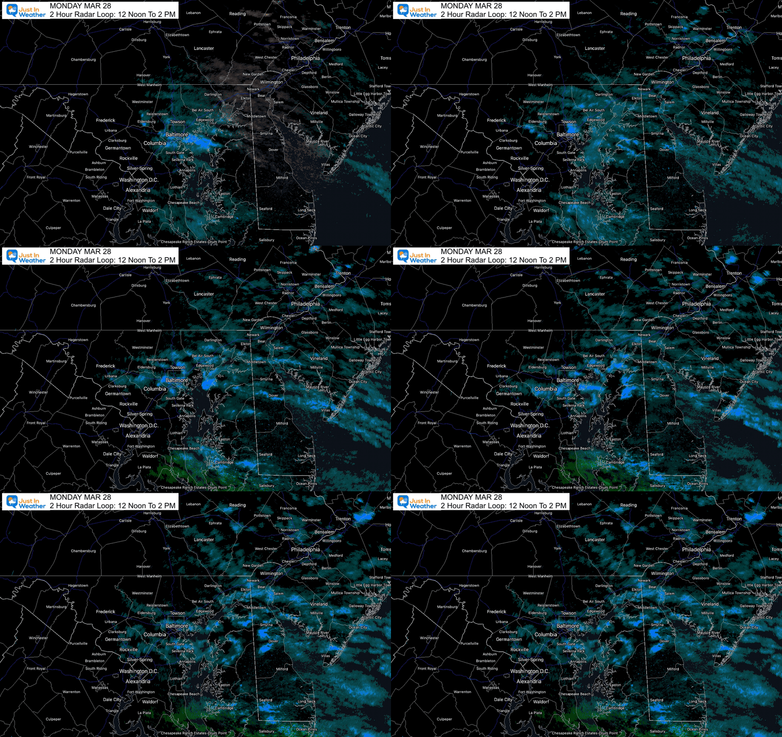
Local Radar Loop
12 Noon to 2 PM
One pice of energy has settled over Central Maryland. This has been more active that short range models suggested.
Snow Forecast
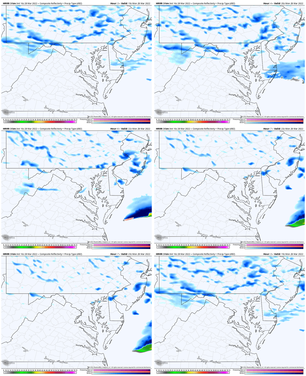
Animation 2 PM to 8 PM – HRRR Model
This is NOT a perfect depiction. However, it does show the bands o snow shifting south and peaking mid afternoon across north central Maryland.
They will begin to fade and diminish between 5 PM and 8 PM.
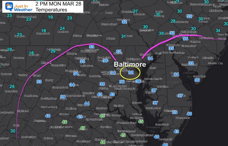
Temperatures At 2 PM
Coldest Maximum Temperature for Baltimore: 37ºF set in 1996.
Near Record? BWI hit 37ºF at noon, but since 1:20 PM it dropped…
The core of the cold air has settled arrive.
Compare the normal High = 59ºF
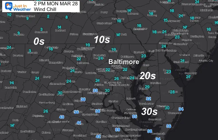
Wind Chill
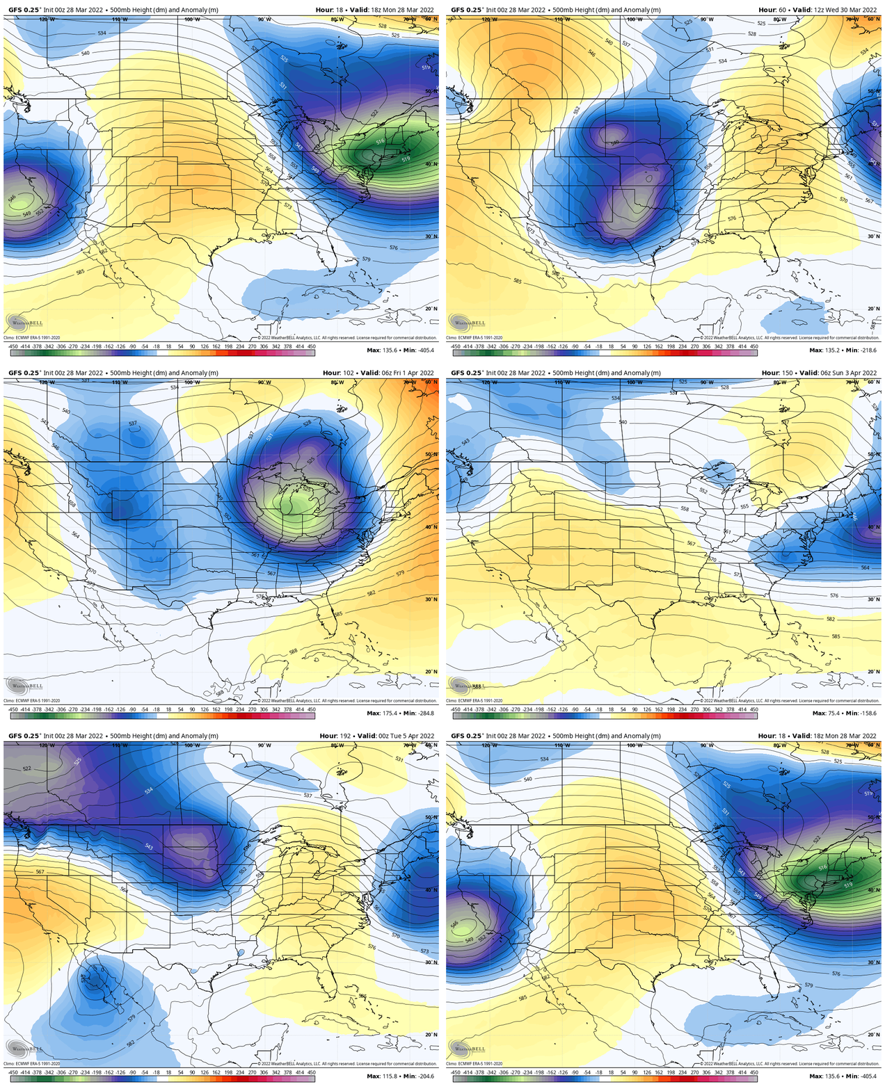
Looking Ahead: Jet Stream OUTLOOK Animation
Forecast Through Monday April 5
The jet stream will be relaxing a little, but it is going to take one week until we get to establish a more consistent spring pattern again.
Tuesday
Morning Temperatures
Record for Baltimore =18ºF in 1923

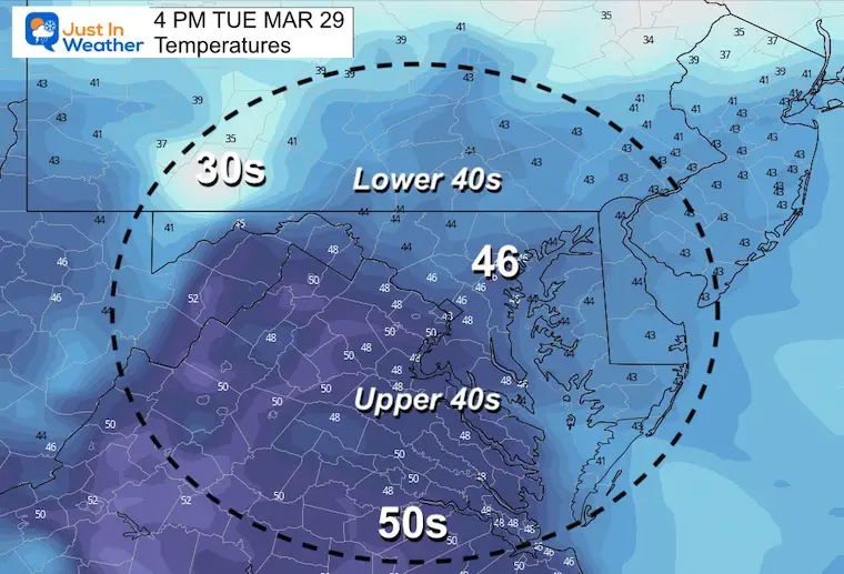
Afternoon Temperatures
Looking Ahead
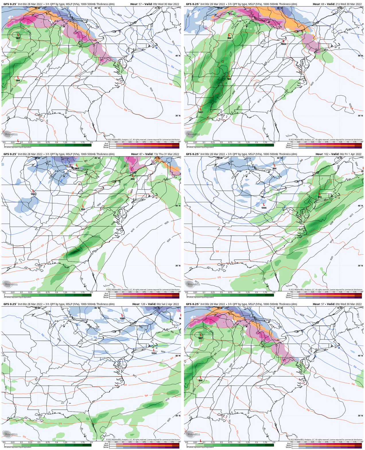
Wednesday Morning Ice?
Still watching the transition to warmer air that may bring in a snow/sleeet mix on Wednesday morning. I doubt there will be much of a problem, but we may need to watch inland areas that tend to be colder given the timing of the day.

Forecast Animation Wednesday Morning To Friday Morning
That wintry mix will be the transition back to a warmer air mass.
On Thursday warmer air will move in, however it will come with showers and some thunderstorms.
Next weekend will dry out and be cool… but not nearly as cold.
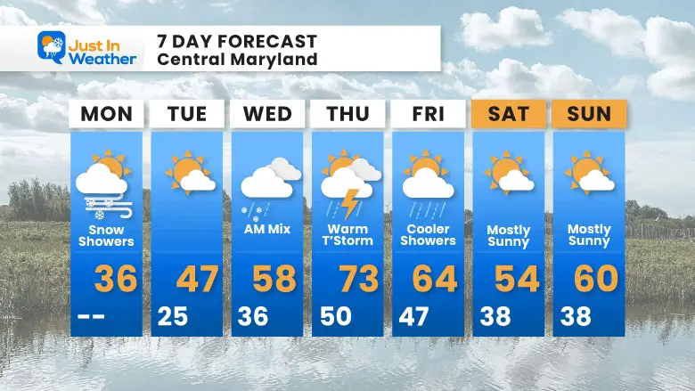
7 Day Forecast
Weather posts straight to your inbox
Sign up and be the first to know!
ALSO SEE
What is Faith in the Flakes: History of December 5th Snow
ALL FITF GEAR
FITF THUNDERSNOW
Winter Outlook Series:
Last Winter Recap: My Old Outlook And Your Grades Of My Storm Forecasts
Winter Weather Page – Lots of resources
Solar Cycle Increasing Sunspots Suggests More Snow
Comparing 4 Different Farmer’s Almanacs: Majority colder winter outlook than NOAA
NOAA Winter Outlook- But Read The Fine Print
Signals For Early Start To Winter In November
Winter Outlook Series: La Nina Double Dip
Nor’easters May Give Hint For Winter La Nina Pattern
Winter Folklore Checklist
Please share your thoughts, best weather pics/video, or just keep in touch via social media
Facebook: Justin Berk, Meteorologist
Twitter: @JustinWeather
Instagram: justinweather
*Disclaimer due to frequent questions:
I am aware there are some spelling and grammar typos. I have made a few public statements over the years, but if you are new here you may have missed it:
I have dyslexia, and found out at my second year at Cornell. I didn’t stop me from getting my meteorology degree, and being first to get the AMS CBM in the Baltimore/Washington region.
I do miss my mistakes in my own proofreading. The autocorrect spell check on my computer sometimes does an injustice to make it worse.
All of the maps and information are accurate. The ‘wordy’ stuff can get sticky.
There is no editor that can check my work when I need it and have it ready to send out in a newsworthy timeline.
I accept this and perhaps proves what you read is really from me…
It’s part of my charm.
#FITF


