Monday March 28 Polar Vortex Passes NYC Today Brings Near Record Cold
Monday March 28
Morning Report
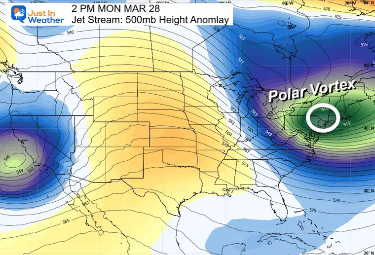
Let’s hope this is the last we mention The Polar Vortex for a while. I have been tracking this for a week, and as it approaches the track keeps getting farther south. This afternoon the core cold of that circulation will pass over metro New York City. This bring us near record cold and one more round of snow showers.
In short: It feels like winter, and will take another two days to improve.
Polar Vortex This Afternoon
This is the core circulation that was at the North Pole last week. It will be responsible for unseasoned cold air.

Record Cold In Reach:
Coldest Maximum Temperature for Baltimore: 37ºF set in 1996. Compare the normal High = 59ºF
Backwards Tracking
I have received some criticism for discussing this topic with the suggestion it was not real. Here is a Tweet from The National Weather Service in Mount Holly, NJ plotting the air mass starting at the North Pole 120 hours (5 days) ago.
The air mass over us tomorrow will be one of the coldest, if not the coldest, we’ve seen all season. Take a look at this trajectory model showing where the air over us tomorrow, at various heights, “originated” from – it is straight out of the Arctic! #NJwx #PAwx #DEwx #MDwx pic.twitter.com/XA0Jgdw5AF
— NWS Mount Holly (@NWS_MountHolly) March 27, 2022
Polar Vortex Forecast
Larger View Today
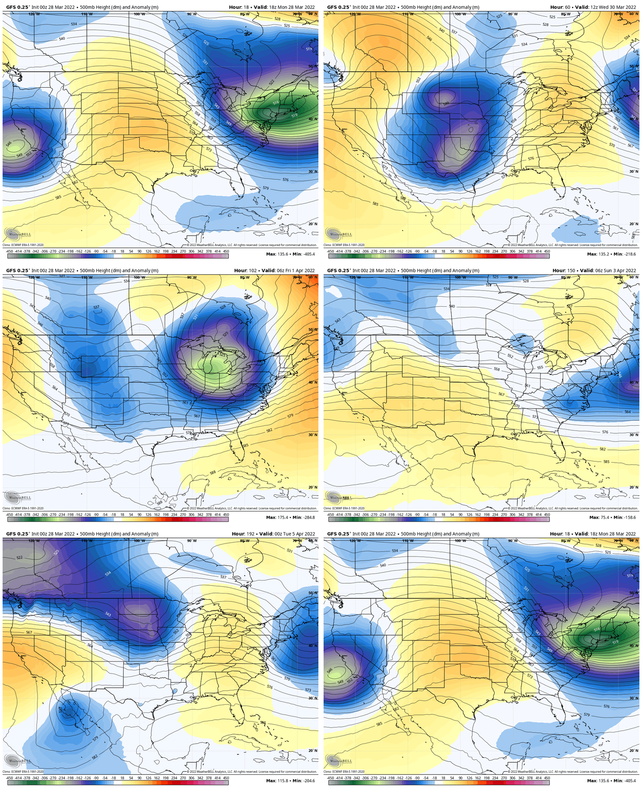
Forecast Through Monday April 5
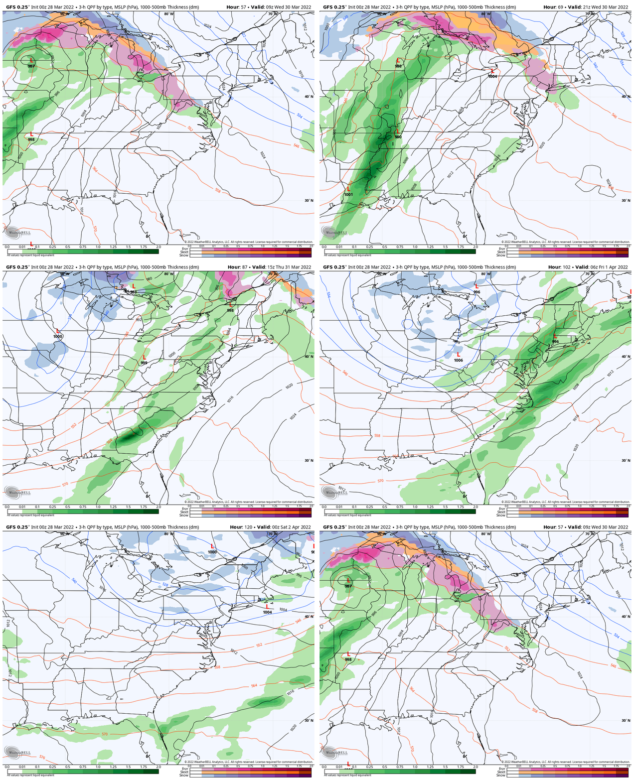
The jet stream will be relaxing a little, but it is going to take one week until we get to establish a more consistent spring pattern again.
Monday Morning Set Up
Surface Weather
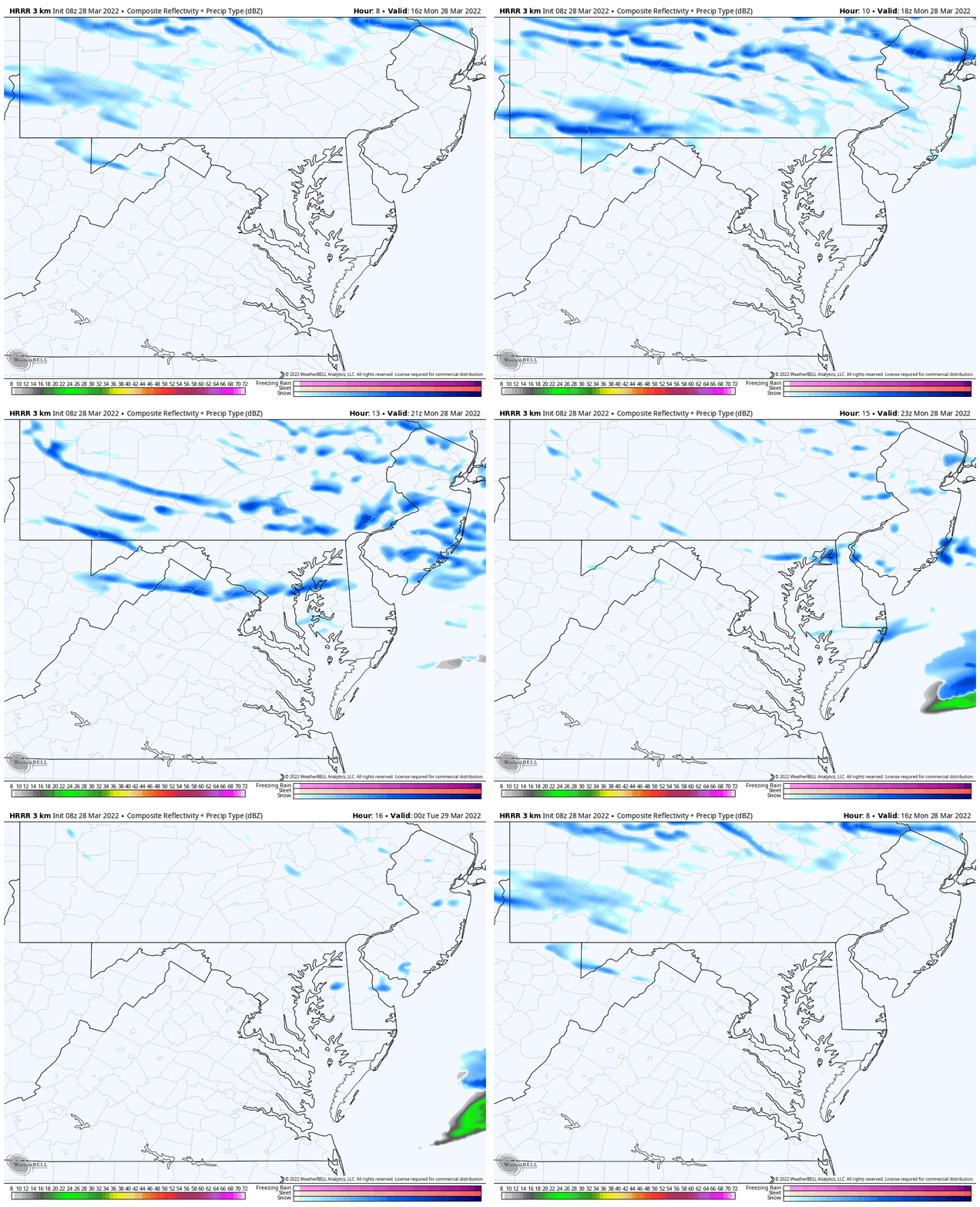
Streamers of snow showers continue off of the Great Lakes.
The cold winds will prevail and more snow showers will expand this afternoon.

Temperatures
The 20s have reached all the way to the beaches!!

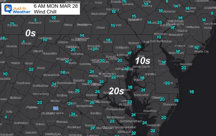
Wind Chill
Most of the region feels like the Teens (10s) this morning.
Radar Simulation: 12 PM to 8 PM
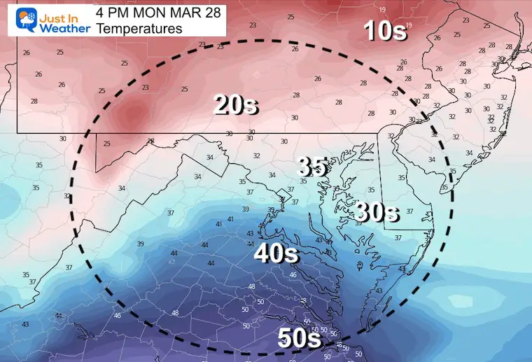
Afternoon Temperatures
Record Coldest Max for Baltimore =37ºF in 1996
CLIMATE DATA
TODAY March 28
Seasonal Snow: 14.4”
Normal Low in Baltimore: 37ºF
Record 21º F in 1982
Normal High in Baltimore: 58ºF
Record 87ºF 1945
Tuesday
Morning Temperatures
Record for Baltimore =18ºF in 1923

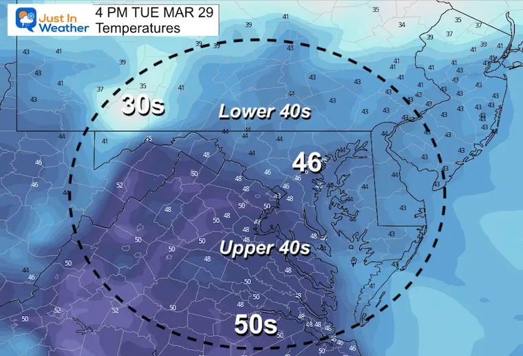
Afternoon Temperatures
Looking Ahead
Wednesday Morning Ice?
Still watching the transition to warmer air that may bring in a snow/sleeet mix on Wednesday morning. I doubt there will be much of a problem, but we may need to watch inland areas that tend to be colder given the timing of the day.

Forecast Animation Wednesday Morning To Friday Morning
That wintry mix will be the transition back to a warmer air mass.
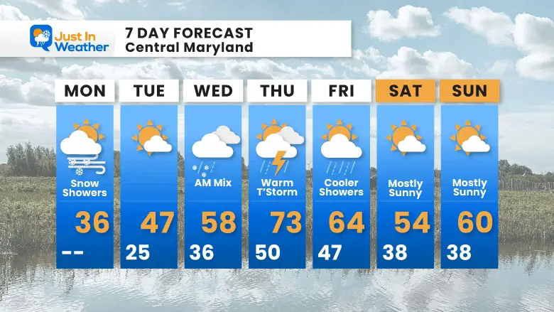
On Thursday warmer air will move in, however it will come with showers and some thunderstorms.
Next weekend will dry out and be cool… but not nearly as cold.
7 Day Forecast
Weather posts straight to your inbox
Sign up and be the first to know!
ALSO SEE
What is Faith in the Flakes: History of December 5th Snow
ALL FITF GEAR
FITF THUNDERSNOW
Winter Outlook Series:
Last Winter Recap: My Old Outlook And Your Grades Of My Storm Forecasts
Winter Weather Page – Lots of resources
Solar Cycle Increasing Sunspots Suggests More Snow
Comparing 4 Different Farmer’s Almanacs: Majority colder winter outlook than NOAA
NOAA Winter Outlook- But Read The Fine Print
Signals For Early Start To Winter In November
Winter Outlook Series: La Nina Double Dip
Nor’easters May Give Hint For Winter La Nina Pattern
Winter Folklore Checklist
Please share your thoughts, best weather pics/video, or just keep in touch via social media
Facebook: Justin Berk, Meteorologist
Twitter: @JustinWeather
Instagram: justinweather
*Disclaimer due to frequent questions:
I am aware there are some spelling and grammar typos. I have made a few public statements over the years, but if you are new here you may have missed it:
I have dyslexia, and found out at my second year at Cornell. I didn’t stop me from getting my meteorology degree, and being first to get the AMS CBM in the Baltimore/Washington region.
I do miss my mistakes in my own proofreading. The autocorrect spell check on my computer sometimes does an injustice to make it worse.
All of the maps and information are accurate. The ‘wordy’ stuff can get sticky.
There is no editor that can check my work when I need it and have it ready to send out in a newsworthy timeline.
I accept this and perhaps proves what you read is really from me…
It’s part of my charm.
#FITF


