Friday March 25 Morning Fog Will Clear Then Cold Winds This Weekend
Friday March 25
*IT IS FRIDAY- THE TITLE WAS MISTAKEN*
Morning Report
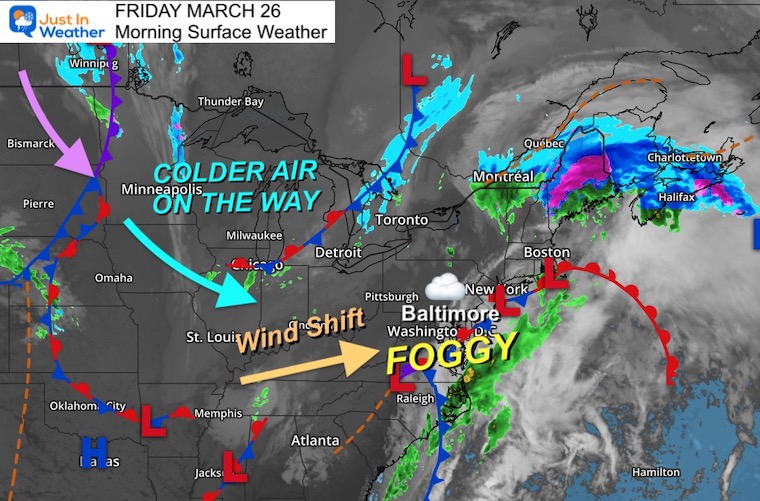
The storm is moving away and the winds have shifted… but we still have leftover fog this morning. It is very thick in spots, and will slow down driving along I-95, the northern Bay, and into southern PA.
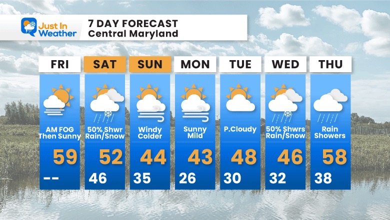
This afternoon will turn out nice, but it’s a tease. This weekend colder winds will whip up, and bring showers of rain mixed with snow Saturday afternoon.
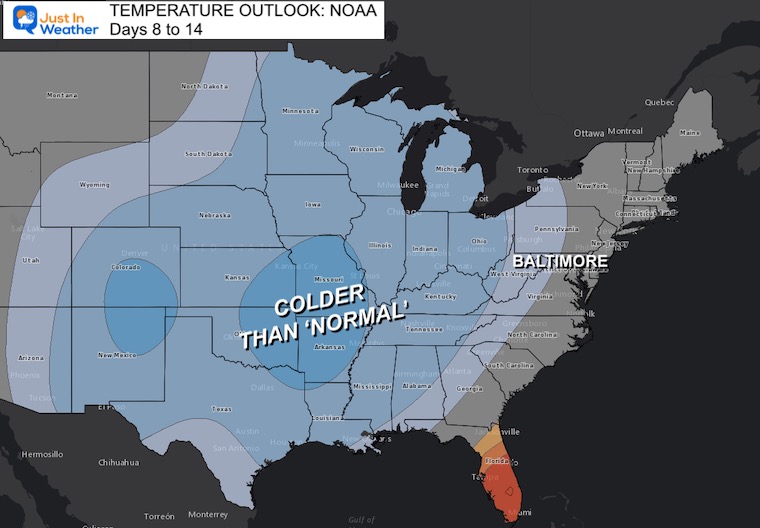
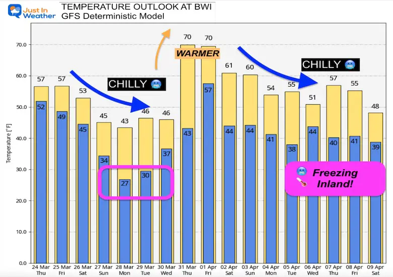
Most of our outlook is colder, with a few warm days mixed in at the end of next week.
Monday Morning Set Up
Surface Weather
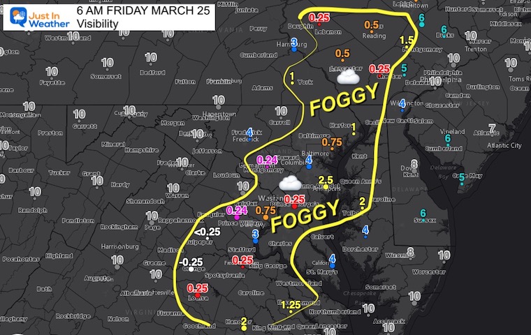
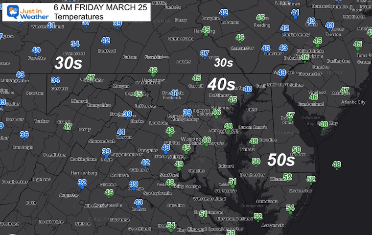
Morning Fog
I’ve highlighted the main footy area this morning.
Temperatures
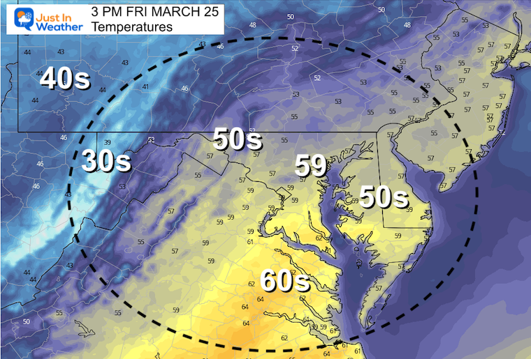
Afternoon Temperatures
Once the fog disperses, we should get more sunshine and a mild day.
CLIMATE DATA
TODAY March 25
Seasonal Snow: 14.4”
Normal Low in Baltimore: 36ºF
Record 20º F in 1940
Normal High in Baltimore: 57ºF
Record 85ºF 1939
Saturday
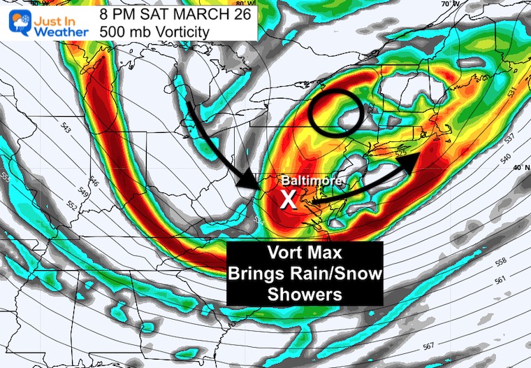
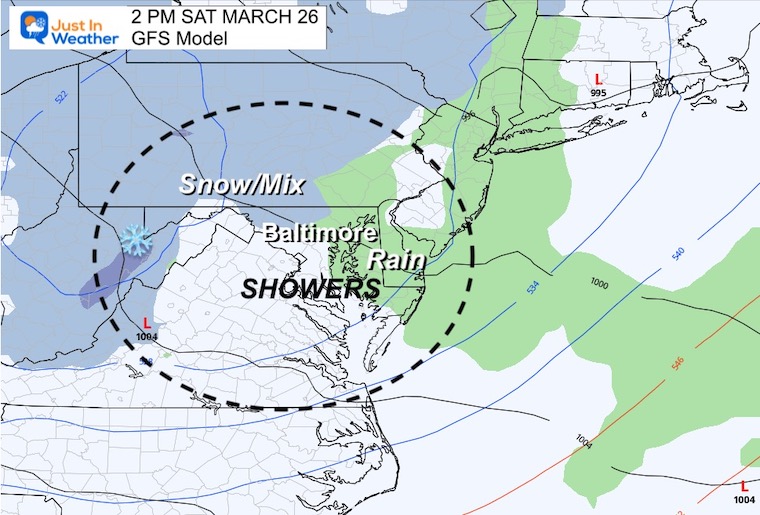
Colder winds and an upper level disturbance will swing through. This was part of the Polar Vortex Disruption report I wrote yesterday (click the image for that report)
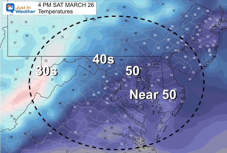
The result will be gusty winds and showers in the afternoon that is likely to mix with snow, sleet, or graupel… especially inland.
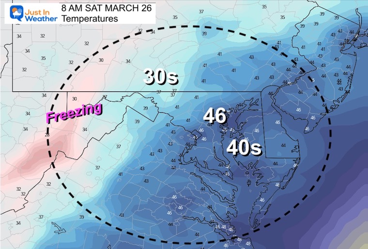
Temperatures
Morning
Afternoon
Looking Ahead Next Week
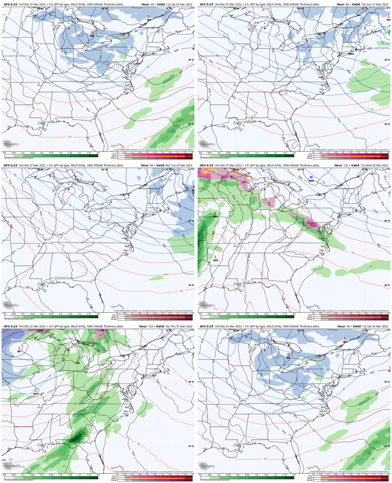
On the edge of the polar air, there will be a band of precipitation breaking out. This may bring a mix to us by Wednesday, then gradual warming with rain on Thursday.
Our warm break will be Friday and next weekend, then turning colder air.
7 Day Forecast
Longer Outlook As Shown In My Prior Report…
Weather posts straight to your inbox
Sign up and be the first to know!
ALSO SEE
What is Faith in the Flakes: History of December 5th Snow
ALL FITF GEAR
FITF THUNDERSNOW
Winter Outlook Series:
Last Winter Recap: My Old Outlook And Your Grades Of My Storm Forecasts
Winter Weather Page – Lots of resources
Solar Cycle Increasing Sunspots Suggests More Snow
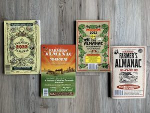
Comparing 4 Different Farmer’s Almanacs: Majority colder winter outlook than NOAA
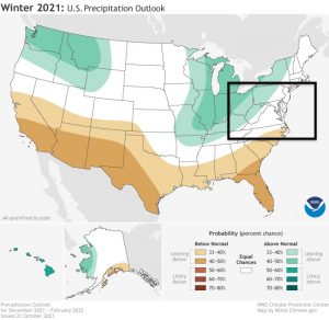
NOAA Winter Outlook- But Read The Fine Print
Signals For Early Start To Winter In November
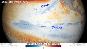
Winter Outlook Series: La Nina Double Dip
Nor’easters May Give Hint For Winter La Nina Pattern
Winter Folklore Checklist
Please share your thoughts, best weather pics/video, or just keep in touch via social media
Facebook: Justin Berk, Meteorologist
Twitter: @JustinWeather
Instagram: justinweather
*Disclaimer due to frequent questions:
I am aware there are some spelling and grammar typos. I have made a few public statements over the years, but if you are new here you may have missed it:
I have dyslexia, and found out at my second year at Cornell. I didn’t stop me from getting my meteorology degree, and being first to get the AMS CBM in the Baltimore/Washington region.
I do miss my mistakes in my own proofreading. The autocorrect spell check on my computer sometimes does an injustice to make it worse.
All of the maps and information are accurate. The ‘wordy’ stuff can get sticky.
There is no editor that can check my work when I need it and have it ready to send out in a newsworthy timeline.
I accept this and perhaps proves what you read is really from me…
It’s part of my charm.
#FITF


