


April 27 Weather Chilly With Showers Then Turning Up The Summer Heat
Saturday, April 27 Morning Report One day to get through before the surge of summer heat. Today, we get clouds and rain showers as a warm front approaches. But on…
Saturday March 19
Morning Report
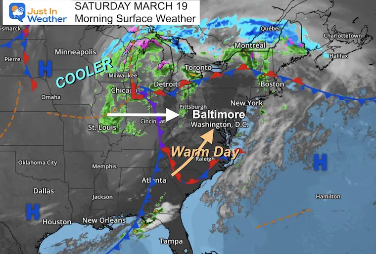
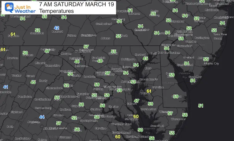
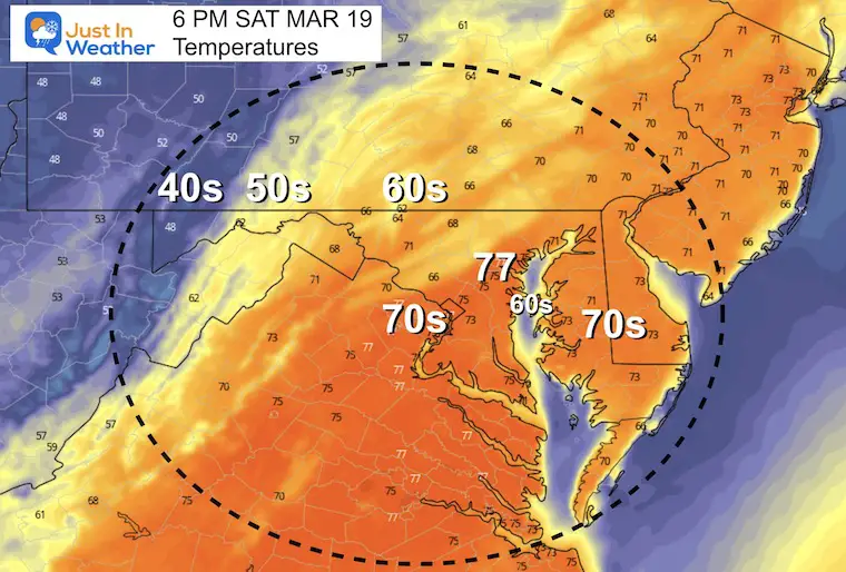
The morning has started warm, and the breeze today will help to pump temps up into the 70s. If you have outdoor plans, just be on the lookout for scattered showers. The chance for severe storms continues increased for the northern half of our region later today.
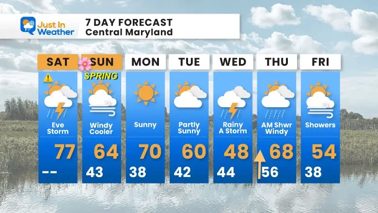
Next week brings rain mid week, the the influence of that Polar Vortex Disruption into next weekend. The first part of that shows up at the end of our 7-day outlook.
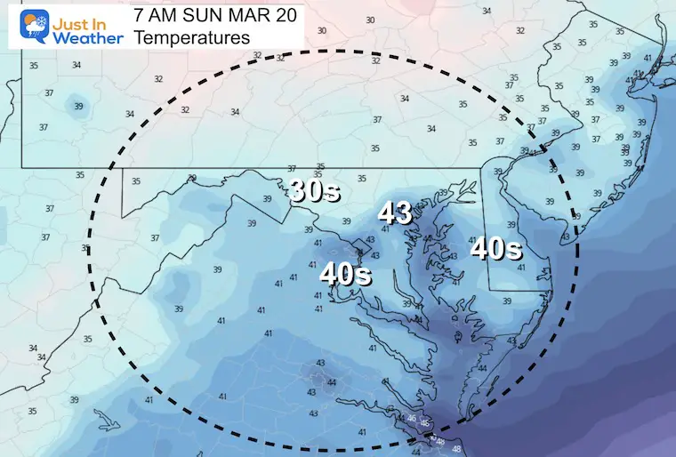
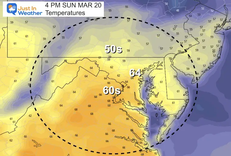
A warm start by March standards with most in the 50s.
There will be a line of storms developing late in the afternoon and evening. NOAA has plotted the Slight Risk (greater chance) for severe storms in northeastern Maryland and Southern Pennsylvania. But it is still worth watching Central Maryland for potential later today. See the timeline slider below.
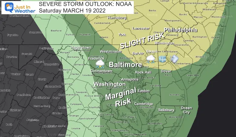
The main risk of storms in metro areas will be 5 PM to 8 PM


The breeze will be increasing. I know I showed cooler weather for Baltimore a few days ago. It looks like the direction will allow the warm air into BWI and the city. The cooler temps will remain along the Bay.
Seasonal Snow: 14.4”
Normal Low in Baltimore: 34ºF
Record 12º F in 1876
Normal High in Baltimore: 55ºF
Record 78ºF 1918
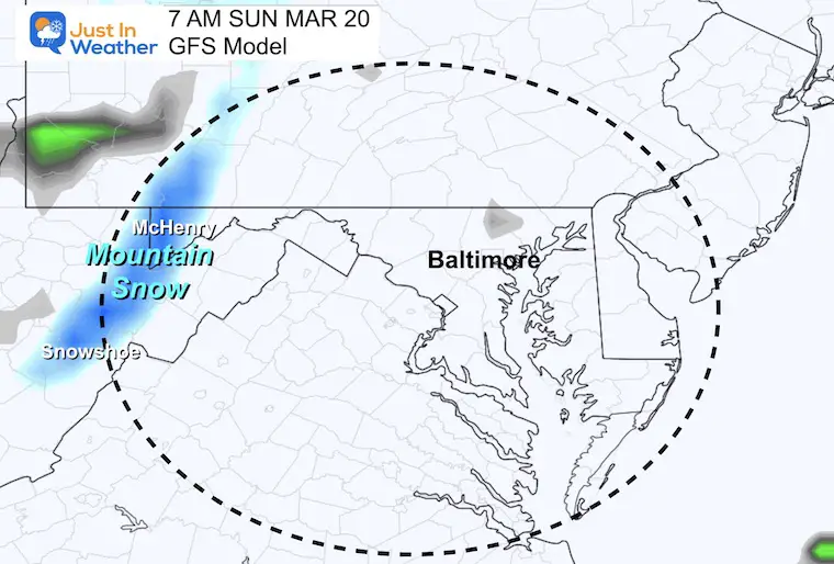
Snow Showers In The Mountains
The next storm will track north of us, but bring rain on Wednesday, perhaps another Thunderstorm. Thursday, some early showers then windy and warm before the next round of cold air arrive.
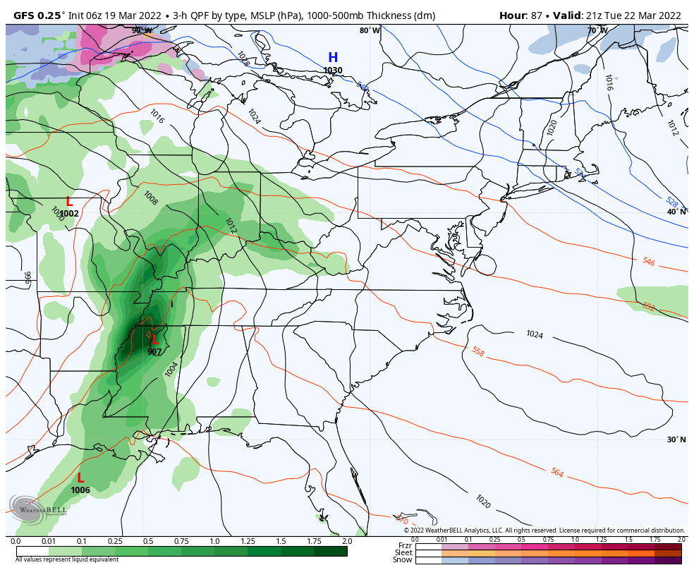
The core of that cold air will reach us next weekend.
Considering it is late March, the ‘cold air’ will be relative… This may bring in some snow showers, but let’s save that until we get closer.
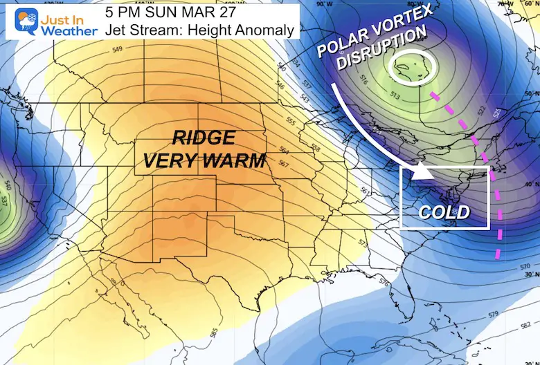
Note: Winds bring in cooler air Sunday, then the rainy day will come with cooler air on Wednesday….
The first signal of that colder air will first show up on Friday, then getting colder next weekend.


Last Winter Recap: My Old Outlook And Your Grades Of My Storm Forecasts


*Disclaimer due to frequent questions:
I am aware there are some spelling and grammar typos. I have made a few public statements over the years, but if you are new here you may have missed it:
I have dyslexia, and found out at my second year at Cornell. I didn’t stop me from getting my meteorology degree, and being first to get the AMS CBM in the Baltimore/Washington region.
I do miss my mistakes in my own proofreading. The autocorrect spell check on my computer sometimes does an injustice to make it worse.
All of the maps and information are accurate. The ‘wordy’ stuff can get sticky.
There is no editor that can check my work when I need it and have it ready to send out in a newsworthy timeline.
I accept this and perhaps proves what you read is really from me…
It’s part of my charm.
#FITF