


May 1 Weather Gradual Cooling Trend Will Bring Rain Into The Weekend
Wednesday, May 1 Morning Report One of the marks of May Day is an ancient European holiday celebrating the start of summer. It feels like we have had our taste…
Friday March 11
Morning Report
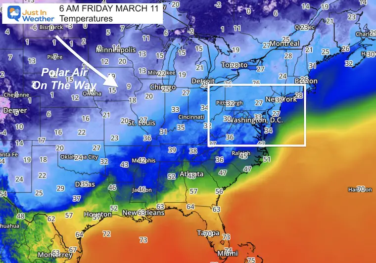
Today is the calm before the storm. In fact sunny, mid, and uneventful and as irony would have it, last year we set the record high on this date at 79ºF. But, not today!
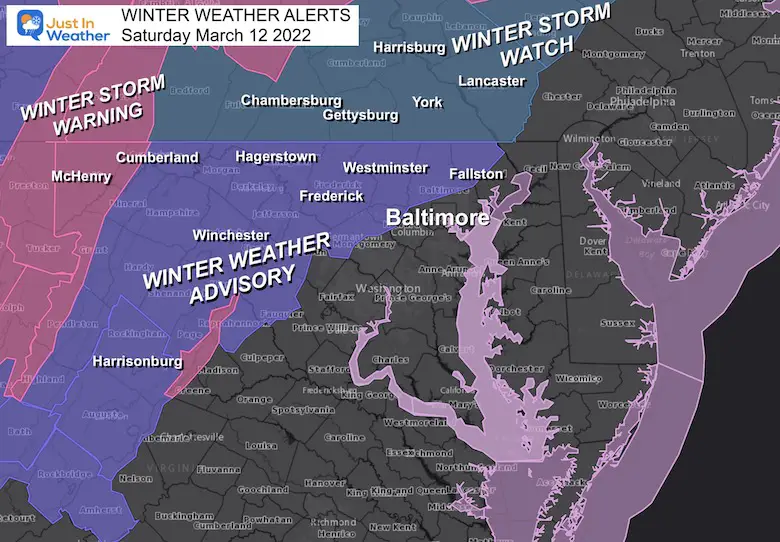
If you are a skeptic the in addition to my maps I have the National Weather Service Winter Storm Alerts issued for Saturday. This really will happen and it will be a shock to the system… Even if you are not in an alert at this time, please pay attention!
I want to show you the set up briefly, and work through some key steps along the way.
Quick Reference:
This is the set up we were waiting for all winter!!!
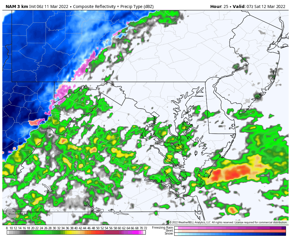
There is a distinct line of snow with the surge of polar air behind it on the move.
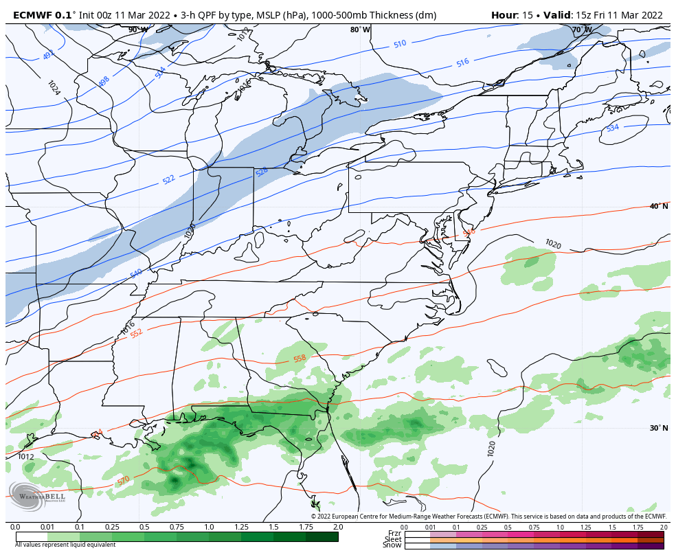
Along the Gulf Coast there is a cluster of storms that has been dumping heavy rain and ready to move north.
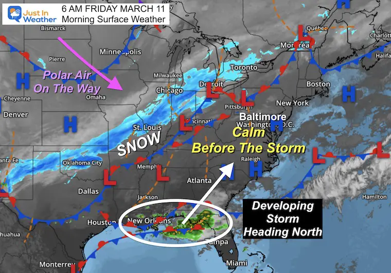
The arctic/polar air is undeniable here. It is on the way…
Animation 10 AM Friday to 7 PM Saturday
See closer look below
Note: There is patchy fog and you might have thick frost to scrape off of the windows.
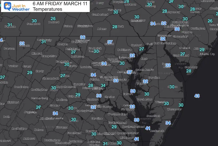

TODAY March 11
Seasonal Snow: 14”
Normal Low in Baltimore: 32ºF
Record 6º F in 1960
Normal High in Baltimore: 52ºF
Record 79ºF 2021
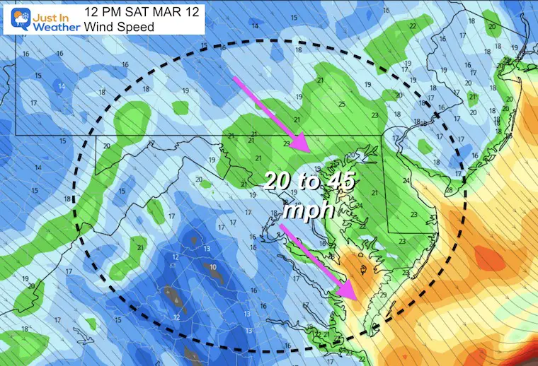
I want to show this so it does’t get lost in the mix. Winds will be pushing 20 to 45 mph form the North-Northwest. This will drop temps and bring the rain to snow mix earlier! The ECMWF Model I have been showing seems to be the winner on this.
Wind Chills will be painful!
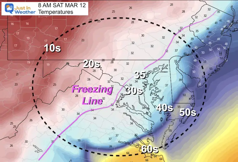
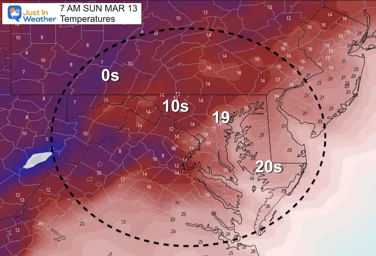
Key Timeframes to show the perspective of the falling thermometers.
NOTE: The High will be early in the morning!

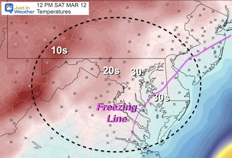

4 PM- This is why I expect icing on anything that is wet

7 PM- This is why I expect icing on anything that is wet
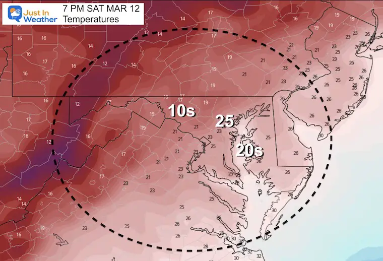
This is why I expect icing on anything that is wet
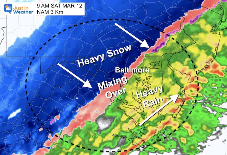
The Transition Time for metro Baltimore should be around 8 to 10 AM.
The timing earlier allows those places a better chance to accumulate snow. Later change over fights both warmer ground AND higher sun angle for stickage…. But it will still snow.
2 AM to 7 PM Saturday
The Transition Time for metro Baltimore should be around 8 to 10 AM.
The timing earlier allows those places a better chance to accumulate snow. Later change over fights both warmer ground AND higher sun angle for stickage…. But it will still snow.
!THESE ARE NOT MY FORECAST MAPS! I will issue my map later if I have a chance (I have a prior obligation today)
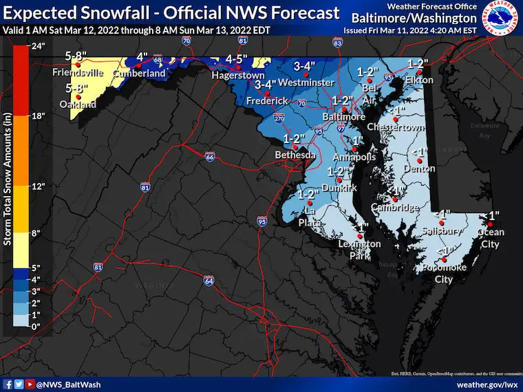
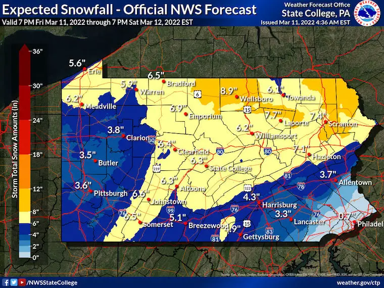
Click to see: The full suite of NWS regional Snow Maps.
You can compare the official forecast to the Low and High End POTENTIAL
Samples for Maryland and Pennsylvania: What is expected to lay and stay (after some melting)


Last Winter Recap: My Old Outlook And Your Grades Of My Storm Forecasts


*Disclaimer due to frequent questions:
I am aware there are some spelling and grammar typos. I have made a few public statements over the years, but if you are new here you may have missed it:
I have dyslexia, and found out at my second year at Cornell. I didn’t stop me from getting my meteorology degree, and being first to get the AMS CBM in the Baltimore/Washington region.
I do miss my mistakes in my own proofreading. The autocorrect spell check on my computer sometimes does an injustice to make it worse.
All of the maps and information are accurate. The ‘wordy’ stuff can get sticky.
There is no editor that can check my work when I need it and have it ready to send out in a newsworthy timeline.
I accept this and perhaps proves what you read is really from me…
It’s part of my charm.
#FITF