Sunday March 6
Morning Report
I need to draw attention to the calendar. It is early March, so any warm up we get is not out of the ordinary, but it will be short lived AND met with a force of late winter trying to return. That is the case this time.
Yes, we should reach the 70s around Baltimore today and tomorrow, but that comes with the trade off clouds and showers, then will come to a crashing end with a line of possible thunderstorms late Monday.
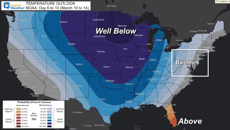
We have a good chance of a record high, but the timing of the front will determine if we can get there. Then the trend will be cooler for the rest of the week, and snow could still mix in. The big story will be the Cold Outlook mid month with two disruptions from the Polar Vortex.
But first, look how warm it is already!
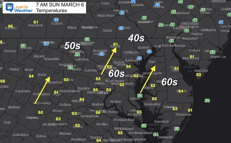
Morning Temperatures
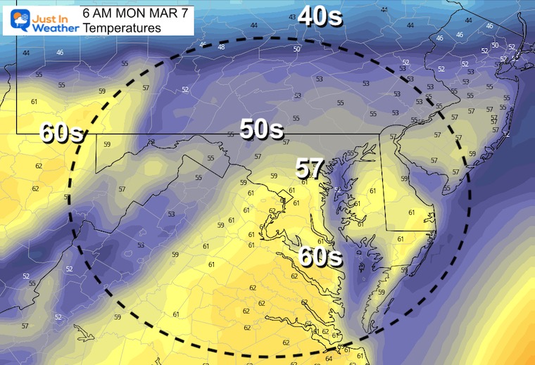
We can literally watch the warm air surge in. At 7 Am, Frederick was 43ºF, but a short drive to Westminster was 61ºF. That is an 18 degree spread over less than 30 miles. The reason was the cold air hanging in the valley while warmer air moved faster at higher elevations.
The cool pocket of 40s in Essex and Aberdeen also at 43ºF by the water of the Bay, but BWI and southward to Annapolis and Washington already in the 60s.
So if you are still in the chill, it will be replaced very soon.
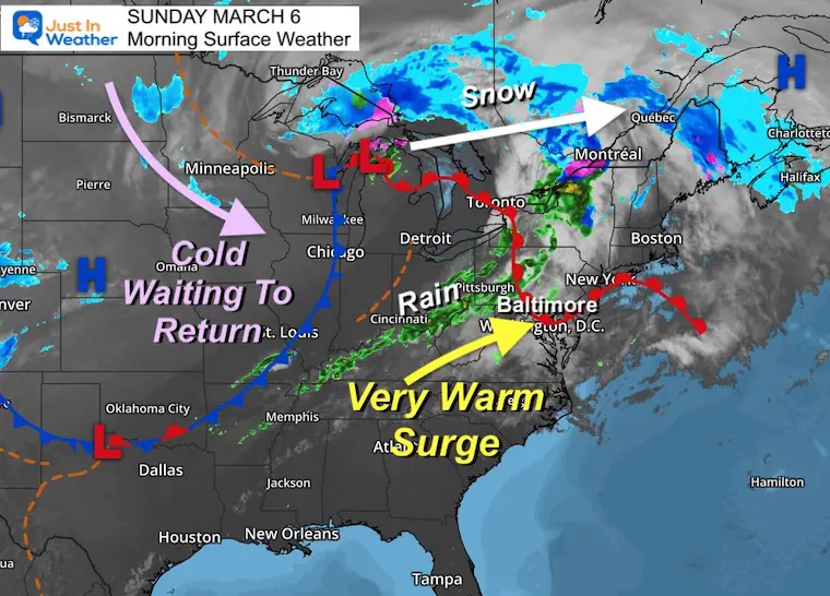
Morning Surface Weather
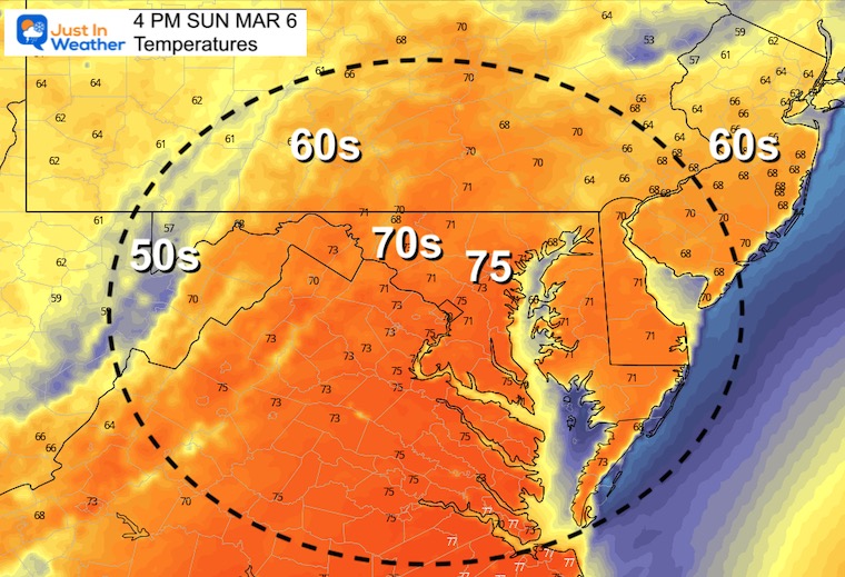
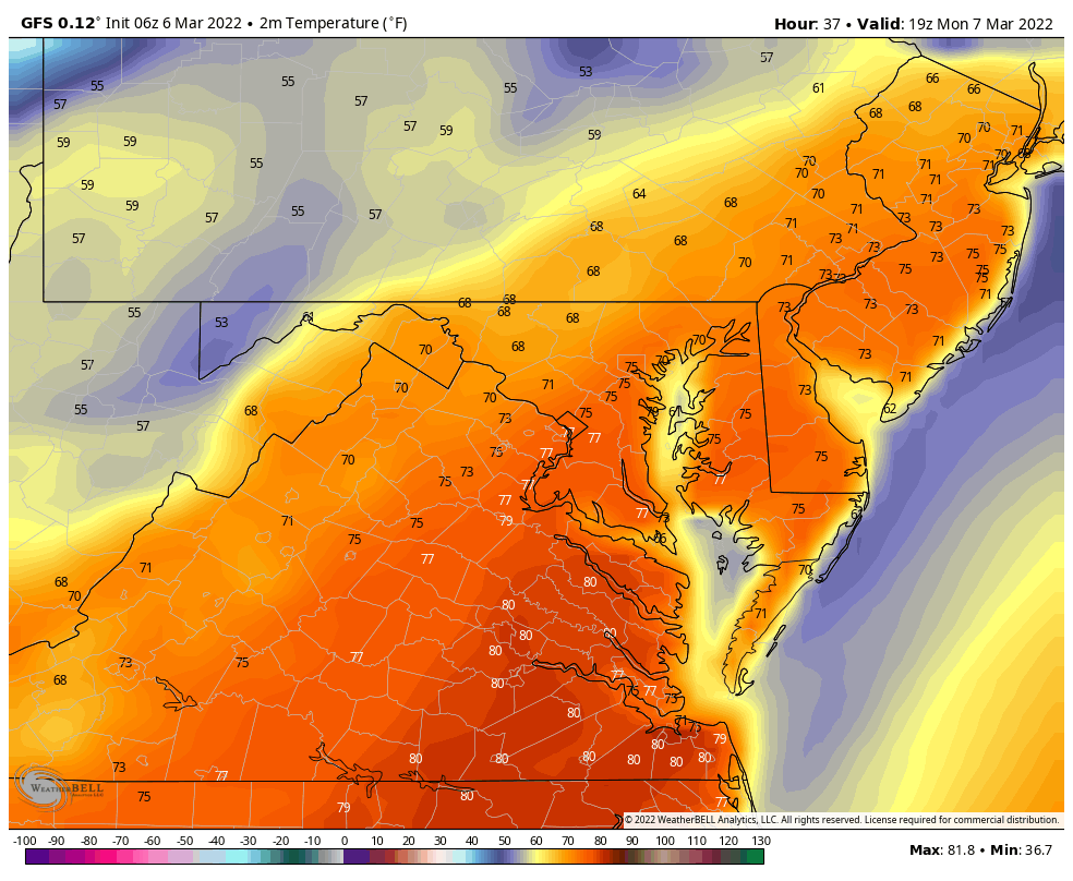
Afternoon Temperatures
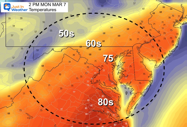
This forecast has jumped higher into the 70s. I am cautious about this with the cloud cover and showers nearby… But it will be much warmer than average regardless. Central Maryland should at least reach 70ºF.
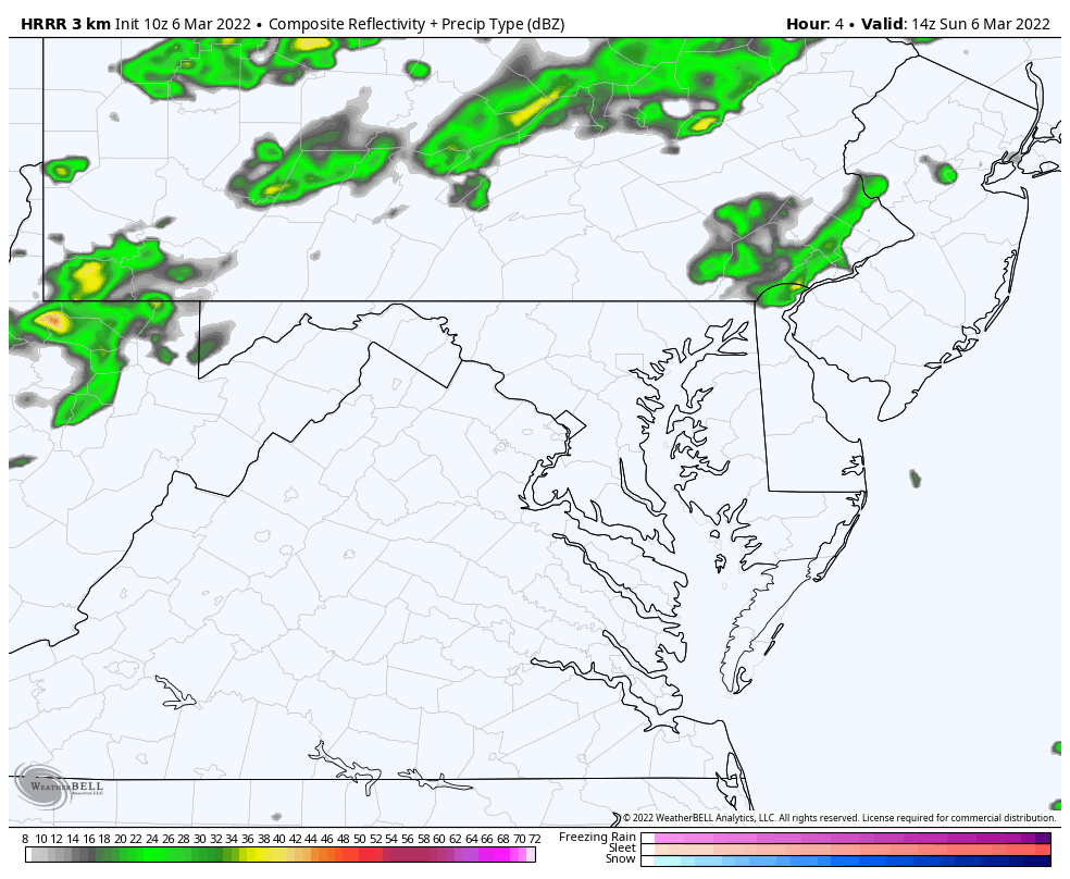
Radar Simulation
Rain Showers more likely this afternoon and evening.
Weather Almanac: Climate Data at BWI
TODAY March 6
Seasonal Snow: 14”
Normal Low in Baltimore: 30ºF
Record 10º F in 2015
Normal High in Baltimore: 50ºF
Record 76ºF 1935
Monday Temperatures
Morning
Afternoon
The record for Baltimore is 76ºF set in 1974 at BWI
There has been a list drop in expectations due to cloud cover and the approaching line of rain/storms. So it will be a close call.
Cold Front By Evening?
The arrival of the rain will determine if we have a chance to reach the record high temperature in time.
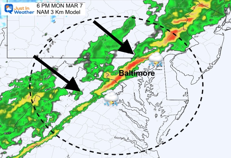
Simulation: NAM 3 Km
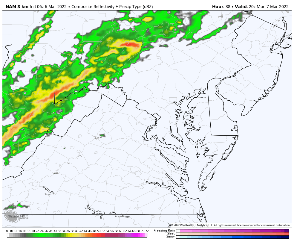
Snapshot 6 PM
The NAM brings that line into Metro Baltimore by 6 PM.
Temperature Animation
2 PM Mon To 7 AM Wed
From mid 70s back to the 30s…
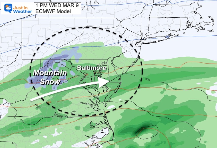
Wednesday (ECMWF)
Showers linger in our region as the front stalls and waves of energy ride along it. This is likely to bring snow to the mountains. Some flakes may mix in later in the day for some of the nearby Piedmont… but not stickage expected.
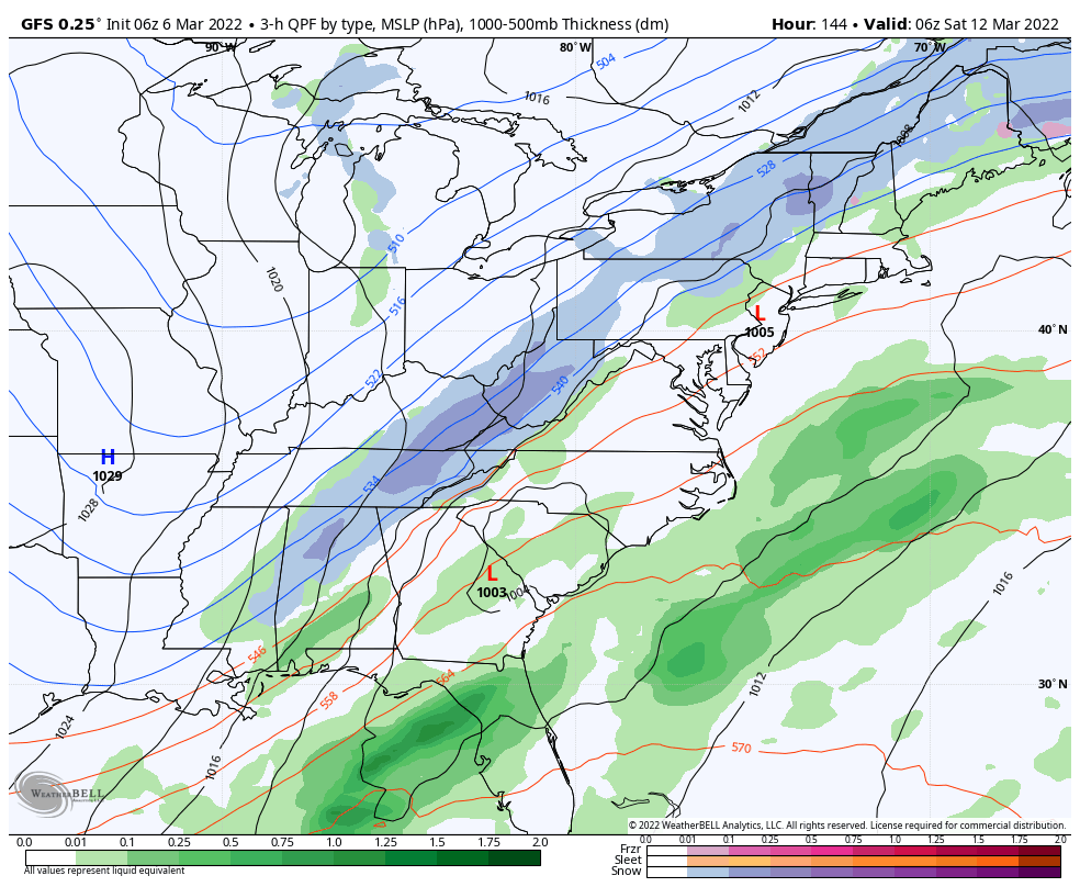
Looking Ahead: Saturday Snow?
The GFS Model continues to hold on to this notion of a costal Low with a steady rain shield turning to inland snow.
*Important Note: The expectation for March snow in our region is that we need it to fall at night to have a chance to impact roads… Daytime snow usually melts on contact, and that is the timing we see now. So we will need to continue to watch:
- If this scenario holds
- Temperatures
- Timing
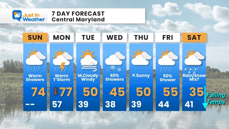
7 Day Forecast
ALSO SEE:
Click to see: NOAA COLD OUTLOOK and Two Polar Vortex Disruptions
ALSO SEE
ALL FITF GEAR

FITF THUNDERSNOW


Winter Outlook Series:
My Call For Snowfall

Last Winter Recap: My Old Outlook And Your Grades Of My Storm Forecasts


Please share your thoughts, best weather pics/video, or just keep in touch via social media
*Disclaimer due to frequent questions:
I am aware there are some spelling and grammar typos. I have made a few public statements over the years, but if you are new here you may have missed it:
I have dyslexia, and found out at my second year at Cornell. I didn’t stop me from getting my meteorology degree, and being first to get the AMS CBM in the Baltimore/Washington region.
I do miss my mistakes in my own proofreading. The autocorrect spell check on my computer sometimes does an injustice to make it worse.
All of the maps and information are accurate. The ‘wordy’ stuff can get sticky.
There is no editor that can check my work when I need it and have it ready to send out in a newsworthy timeline.
I accept this and perhaps proves what you read is really from me…
It’s part of my charm.
#FITF


