March 5 2022
Saturday Evening Update
Extreme weather is common in the month of March. The transition from winter to spring means abnormal is normal. So the outlook we have for the week ahead is a will ride to show off the season in full fashion.
The storm crossing Iowa this evening with severe weather is part of the pattern that will help surge warm air our way over the next two days.
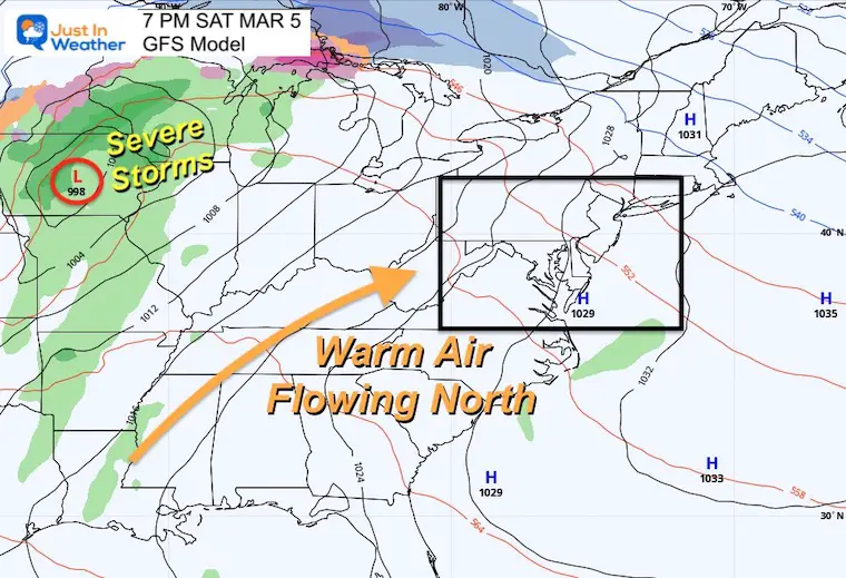
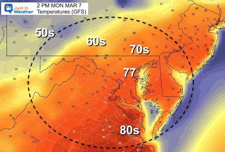
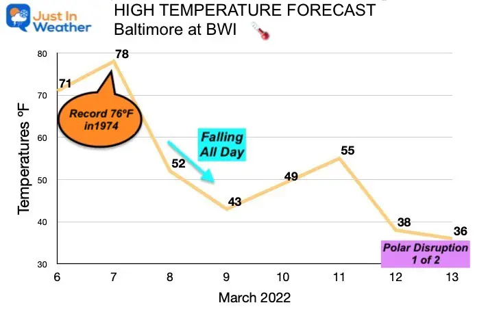
Here in the Mid Atlantic we are expecting temperatures in the 70s Sunday and Monday. Monday has a good chance to reach a new record high at least in Baltimore.
Monday Forecast High (GFS)
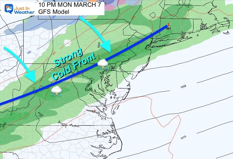
Then a strong cold front will begin the step back to winter, perhaps sooner than expected.
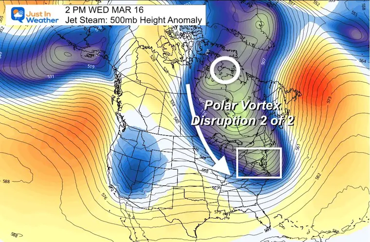
Falling temperatures will come with a series of cold fronts Tuesday night into next weekend. That is when the first of two Polar Vortex Disruptions are expected.
Monday Night Cold Front
This warm air in place may help provide enough energy for this cold front to produce a few thunderstorms with the nighttime passage.
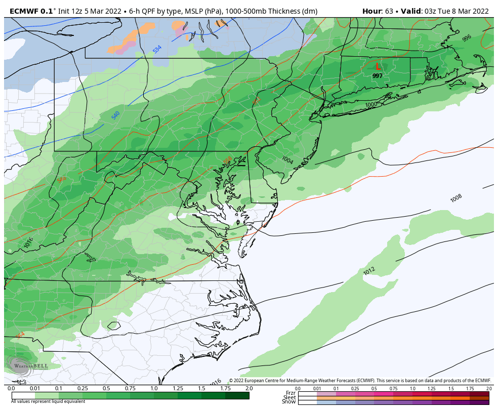
Tuesday- Wednesday ECMWf Model
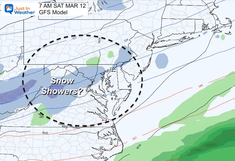
Mid Week Showers may be mixed with snow, especially in the higher elevations. Looks closer and you can see the speckled blue hinting that there may be a mix in metro Baltimore on Wednesday.
NO- STICKAGE- EXPECTED
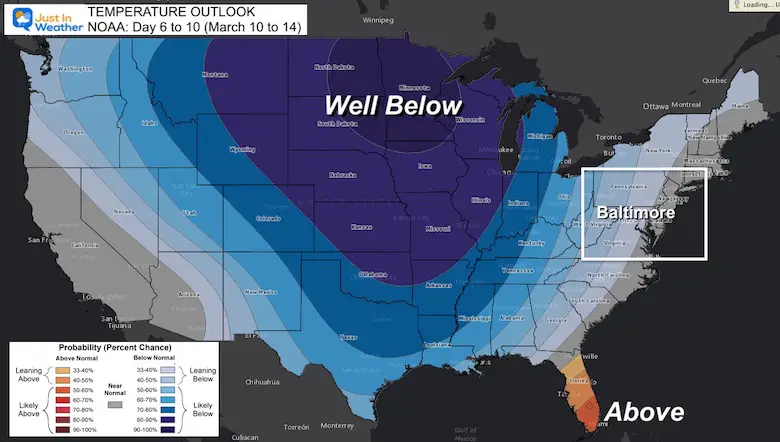
Temperature Outlook
I am calling for 78ºF on Monday since BWI tends to verify a little higher than model plots in warm ups. But the record should be well within reach.
NOAA Outlook: March 10 to 14
The temperature outlook between Thursday and Monday covers the first of the two expected Polar Vortex Disruptions. The coldest air will be in the Northern Plains, which will eventually spill our way over the weekend.
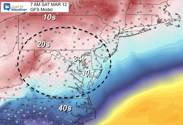
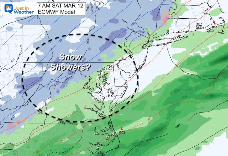
Saturday Morning
The arrival of the cold air will be with us by the weekend. Here is the latest snapshot at daybreak on Saturday with temps near freezing and snow showers shown on both the GFS and European ECMWF Models.
Again, I do not see much stickage as a problem, but we need to watch this for any March surprises.
Temperatures
Snow Showers?
GFS Model
European Model
Repost:
Polar Vortex Disruption 1
This first surge of cold air will expand over the weekend.

Polar Vortex Disruption 2
This second surge of cold air will arrive in the middle of the following week. You will continue to hear me and likely other meteorologists say ‘Beware The Ides Of March’
Take Away: Don’t let your guard down
It will get warm Sunday and we may get a new record high on Monday, only to see the the bottom fall out at the end of the week.
A high of 39ºF for Baltimore may not sound impressive, but that would translate to near freezing for the inland suburbs.
Can it snow?
Yes! However, we would need something special for it to be a legit impactful storm. Most of the time in March, we need an event to begin or mostly fall at night to allow stickage. Then again, March 12 to 14 in 1993 was the famed SuperStorm event that produced about a foot of snow with heavy icing on Baltimore, and three feet of snow inland.
Anything is possible… Especially with a high amplitude pattern like this.
So, no promises, but if you have Faith in the Flakes it will be an interesting week or two to watch.
ALSO SEE
ALL FITF GEAR

FITF THUNDERSNOW


Winter Outlook Series:
My Call For Snowfall

Last Winter Recap: My Old Outlook And Your Grades Of My Storm Forecasts


Please share your thoughts, best weather pics/video, or just keep in touch via social media
*Disclaimer due to frequent questions:
I am aware there are some spelling and grammar typos. I have made a few public statements over the years, but if you are new here you may have missed it:
I have dyslexia, and found out at my second year at Cornell. I didn’t stop me from getting my meteorology degree, and being first to get the AMS CBM in the Baltimore/Washington region.
I do miss my mistakes in my own proofreading. The autocorrect spell check on my computer sometimes does an injustice to make it worse.
All of the maps and information are accurate. The ‘wordy’ stuff can get sticky.
There is no editor that can check my work when I need it and have it ready to send out in a newsworthy timeline.
I accept this and perhaps proves what you read is really from me…
It’s part of my charm.
#FITF


