


July 18 Flood Watch In The Mountains Then Storms Expand Back This Weekend
Friday, July 18 2025 Morning Report There is some relief in sight, but I remain cautious. For the short term, today remains muggy, while the focus of strong storms and…
February 28 2022
Seasons are blocked out in 3 full months for meteorological records. The end of February marks the end of meteorological winter. So March 1st marks meteorological spring! This is when we begin the records for the new, even though your calendar and astronomical start of spring is on March 20th.
I want to take a brief look back at the Winter Headlines, and look ahead to what March will bring us. This will include:
For simplicity, I will continue to use Baltimore’s BWI data since it is central to our Mid Atlantic region (at least where I cover).
There was such promise in January with multiple events and ending the month above average for the season. But that has been dashed with a paltry 0.7″ of snow in all of February.
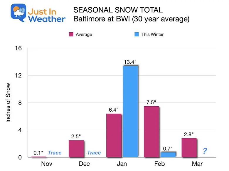
It is likely we end the season below average. I remember I called for an average winter… and if BWI was 50 miles Southeast that would have worked out. But, I will compare my outlook with what verified in a follow up with my seasonal wrap up later in March.
It is important to note that we can still get a few inches of snow in March. But it will take something exceptional like that Superstorm of 1993 to bring many spots back up to near or above normal.
(National Operational Hydrologic Remote Sensing Center)
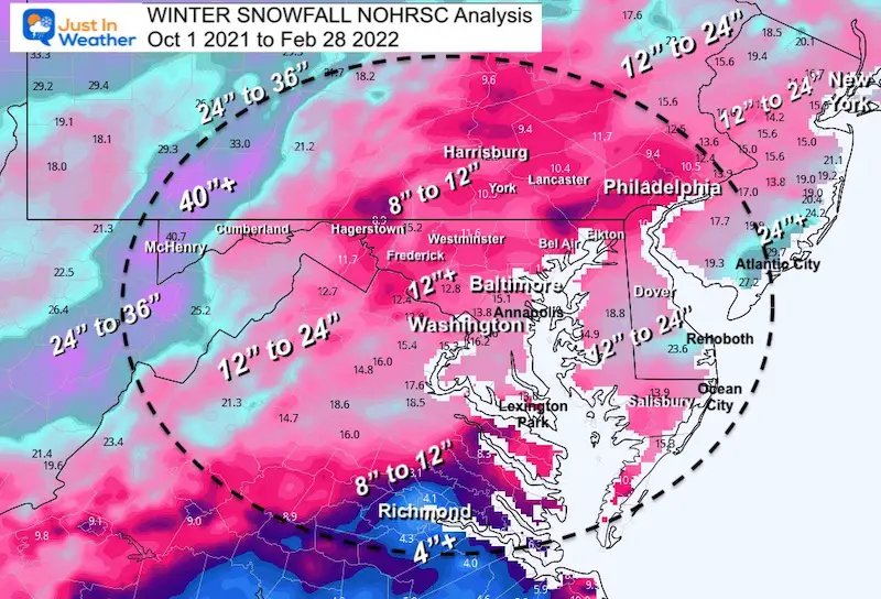
November 1 2021 to February 28 2022
Notable Winter Weather Events:
These are based on dates I have had to write snow and ice reports for my clients. It was pretty active, even if most events were minor, or didn’t affect the entire region.
The long range weather is not in the scope of this post. I will cover that separately. However there is potential for one more push of arctic air mid month. March is known for weather surprises, so I would never count out what it may bring… But the first 10 days will be more like Pre-Spring.
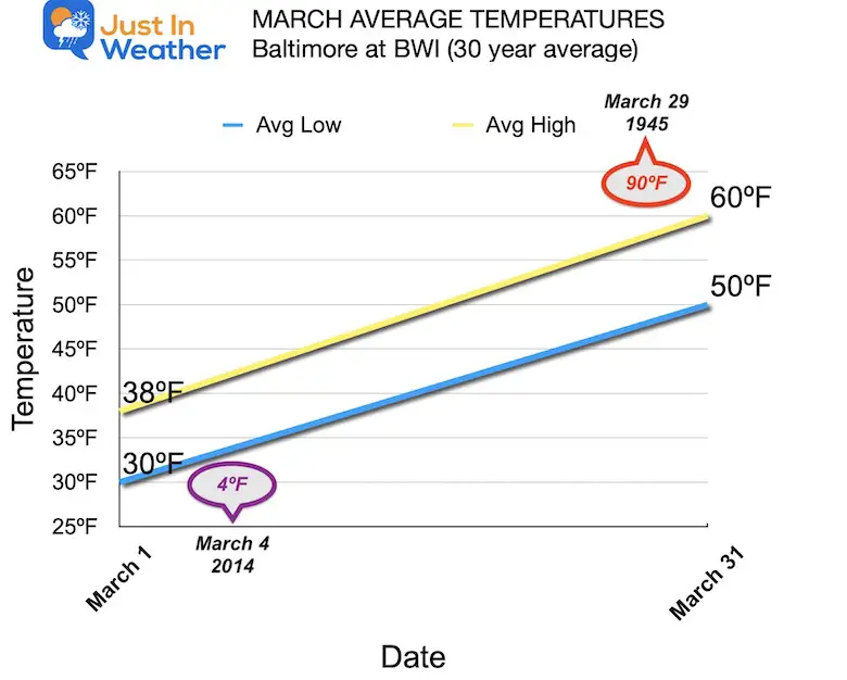
We increase our daily high by 10ºF. But look at the extremes:
There is literally no rhyme, reason, or pattern for what we can expect in March. It is a true WildCard!
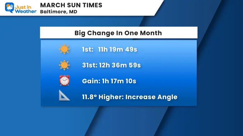
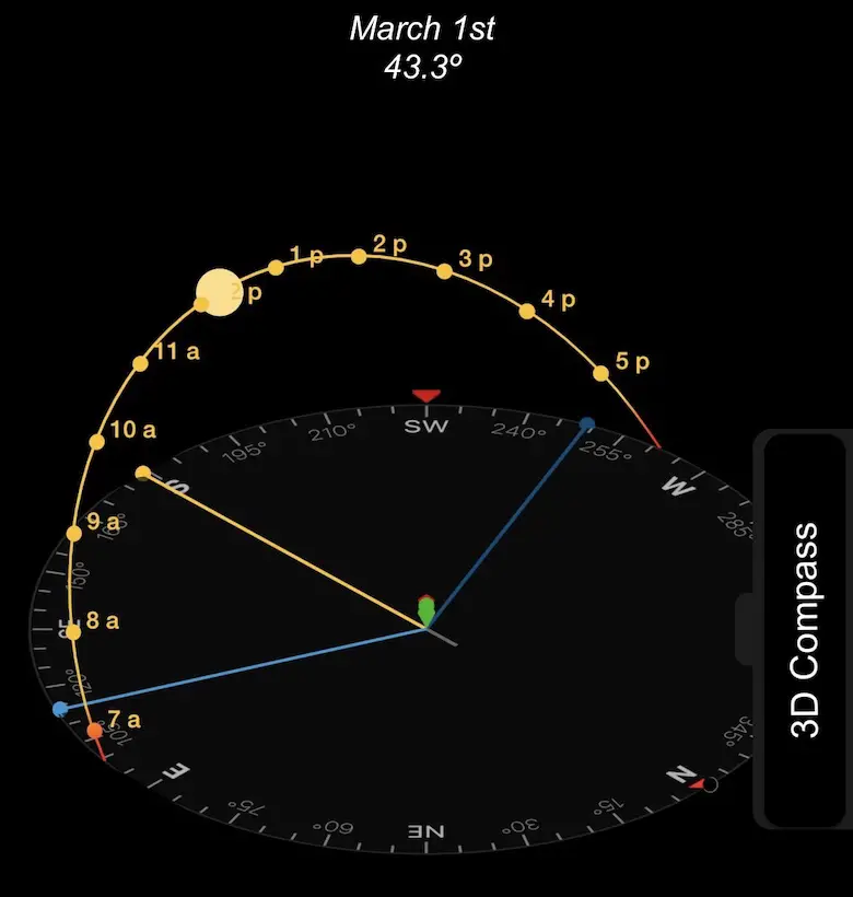
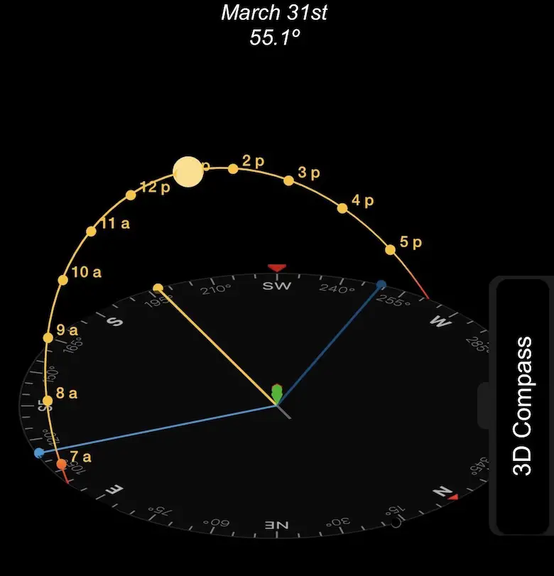
Between March 1 and 31st:
1 Hour 17 minutes and 10 seconds
Average Increase Per Day 2 min 34 sec
March 18 = Worm Moon
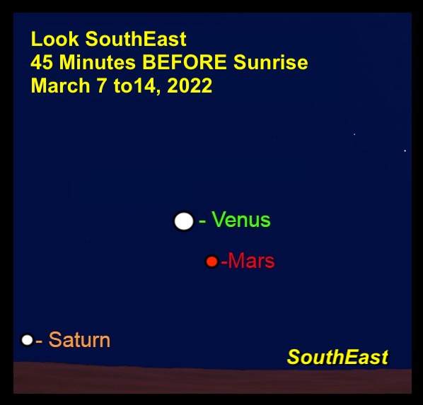
Planetary Sky Show:
Morning Planet Conjunction: Venus, Mars, Saturn
Sign up and be the first to know!


Last Winter Recap: My Old Outlook And Your Grades Of My Storm Forecasts


*Disclaimer due to frequent questions:
I am aware there are some spelling and grammar typos. I have made a few public statements over the years, but if you are new here you may have missed it:
I have dyslexia, and found out at my second year at Cornell. I didn’t stop me from getting my meteorology degree, and being first to get the AMS CBM in the Baltimore/Washington region.
I do miss my mistakes in my own proofreading. The autocorrect spell check on my computer sometimes does an injustice to make it worse.
All of the maps and information are accurate. The ‘wordy’ stuff can get sticky.
There is no editor that can check my work when I need it and have it ready to send out in a newsworthy timeline.
I accept this and perhaps proves what you read is really from me…
It’s part of my charm.
#FITF