Tuesday February 22
Morning Report
Today we have a different type of spring-like day. Yesterday we had glorious sunshine and Baltimore reached a high at BWI of 65ºF. Today, we will reach the 60s but rain will be moving in during the afternoon.
Tomorrow, the rain will end by mid day and allow temps to approach 70ºF. THEN, snow, sleet, and even some inland freezing rain is possible Thursday and Friday. This is the kind of weather weather that makes you crazy or proud to live here.
Trivia (although well known today)
Today is Tuesday 2/22/22
People are also celebrating 2:22 AM AND 2:22 PM
Or even tonight if you in the military or health care 22:22 (10:22 PM)
Headlines:
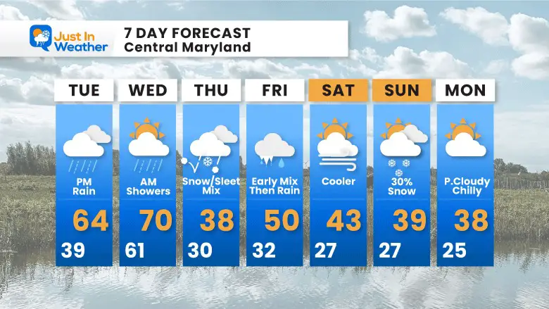
- Today: Warm with afternoon rain.
- Wednesday: Rain ending, brief push of warmer air.
- Thursday: Colder with Snow/Sleet/ Freezing Rain mix
- Friday: Wintry Mix trends to just rain.
- Weekend: COLDER
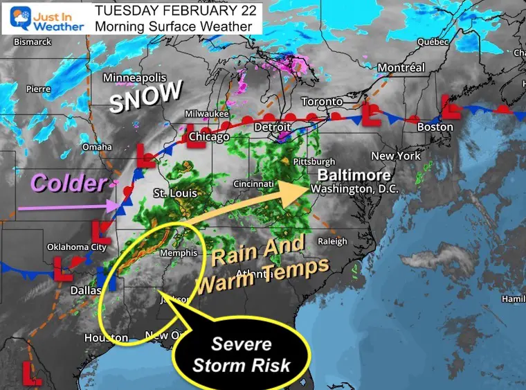
Morning Surface Weather
Rain covered the Ohio Valley just west of Maryland at 6 AM. This will be spreading in by the afternoon through this evening.
A second cluster of thunderstorms in the Southern US could bring severe weather to that region again. This may include tornadoes and large hail between East Texas to Western Tennessee.
A large region of colder air sits behind this weather system with snow expanding across the Northern US.
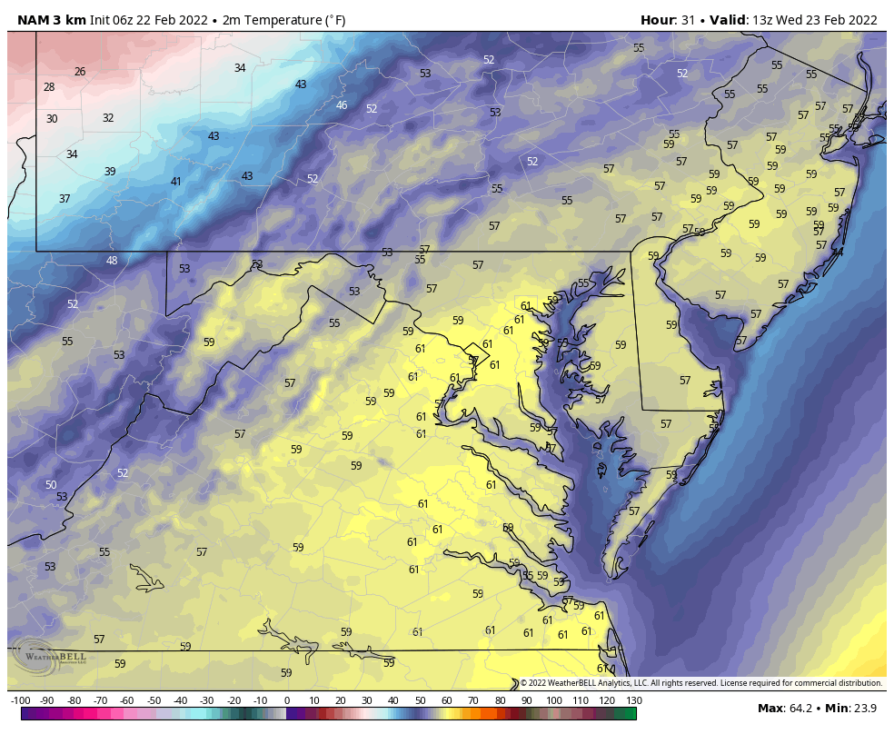
Temperatures This Morning
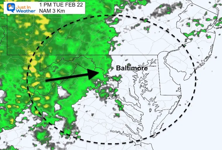
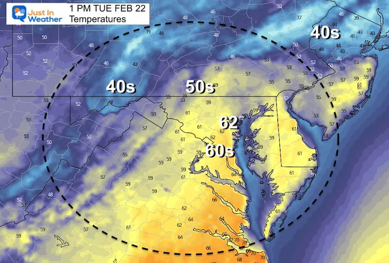
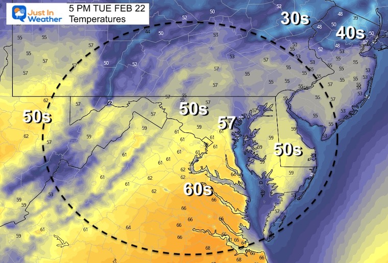
Rain and Temperatures Later Today
1 PM – Rain moving in from the west.
Temperatures in metro areas will be in the lower 60s, with 50s and 40s under the rainfall.
5 PM- Rain will begin to move out from metro areas. But showers will be scattered behind into Tuesday night.
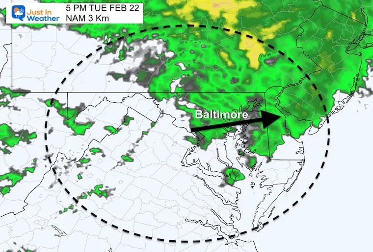
Temperatures cool to the 50s in metro areas under the rain
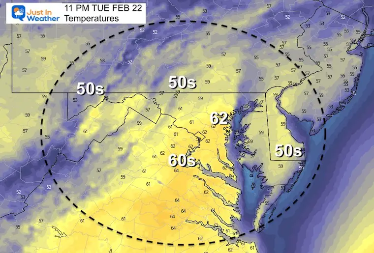
Tonight – Warmer air moves back in. Yes, you may be able to open your windows to sleep with fresh air.
Weather Almanac: Climate Data at BWI
TODAY February 22
Seasonal Snow: 14”
Normal Low in Baltimore: 28ºF
Record +7 F in 1963
Normal High in Baltimore: 47ºF
Record 74ºF 1874
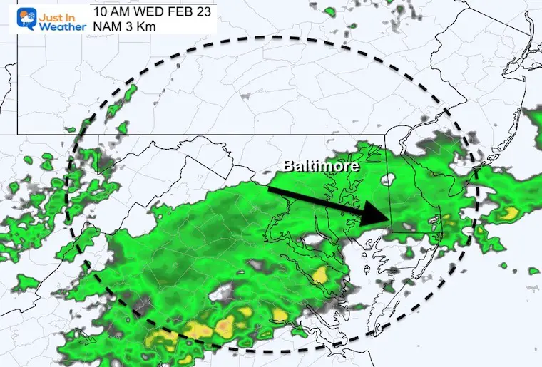
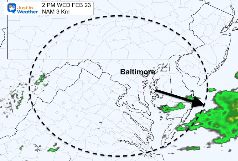
Wednesday Weather
Rain Departing
10 AM
2 PM
Temperature Timeline
A surge close to 70ºF AFTER the rain ends around Baltimore, then CRASHING to FREEZING by midnight.
Looking Ahead! Thursday To Friday
1 PM Thu to 7 PM Fri
The mention of a wintry mix conjures up all kinds of expectations. This event looks like there will be a mix of snow, sleet, and freezing rain developing on Thursday. At this point I do not see much travel impact on the roads, but we will watch it.
Ground temps will be warm, but the mix will continue through Friday morning allowing time for the ground to cool, especially inland west and north of Baltimore.
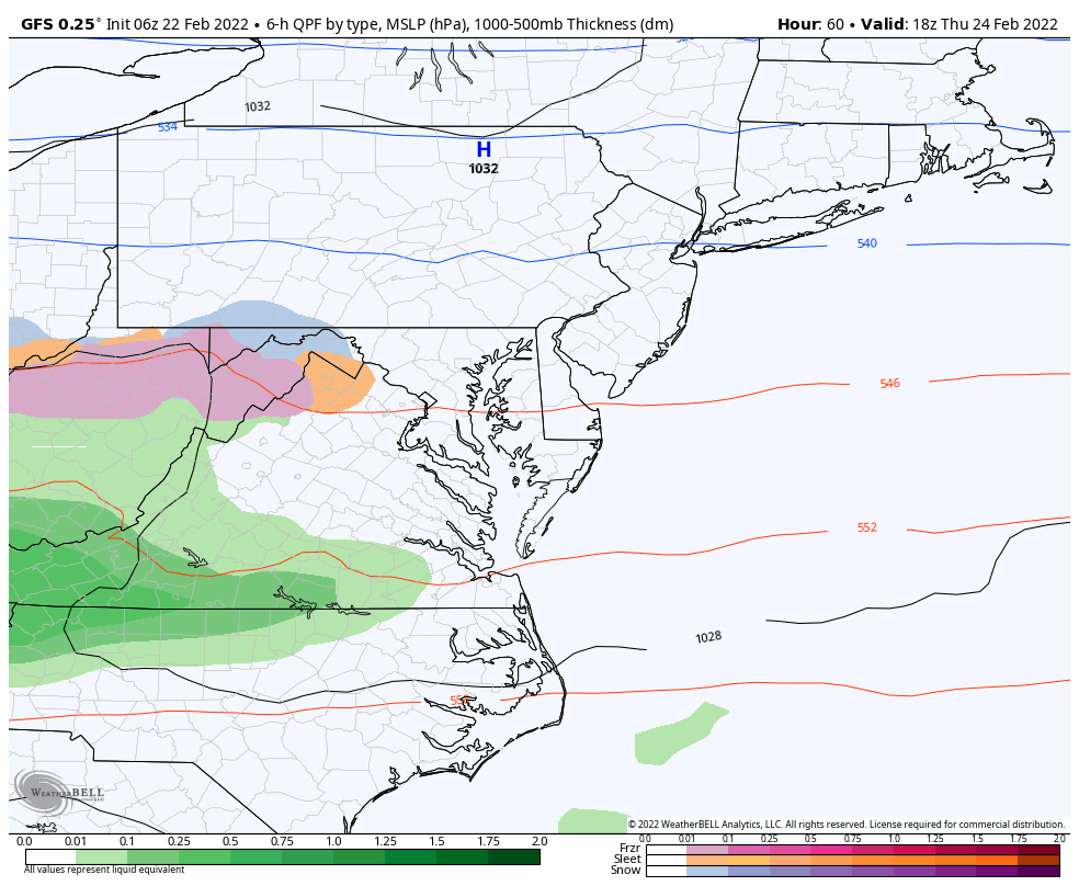
THIS WILL LIKEY NOT BE AN ISSUE ALONG THE BAY OR SOUTHERN MARYLAND.
The system will bring in warmer air, eventually turning to just rain on Friday. This will be followed by yet anther arctic push on yet another weekend.
7 Day Forecast
ALSO SEE
ALL FITF GEAR

FITF THUNDERSNOW


Winter Outlook Series:
My Call For Snowfall

Last Winter Recap: My Old Outlook And Your Grades Of My Storm Forecasts


Please share your thoughts, best weather pics/video, or just keep in touch via social media
*Disclaimer due to frequent questions:
I am aware there are some spelling and grammar typos. I have made a few public statements over the years, but if you are new here you may have missed it:
I have dyslexia, and found out at my second year at Cornell. I didn’t stop me from getting my meteorology degree, and being first to get the AMS CBM in the Baltimore/Washington region.
I do miss my mistakes in my own proofreading. The autocorrect spell check on my computer sometimes does an injustice to make it worse.
All of the maps and information are accurate. The ‘wordy’ stuff can get sticky.
There is no editor that can check my work when I need it and have it ready to send out in a newsworthy timeline.
I accept this and perhaps proves what you read is really from me…
It’s part of my charm.
#FITF


