Monday February 21
Morning Report
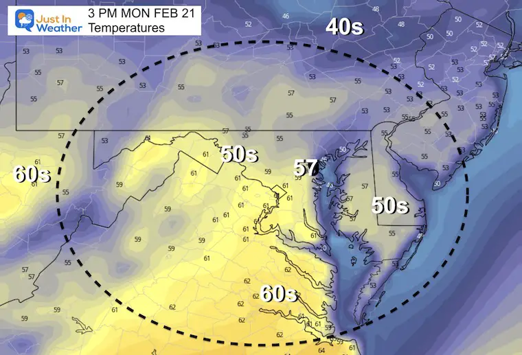
Presidents Day Week has a reputation of brining some of our biggest snowstorms. This week will be different. If you have today off, you lucked out. Sunshine will allow temps to get close to 60ºF.
Rain will return tomorrow, but we remain mild through Wednesday.
Then another attempt by winter to push back will bring in a snow and rain mix Thursday, which will trend to a chilly rain on Friday. Then another arctic push next weekend.
Trivia: Extreme Weather 3 years apart.
Check out the Almanac Today!
Record Low +2ºF in 2015
Record High 79ºF in 2018
Both records each year was set two days in a row.
Headlines:
- Today: Sunny and Mild
- Tuesday: Rain
- Wednesday: Rain ending, brief push of warmer air.
- Thursday: Colder with Snow/Rain mix
- Friday: Wintry Mix trends to just rain.
- Weekend: COLDER
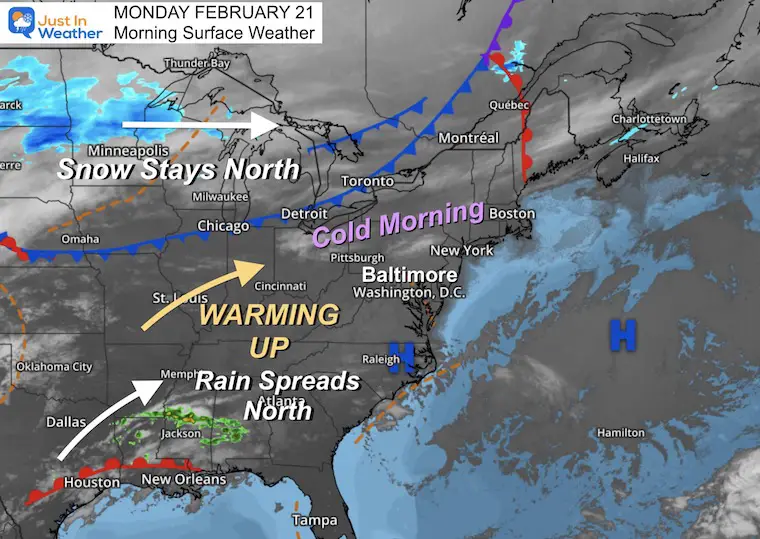
Morning Surface Weather
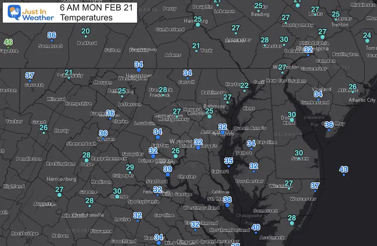
High Pressure is in control. After a cold start, sun and a shift in wind will allow temps to warm up near 60ºF this afternoon.
The rain event event doesn’t look like much here, but it will spread our way tomorrow from the south.

Temperatures This Morning
Afternoon Temperatures
Weather Almanac: Climate Data at BWI
TODAY February 21
Seasonal Snow: 14”
Normal Low in Baltimore: 28ºF
Record +2ºF in 2015
Normal High in Baltimore: 46ºF
Record 79ºF 2018
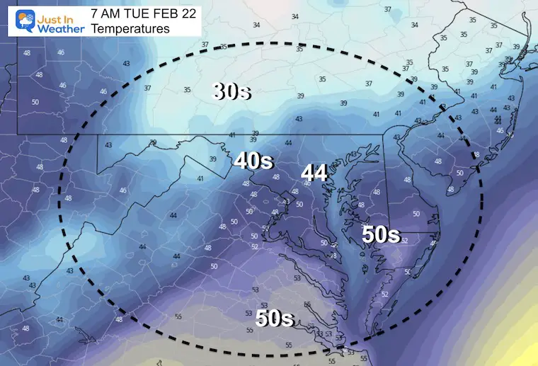
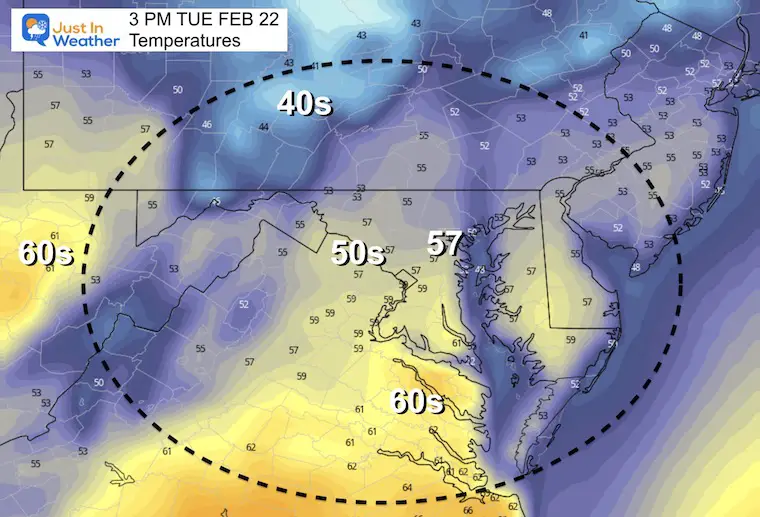
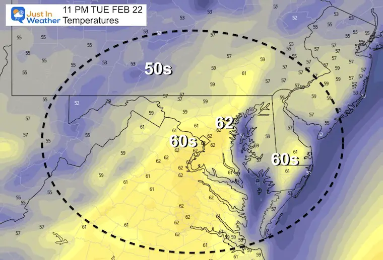
Tuesday Temperatures
Morning
Afternoon
Night:
The warmest part of the day will be just before midnight.
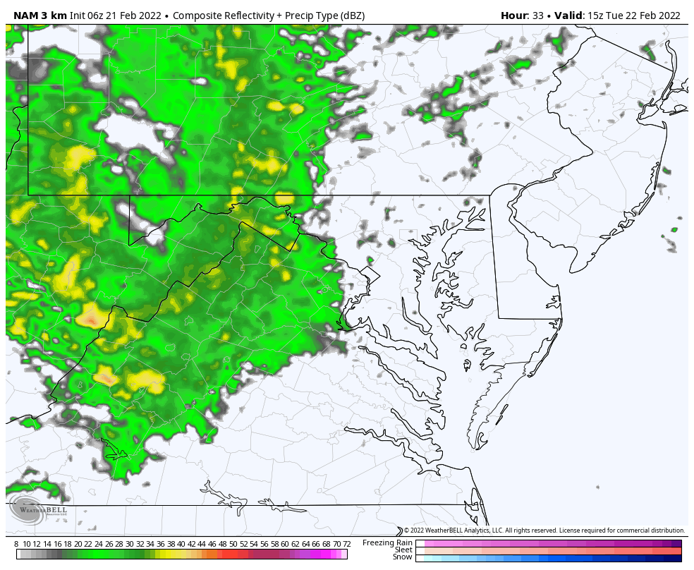
Rain Timeline:
10 AM Tue to 12 PM Wed
It will become more wet un the afternoon, then rain will end Wednesday morning.
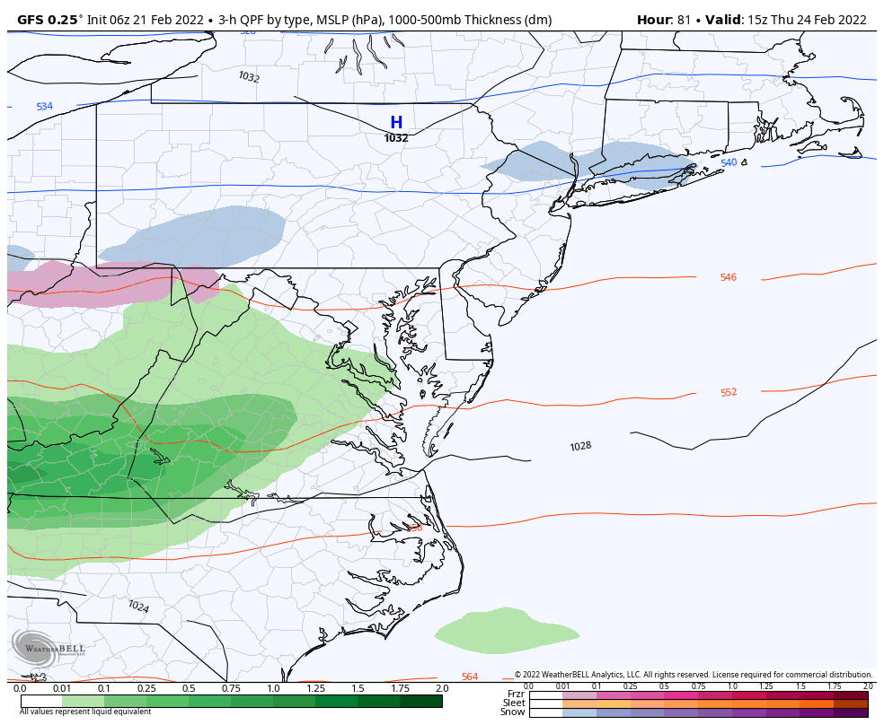
Looking Ahead! Thursday To Friday
10 AM Thu to 4 PM Fri
The mention of a wintry mix conjures up all kinds of expectations. This event looks like there will be a mix of snow and rain developing on Thursday. At this point I do not see much travel impact on the roads, but we will watch it.
If you are traveling north, this looks like a bigger snow and ice event from central PA and NY into New England.
The system will bring in warmer air, eventually turning to just rain on Friday. This will be followed by yet anther arctic push on yet another weekend.
7 Day Forecast
Warm days start the week. I am actually pushing the 70ºF button for BWI, a little above model guidance. We often tend to end up warmer on a day when rain ends and warm winds surge in.
Thursday will turn colder. That snow/rain mix may be more ambiance than impact, but we will track it.
Next Weekend brings back another attempt for arctic air.
ALSO SEE
ALL FITF GEAR

FITF THUNDERSNOW


Winter Outlook Series:
My Call For Snowfall

Last Winter Recap: My Old Outlook And Your Grades Of My Storm Forecasts


Please share your thoughts, best weather pics/video, or just keep in touch via social media
*Disclaimer due to frequent questions:
I am aware there are some spelling and grammar typos. I have made a few public statements over the years, but if you are new here you may have missed it:
I have dyslexia, and found out at my second year at Cornell. I didn’t stop me from getting my meteorology degree, and being first to get the AMS CBM in the Baltimore/Washington region.
I do miss my mistakes in my own proofreading. The autocorrect spell check on my computer sometimes does an injustice to make it worse.
All of the maps and information are accurate. The ‘wordy’ stuff can get sticky.
There is no editor that can check my work when I need it and have it ready to send out in a newsworthy timeline.
I accept this and perhaps proves what you read is really from me…
It’s part of my charm.
#FITF


