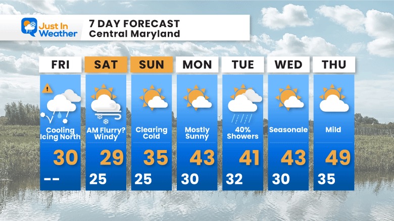
Despite the delay of the icing this morning, the expectation for ice this evening is still on.My concern is the leftover rain showers, with temperatures falling below 32ºF. Combine that with the setting sun and dark hours, and the ground will cool down faster. At first glance, the icing issues have reached York, northern Baltimore and Harford Counties. This will spread southward.
I have told my clients that salting their properties would be prudent, and they are on point. I hope the road crews are prepared for this as well.
There are no ‘Advisories’ at this time, but it is worth mentioning.
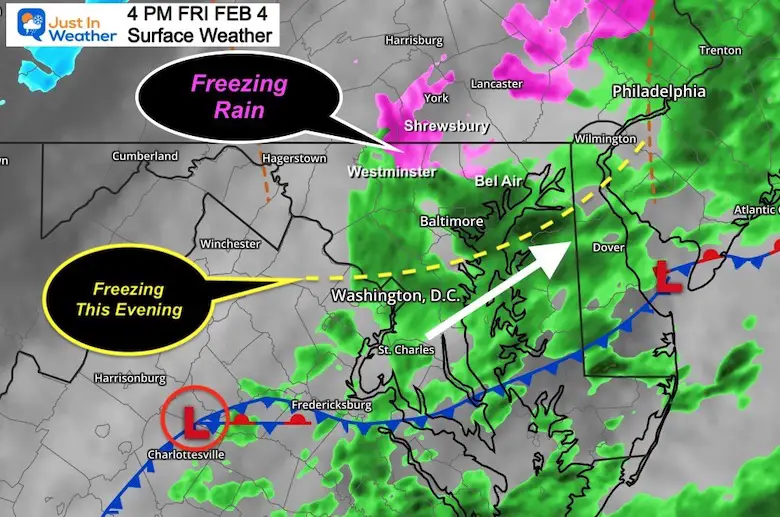
The Freezing temps will reach most of the former Winter Weather Advisory areas between 4 and 6 PM.Then it will extend south of Baltimore through the evening.
One more surge could produce showers with freezing rain, sleet, or light snow. So please pay attention if you have plans to be out tonight.
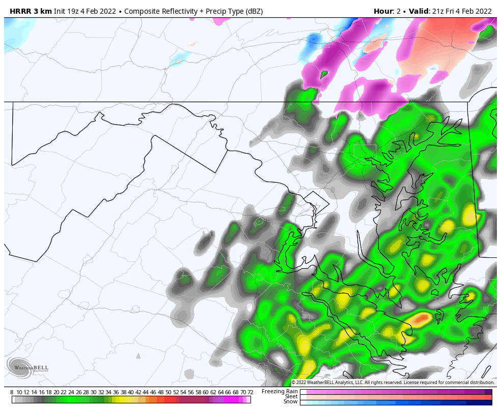
Here’s a brief look at the set up from 4 PM
Surface Weather
The nearly stationary front is now in southern Maryland. One more Low Pressure is riding along it, now located near Charlottesville, VA. This ill enhance the showers into the evening as the colder air is filling in. The is the concern for additional icing across central Maryland into southern Pennsylvania.
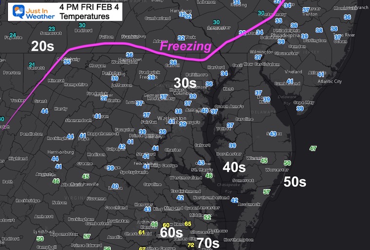
Temperatures
The freezing line is already pushing into the northern areas. There are locations between these official reports that are colder.
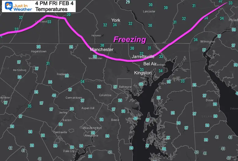
Closer Look
Icing Now: Northern Harford, Baltimore, Carroll Counties in Maryland and York to Lancaster in PA.
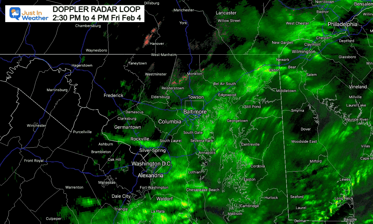
Doppler Radar Loop:
2:30 PM to 4 PM
We can see the progress of showers continuing from the southwest to the northeast.
I am aware there are some spelling and grammar typos. I have made a few public statements over the years, but if you are new here you may have missed it:
I have dyslexia, and found out at my second year at Cornell. I didn’t stop me from getting my meteorology degree, and being first to get the AMS CBM in the Baltimore/Washington region.
I do miss my mistakes in my own proofreading. The autocorrect spell check on my computer sometimes does an injustice to make it worse.
All of the maps and information are accurate. The ‘wordy’ stuff can get sticky.
There is no editor that can check my work when I need it and have it ready to send out in a newsworthy timeline.
I accept this and perhaps proves what you read is really from me…