Tuesday February – Morning Report
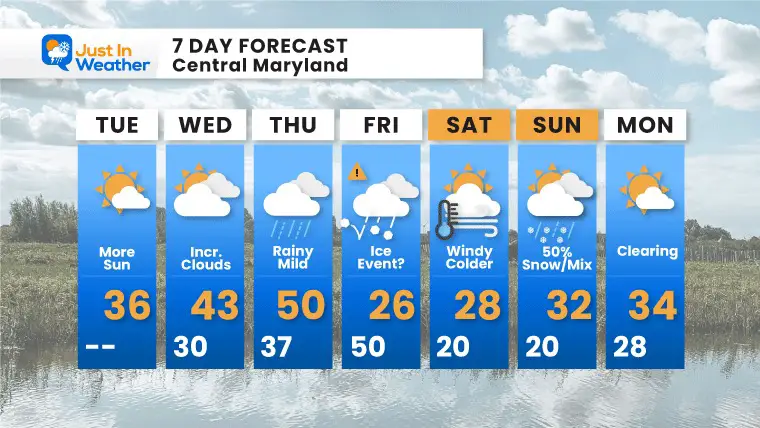
This new month is picking up where January left off. A busy week ahead will bring a brief warm up along with rain Wednesday night into Thursday. That will be part of a major storm across the middle of the nation, and there is support for arctic air to catch up to us Friday, turning that into an ice event.
January numbers: Baltimore measured 6.4 inches of snow, with the season total at 13.3 inches of snow. The monthly temps have been almost 2 degrees below normal.
Headlines
- Wednesday: Groundhog Day
- Thursday: Mild with rain
- Friday: Falling temps and ice event may being in the morning.
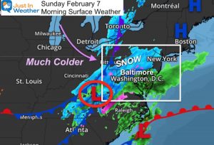
- Sunday: Another possible snow/ice event.
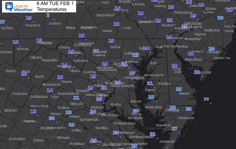
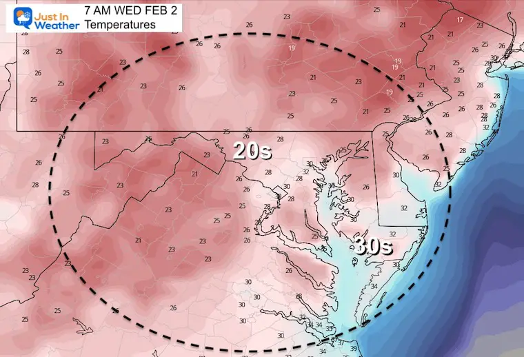
Morning Temperatures
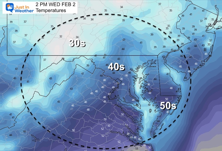
Afternoon Temperatures

Weather Almanac: Climate Data at BWI
TODAY February 1
Seasonal Snow: 13.3”;
+4.7″ ABOVE AVERAGE
Normal Low in Baltimore: 25ºF
Record 7ºF in 1965
Normal High in Baltimore: 42ºF
Record 75ºF 2002
Groundhog Day Tomorrow
Before I get to the interesting forecasting this week, I need to address the holiday:
Tomorrow is Groundhog Day. While the nation will celebrate Punxsutawney Phil, The National Weather Service in State College PA is already throwing shade on Twitter today. Are they jealous of the attention?
It is the #GroundhogDay edition of #MythBusterMonday! Can Punxsutawney Phil accurately predict the arrival of spring? Since he is only right less than half of the time, you are better off to flip a coin! Or even using NWS forecasts 👀 https://t.co/LXslk2bHut #PAwx pic.twitter.com/2PtawGhGdP
— NWS State College (@NWSStateCollege) January 31, 2022
Wednesday Temperatures
Storm Outlook:
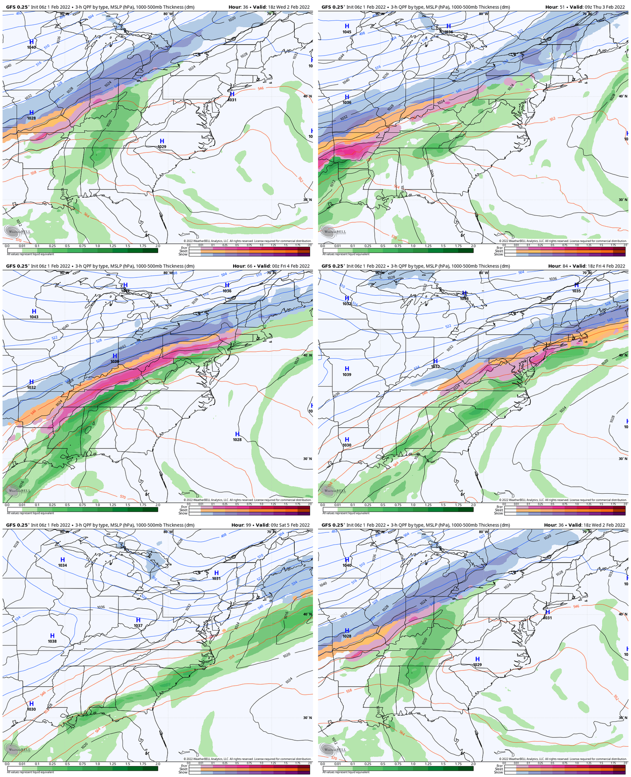
1 PM Wednesday to 7 AM Saturday
Tracking a major snow and ice storm across the middle of the nation.
Rain moves in for us Wednesday night in to Thursday.
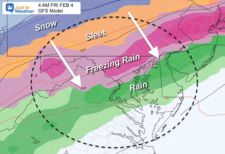
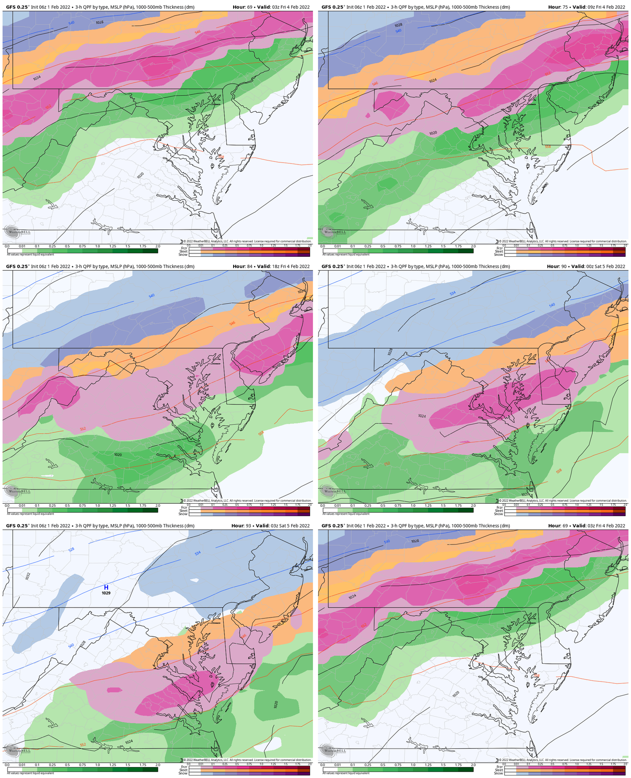
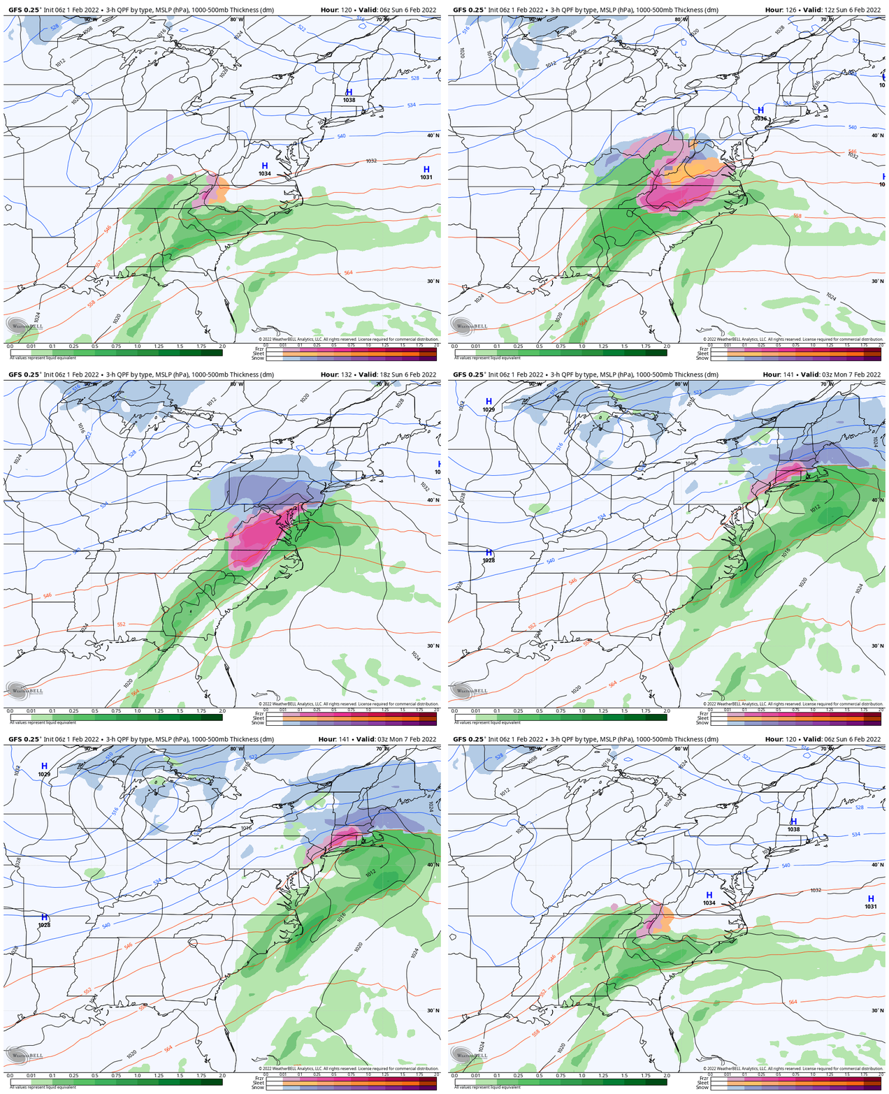
The cold air catches up (according to the GFS Model) early Friday morning. This would develop freezing rain and sleet early Friday.
Snapshot:
Also See:
My report last night compared the GFS to European Model
Closer Look
10 PM Thursday to 10 PM Friday
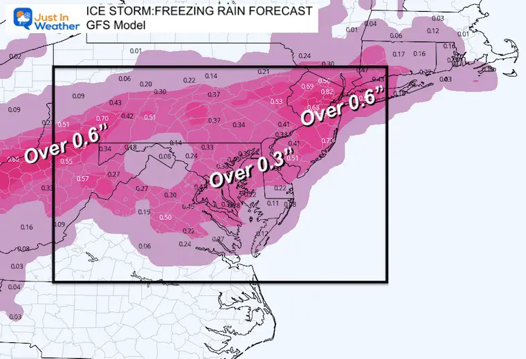
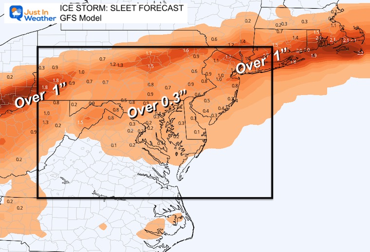
Ice Storm?
I called this an ‘event’ earlier on purpose since this is not a guarantee. The GFS Model is more aggressive, but earned respect with two events in January.
‘Potential’ Ice Accumulation :
Freezing Rain
Sleet
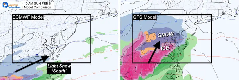
Another One Sunday?
Again here is the aggressive GFS Model showing snow and ice, but the European Model has a weaker system passing south.
This is why I gave odds, not a promise
GFS Model Animation
Worse Case Scenario
7 Day Forecast
Weather posts straight to your inbox
Sign up and be the first to know!
ALSO SEE
What is Faith in the Flakes: History of December 5th Snow
ALL FITF GEAR
FITF THUNDERSNOW
Winter Outlook Series:
Last Winter Recap: My Old Outlook And Your Grades Of My Storm Forecasts
Winter Weather Page – Lots of resources
Solar Cycle Increasing Sunspots Suggests More Snow
Comparing 4 Different Farmer’s Almanacs: Majority colder winter outlook than NOAA
NOAA Winter Outlook- But Read The Fine Print
Signals For Early Start To Winter In November
Winter Outlook Series: La Nina Double Dip
Nor’easters May Give Hint For Winter La Nina Pattern
Winter Folklore Checklist
Please share your thoughts, best weather pics/video, or just keep in touch via social media
Facebook: Justin Berk, Meteorologist
Twitter: @JustinWeather
Instagram: justinweather
*Disclaimer due to frequent questions:
I am aware there are some spelling and grammar typos. I have made a few public statements over the years, but if you are new here you may have missed it:
I have dyslexia, and found out at my second year at Cornell. I didn’t stop me from getting my meteorology degree, and being first to get the AMS CBM in the Baltimore/Washington region.
I do miss my mistakes in my own proofreading. The autocorrect spell check on my computer sometimes does an injustice to make it worse.
All of the maps and information are accurate. The ‘wordy’ stuff can get sticky.
There is no editor that can check my work when I need it and have it ready to send out in a newsworthy timeline.
I accept this and perhaps proves what you read is really from me…
It’s part of my charm.
#FITF


