Saturday January 29 2022
Mid Day Report
The major winter storm has passed my The Mid Atlantic, leaving behind a wide range of snow depths. As the blizzard cranks for New England we all are in the cold winds. There is a lot of data to sort through, but I wanted to share some of the best snow photos I gathered this morning.
Before we get to them, here is a list of preliminary snow totals. The final official report will be out later today. I will share those with my formal storm recap and Grade My Forecast Poll.
For now, just the eye candy.
Preliminary Snow Reports
Some of these numbers are in locations that continued to get snow.
- Low End- Dusting to 2 inches: Metro Baltimore and Washington: I made the mistake of bumping this area into my 2” to 4” range in my updated call. My original call would have verified.
- 2” to 4” did verify in Anne Arundel County, with the higher amounts around Annapolis. Also in Cecil and Kent County in northern Delmarva.
- 3” to 6” in southern Maryland and between Queen Annes and Kent Counties
- 6” to 12”+ This was expected for much of Delmarva. The highest amount were closer to the beach

Top Snow Photos
In No Particular Order… Actually there were so many good ones sent to me and I was not able to see them all yet.
Parsonburg MD
Just east of Salisbury looks like more then the 11 inch report on the map.

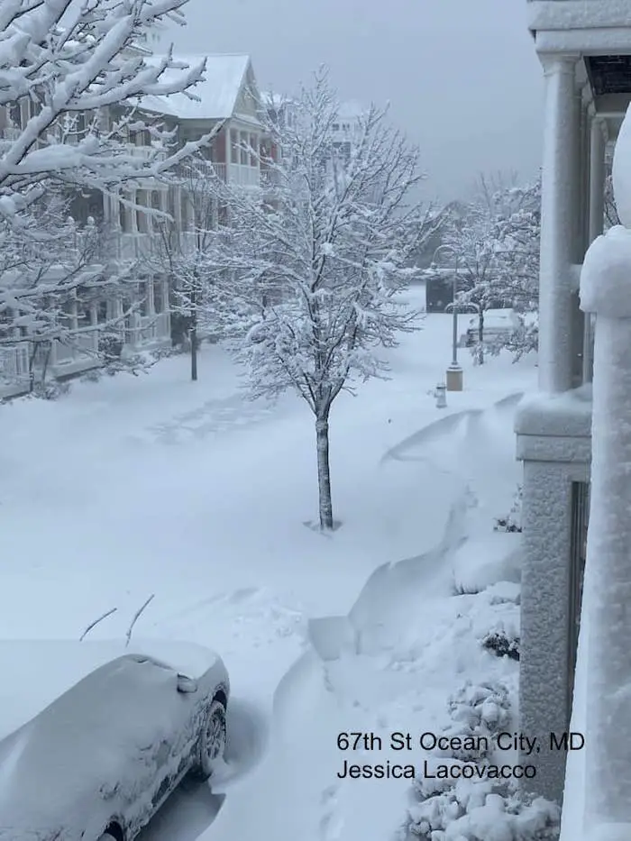
Ocean City, MD Collection
67th Street Thanks to Jessica Lacovacco
West Ocean City- Thanks to Beth Bole

127th Snowy Dunes – Thanks Jennifer Ginski-Alvey

Gateway to Ocean City – Thanks Eric Lee

Bethany, DE
11” on the SnowStix and still snowing at this 8:30 AM report
Thanks John Lantz

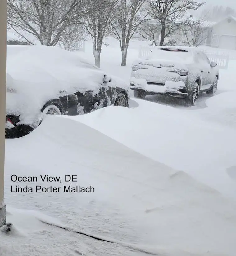
Ocean View, DE
Wind blown snow drifts
Thank you Linda Porter Mallach
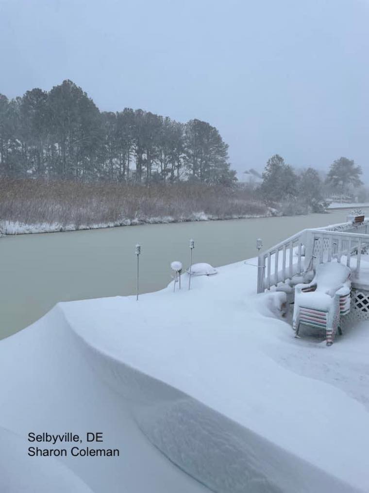
Selbyville, DE
Wind Carved Snow Drifts!!!!
Thanks Sharon Coleman
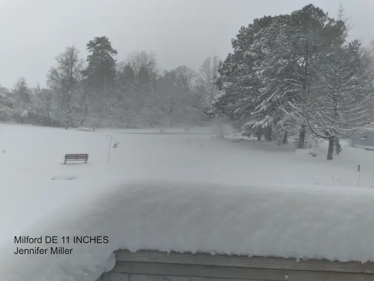
Milford, DE
11” of snow from Jennifer Miller
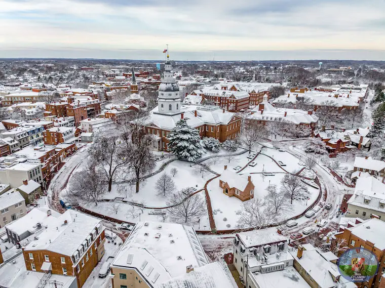
Annapolis, MD
They got about 4 inches of snow! One of the local winners in the metro area.
Drone Photo from my friends at Mid Atlantic Aerial
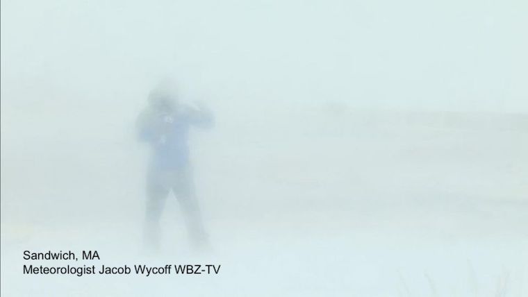
BONUS PHOTO
Sandwich, MA
My friend Meteorologist Jacob Wycoff during a live shot for WBZ-Boston.
They are expecting around 2 Feet of snow.
I will have a full snow recap report later.
Faith in the Flakes
Get your own Snowstix

ALSO SEE
ALL FITF GEAR

FITF THUNDERSNOW

Winter Outlook Series:
My Call For Snowfall

Last Winter Recap: My Old Outlook And Your Grades Of My Storm Forecasts


Please share your thoughts, best weather pics/video, or just keep in touch via social media


