Snow Update Thursday Evening: Analysis And My Final Call For Snowfall
Thursday January 6 2022
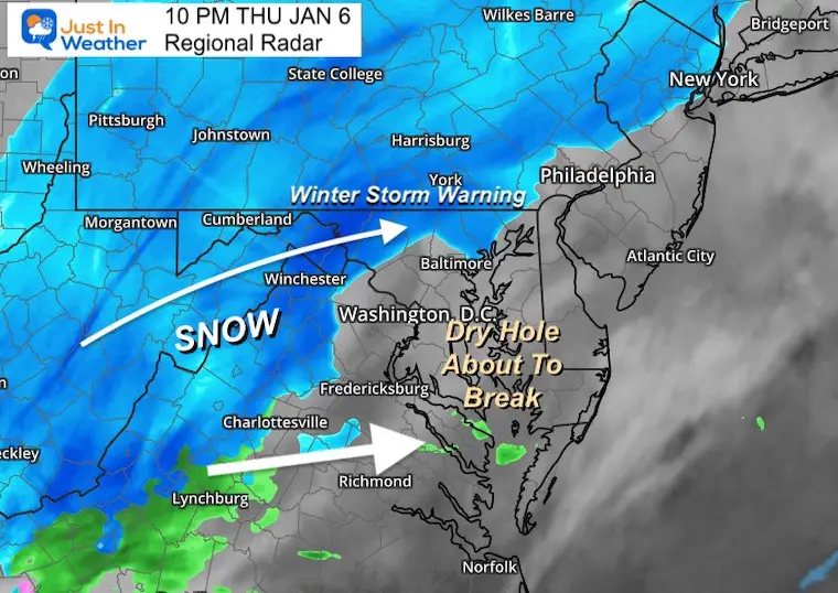
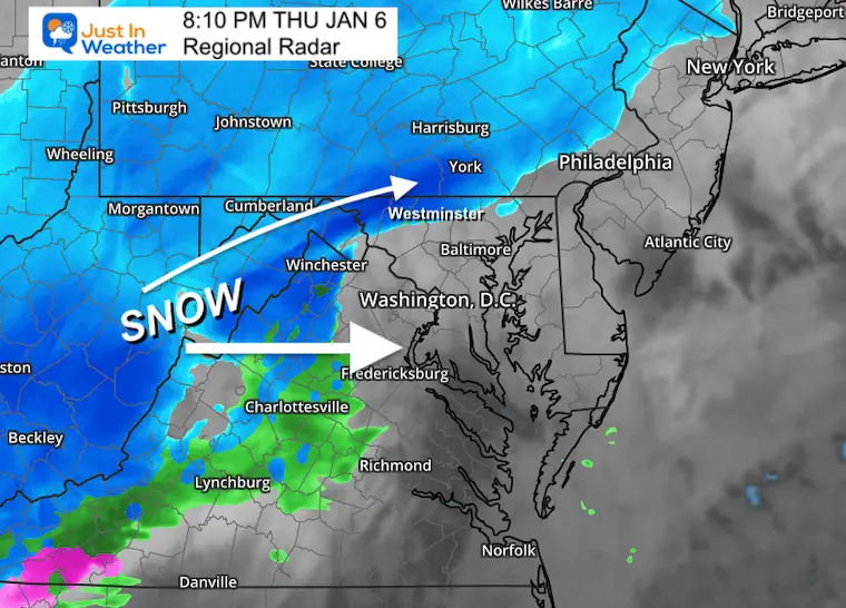
It’s going to snow. That’s the easy part this time, as it will be a widespread moderate event. Snow has begun a little early in some areas, which follows with the trend we saw back in Fall. The other well known is that this is mostly be done by sunrise.
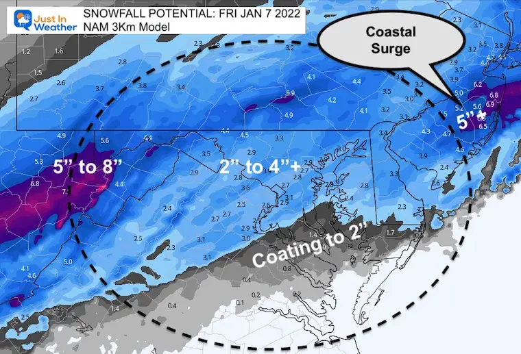
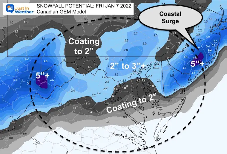
So the heaviest snow will fall overnight. We are watching the coastal Low that will take over and develop a snow surge for some eastern places overnight.
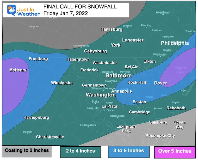
The real issue now will be how much will pile up for you to shovel. Most will see between 2 and 4 inches. Determining places that will get a little less or more is the game, and most important to snow plow operators that get paid by the inch.
I have my FINAL CALL FOR SNOWFALL below. But I need to show an analysis and how the nighttime storm may unfold.
UPDATE:
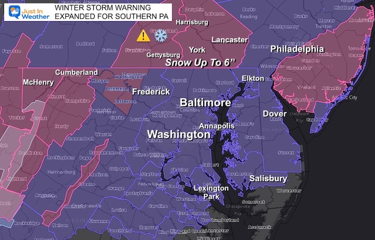
WINTER STORM WARNING EXPANDED TO SO PA
Snow Overachieving: Click here for new report
Thursday Evening
Radar Snapshot
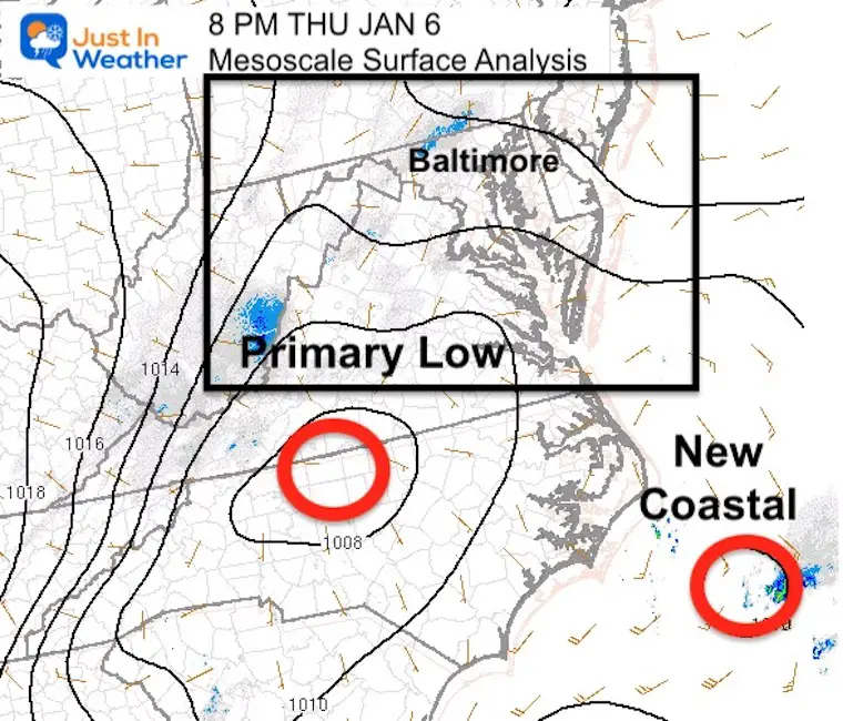
Mesoscale Analysis
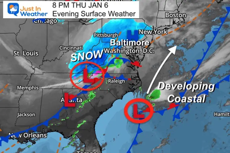
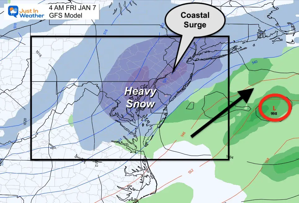
Here we see two rare of Low Pressure. The inland Low is the primary that is bringing in the snow already.
The coastal system is where the energy will be transferred and take over.
This is important for a surge of snow expected along the coast.
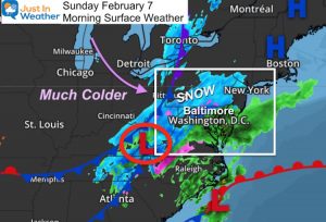
Surface Weather
Storm Development
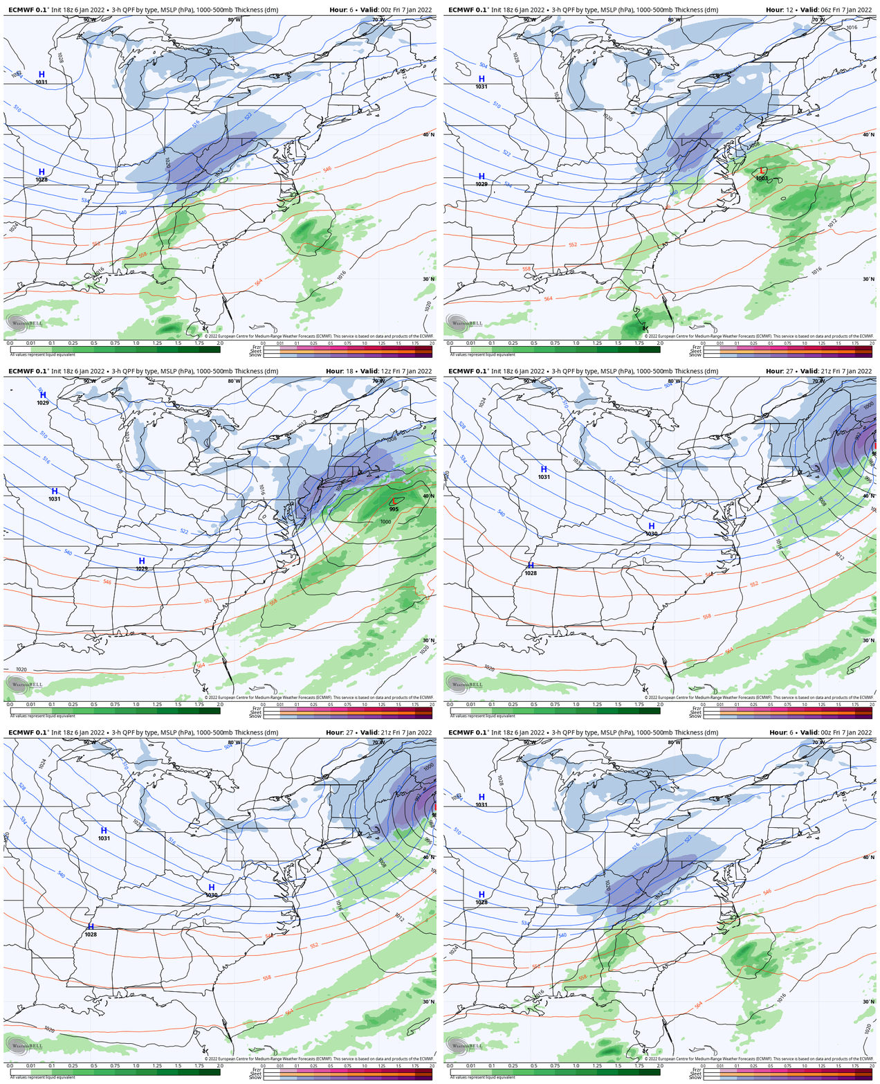
European Model 7 PM Thu to 4 PM Friday
Here we see the snow evolve and enhance overnight. It is the interaction and transfer of energy to the coastal Low that will make this event ‘pop’.
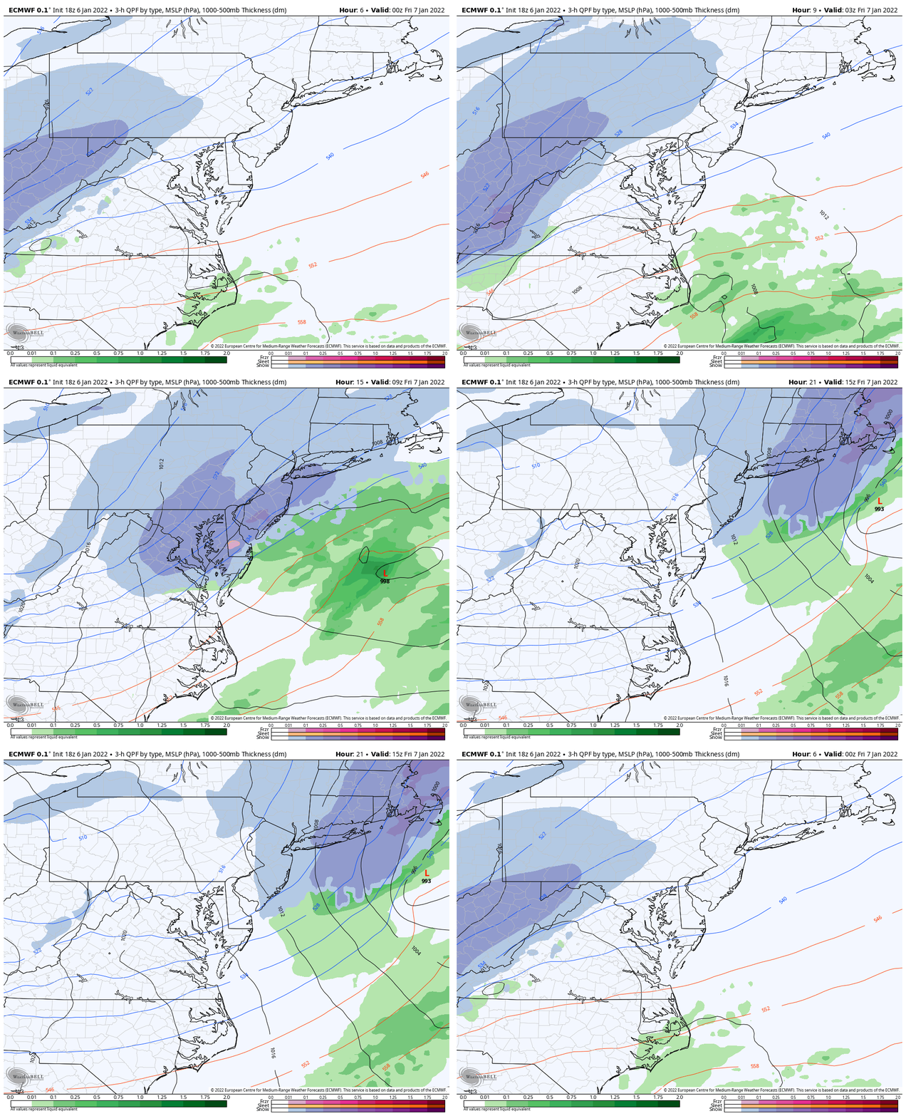
Closer Look
This may help show the moderate to heavy snow burst after midnight, and the surge along the coast.
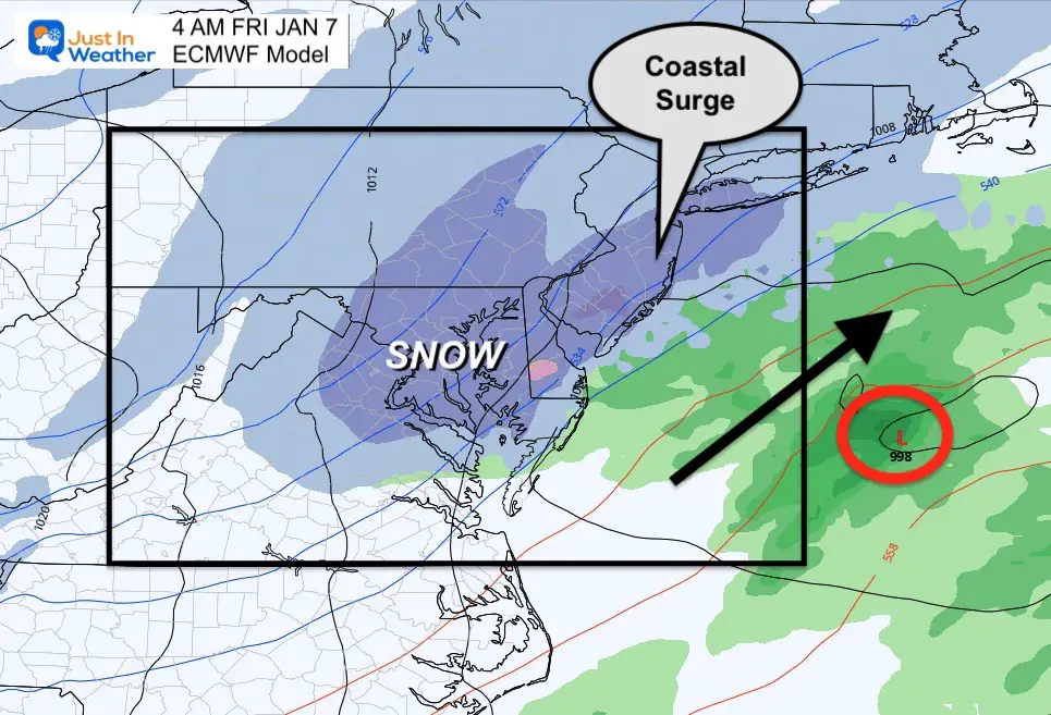
Snapshots
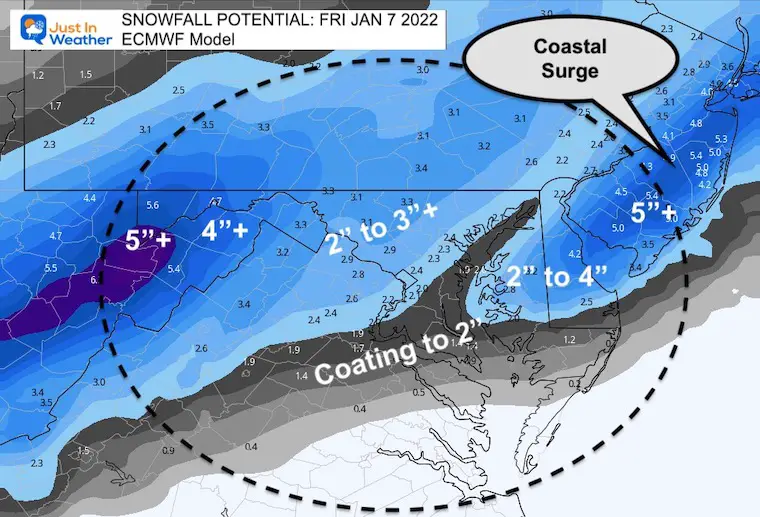
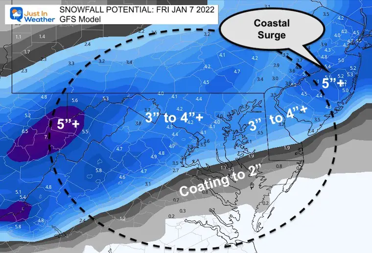
Compare the European to the American Model (GFS) . We can see the surge along the coast, with the subtle difference of heavier snow on the GFS.
ECWMF Model
GFS Model
COMPARE My Final Call Map to Model Snow Plots
My Final Call For Snowfall
I made a slight adjustment to the higher snow zone.. This still accounts for the influence of the coastal Low. I’ve included Annapolis and central Delmarva based off Atmospheric Memory.
I’ve shaved the southern zones due to track and location of warmer air.
Model Snow Forecast Maps
European Model
GFS Model
NAM 3 Km
Canadian GEM
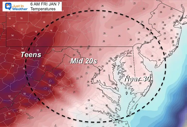
Morning Temperatures
Reminder that it will get colder with the snowfall and remain in the upper 20s for most into the morning. Snow stickage will be widespread.
Weather posts straight to your inbox
Sign up and be the first to know!
ALSO SEE
What is Faith in the Flakes: History of December 5th Snow
ALL FITF GEAR
FITF THUNDERSNOW
Winter Outlook Series:
Last Winter Recap: My Old Outlook And Your Grades Of My Storm Forecasts
Winter Weather Page – Lots of resources
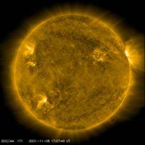
Solar Cycle Increasing Sunspots Suggests More Snow
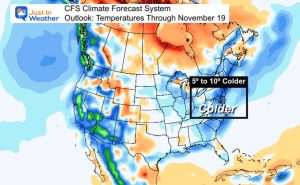
Comparing 4 Different Farmer’s Almanacs: Majority colder winter outlook than NOAA
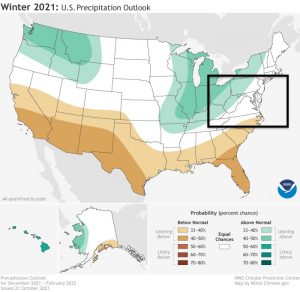
NOAA Winter Outlook- But Read The Fine Print
Signals For Early Start To Winter In November
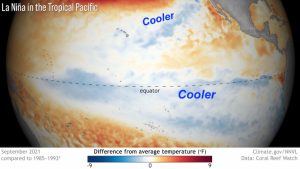
Winter Outlook Series: La Nina Double Dip
Nor’easters May Give Hint For Winter La Nina Pattern
Winter Folklore Checklist


