


May 19 Weather Sunday Starts Foggy The Warming With Sun And Summer Heat On The Way
Sunday May 19 Morning Report The aftermath of the rainy Saturday is plenty of leftover moisture. This has left us with a bit of humidity and areas of thick fog…
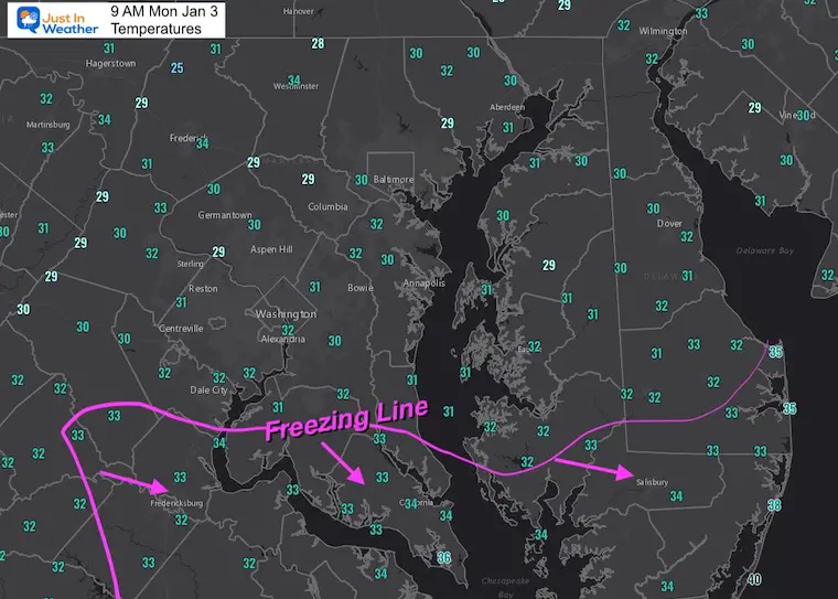
Updated at 9 AM Monday January 3
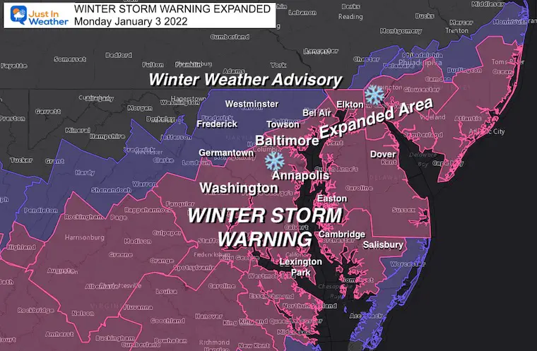
I may be the first to say this, but parts of Maryland will have near blizzard conditions today. The combination of heavy snow and strong winds will approach that criteria.
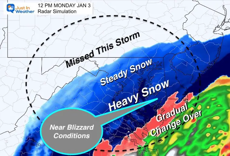
Now that the winter storm is taking form, I want to analyze the conditions and short range forecast. Most of this is behaving as expected with a few exceptions. There is very heavy precipitation moving in to the cold air. There will be parts of metro Washington/Annapolis/Southern Maryland they get in on 1″ to 2”/Hour snowfall rates!
The heavy snow zone will hit or overachieve my snow call!
The northern edge will BUST for Frederick to Westminster. The dry air has shifted about 30 miles south of my expectation.
Roundup from 8 AM
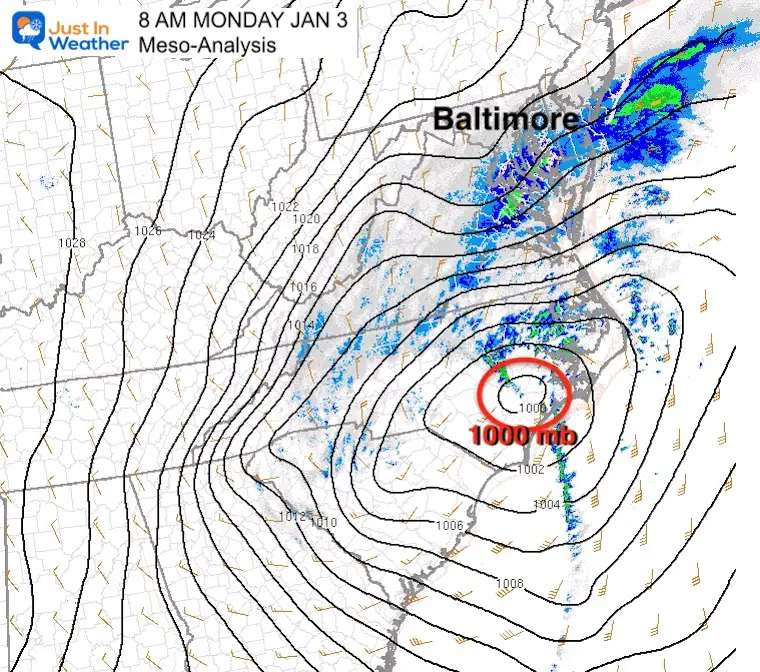
Mesoscale Analysis
The primary Low Pressure is under 1000 mb and pushing through eastern North Carolina. The pressure gradient shows how tightly wrapped this is.. which will increase the winds pulling in towards the center.
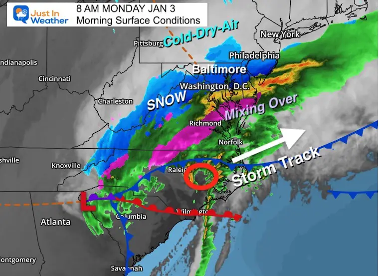
Surface Conditions
The steady snow covers a large area including the cities. The cold/dry air did slip a little farther south. I am missing my mark by about 30 miles and that will BUST the north end of this.
The sloppy mix across southern Maryland and Delmarva will change to all snow soon.
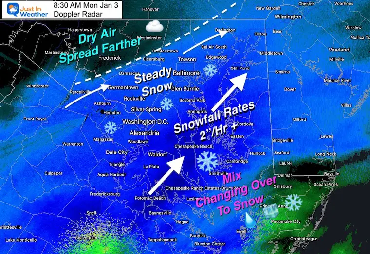
I’ve analyzed where the heaviest snow is falling including Annapolis, where snowfall rates are 2”/ Hour or higher in this band. That is moving from Southern Maryland up NE along the Bay.
Some of the moderate snow has reached metro Washington and will approach metro Baltimore.
Farther Northwest, my dry line forecast was off by about 30 miles. That keeps Frederick and Westminster out of the main event.. but some light snow may still sneak back in for a few hours.
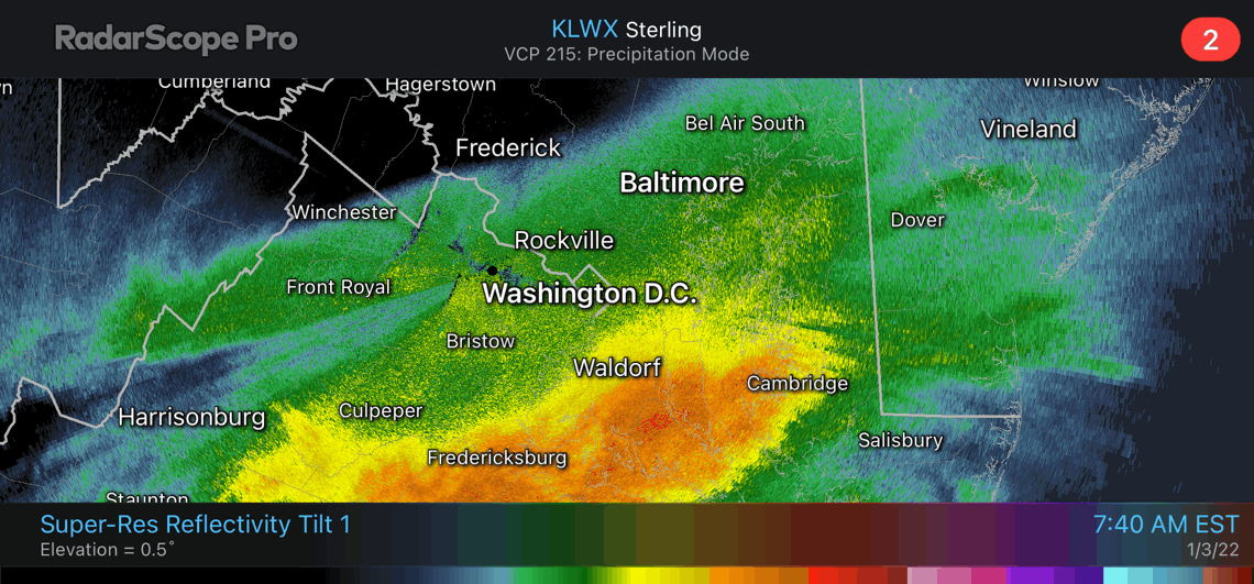
Super Res- Reflectivity
90 minutes ending at 9 AM
This is the stopped down version to highlight the heavy precipitation in yellow and orange.
The movement shows it spreading north with Germantown and Washington on the edge.
Very heavy snow has reached Annapolis with 2”/Hr or higher snow rates.
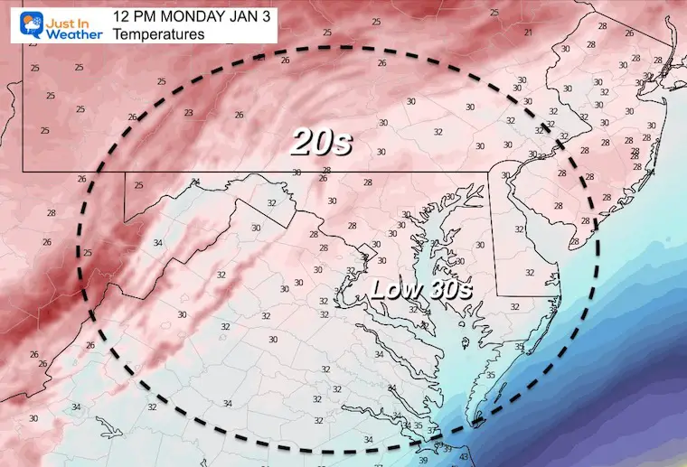
It is getting colder! The freezing line is about to reach southern Maryland, and located between Cambridge and Salisbury.
Snow is already sticking with temps above freezing, but it will ice up in the transition zone today.
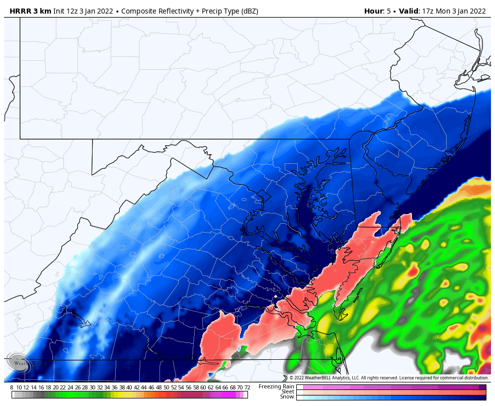
Peak Storm Conditions
HRRR Model depiction of the snow set up. I believe the mixing and change over will occur sooner for Salisbury.
Official criteria is snowfall rates of 1”/Hour or higher with winds of 35 mph or higher for 3 consecutive hours.
There may be ‘times’ with those conditions near and south of the Bay Bridge.
These are steady wind expectations
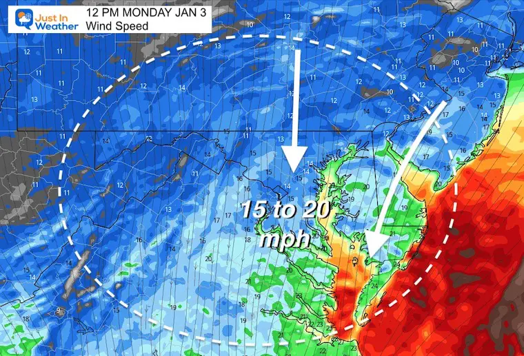
Peak 3 to 10 second forecasts… Notice the 35 to 45 mph winds along with the snow in southern Maryland!
This will lead to blowing and drifting snow. Plus visibility down to near White Out at times!!!
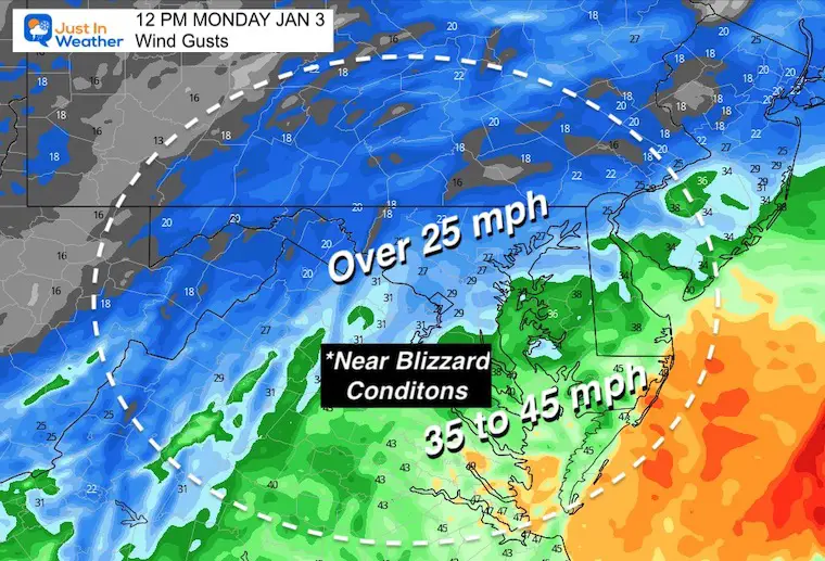
This is a legit storm and hitting areas that normally do not get hit the hardest. I recommend not traveling near and south of Annapolis through the afternoon. This includes Kent Island and much of Delmarva. Conditions will be poor at best.

Last Winter Recap: My Old Outlook And Your Grades Of My Storm Forecasts


