This is going to be an abrupt change of pace, but w are about to go from a spring-like afternoon to a winter storm on tomorrow morning. I know there will be doubters, but this will happen as there is growing support for a bigger impact.
Despite temps in the 60s, many will end up in the 20s to near 30ºF by morning and stay there all day. So as the snow beings after midnight, it will cool the pavement. The heavy intensity will support stickage and could very well turn icy the initial melting freezes.
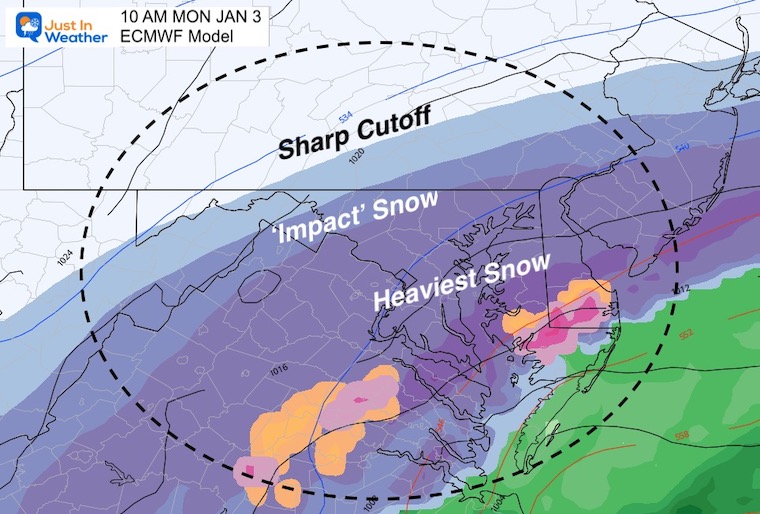
The hardest hit areas will be in southern Maryland and the beaches, but the northern edge will clip the cities and inland suburbs.
Winter Storm Watch
These current alerts focus south of Baltimore. However, the cold air and trend shows the cities and inland suburbs need to pay attention.
Pay Attention: There will be upgraded and expanding alerts today, and possibly Winter Weather Advisories for the cities and inland suburbs.
Winter Storm Watches will be upgraded to Warning shortly. This is standard practice with confidence of heavy snow in less than 24 hours.
Sunday Morning Weather
This complex pattern is taking the last line of rain across Delmarva this morning. The afternoon should be mostly dry and warm up to the 60s.
Arctic air will arrive tonight and time up with Low Pressure from The Gulf Coast.
This will rapidly intensify and amplify the digging trough to pull up along the coat.
Net Result: Heavy Snow Monday Morning!
Reminder –>
Current Weather, Climate Data, sun times and moon phase can be found in the tabs on the right.
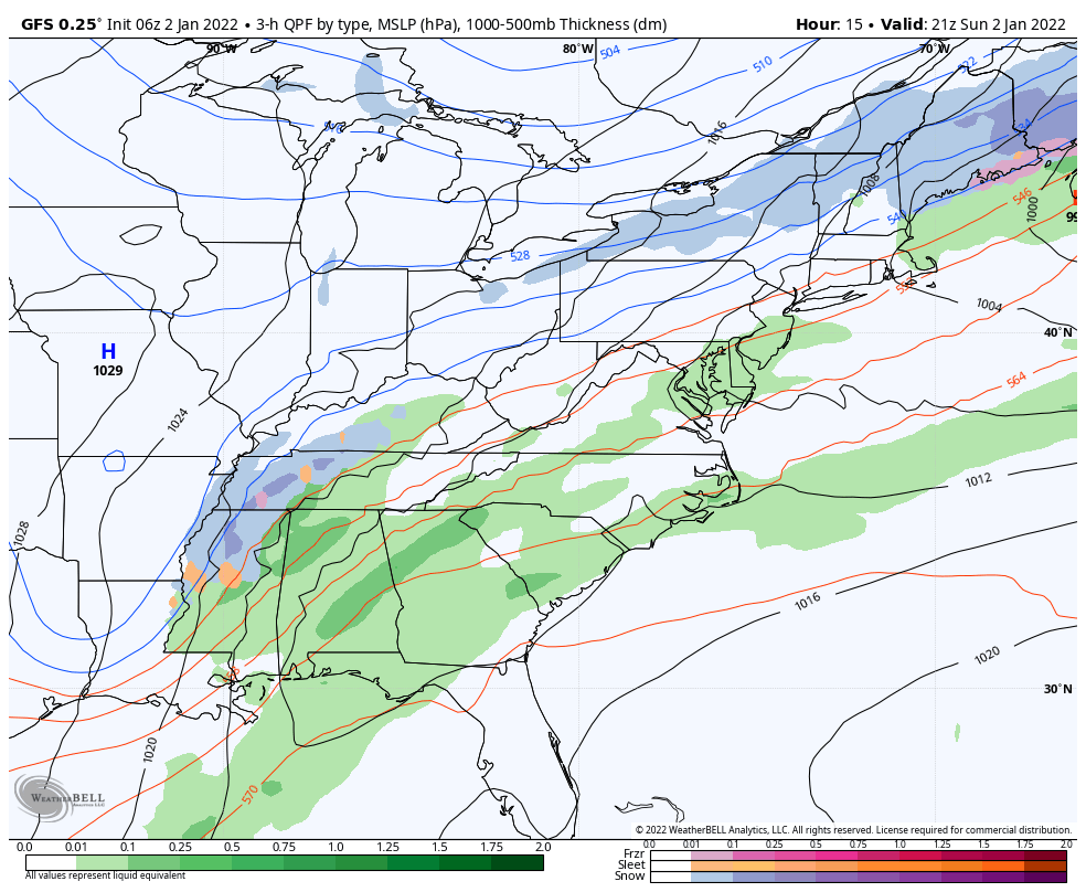
Storm Animation
GFS Model: 3 PM Sun to 3 PM Mon
This wide view shows the evolution of the Low Pressure. It might be hard to imagine the snow developing, but it will happen rapidly. Some areas in Alabama and Tennessee that were in the 70s and had severe storms with tornadoes yesterday… will get accumulating snow.
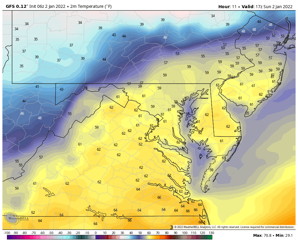
Temperature Forecast Animation
12 PM Sun to 8 AM Mon
YES, it will get cold enough to stick!
From the lower 60s today to 20s for many Monday morning.
Concern will be initial melting will then support stickage… but possibly turn to a layer of ice in addition to accumulating snow.
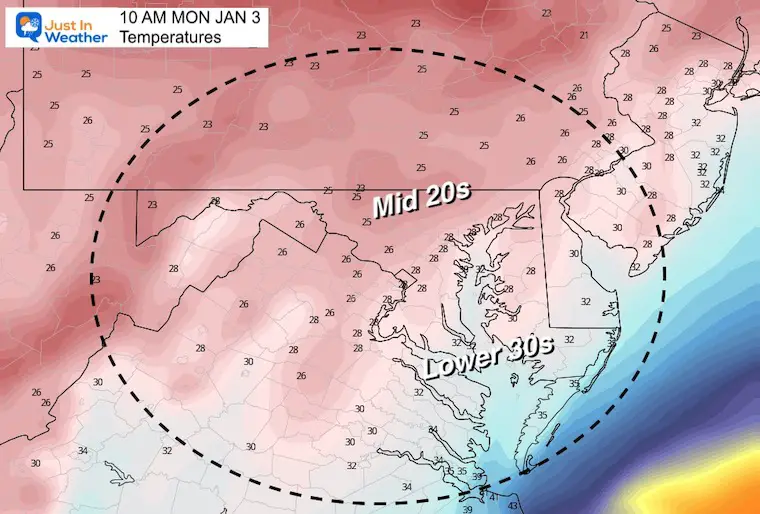
Temperature Snapshot: Monday Morning
These numbers AFTER sunrise may remain steady or even get colder during the day.
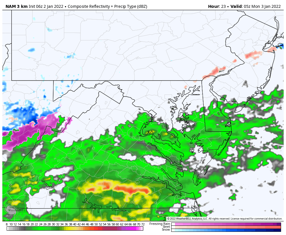
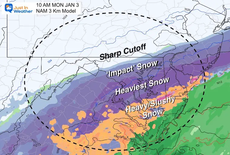
Snow Timeline: NAM 3 Km
Midnight to 3 PM Monday
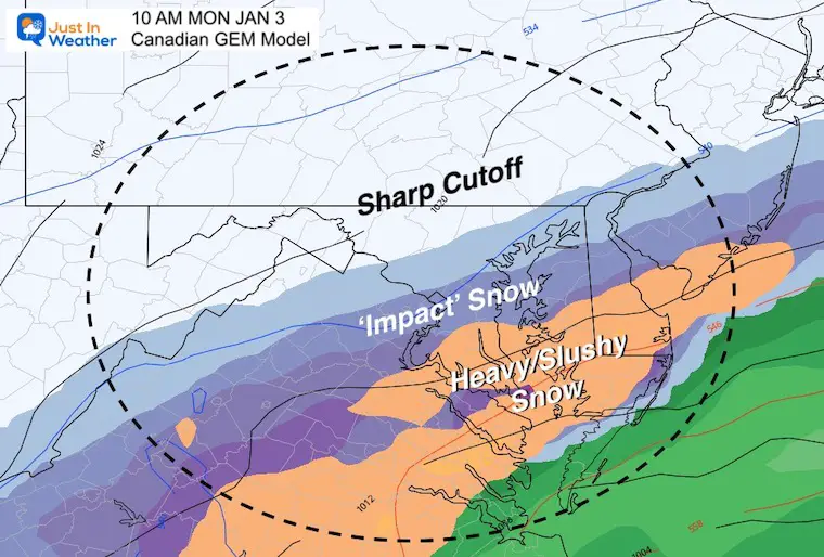
This model is actually on of the least aggressive for the northern edge.
There will be a sharp cutoff north of Baltimore, but compare to the other models below for how far this could expand.
Some of the snow will initially melt AND then compress
We often must save some off the top numbers…
I will have my first call snowfall map in my next report.
january-2-weather-snow-total-monday-gfs
january-2-weather-snow-total-monday-ecmwf
january-2-weather-snow-total-monday-canadian-gem
january-2-weather-snow-total-monday-nam-3k
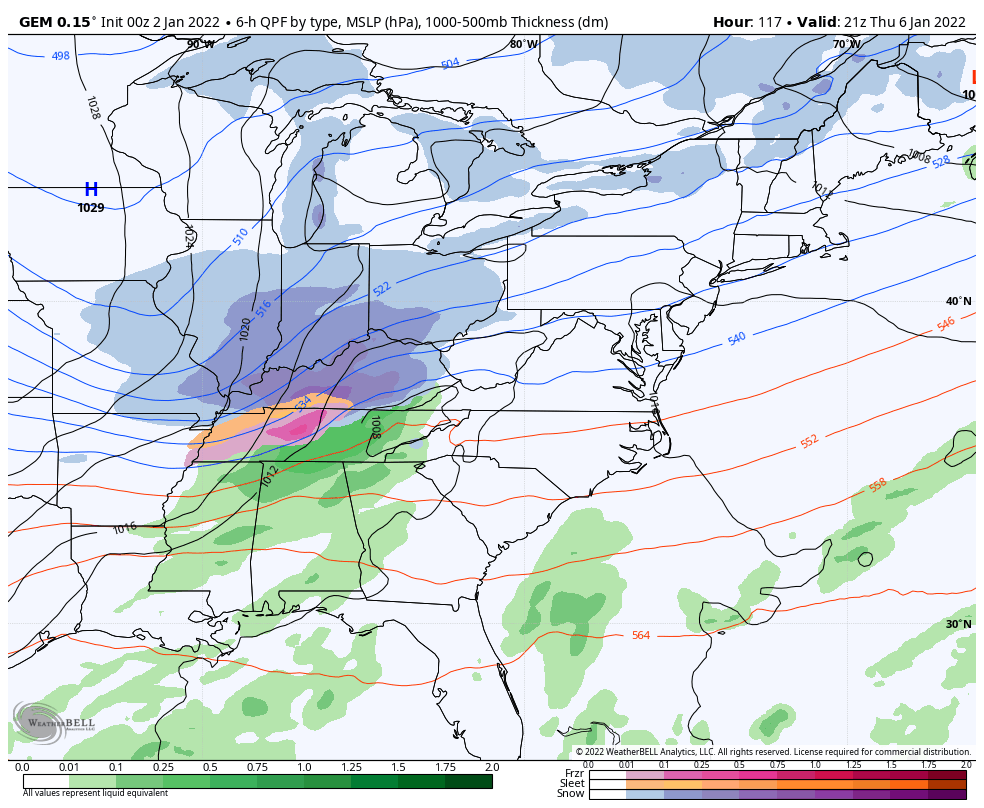
Next Storm
4 PM Thu to 4 PM Fri
I am showing the Canadian GEM Model as this performs best in arctic air. We see the next snowmaker ‘possible’ Thursday overnight into Friday morning. It looks like we have the quick flip to winter!
NOTE
Due to the amount of data and need for rapid updates, I did not make a 7-day forecast this morning. I will be working on my First Call For Snowfall Map for my next report.