


January 13 Mild Ahead Of Arctic Front That Will Bring Rain To Snow Later Wednesday
Tuesday January 13 We are once again back to mild afternoons with sunshine, but that is about to change. The next cold front will usher in a series of arctic…
Friday December 31
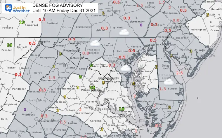
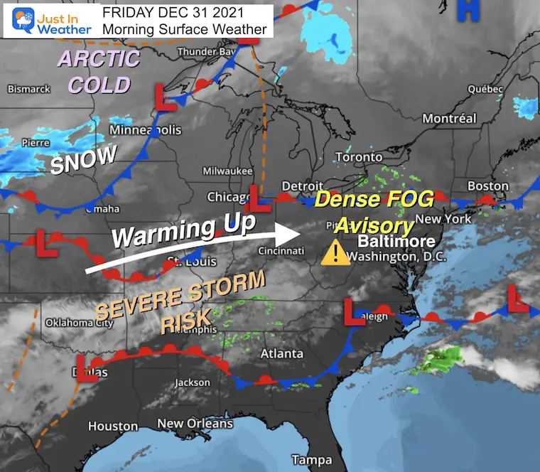
We begin this last day of 2021 with thick fog. Yes, this does not feel or resemble a winter pattern… yet. There is plenty of cold air, which will will initially get in short bursts of a couple of days next week.
DENSE FOG ADVISORY:
This expires at 10 AM but there may be fog lingering longer in known spots.
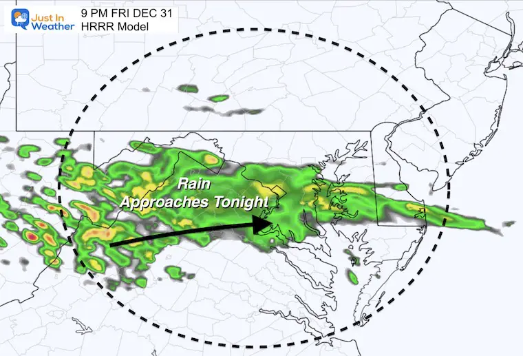
We must deal with a complex storm that arrives in a few waves. First some showers tonight. Then the main rain during the day tomorrow, with a let day break allowing the very warm air in Saturday night. This will be followed by an overnight line of heavy rain and some thunder.
For now the wild card is the cold air catching up at the end. This keeps a chance or light snow early Monday, but a promise of much colder air to start the week.
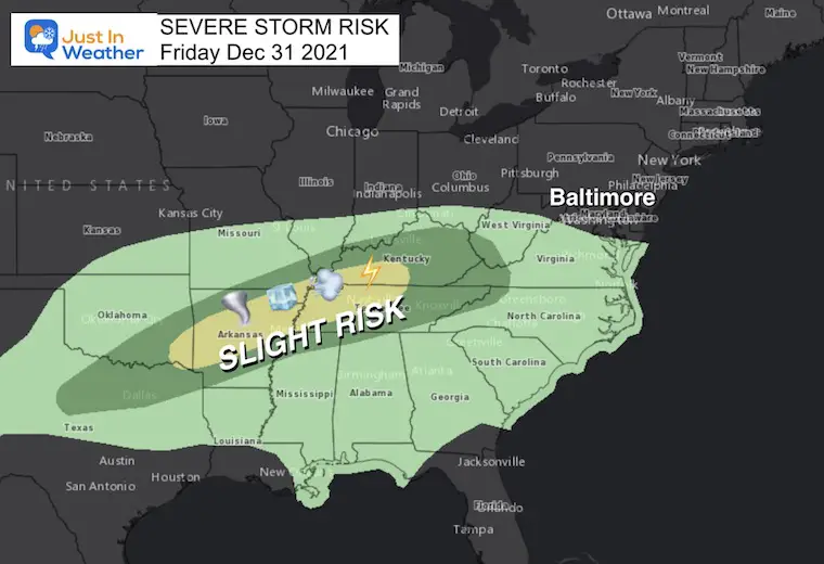
This will be a 2-day event in the Deep South (again). The worst will be tomorrow.


Normal Low in Baltimore: 25ºF
Record -1ºF in 1880
Normal High in Baltimore: 42ºF
Record 72ºF 1992


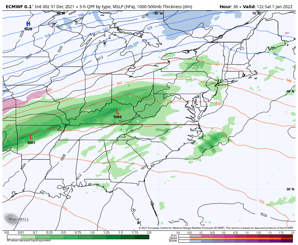
Rain develops on New Year’s Day, but a break late in the day will bring the surge of warmest air at night.
We could be in the mid 60s at midnight.
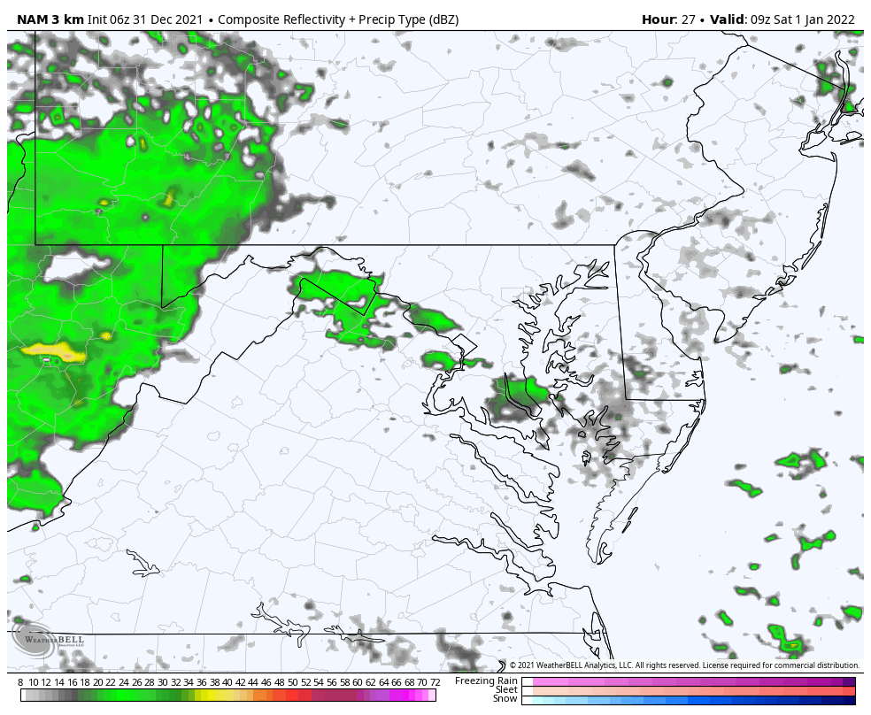
Here we can see the waves of rain on New Year’s Day , then again Saturday night into early Sunday.
The final part will be Monday morning. This wave continues to focus south of our region. If this verifies, there will be a better chance for snow south of Baltimore and to the beaches.
Our heaviest rain will be during the day Saturday, then perhaps a line with thunder Saturday night.
Colder air will be with us Monday and Tuesday. The wild card is if it arrives at the end of the storm for morning snow. At this point is more conversation than concern.

Sign up and be the first to know!

Last Winter Recap: My Old Outlook And Your Grades Of My Storm Forecasts


