


Average Last Frost or Freeze Dates And Map For Maryland
There is a good reason why many gardeners suggest NOT to plan tomatoes until after Mother’s Day. Early surges of warm air in spring can be deceiving. Just because the…
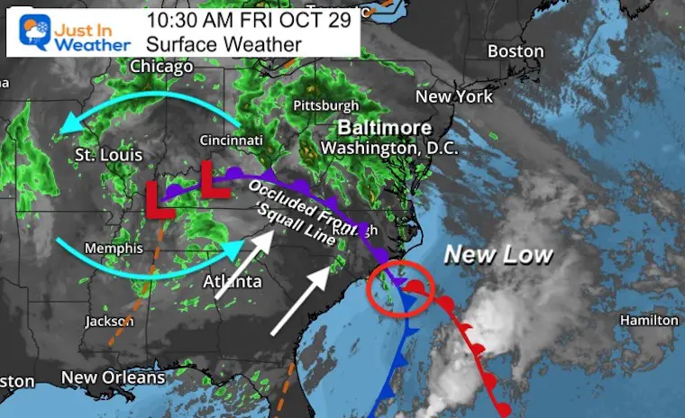
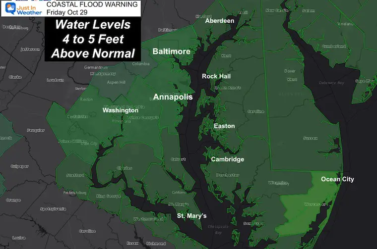
Friday October 29
By now, most of our region has already noticed some impact of this storm. I have had my power go out, and fielded many calls about what is next and when to expect it.
Many area schools have closed in anticipation of the worst to come. It will, during the afternoon.
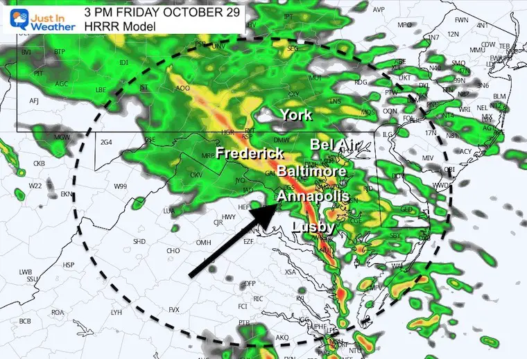
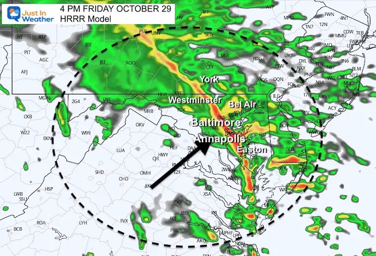
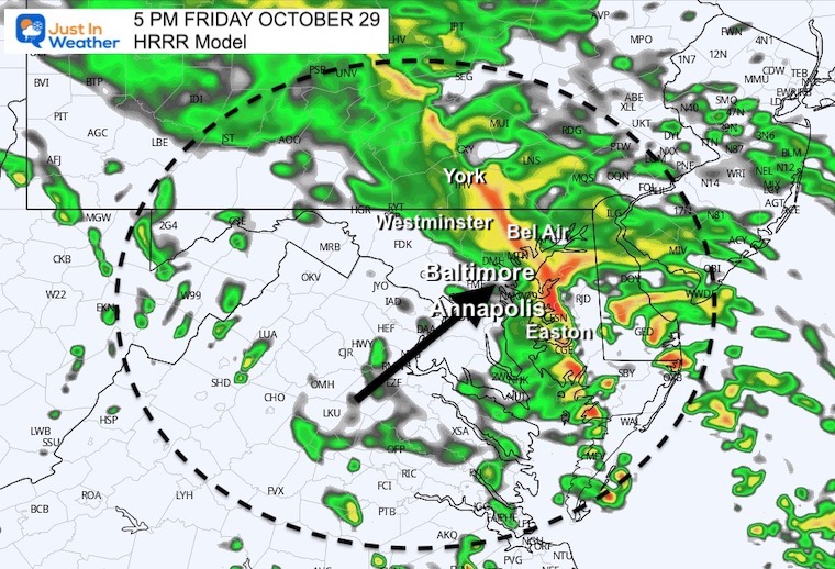
This is a brief update on the latest timeline from the High Resolution HRRR Model.
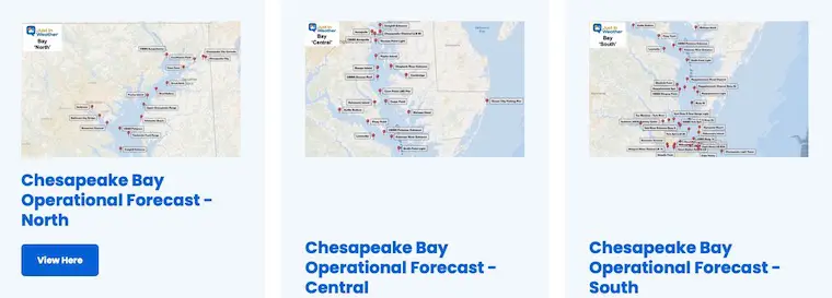
If you have not seen my Bay and Boating page yet, there are a lot more resources to check on the water forecasting in real time.
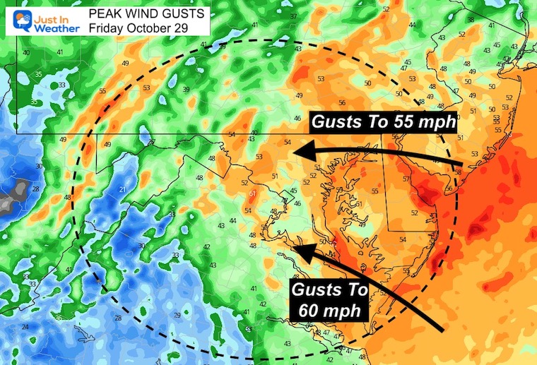
I want to highlight that there will be one strong line with the worst conditions that will behave like a squall line. That is the Occluded Front.
After that passes, the winds will actually shift from the dominant east flow, to the south. It will be followed by more showers tonight, and that wind will keep the high water on the Bay through Saturday.
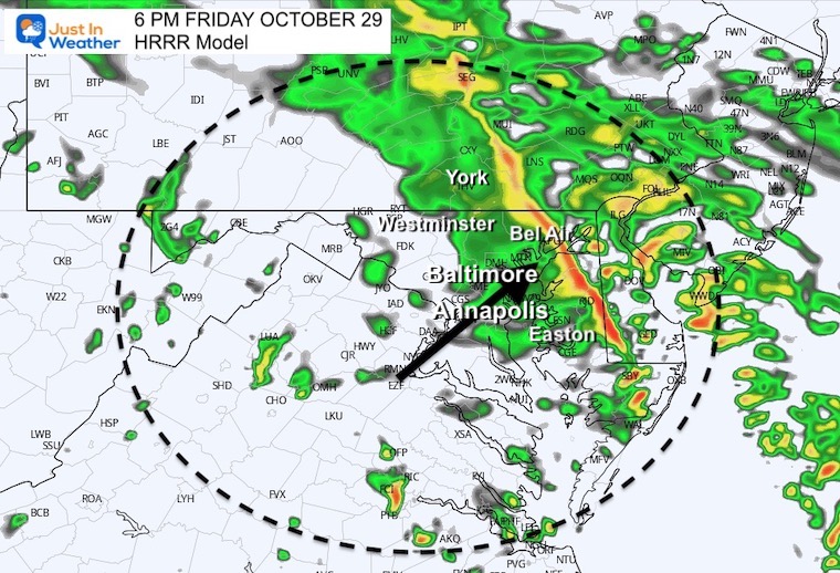
HRRR Model Forecast– Allow a buffer of up to 1 hour
The main/squall line will move through metro areas between 3 and 6 PM, but more showers will follow tonight.


This may not be perfect, so expect this may be within an hour of the plot time for these locations.
3 PM
4 PM
5 PM
6 PM
I will be posting quick updates during the storm. See it all on the Live Updates page
12 PM to Midnight
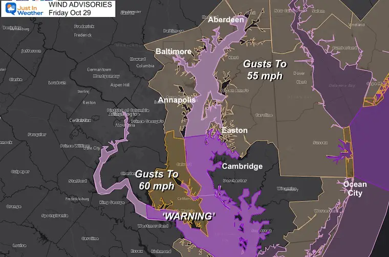
This flow from the East and Southeast prevents low tide from flowing out and increases the High Tides.
These are 1 minute sustained winds…
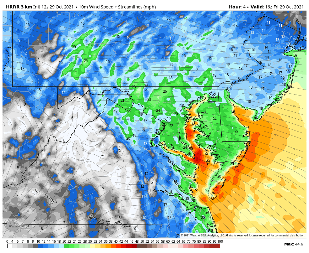
These are peak winds lasting to 10 seconds. This is when we may see gusts 50 to 60 mph.
See the additional Bay Resources, and the Rain Maps below.
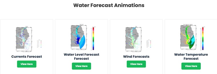
Click to see water forecast levels, winds, and tides for dozens of locations
Click here for: Maryland Tide Tables
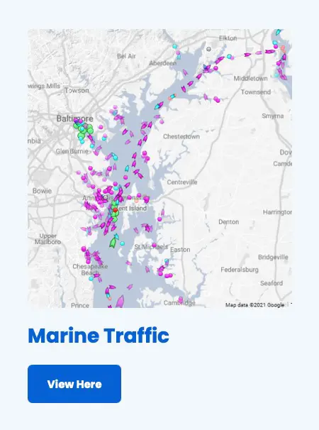
My Favorite: Live Marine Traffic
NOAA Winter Outlook- But Read The Fine Print
Signals For Early Start To Winter In November
Winter Outlook Series: La Nina Double Dip
Nor’easters May Give Hint For Winter La Nina Pattern

