


July 5 Heating Up And Tropical Storm Chantal Expected To Get Named Today
Saturday, July 5 2025 Morning Report After the beautiful Independence Day we just had, we will see a little increase in heat and humidity today and tomorrow. There is a…
Tuesday October 26 2021
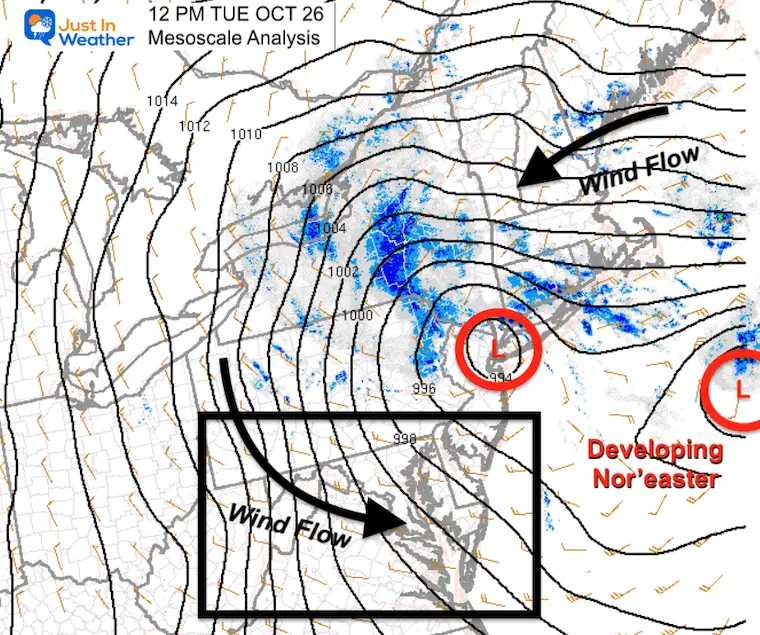
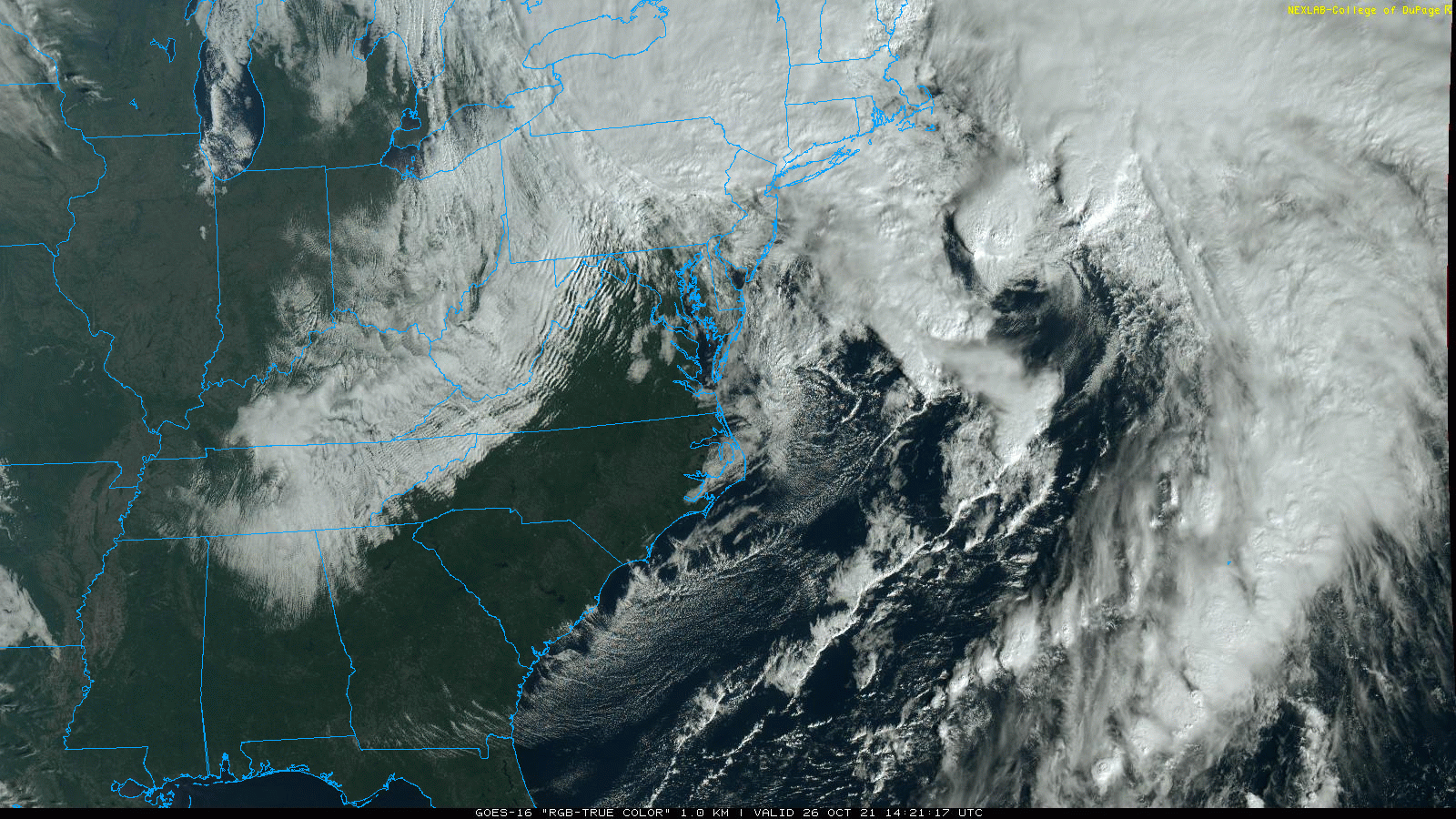
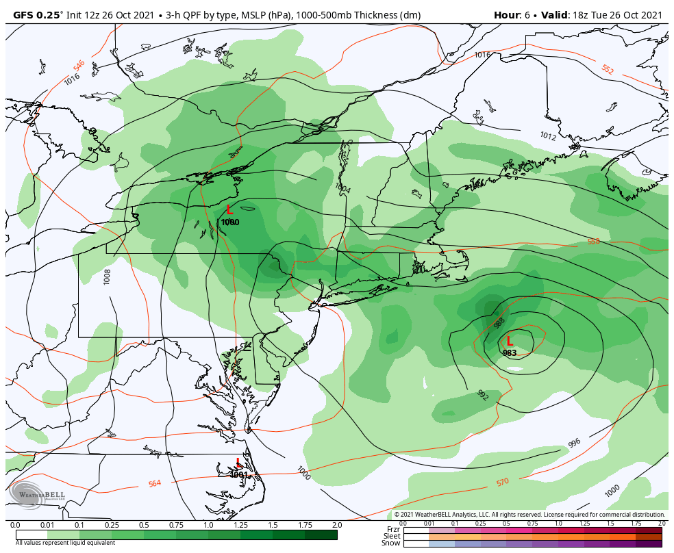
The Nor’easter that has been advertised is just getting cranking now. At first glance, the surface weather map looks quite busy with a few surface Low Pressure centers identified. However, the main event is more evident on the satellite loop entering the afternoon.
Here is a look at the conditions across the Northeast US to plot and track the Nor’easter forming. This includes satellite loop, surface measurements, forecast animation and interactive wind widget (at the bottom).
Sign up for my newsletter and get alerted on each update in your inbox.
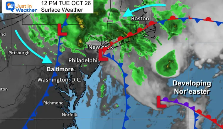
Refer back to the satellite loop and the Surface Weather map below below.
This is a raw look at the surface pressure and wind flow from the noon observations. Maryland and our main forecast region is in the black box.
10:21 AM to 12:21 PM
The broad circulation here is dominated by the developing Surface Low south of Cape Cod. There is a clearing in the core, with the clouds wrapping quickly around it.
The is the combined view of satellite, surface pressure, fronts, radar, and annotated wind flow.
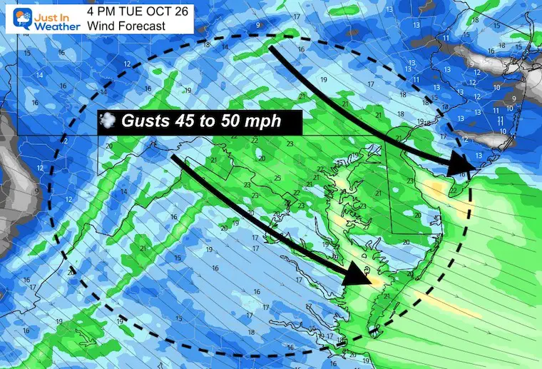
A lot of stations began to report winds over 20 and 30 mph.
Winds will continue to increase as the storm develops and then retrogrades back closer to the coast.
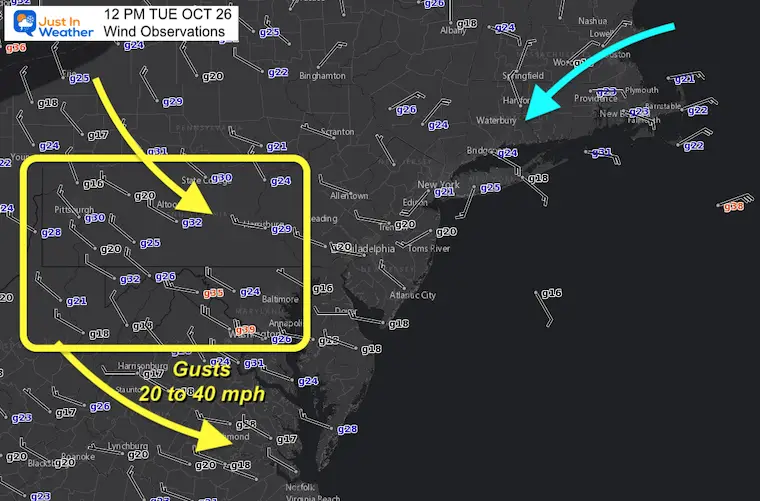
Reminder that we are expecting gusts between 45 and 50 mph this afternoon.
Strong winds are likely to continue Wednesday as the Low retrogrades (loops backwards to the west).
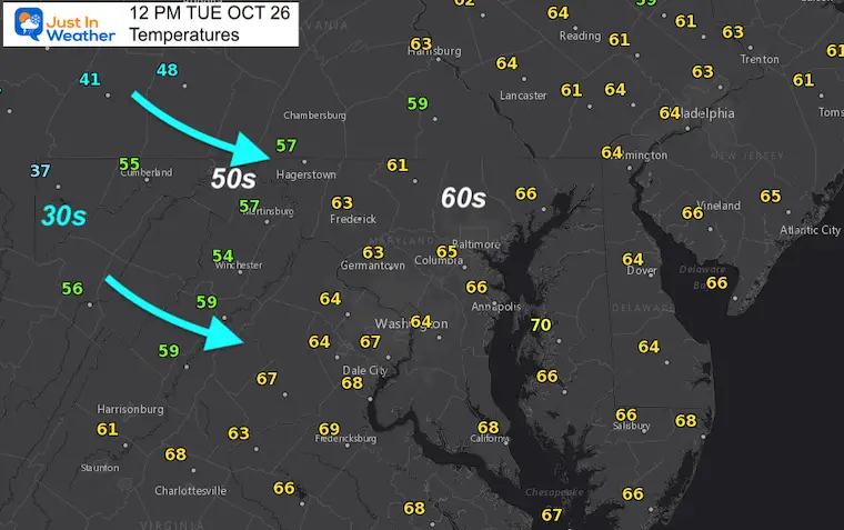
While it has remained mild in the 60s for most metro areas, 40s and 30s linger in the mountains. Western Maryland’s Garrett has dropped into the 30s.
The winds will help drop our temps during the day and tonight.
Here is the retrograde I mentioned. Watch the Surface Low loop back to the west, then south, then swing out to east to the open ocean by Wednesday night.
Use the slider to control the forecast time and track that Storm Center.
Pinch and slide to zoom in and see the winds in any area.
NOAA Winter Outlook- But Read The Fine Print
Signals For Early Start To Winter In November
Winter Outlook Series: La Nina Double Dip
Nor’easters May Give Hint For Winter La Nina Pattern
Please make sure you sign up for my newsletter.

