


July 12 Very Humid With Scattered Thunderstorms Later And More Storms Tomorrow
Saturday, July 12, 2025 Morning Report This may sound familiar: We remain in the ambiguous humid air mass. There is thick fog this morning, and the sun will dominate the…
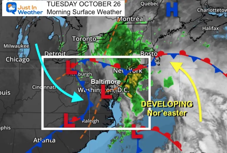
Tuesday October 26
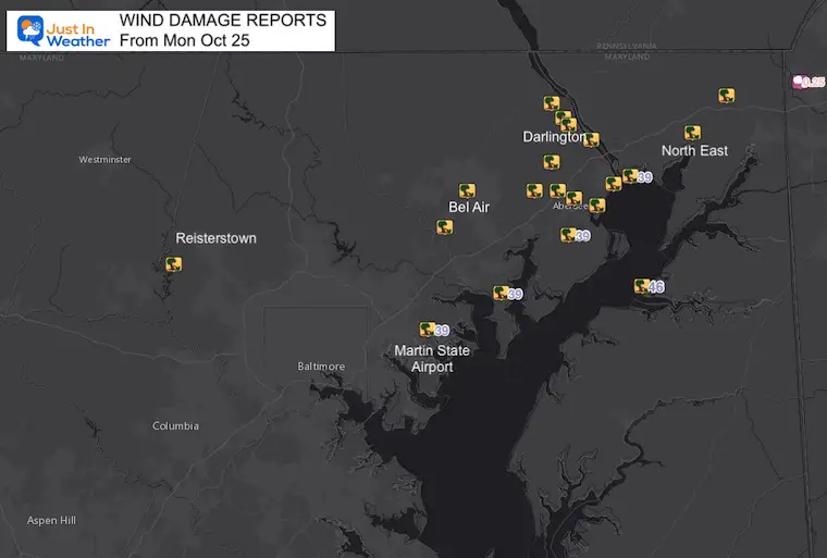
Heavy rain and strong winds erupted yesterday, and enhanced as to moved into Northeastern Maryland. Widespread wind damage reports between Baltimore, Harford, and Cecil Counties.
Wind Advisory issued today in Maryland. It may/should expand into PA/DE.
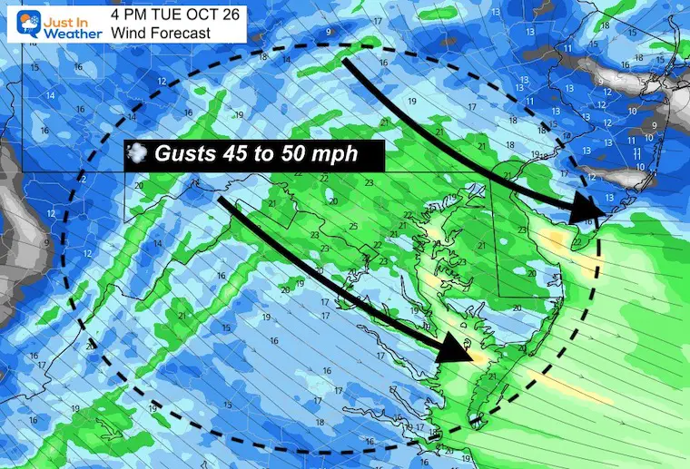
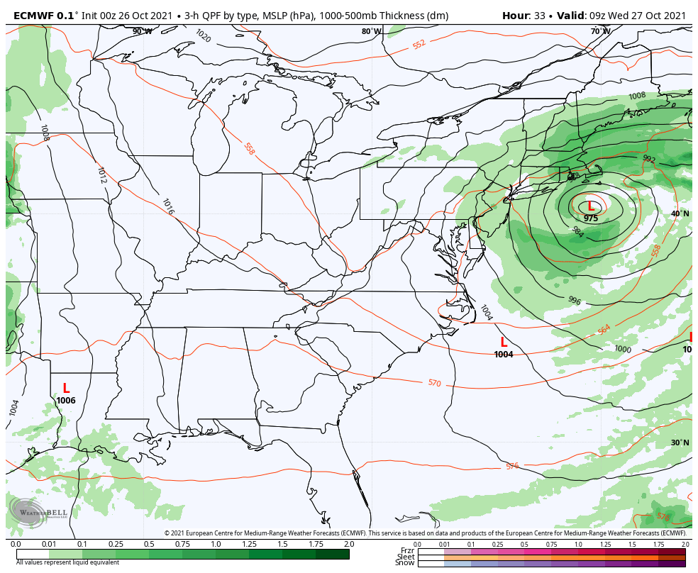
Today, the strongest winds will develop during the afternoon as a Nor’easter develops off of the coast. Most of the rain will be in New England, but a few showers may pass by, and temps get cooler during the afternoon.
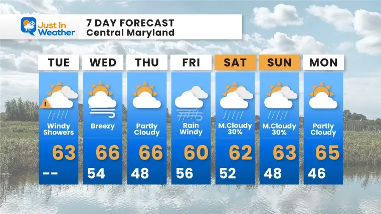
Our next storm will arrive Friday.
Jacket: A few rain showers, stronger winds make the afternoon cooler.
All counties west of the Chesapeake Bay through Maryland. Northern Virginia, and West Virginia.
That is a Gale Warning on the Chesapeake and Delaware Bays. Stay alert to wind restrictions on bridges and ‘advisories’ to be expanded to the counties north and east.
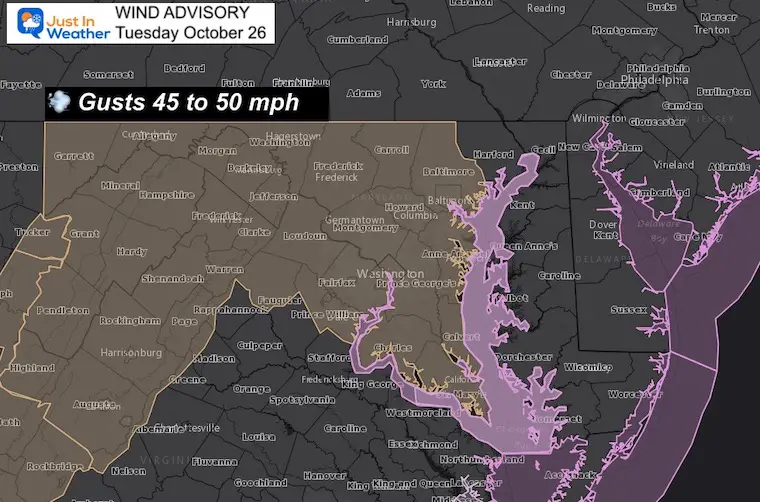
This product is showing the steady winds, but gusts will reach 40 to 50 mph. Considering the even spread, nearby NWS offices may expand the Wind Advisory to their regions in southern PA , Delmarva, and NJ.
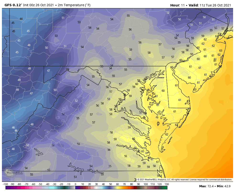
I wanted to show this animation to highlight the fall of temps into the 50s during the afternoon
A classic comma shape is forming off of the coast with the developing Nor’easter.
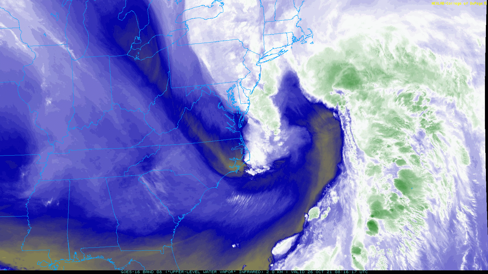
A lot of energy in the atmosphere will be combining forces to develop a Nor’easter. That will be the reason for the increased winds.
Normal Low in Baltimore: 42ºF
Record 27ºF in 1952
Normal High in Baltimore: 64ºF
Record 81º F 1978
NOAA Winter Outlook- But Read The Fine Print
Signals For Early Start To Winter In November
Winter Outlook Series: La Nina Double Dip
Nor’easters May Give Hint For Winter La Nina Pattern

As the first storm departs, the next one cross the nation with another severe outbreak in the southern Plains. That will reach us with heavy rain on Friday.
Finally, this looks seasonal in the 60s. The impacts of the first storm linger into Wednesday. The next storm will arrive Friday and linger with cool winds and showers over the weekend.
Please make sure you sign up for my newsletter.
Sign up and be the first to know!

