October 25 2021
Exceptionally warm temperatures and a strong cold front will combine for an eruption of severe storms later this afternoon through tonight. This post has the parameters and simulation timeline.
I believe this will be more widespread thanks to a few key ingredients.
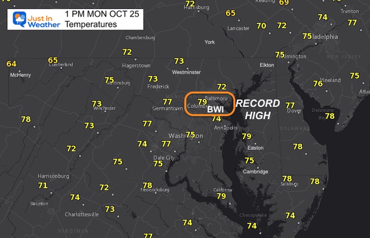
Let’s start with the heat: At 12:30 PM, the temperature at Baltimore’s BWI was observed at 79ºF. This surpassed the old record high of 77ºF set in 1931. It should be noted this was the only date of the month with a record under 80ºF, and we are about to change that.
Temperatures at 1 PM
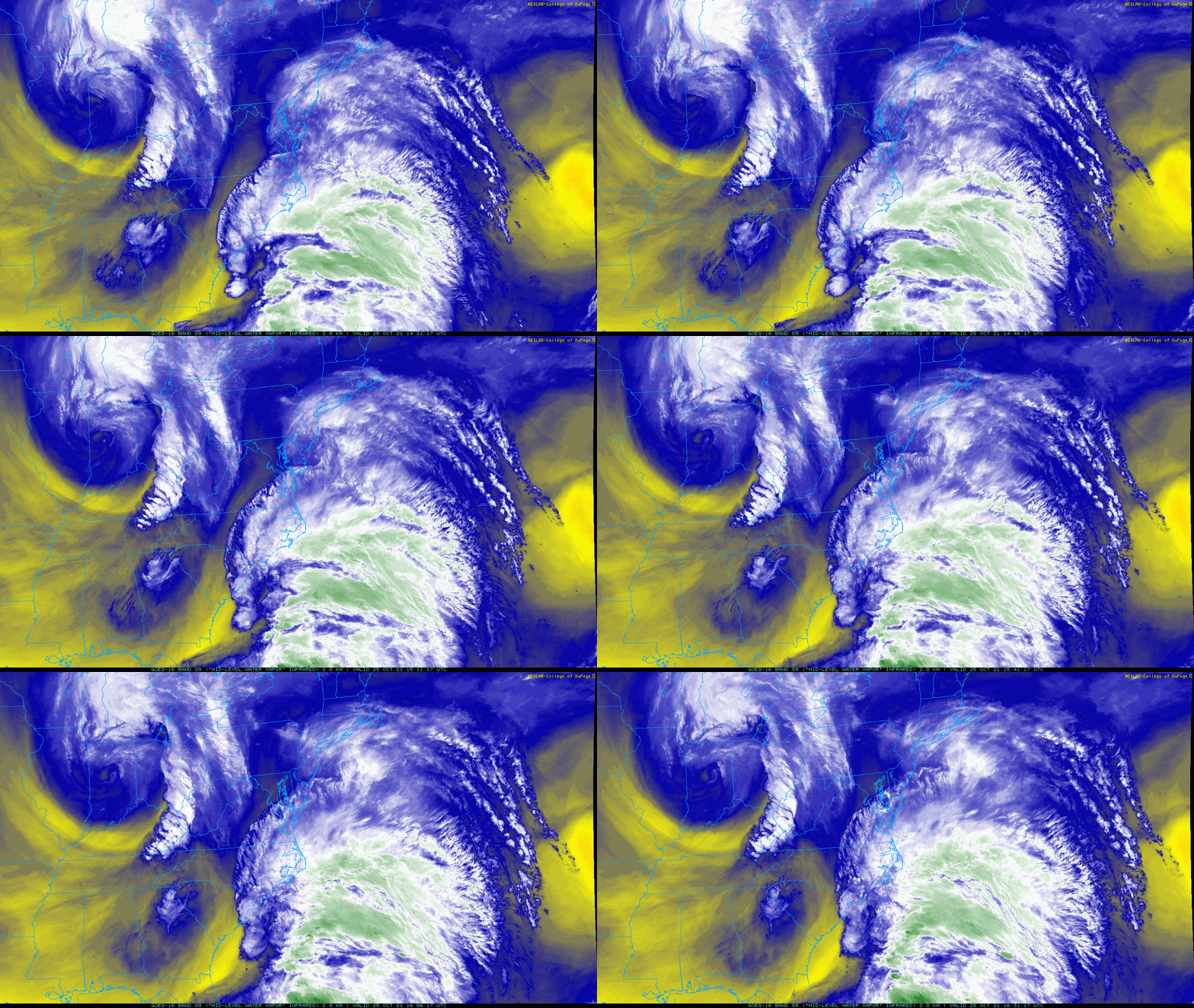
Water Vapor Satellite Loop
10:21 AM to 12:31 PM
The moisture aloft is broken in two clusters. One in the semi-tropical flow up the east coast. The other spinning around a cold upper level Low in Indiana.
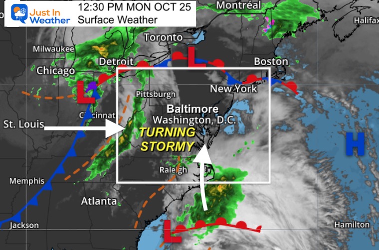
Surface Map
The forecast will combine right over central Maryland late afternoon and evening. The colder air will win and then transfer to a new storm/Nor’easter off the coast in the next two days.
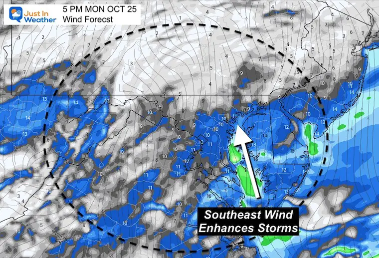
Wind Forecast
Many times I have highlighted the wind direction. A Southeast Wind enhances storm chances in urban areas.
In our region that plays a key role to offset the disruption over the mountains and moist flow from the Chesapeake Bay.
We will watch for that to develop before the storms arrive. If this swings to the South/Southeast, the risk for severe storms increases.
Potential:
-
Damaging winds over 60 mph
-
Large Hail over 1” diameter
-
Isolated Tornado
Reminder about alerts
- Watch means it might happen.
- Warning means it is happening and being tracked.
Weather posts straight to your inbox
Sign up and be the first to know!
Simulation Radar —-> slider
We will watch for scattered showers forming in the southern Bay to move north. That would enhance the eruption of storms this evening.
If that does not develop, then the activity will be less robust than shown here.
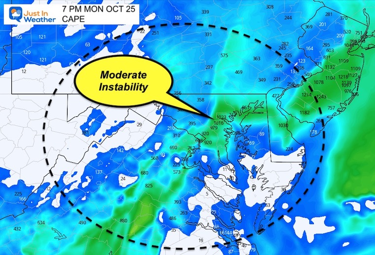
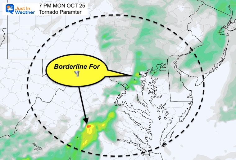
Severe Storm Parameters
CAPE- Convective Available Potential Energy
When this rises above 1000 J/Kg then supercell chances are moderate.
Significant Tornado Parameter
When values reach above 1, there is an increased chance for EF-2 twisters.
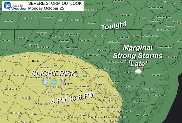
NOAA Severe Storm Outlook
(From this morning)
I believe the ‘RISK’ will be expended into metro Washington and Baltimore.
Also See:
NOAA Winter Outlook- But Read The Fine Print
Signals For Early Start To Winter In November
Winter Outlook Series: La Nina Double Dip
Nor’easters May Give Hint For Winter La Nina Pattern
Email Updates
Please make sure you sign up for my newsletter.
Weather posts straight to your inbox
Sign up and be the first to know!
Faith in the Flakes Gear
SNOWSTIX – Available Now


