


Average Last Frost or Freeze Dates And Map For Maryland
There is a good reason why many gardeners suggest NOT to plan tomatoes until after Mother’s Day. Early surges of warm air in spring can be deceiving. Just because the…
Thursday October 21
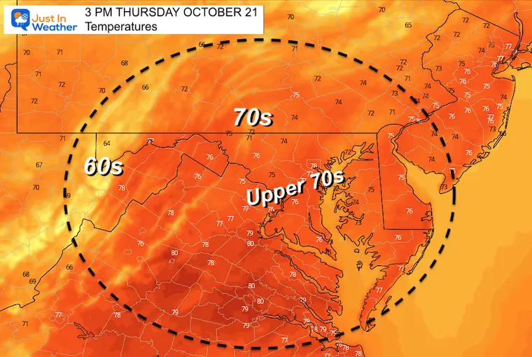
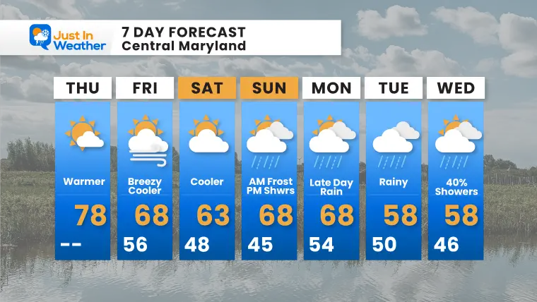
If you have been enjoying our slow entrance to fall weather, today may be your last warm day for a long while. Enjoy the mid to upper 70s. Out next cold front will cut temps down tomorrow, then open the pattern for even colder air and rain into next week.
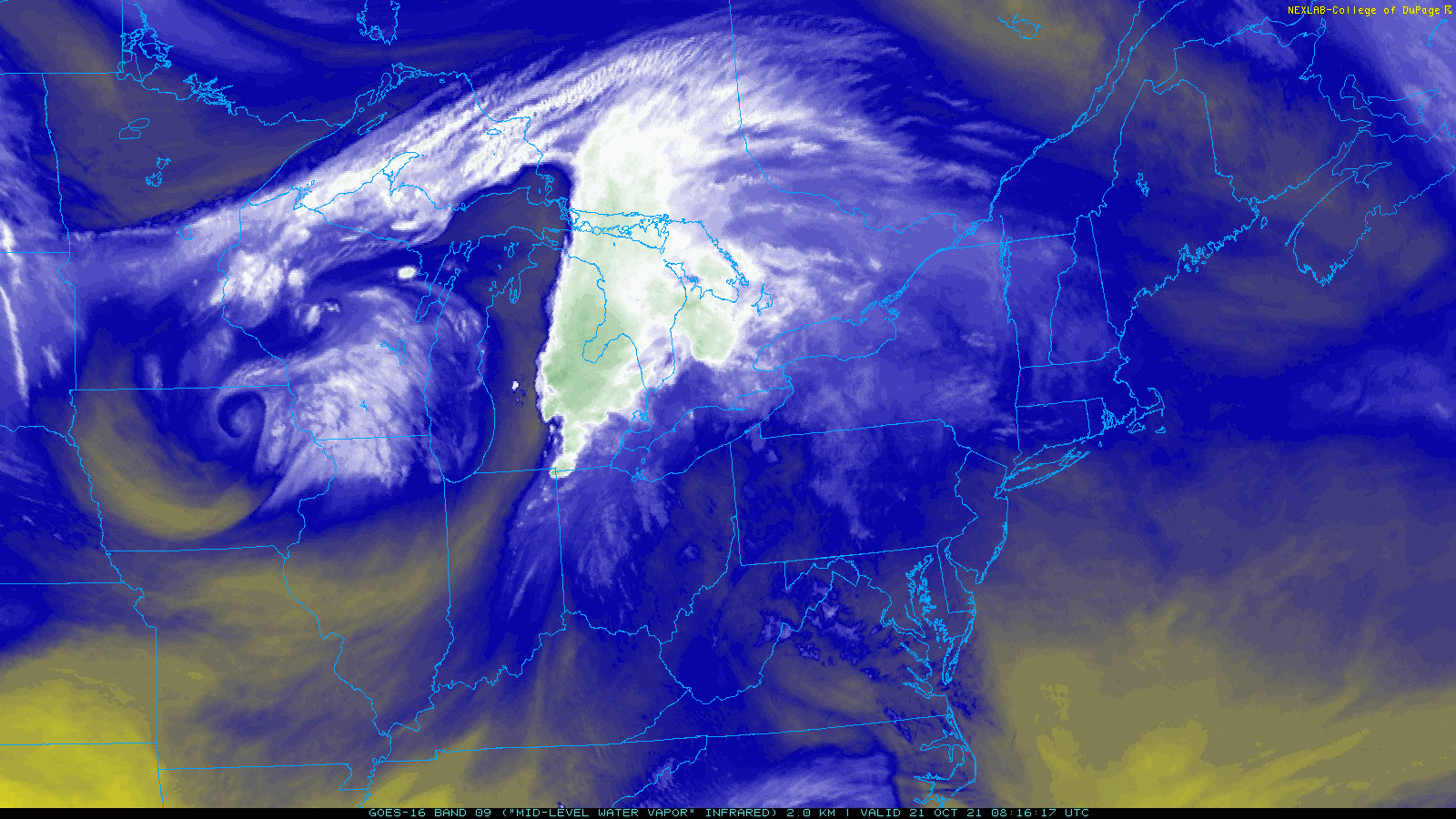
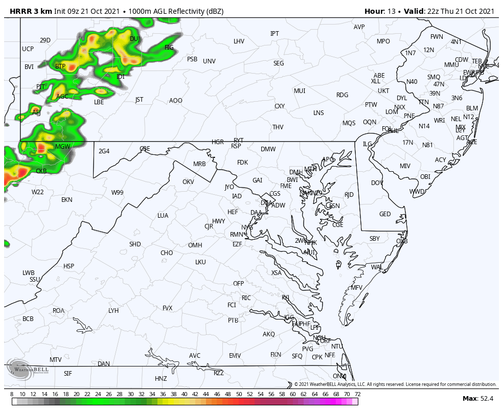
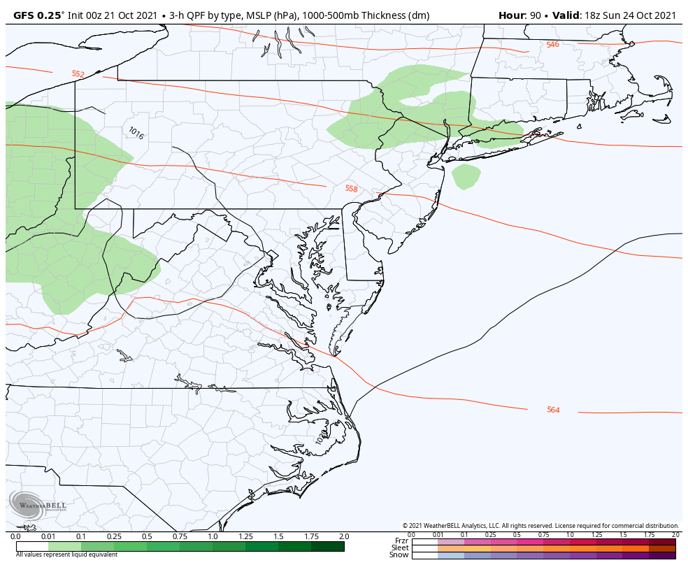
A storm in the Upper Midwest will spin and pass to our north. But ahead of it we get warmer air on Southwesterly winds. The cold front will bring showers to western Maryland today, and some NW Suburbs tonight. It’s likely to dry out for metro areas.
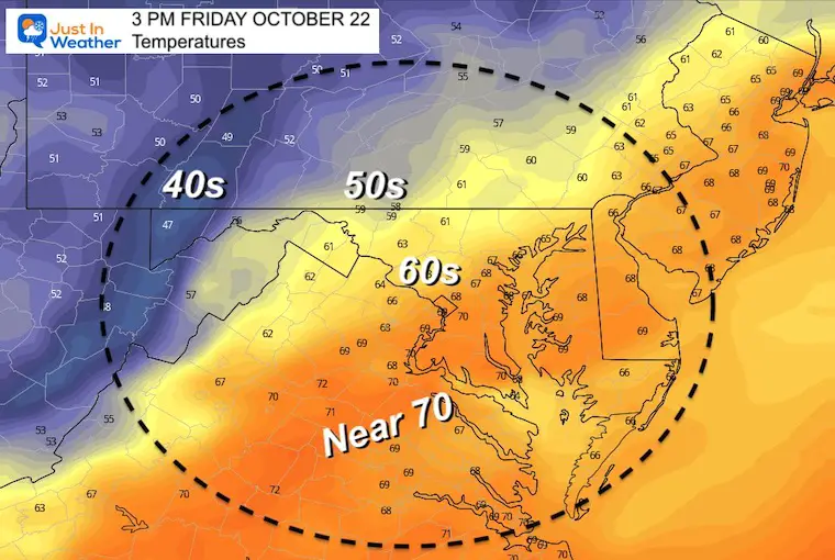
By tomorrow we get into the colder winds.
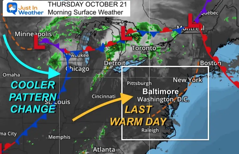
The circulation can been seen moving through eastern Iowa. This will ‘turn the corner’ and start to move more east then northeast across the lower Great Lakes.
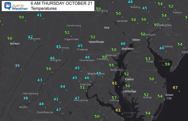
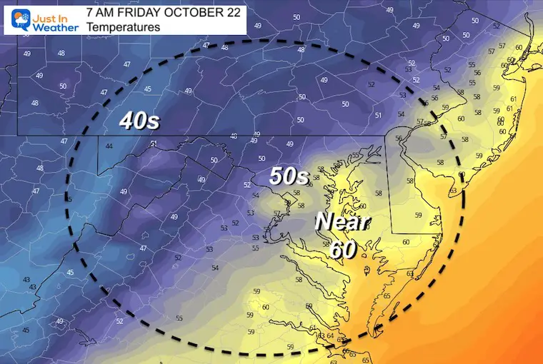
Cool, but milder than recent mornings. You still might need a jacket.
This should be the warmest day of the week, and for a while. Metro areas will reach the upper 70s. Some car and bank thermometers might touch 80ºF.
6 AM To 11 PM – rain mainly west and north of the cities.
Normal Low in Baltimore: 44ºF
Record 26ºF in 1952
Normal High in Baltimore: 65ºF
Record 90º F 1947

Also See:
Signals For Early Start To Winter In November
Winter Outlook Series: La Nina Double Dip
Full Hunter’s Moon May Appear Full For 3 Nights
Waterspout Among Top 10 Storm Photos Saturday
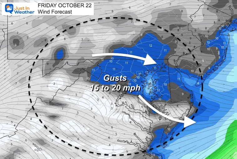
This will not be too gusty, but enough to impact the feel of the air.
The Cold Front arrives overnight Thursday into Friday morning. This will being showers to the mountains, and some may reach our NW hilly suburbs after dark, before falling apart.
The next push of showers will be Saturday afternoon


Please make sure you sign up for my newsletter.
See the SUBSCRIBE button at the bottom of the page.
This way you will get an email to make sure you are notified with each n