


Average Last Frost or Freeze Dates And Map For Maryland
There is a good reason why many gardeners suggest NOT to plan tomatoes until after Mother’s Day. Early surges of warm air in spring can be deceiving. Just because the…
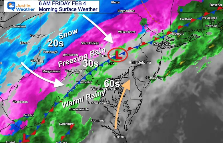
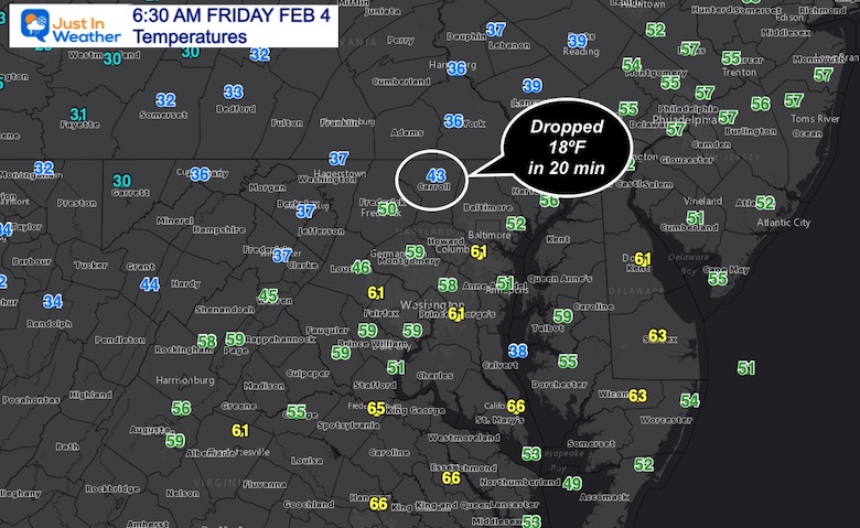
Friday February 4 – Morning Report
I do hope my messaging was received. This event has always been about timing, and yesterday it become obvious that the cold air will would just a few hours later. If you are checking in for a surprise, it has been the surge of warm air overnight. Baltimore reached the 60s AFTER 3 AM!
Cold air is on the way, and our northern counties still expect freezing rain and sleet. But since the arrival will be after sunrise, most roads will be OK.
We should watch for icing into metro Baltimore this evening.
The front is THAT CLOSE and THAT SHARP! Freezing rain has reached western Maryland’s Garrett County. The icing is just northwest of Harrisburg, with snow on the doorstep of Pittsburgh.
This wave of Low Pressure slowed everything down, but the movement will resume this morning.
See the animation below.
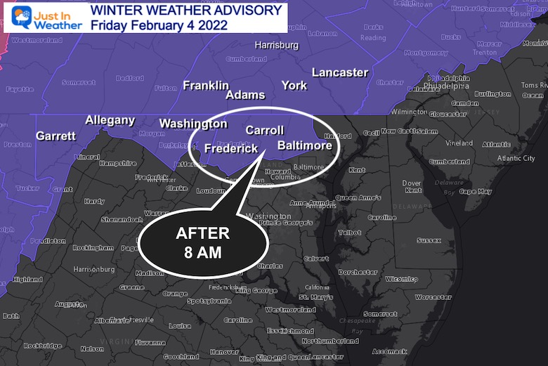
Reminder: North Central Maryland engages at 8 AM.
5 AM to 7 PM
There will be freezing rain and sleet developing in the Advisory Counties
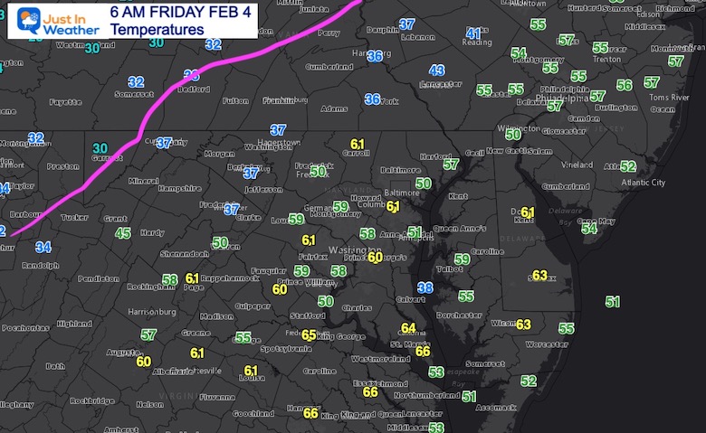
Observation at 6 AM
This is a wild swing!
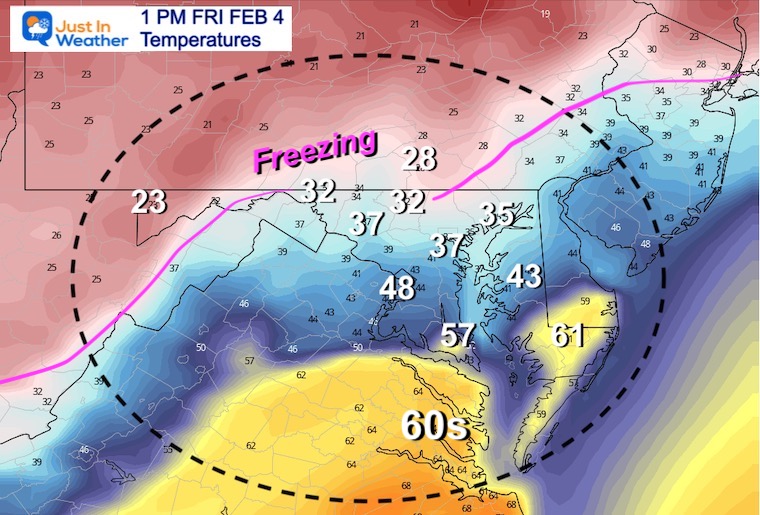
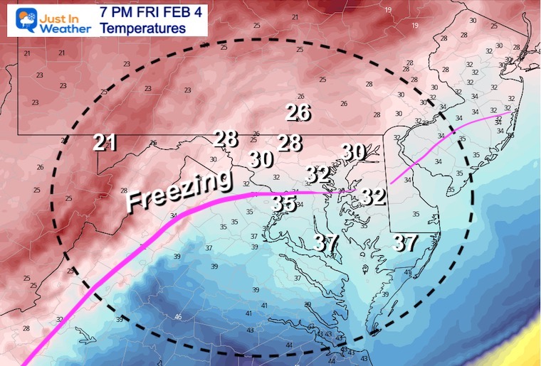
5 AM to 7 PM
Temps will be FALLING A LOT!
Some icing in the Advisory areas, but road ice will be limited during the day.
Due to rain lingering, Icing will develop after 5 PM where ground is wet.
Icing on wet pavement and salting may be needed NORTH of Rt 50. Near Annapolis but through metro Baltimore and northern Eastern Shore in Queen Annes, Kent, and Cecil County. Also north of Dover in Delaware.
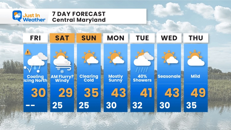
TODAY February 4
Seasonal Snow: 13.3”;
+4.7″ ABOVE AVERAGE
Normal Low in Baltimore: 25ºF
Record 5ºF in 1918
Normal High in Baltimore: 43ºF
Record 72ºF 1991
There is a quick disturbance that will move through in the morning. This may produce a flurry, but more likely just cold winds!
Next week will be quiet and seasonal. One coastal system on Tuesday will be weak, but could produce showers early. The warm up looks less impressive now.
Winter Lovers: Mid month we expect another Polar Vortex Disruption, which will send in more arctic air. Look for our next possible ‘event’ around Valentine’s Day. I will have more on that later.


Last Winter Recap: My Old Outlook And Your Grades Of My Storm Forecasts


*Disclaimer due to frequent questions:
I am aware there are some spelling and grammar typos. I have made a few public statements over the years, but if you are new here you may have missed it:
I have dyslexia, and found out at my second year at Cornell. I didn’t stop me from getting my meteorology degree, and being first to get the AMS CBM in the Baltimore/Washington region.
I do miss my mistakes in my own proofreading. The autocorrect spell check on my computer sometimes does an injustice to make it worse.
All of the maps and information are accurate. The ‘wordy’ stuff can get sticky.
There is no editor that can check my work when I need it and have it ready to send out in a newsworthy timeline.
I accept this and perhaps proves what you read is really from me…
It’s part of my charm.
#FITF