February 17 Friday Morning Rain Then Strong Colder Winds Afternoon
February 17 2023
Friday Morning
Today may be the reverse of yesterday. Rain is already in place and will be sweeping through central areas around noon, later on Delmarva and the coast. The end of the rain will be with the cold front that will reverse our fortune and bring in strong winds as temps tank!
The high temperatures have already occurred in the 60s. This afternoon plan for falling temperatures into the 40s and even 30s.
Have you seen tree buds, flowers sprouting, or even bugs flying around? They will be in trouble! A hard freeze will be here Saturday morning and bring us one cold day. It does seem like our theme all winter has been a cold snap that lasts just one day, usually on a Saturday.
Morning Temperatures
We have already seen high temperatures for today. A mild morning will turn colder mid-day and this afternoon. Definitely bring an extra layer or coat if you will be out later.

Live Radar Widget
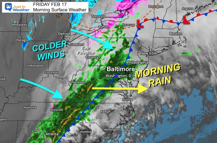
Tracking the rain this morning, that will move out by this afternoon.
Morning Surface Weather
The cold front today is responsible for our rain. The winds will shift and colder air will arrive before the rain ends.
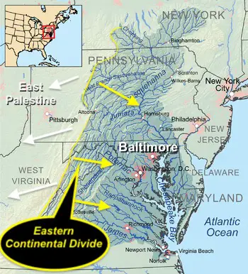
If you are concerned about air flow from East Palestine: Now that the fire is out, the rain takes chemicals down to the ground and into the water system… so larger transport at this point is not expected through the atmosphere. The concern is in the flow down streams and rivers. I will address that in my next report.
IMPORTANT NOTE:
I wrote a report with all the legitimate info and some controversial videos about the toxic train derailment in East Palestine, OH. I also explained how this relates to the Chesapeake Bay and Ohio Watersheds. Please click here for the images if you missed that report.
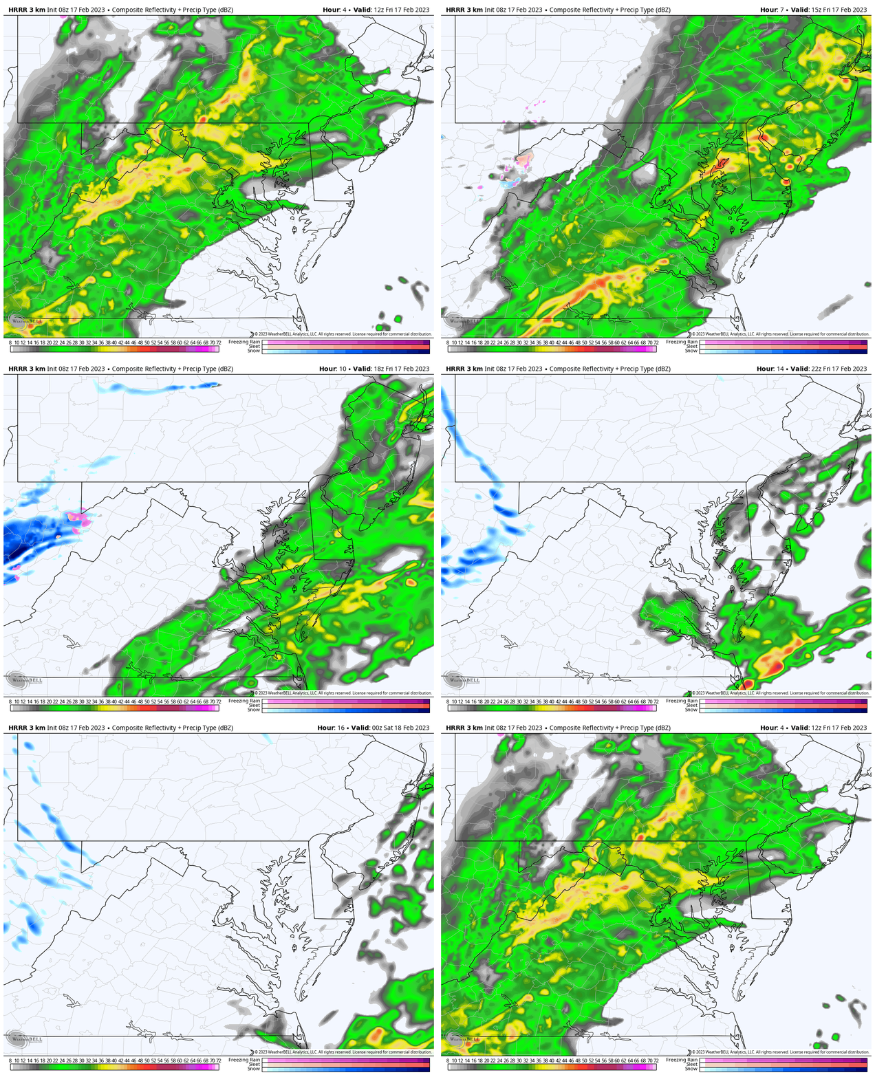
Radar Simulation Animation
7 AM to 7 PM
Most of the rain will be moving through mid-day, then early afternoon on Delmarva.
The colder winds will bring snow showers and perhaps a fresh coating to the mountains of Garrett County.
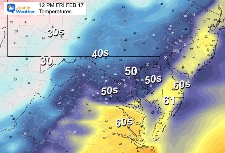
Temperatures at Noon
Already seeing the colder air moving in.
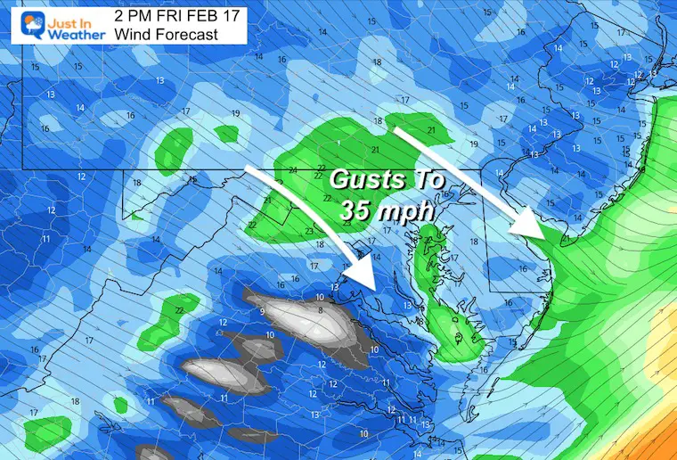
Wind Forecast
Behind the cold front. Winds will gust FROM THE NORTHWEST up to 35 mph.
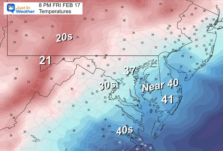
Temperatures This Evening
A much colder more wintry feel. Plan accordingly if you are going out tonight.
Subscribe for eMail Alerts
Weather posts straight to your inbox
Sign up and be the first to know!
CLIMATE DATA
TODAY February 17
Normal Low in Baltimore: 27ºF
Record 3ºF in 1958
SNOW: 7.8” in 1883
Normal High in Baltimore: 47ºF
Record 76ºF 1976
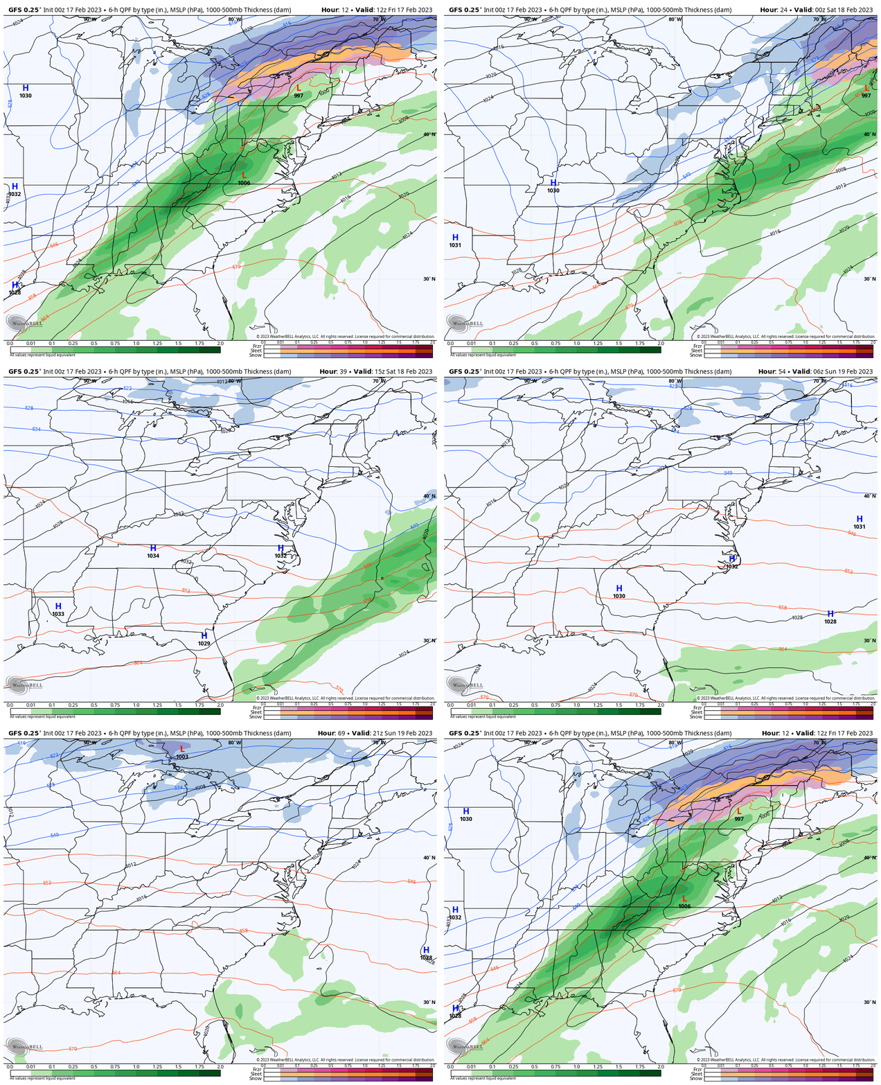
Forecast Animation:
Friday Morning To Sunday Afternoon
After this storm sweeps off the coast, High Pressure will dominate our weekend. It will be a cold Saturday, then mild again Sunday.
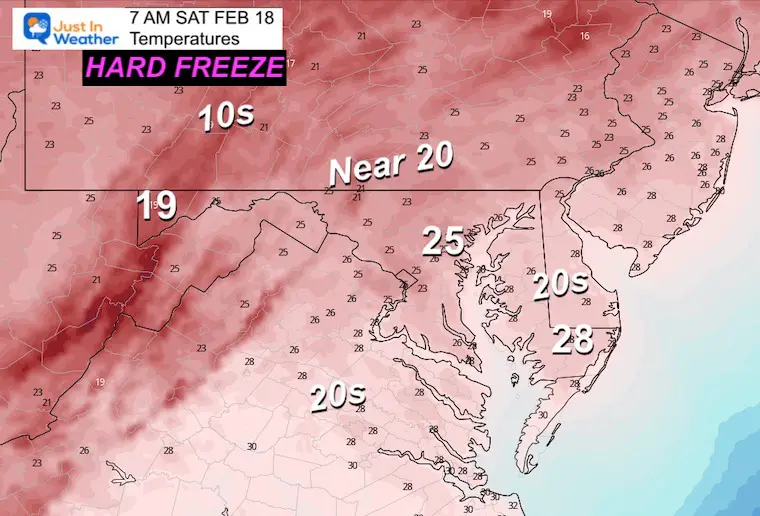
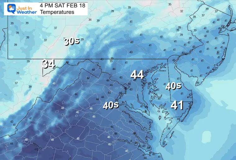
Saturday Temperatures
Morning
A hard freeze will affect the flower sprouts and bugs.
Afternoon
This will be close to a seasonal day. The theme we have had all winter has been these cold shots only lasting for a day. Most have been on a Saturday.
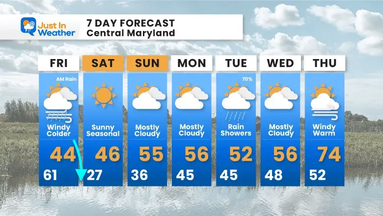
7 Day Forecast
Falling temperatures today and a hard freeze tonight. Saturday will be chilly, then back to the mild pattern Sunday into next week.
That Thursday warm up is actually plotted much warmer on models. I am being cautious considering weather systems have trended faster and can affect the long-term results.
Also See:
Winter History: Low Snow And Late Starts
See my research based on Baltimore data since 1883.
Subscribe for eMail Alerts
Weather posts straight to your inbox
Sign up and be the first to know!
STEM Assemblies/In School Fields Trips Are Back
Click to see more and ‘Book’ a visit to your school
My Winter Outlook: Not A Typical La Niña!
I see many factors to support colder influence with multiple systems. Early and later in winter. Check it out.
Also See The Winter Outlook Series:
Farmer’s Almanac Comparison
September Starts Meteorological Autumn: Weather Climate Stats For Maryland at Baltimore
Triple Dip La Niña Winter
https://justinweather.com/2022/09/09/winter-outlook-2023-la-nina-triple-dip-expectations/
CONNECTION TO WINTER?
If you want a snowy winter, this is what you might want to look for in the rest of the tropical season.
Rainbow Ice Cave In Mt. Rainier A Very Rare Find: Photos And Video
Wooly Bear Caterpillars
https://justinweather.com/2022/10/25/winter-weather-outlook-from-the-wooly-bear-caterpillar/
Persimmon Seeds
Click to see Top 20 and MORE
Normals And Records: Maryland and Baltimore Climate History
Please share your thoughts, best weather pics/videos, or just keep in touch via social media
-
-
Facebook: Justin Berk, Meteorologist
-
Twitter: @JustinWeather
-
Instagram: justinweather
-


