Monday March 8
Morning Report
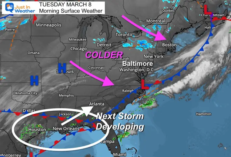
We are riding the crazy train now! After two days of record high temperatures, we are back to cooler weather today. This is the transition just waiting for the next weather system that will bring in a snowy mix tomorrow morning.
Then we get another storm this weekend that appears to start with rain then the polar front brings in colder air and ends with snow.
Ground temps are still warm, and the higher March sun angle mean most pavement will remain wet. But falling snow can reduce visibility, and accumulate on the grass. So this may still play a role in landscaping and construction plans.
Headlines
- Another Record High Set Monday: 79ºF
- Peak Wind was 48 mph
- Today: Much Cooler
- Tomorrow: Rain/Snow Mix
- Saturday: Larger Storm/Falling Temps/Rain To Snow
Morning Surface Weather
Morning Temperatures

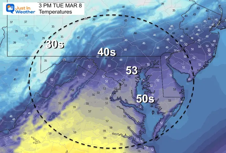
Afternoon Temperatures
Weather Almanac: Climate Data at BWI
TODAY March 8
Seasonal Snow: 14”
Normal Low in Baltimore: 31ºF
Record 10º F in 1960
Normal High in Baltimore: 51ºF
Record 83ºF 2000
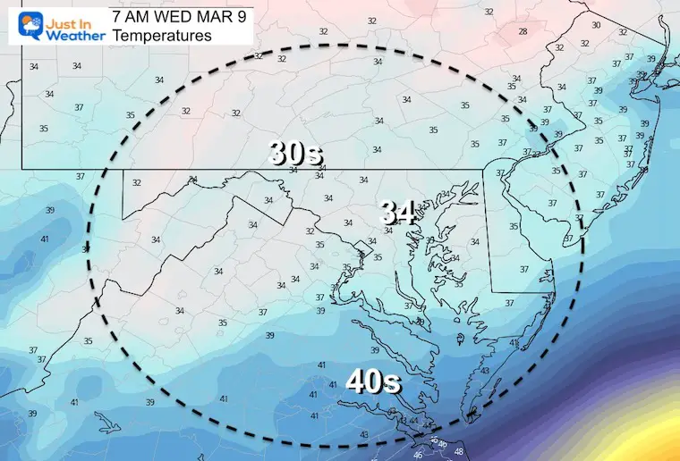
Wednesday Morning
Temperatures
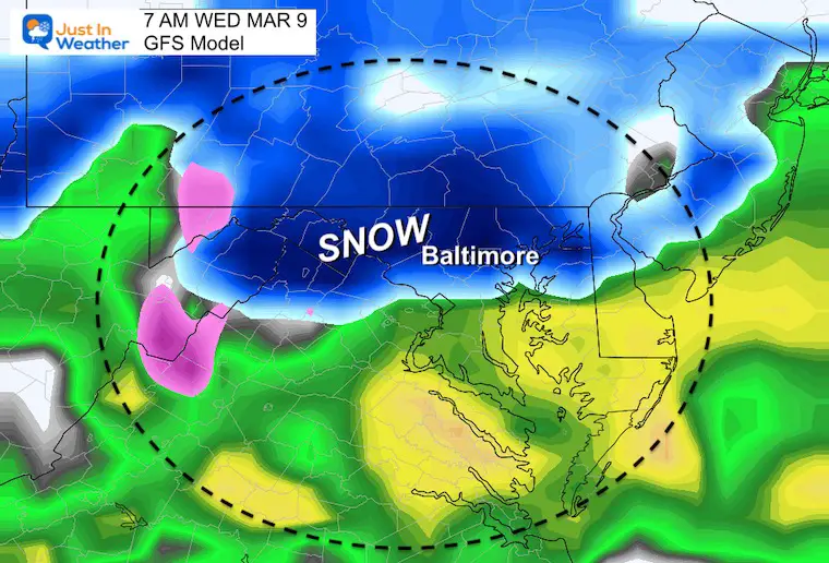
Slushy Snow Mix
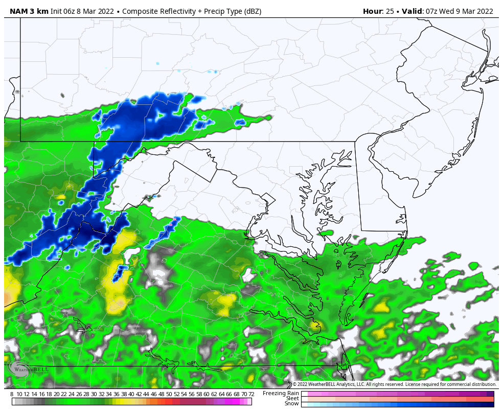
This looks like it will begin as rain and mix with snow, especially west and north of Baltimore.
Temps will be to warm for pavement to get stickage, but lower visibility AND coatings on the grass are very possible.
GFS Model
European Model

NAM 3 Km Model
This is the warmest solution keeping the snow farther west and north…

Snow Animation: NAM 3 Km
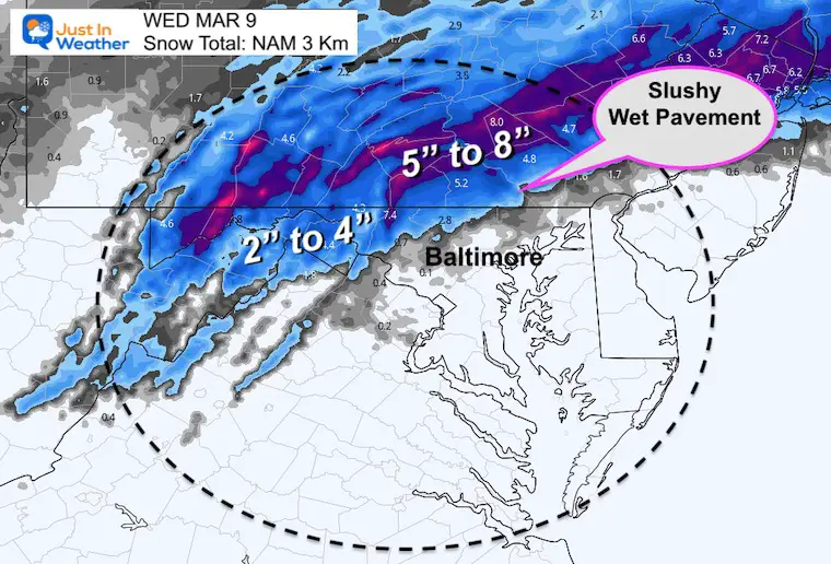
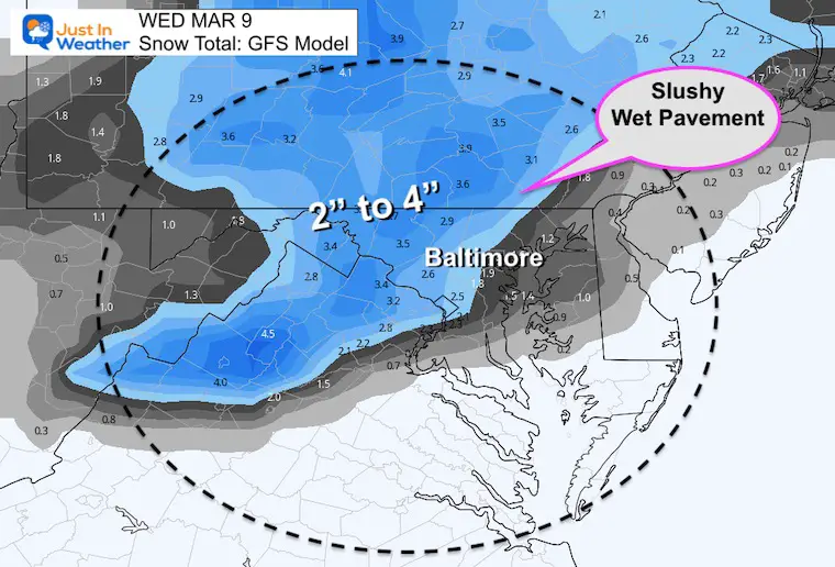
Snow Total?
- Note, this is mainly for what will fall.
- Most roads stay WET!
- Slushy accumulation on grass, but some melting will result in lower snow depth.
NAM 3Km
GFS Model
Afternoon Temperatures

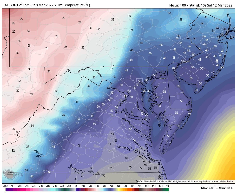
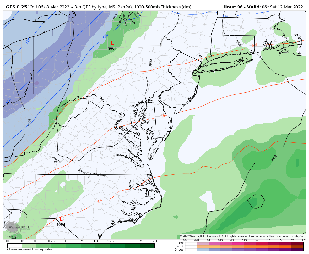
Looking Ahead: Saturday Snow?
If you are comparing to your weather app, there is a reason it is showing 50s for high temps. That will be in the morning!
Temperature Animation
Temps will be FALLING after the morning highs…
Snapshots
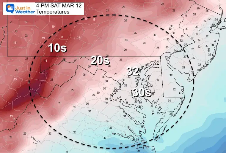
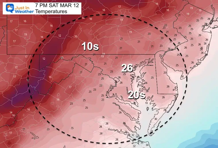
Morning Temperatures

Afternoon Temperatures
Evening Temperatures
Rain To Snow
This is the influence of the polar air… But with snow falling during the day the warmer ground and higher sun angle will likely mean pavement stays wet.
We will need to watch higher elevations for some possible stickage and ice at night.
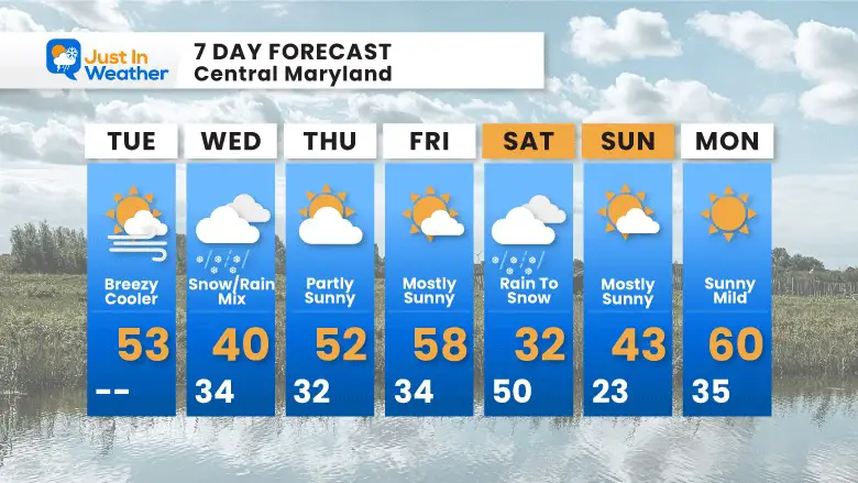
7 Day Forecast
ALSO SEE
ALL FITF GEAR

FITF THUNDERSNOW


Winter Outlook Series:
My Call For Snowfall

Last Winter Recap: My Old Outlook And Your Grades Of My Storm Forecasts


Please share your thoughts, best weather pics/video, or just keep in touch via social media
*Disclaimer due to frequent questions:
I am aware there are some spelling and grammar typos. I have made a few public statements over the years, but if you are new here you may have missed it:
I have dyslexia, and found out at my second year at Cornell. I didn’t stop me from getting my meteorology degree, and being first to get the AMS CBM in the Baltimore/Washington region.
I do miss my mistakes in my own proofreading. The autocorrect spell check on my computer sometimes does an injustice to make it worse.
All of the maps and information are accurate. The ‘wordy’ stuff can get sticky.
There is no editor that can check my work when I need it and have it ready to send out in a newsworthy timeline.
I accept this and perhaps proves what you read is really from me…
It’s part of my charm.
#FITF


