Friday January 7 2022
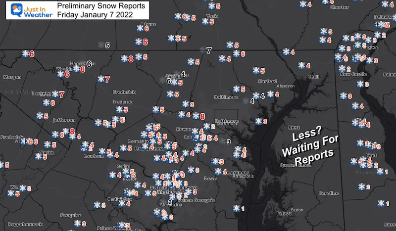
For the most part, this storm behaved as expected with timing and dumping. There are many overachieving areas west and north, making up for missing out the last event. There were some low amounts on the southern end.
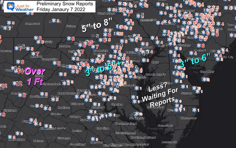
Here is a look at the preliminary snow reports. I will have final totals when complete this afternoon.
Weather: The next event may be freezing rain for part of Sunday. Then arctic cold settles in next week.
Preliminary Snow Reports
Note: Some of these are not final and still waiting for more reports to be filed. I will have a final report late today.
Baltimore’s BWI recorded 3 inches of snow!
Now 9.8” for the month. This is on pace for the first double digit snow month since the ll time record storm in Jan 2016.
Wide View: NWS Snow Spotters
Winner:
West Virginia Mountains over 1 Foot
NW of Baltimore with many 5” to 8”
Central View:
Metro Baltimore/Central Maryland mostly in or above the 2 to 4 inch forecast.
Kent Island and Delmarva: Still missing reports on Maryland Eastern Shore
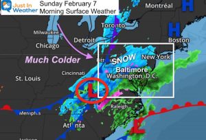
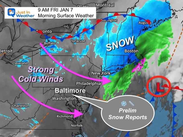
Morning Surface Weather
This is a quick moving system, and pulling in very strong winds.
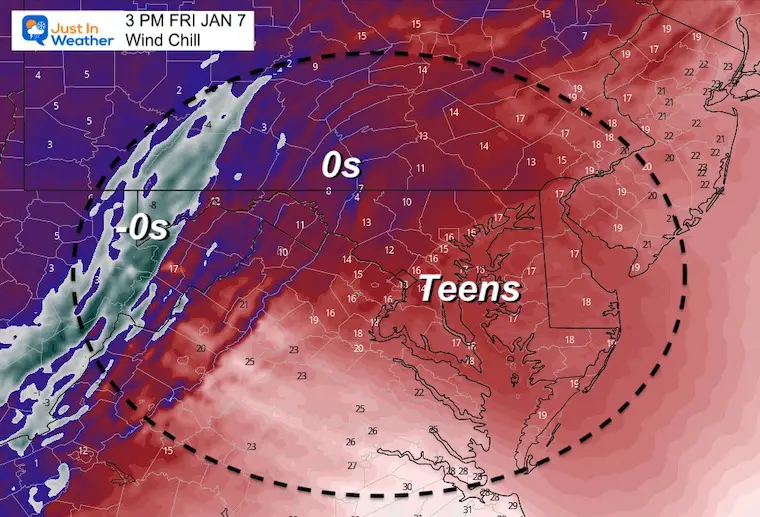
The issue today will be blowing and drifting snow, plus bitter wind chills.
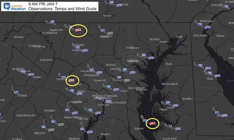
Morning Temperatures And Wind Gusts
Temps in the 20s, but look at the winds!!!
Most in the 20 to 35 mph range
Peak winds:
- Camp David = 41 mph
- Dulles = 36 mph
- Chesapeake Bay = 54 mph
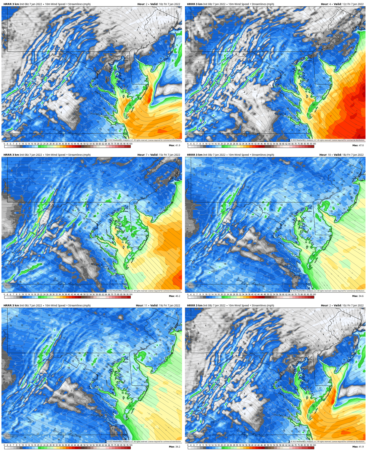
Wind Forecast
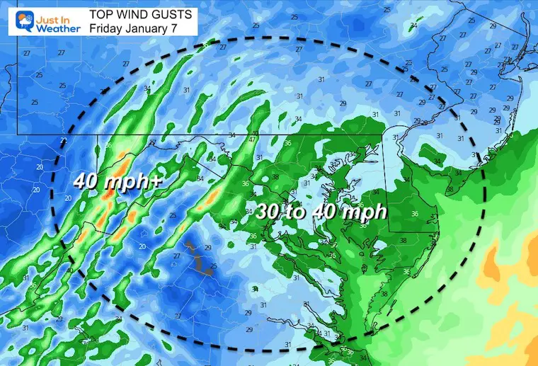
Winds will increase by noon from the Northwest averaging 15 to 20 mph. The fluffy snow will be blowing and drifting.
Afternoon Wind Gusts
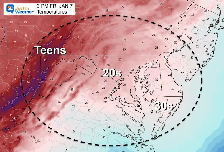
Afternoon Temperatures
Afternoon Wind Chill
Weather Almanac: Climate Data
TODAY January 7
Normal Low in Baltimore: 25ºF
Record 1ºF in 2018
Normal High in Baltimore: 41ºF
Record 74ºF 1907
Looking Ahead:
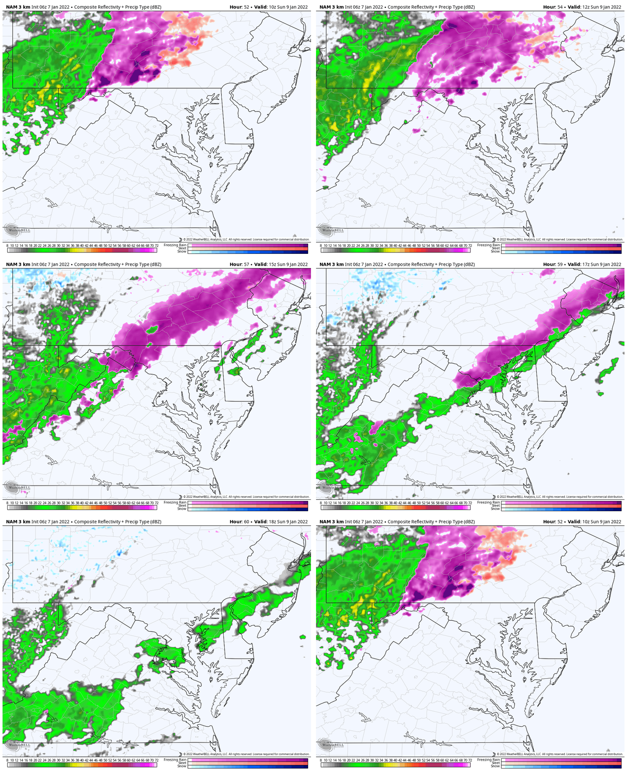
Sunday Freezing Rain
NAM 3 Km 5 AM to 1 PM
This looks like initial freezing rain at sunrise to noon, then thawing as it reached Baltimore.
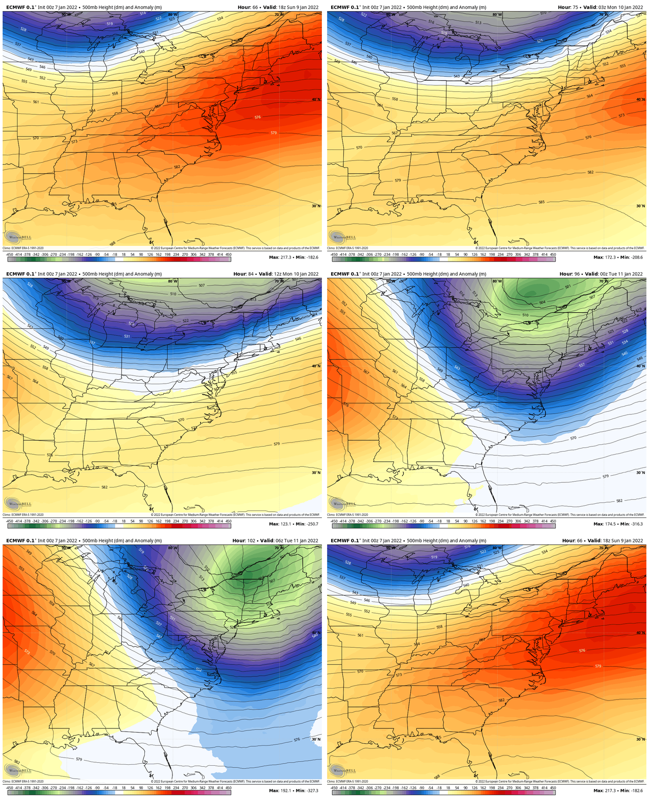
Jet Stream Next Week
Sunday Afternoon to Tuesday Morning
We get a thaw Sunday afternoon, then a surge of the next trough early in the week. This may arrive with flurries, the arctic air arrives Tuesday. A piece of the Poor Vortex will try to dive into northern New England.
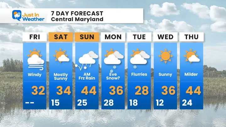
7 Day Forecast
- Sunday: Freezing rain in the morning.
- Monday: Windy and colder, flurries
- Tuesday: Arctic air arrives
- Warm Up: We we get back to mild are by the end of next week.
Weather posts straight to your inbox
Sign up and be the first to know!
ALSO SEE
What is Faith in the Flakes: History of December 5th Snow
ALL FITF GEAR
FITF THUNDERSNOW
Winter Outlook Series:
Last Winter Recap: My Old Outlook And Your Grades Of My Storm Forecasts
Winter Weather Page – Lots of resources
Solar Cycle Increasing Sunspots Suggests More Snow
Comparing 4 Different Farmer’s Almanacs: Majority colder winter outlook than NOAA
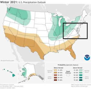
NOAA Winter Outlook- But Read The Fine Print
Signals For Early Start To Winter In November
Winter Outlook Series: La Nina Double Dip
Nor’easters May Give Hint For Winter La Nina Pattern
Winter Folklore Checklist
Please share your thoughts, best weather pics/video, or just keep in touch via social media
Facebook: Justin Berk, Meteorologist
Twitter: @JustinWeather
Instagram: justinweather


