Monday November 1
As we turn the page to a new month, the weather seems to be on track with turning cooler. To get you in the mood, a weather system on Tuesday will bring a chilly band of rain showers. However, in thee mountains of western Maryland and West Virginia the first snow of the season might be enough to coat the ground.
What will follow will be an air mass that should bring inland areas (away from the cities and Bay) into the 30s. Computer model guidance is suggesting the first freeze might be as close as Carroll and western Howard Counties.
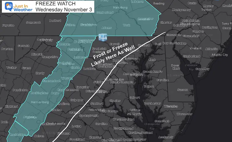
First Freeze Watch
This has been issued for Wednesday morning. I’ve indicated where I expect there will be an expansion of either the Freeze or Frost Advisories.
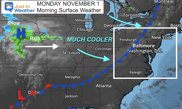
Morning Surface Weather
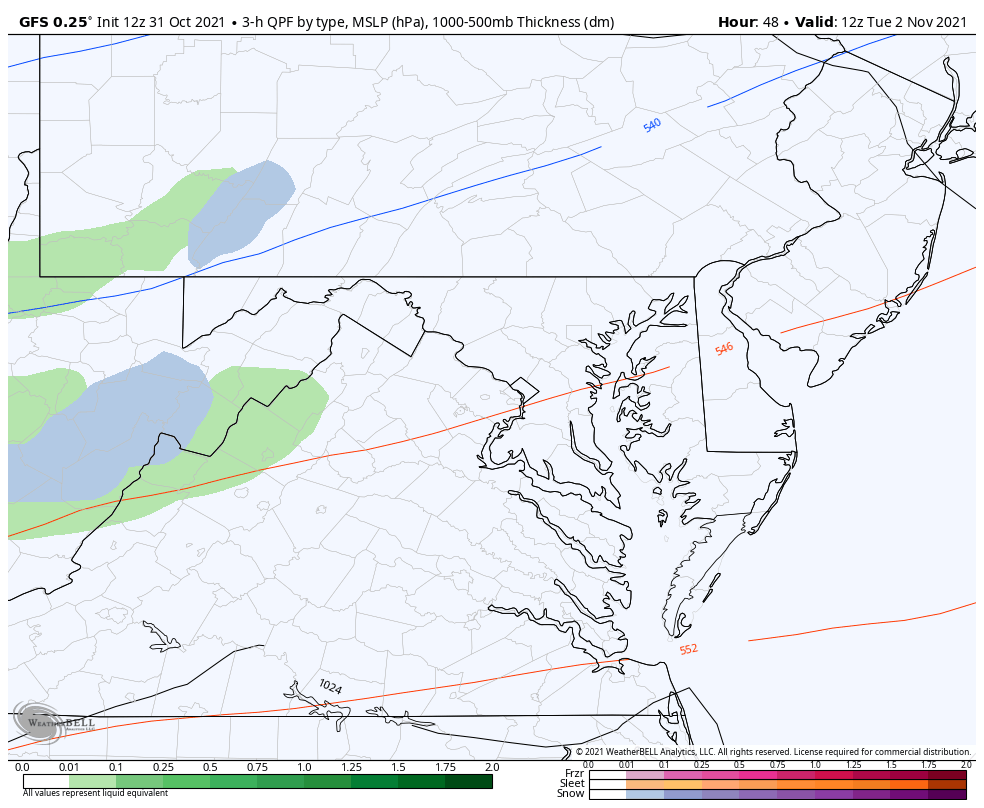
A cold front is on your doorstep. But it’s the cluster of rain and first snow entering the Central Plains States that will be heading our way tomorrow to really enforce the colder air.
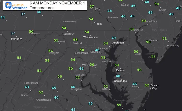
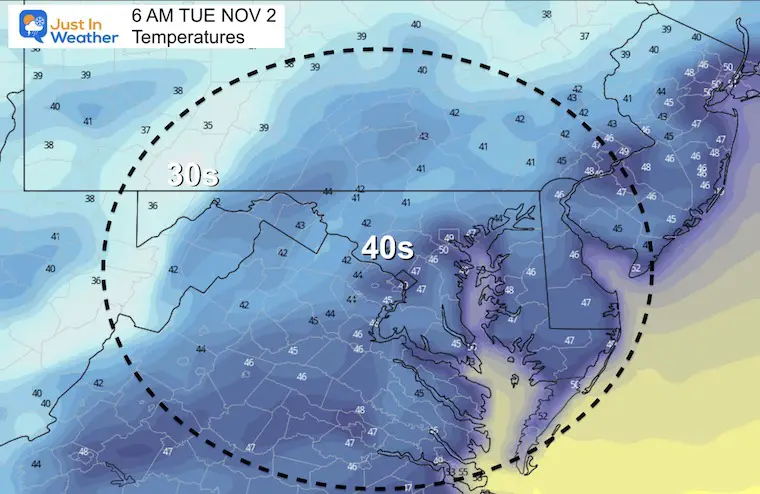
Morning Temperatures
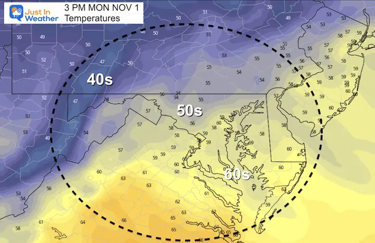
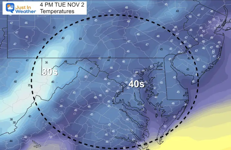
Afternoon Forecast
Weather Almanac: Climate Data
TODAY November 1
Normal Low in Baltimore: 40ºF
Record 29ºF in 1954
Normal High in Baltimore: 62ºF
Record 86º F 1950

Tuesday
Morning
Afternoon
Rain and Mountain Snow
This will bring in rain showers, with a band of snow in the mountains that should include Garrett County to Snowshoe.
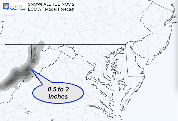
Snow Forecast
About The Freeze or Frost
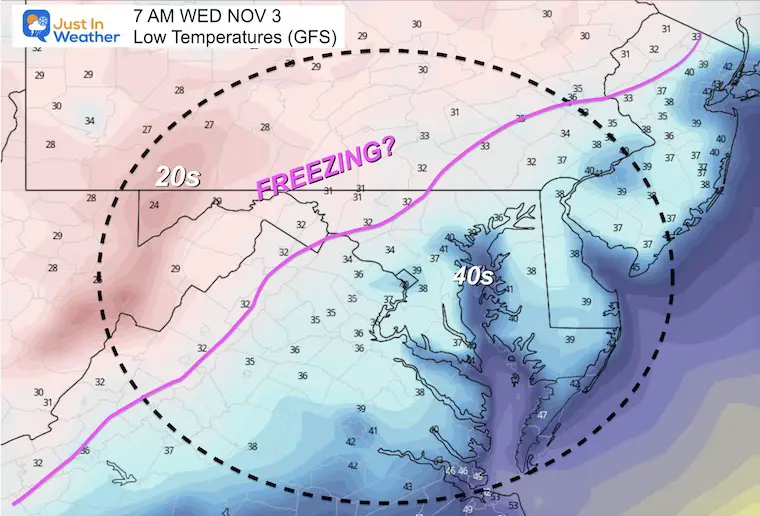
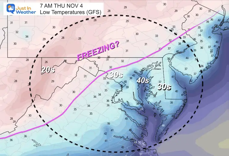
Both Wednesday and Thursday mornings show temperatures in the mid to lower 30s just inland from the cities.
This is why I expect there will be an expanded area for Freeze or Frost Advisorie.
What’s the difference? A Freeze is when temps drop below 32ºF, while Frost is when temps can be as high as 39ºF but ice crystals form on the surface of plants (car tops, etc).
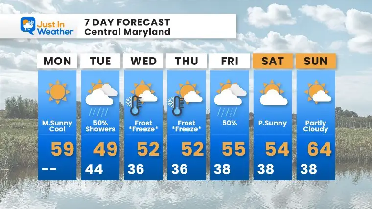
7 Day Forecast
Quick moving systems next week will reinforce colder air. The event on Tuesday has some models bringing snow to the nearby mountains.
Both Wednesday and Thursday mornings will bring frost and freeze conditions inland.
Also See The Winter Outlook Series:
Winter Folklore Checklist
NOAA Winter Outlook- But Read The Fine Print
Signals For Early Start To Winter In November
Winter Outlook Series: La Nina Double Dip
Nor’easters May Give Hint For Winter La Nina Pattern
Faith in the Flakes Gear

Please share your thoughts, best weather pics/video, or just keep in touch via social media


