January 15 Winter Weather Advisory Today To Tuesday Morning
January 15 2024 Martin Luther King Jr. Day
Monday Morning Update
We will end the snow drought today. This will be the first region-wide impact snow in nearly two years for central Maryland. It will not be a heavy event. It is worth noting that a little snow can still cause a big problem. Especially when it has been so long since many have driven in snow.
Please take this seriously as temps will be cold for stickage as the time window will be all afternoon into Tuesday morning.
There may be an impact on travel and perhaps schools on Tuesday morning. I will not make any promises as the decisions are local, but there is hope. There is also a chance for another snow event on Friday.
Faith in the Flakes
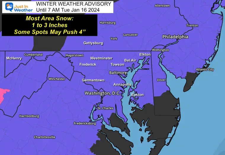
Winter Weather Advisory
This covers most of our region with light but impactful snow.
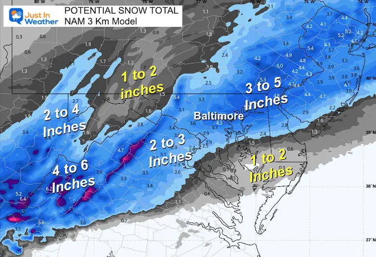
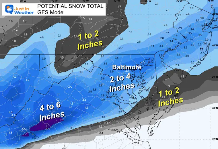
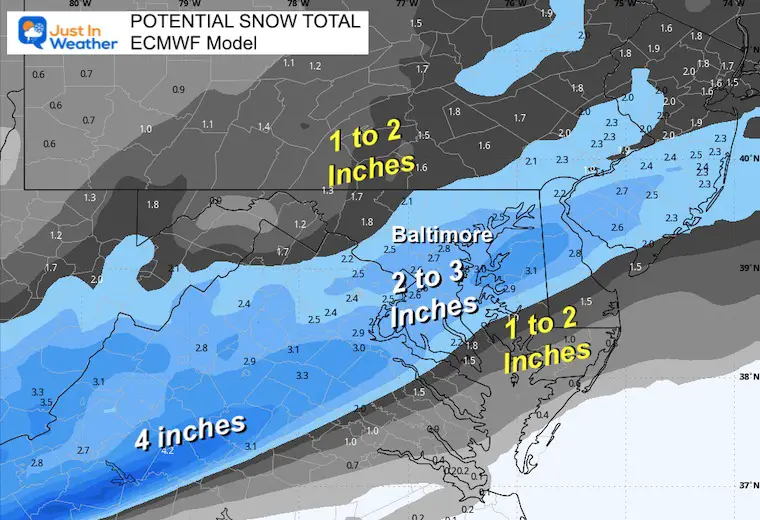
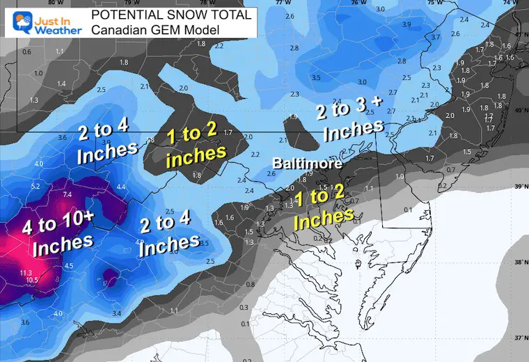
The general expectation is 1 to 3 inches. There will be some higher spots. I’ve included MANY SNOW MAP PRODUCTS below.
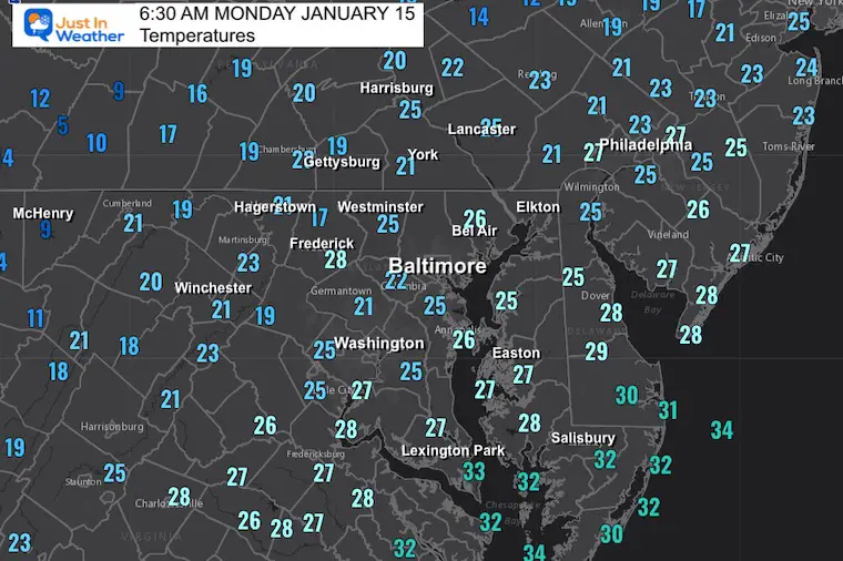
Temperatures
We are well below freezing and will remain there all day!
Radar Widget
A few bands of light snow and flurries have arrived, but not in all areas. It did fall over Baltimore earlier with a coating of snow and slick sidewalks/roads.
This will display in non-winter mode… Most of this is likely to continue to be snow today.
NOTE: I want to apologize for last night. I did see the Special Statement about the morning snow and discounted it, thinking most would be Virga. I was out with some friends and got lazy in reporting. Just want to hold myself accountable and let you know I am at full attention today.
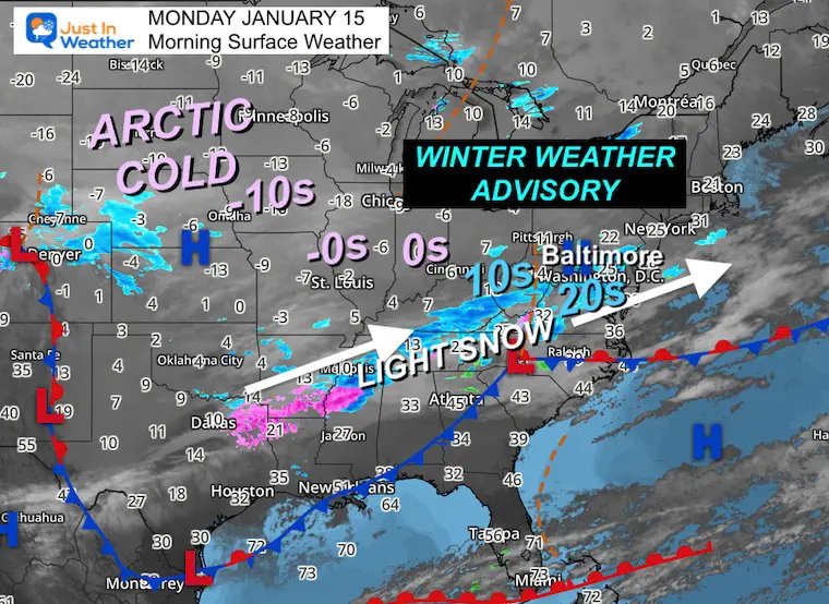
Morning Surface Weather
As I shared with you over the weekend, this is not a well-organized storm. Most of the energy is coming from fast winds in the jet stream. That is what is expected to enhance and expand the snow along this same general line during the day and into tonight.
There is plenty of arctic air across the nation. I’ve highlighted the temps here to show what is available to flow in through the week.
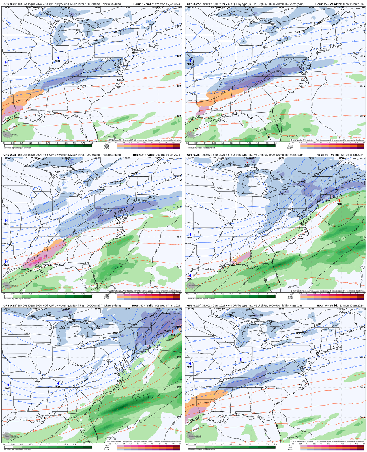
Storm Animation
GFS Model: Monday Morning To Tuesday Evening
The stripe of snow will reach top intensity tonight, then move away on Tuesday.
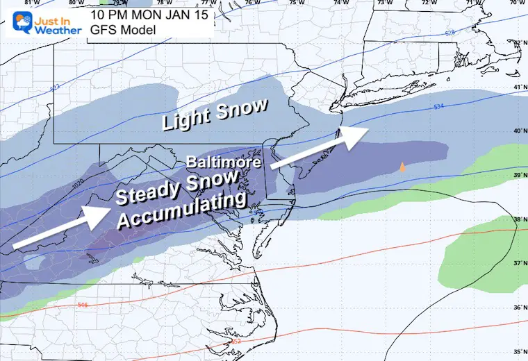
Snapshot Monday Night
The heaviest snow (if we can call it that) will fall after dark this evening.
Closer Look
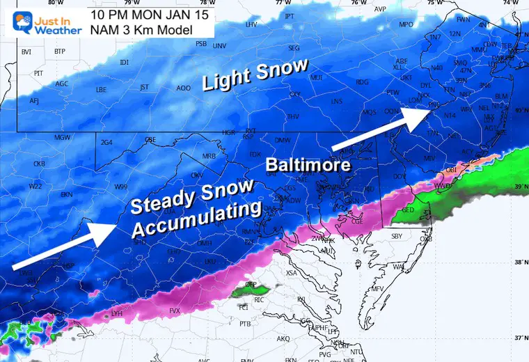
NAM 3 KM Model
This higher resolution shows the areas of steady, accumulating snow in a narrow band. Lighter snow will fall to the north in central Pennsylvania. The back edge and possible warming will creep in through southern Maryland.
Radar Simulation:
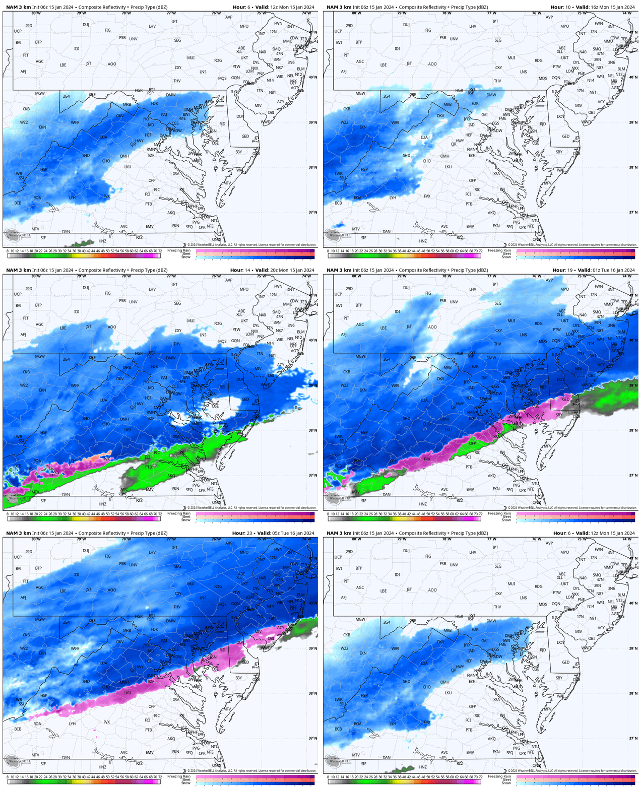
NAM 3 Km 8 AM to Midnight (Part 1 of 2)
There may be a lull, then a redevelopment and expansion during the afternoon. The timing may be faster than models are picking up on.
I place emphasis on the low angle of the sun. Plan for road issues becoming more of a problem from 2 to 4 PM and then into the evening!
Temperatures
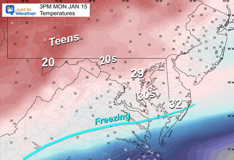
Monday afternoon numbers will remain nearly steady through tonight. Cold enough for stickage! The 20s also provide for a lighter, fluffy type flake that can be easier to push but extra slippery.
CLIMATE DATA: Baltimore
TODAY January 15
Sunrise at 7:25 AM
Sunset at 5:08 PM
Normal Low in Baltimore: 25ºF
Record -2ºF in 1964
Normal High in Baltimore: 43ºF
Record 78ºF 1932
Tuesday Weather
Radar Simulation
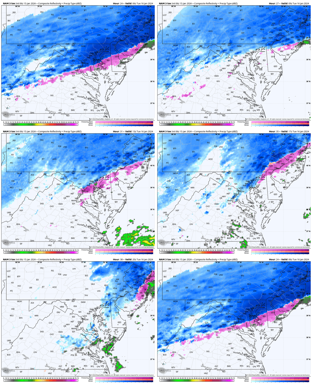
NAM 3 Km Model: 1 AM to 3 PM (Part 1 of 2)
Steady snow will fall overnight and lift north. The back edge may reach near Baltimore in the morning with some sleet mixed in.
Northern areas may remain with light snow through the morning and mid-day hours.
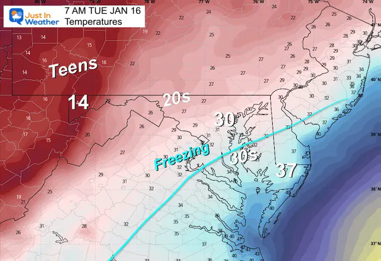
Temperatures Tuesday Morning
Still Supports Stickage!
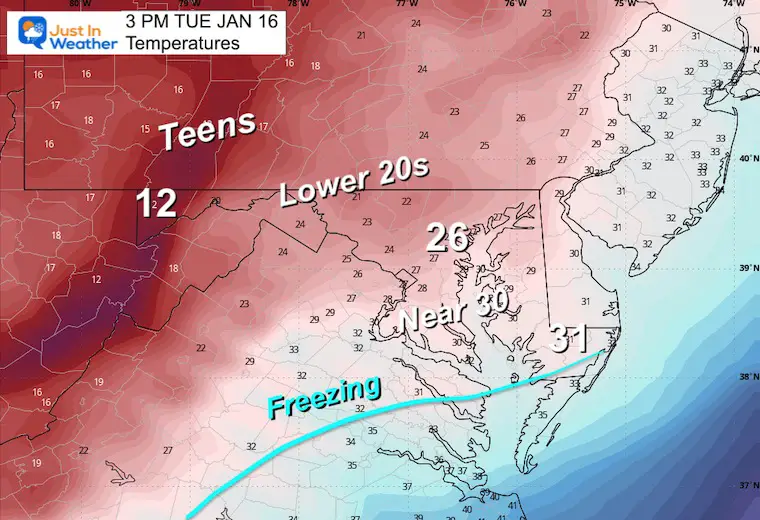
Tuesday Afternoon
Remaining cold.
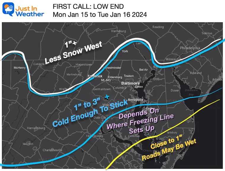
How Much Snow?
Compare My First Call to 4 Models and National Weather Service Maps
My First Call (from yesterday)
I hedge my bets just under guidance. Models tend to overplay snow. I need to consider some flakes may get lost to Virga (sublimation). But with a cold snow, the ratio may be higher… Which is why some spots could push 4 inches.
Model Snow Maps
NAM 3 Km
GFS Model
European ECMWF
Canadian GEM
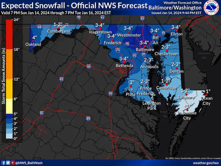
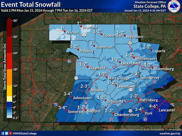
National Weather Service Maps
Maryland and Virginia
Central Pennsylvania
Looking Ahead
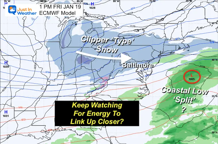
The next storm may be following the bias we saw with this event. In the 3 to 5 day period, the energy can get lost.
This looks like a clipper through the Great Lakes ‘not phasing’ with a distant coastal storm. But that could be a glitch…
Snapshot: Friday Afternoon
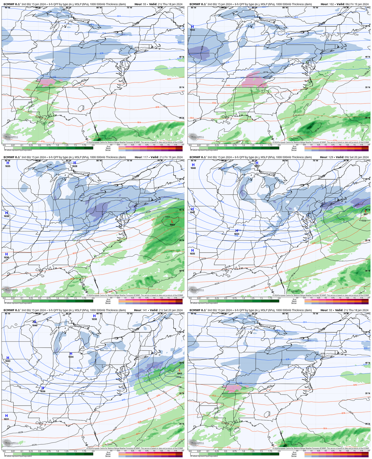
NOTE: The tendency is for the upper-level energy to speed up and pull back west/north. So, I think in a day or two, we may see this system come back together and keep snow on the outlook for Friday.
Storm Animation: Thursday Afternoon to Saturday Afternoon
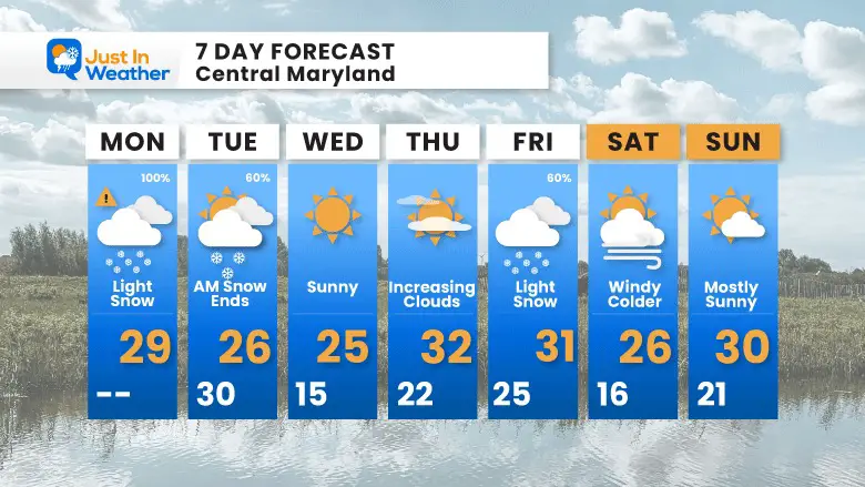
7 Day Outlook
Remaining COLD! Wind Chill on Wednesday might be near zero!
Subscribe for eMail Alerts
Weather posts straight to your inbox
Sign up and be the first to know!
RECENT Winter Outlook Reports:
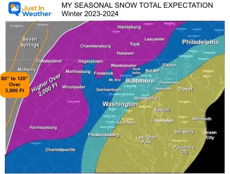
My Winter Outlook: More Snow
El Niño Winter Updates
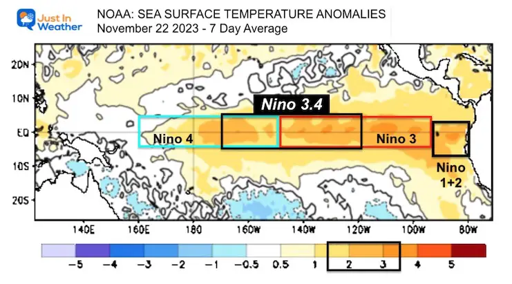
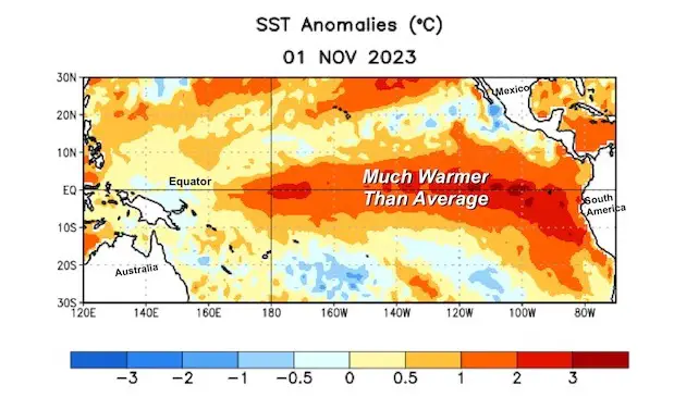
Late November: Warm Water Shifts West In Pacific Could Mean More Snow For Eastern US
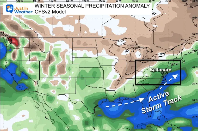
Computer Models Support East Coast Storm Track
The latest NOAA report is confident in a Very Strong event. Possibly HISTORIC! This refers to the temperatures in the Pacific, with impacts on the US Winter Storm Track.
Winter Weather Folklore: Top 20 and more signals from nature for snow.
Winter Outlook 2024 From Two Farmers Almanacs Return to Cold and Snow
Explore More
Maryland Snow Climate History And Other Winter Pages
Faith in the Flakes Gear
STEM Assemblies/In School Fields Trips Are Back
Click to see more and ‘Book’ a visit to your school
Please share your thoughts and best weather pics/videos, or just keep in touch via social media
-
Facebook: Justin Berk, Meteorologist
-
Twitter
-
Instagram
RESTATING MY MESSAGE ABOUT DYSLEXIA
I am aware there are some spelling and grammar typos and occasional other glitches. I take responsibility for my mistakes and even the computer glitches I may miss. I have made a few public statements over the years, but if you are new here, you may have missed it: I have dyslexia and found out during my second year at Cornell University. It didn’t stop me from getting my meteorology degree and being the first to get the AMS CBM in the Baltimore/Washington region. One of my professors told me that I had made it that far without knowing and to not let it be a crutch going forward. That was Mark Wysocki, and he was absolutely correct! I do miss my mistakes in my own proofreading. The autocorrect spell check on my computer sometimes does an injustice to make it worse. I also can make mistakes in forecasting. No one is perfect at predicting the future. All of the maps and information are accurate. The ‘wordy’ stuff can get sticky. There has been no editor who can check my work when I need it and have it ready to send out in a newsworthy timeline. Barbara Werner is a member of the web team that helps me maintain this site. She has taken it upon herself to edit typos when she is available. That could be AFTER you read this. I accept this and perhaps proves what you read is really from me… It’s part of my charm.
#FITF


