January 11, 2024
Thursday Morning Update
Today will be a quiet day as the clean-up and receding water are the main focus. What is on the way can be chalked up to Atmospheric Memory with a repeating storm pattern Friday night into Saturday. This may not be as intense for our area, but it will be a large storm bringing strong winds and heavy rain.
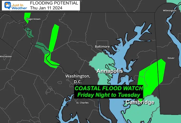
A Coastal Flood Watch has already been posted for places like Annapolis and Cambridge. More may be added. See below.
Strong winds and a band of heavy rain will also accompany this event. Again, it will be similar but perhaps not as extreme.
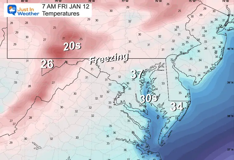
Much colder air will follow, and we will trade the potential for a snow event early next week.
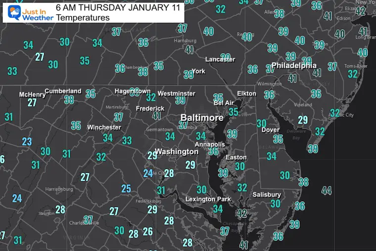
Morning Temperatures
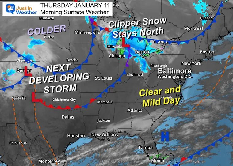
Morning Surface Weather
We get a quiet and mild day while an active storm track brings snow to the Great Lakes.
The next storm is located near Denver and will get organized in a hurry. This will yet again track through the Northern Plains, which will keep us on the warmer side. But there is plenty of cold air with this that will spill east after it passes.
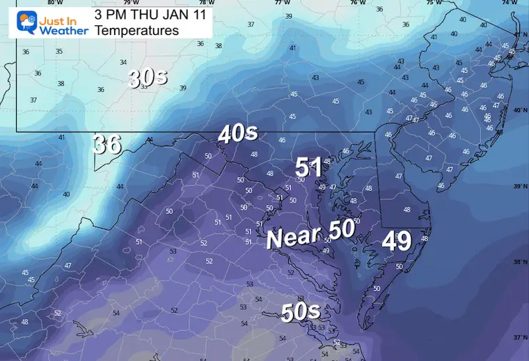
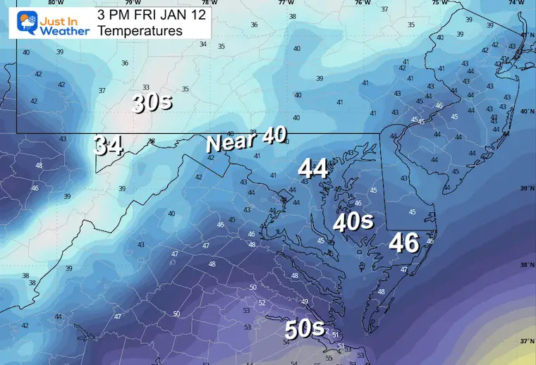
Afternoon Temperatures
CLIMATE DATA: Baltimore
TODAY January 11
Sunrise at 7:26 AM
Sunset at 5:03 PM
Normal Low in Baltimore: 26ºF
Record 1ºF in 1982
Normal High in Baltimore: 43ºF
Record 73ºF 1975
Friday Weather
Clouds will be increasing with rain by the evening. The worst will arrive OVERNIGHT.
Temperatures Morning
Temperatures Afternoon
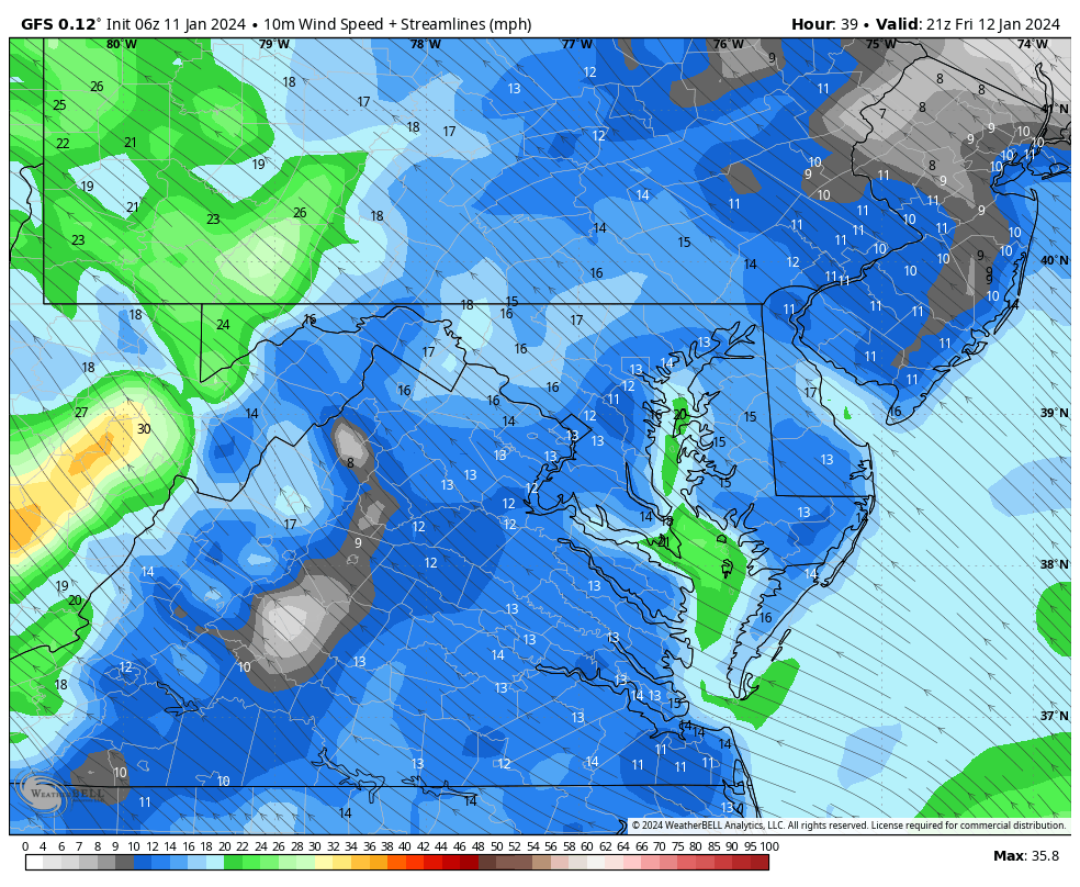
Wind Forecast
Friday Afternoon to Saturday at Noon
Again, from the Southeast, and may gust 40 to 60 mph! Then, the winds will shift to the West after the storm passes on Saturday.
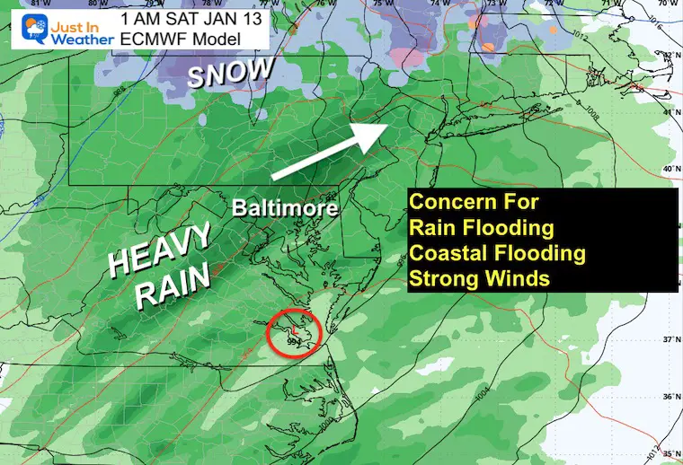
Storm Friday Evening to Saturday Morning
COASTAL FLOOD WATCH
At this point, the focus is on the Annapolis and Cambridge areas. Water levels may rise 3 Feet! This is less than the last storm, but it is still a problem.
IMPACTS…At 3.5 feet, water reaches the floor of the Maritime
- Museum in Annapolis begins to cover Bowyer Road on the Naval
- The Academy campus and numerous businesses on Dock Street are flooded, along with the City Dock parking lot.
* ADDITIONAL DETAILS…Tides up to 3 feet above normal during the Saturday morning high tide.
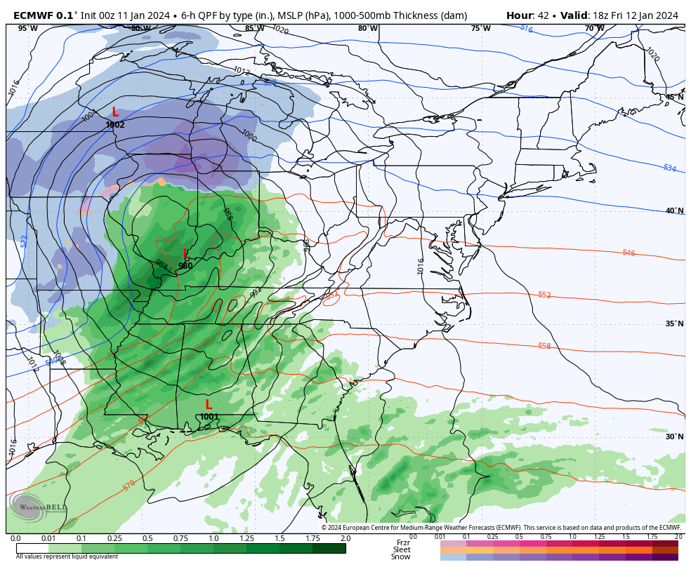
Storm Simulation: Friday Afternoon to Saturday Night
This looks like a potential repeat of what we just had. It will be a larger snowstorm for the Great Lakes… and may produce more flooding rain, and bay surge.
It looks like an overnight rain, ending Saturday with strong winds as well.
Snapshot Overnight
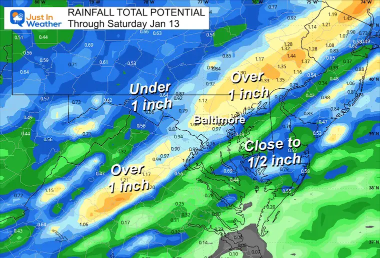
Rainfall
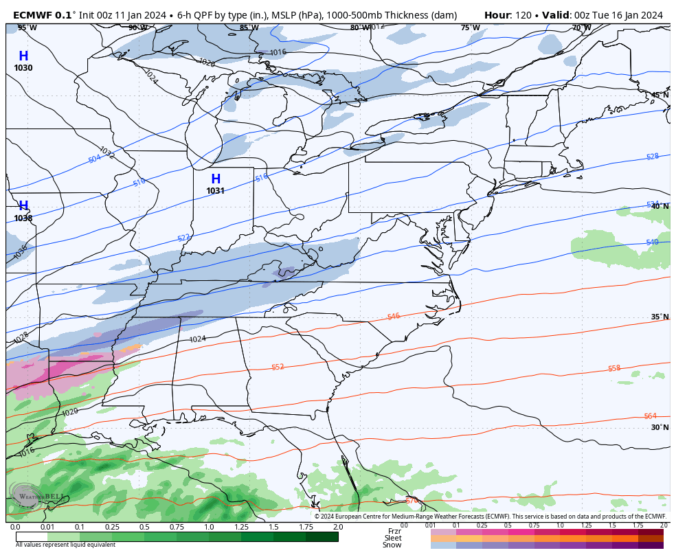
Snow Next Week
This looks like the jet stream along with the Arctic front, will help enhance a southern Track Storm. We need to consider this and may still adjust the timing and storm track… So, this is not a lock yet.
Animation from ECMWF Model
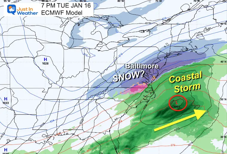
Monday Evening to Wednesday Afternoon
This did perform better than the GFS last weekend.
Snapshot Tuesday Night
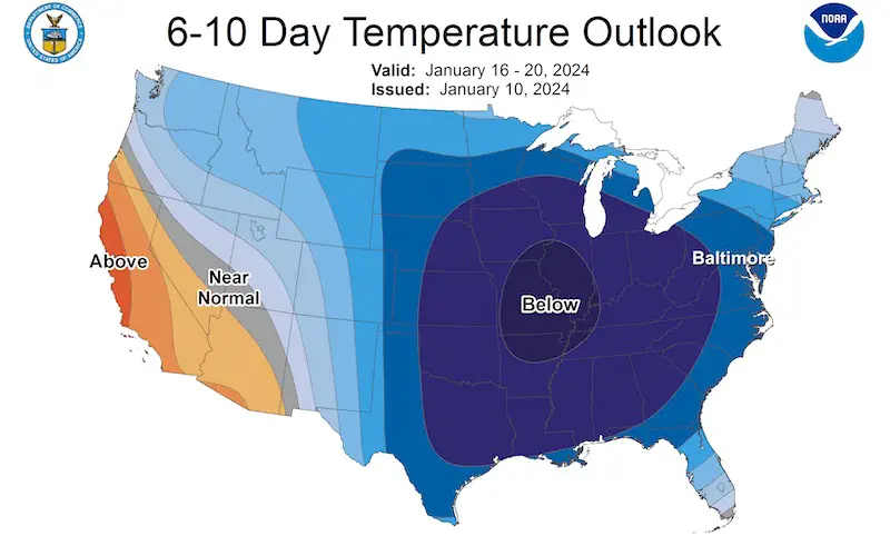
Temperature Outlook From NOAA
Next week will be colder!
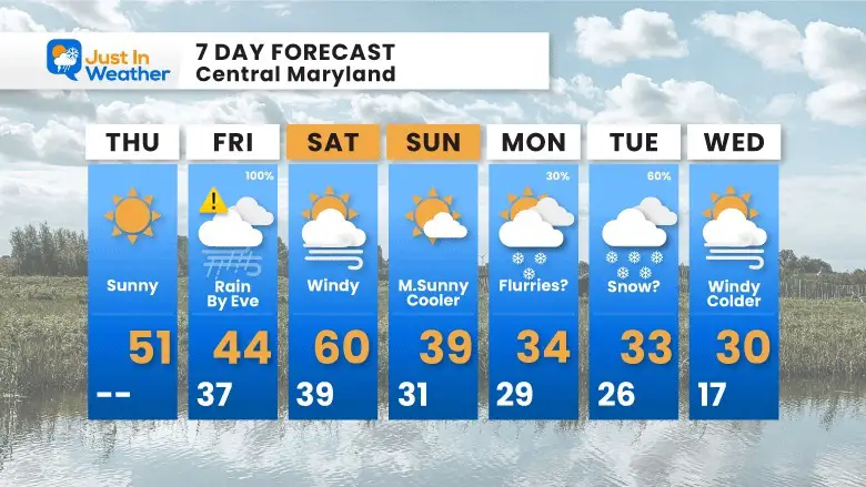
7 Day Forecast
The next storm may not be as extreme as what we just had, but it will be intense Friday night. Flooding from heavy rain and coastal water rising.
Colder air is on the way and may bring snow flurries on Monday and accumulation on Tuesday.
Subscribe for eMail Alerts
RECENT Winter Outlook Reports:

El Niño Winter Updates

Computer Models Support East Coast Storm Track

El Niño Advisory
The latest NOAA report is confident in a Very Strong event. Possibly HISTORIC! This refers to the temperatures in the Pacific, with impacts on the US Winter Storm Track.

Winter Weather Folklore: Top 20 and more signals from nature for snow.
NOAA’s Winter Outlook 2024
Winter Outlook 2024 From Two Farmers Almanacs Return to Cold and Snow
Explore More
Maryland Snow Climate History And Other Winter Pages

Faith in the Flakes Gear

STEM Assemblies/In School Fields Trips Are Back
Click to see more and ‘Book’ a visit to your school

Please share your thoughts and best weather pics/videos, or just keep in touch via social media
RESTATING MY MESSAGE ABOUT DYSLEXIA
I am aware there are some spelling and grammar typos and occasional other glitches. I take responsibility for my mistakes and even the computer glitches I may miss. I have made a few public statements over the years, but if you are new here, you may have missed it: I have dyslexia and found out during my second year at Cornell University. It didn’t stop me from getting my meteorology degree and being the first to get the AMS CBM in the Baltimore/Washington region. One of my professors told me that I had made it that far without knowing and to not let it be a crutch going forward. That was Mark Wysocki, and he was absolutely correct! I do miss my mistakes in my own proofreading. The autocorrect spell check on my computer sometimes does an injustice to make it worse. I also can make mistakes in forecasting. No one is perfect at predicting the future. All of the maps and information are accurate. The ‘wordy’ stuff can get sticky. There has been no editor who can check my work when I need it and have it ready to send out in a newsworthy timeline. Barbara Werner is a member of the web team that helps me maintain this site. She has taken it upon herself to edit typos when she is available. That could be AFTER you read this. I accept this and perhaps proves what you read is really from me… It’s part of my charm.
#FITF


