


Soggy Saturday Update: Rain Timeline Through Preakness In Baltimore
Friday, May 17, 2024 As we approach another weekend, we have yet another weather system bringing us rain. This will make 16 of 20 weekends this year with some wet…
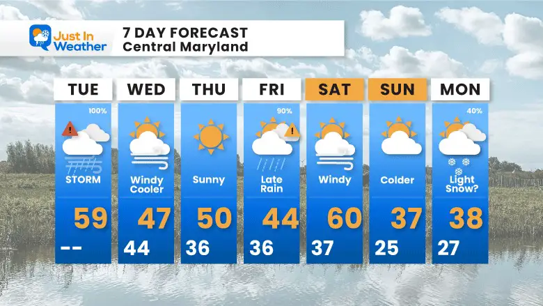
Tuesday January 9, 2024
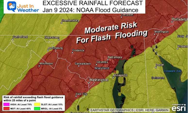
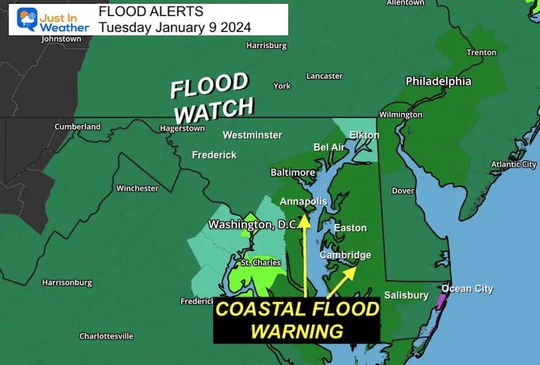
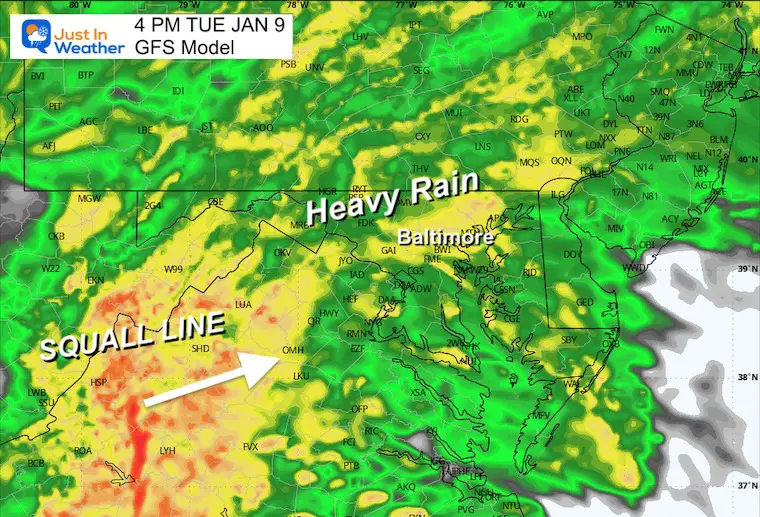
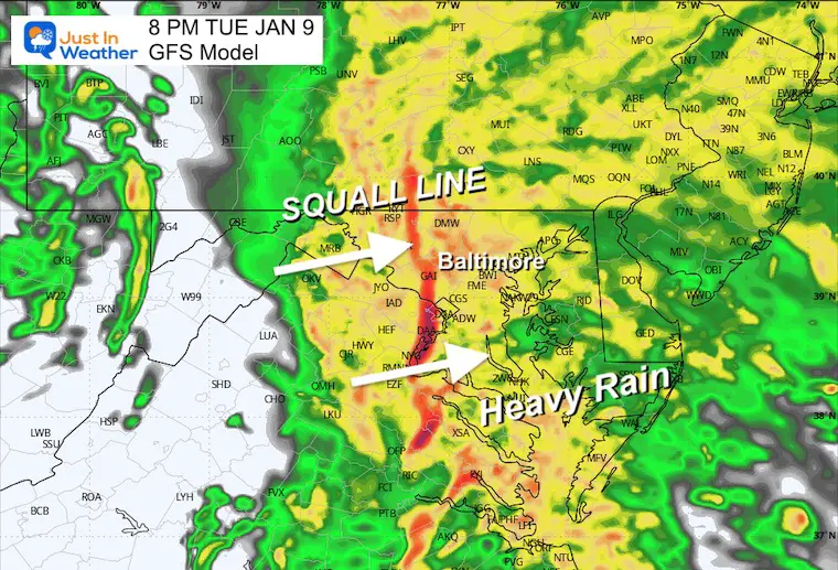
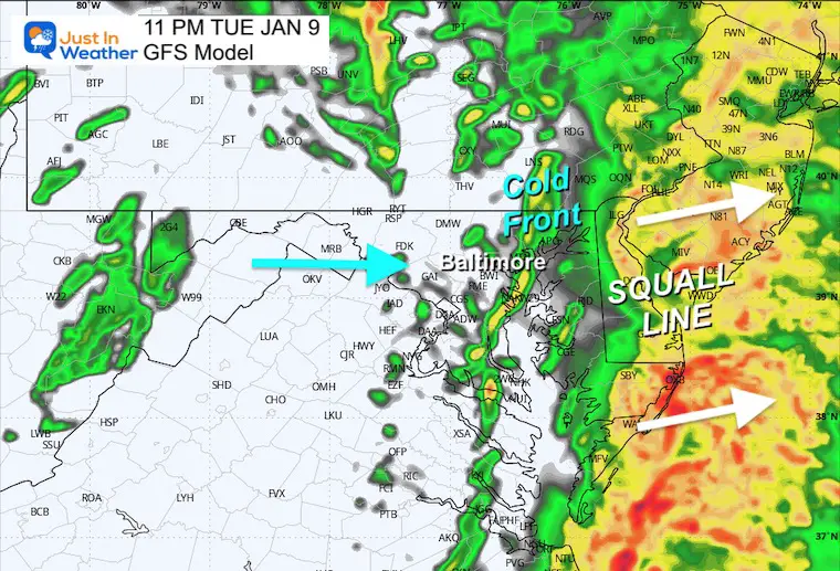
With the storm moving through today, the trend has been to increase the expectations for the impact. The latest has been expanding the High Wind Warning to include metro Washington, DC. This is in addition to NOAA posting a moderate risk for Flash Flooding to occur this evening. Yes, there may be some rumbles of thunder in addition to the loud wind and pounding rain. While it will be a bumpy ride, the squall line will bring the worst conditions between 7 PM and Midnight.
Here is a brief mid-afternoon update.
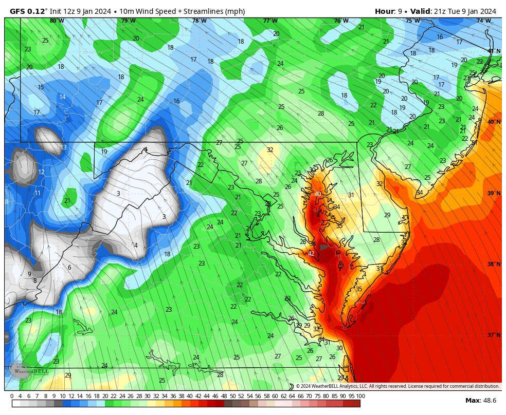
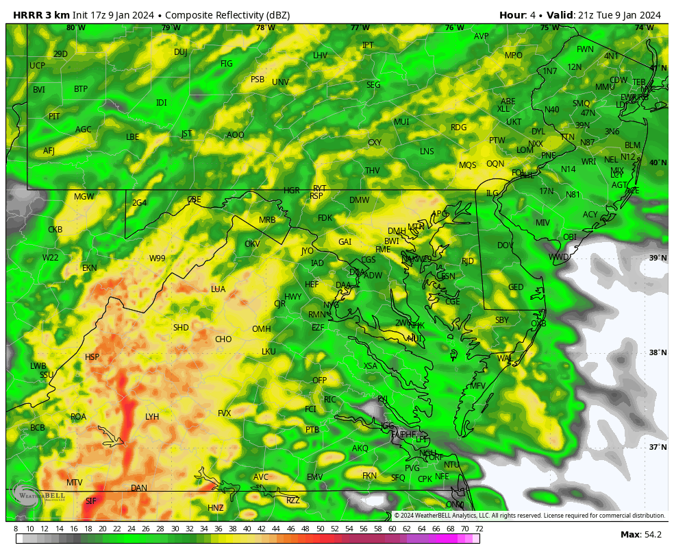
Live Radar and new model maps are below.
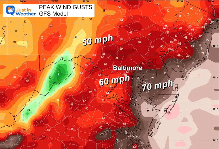
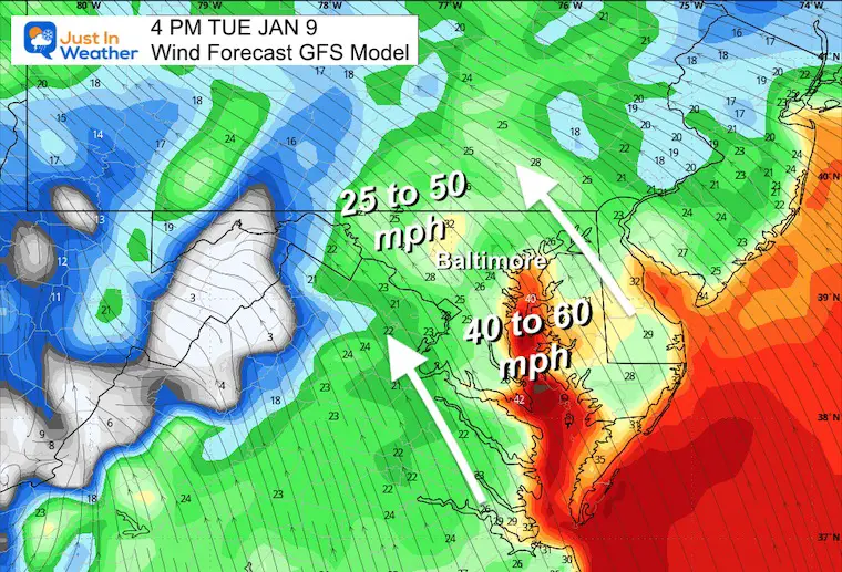
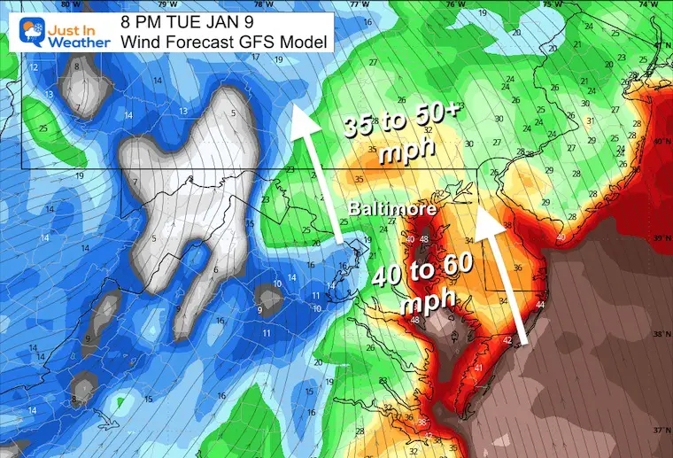
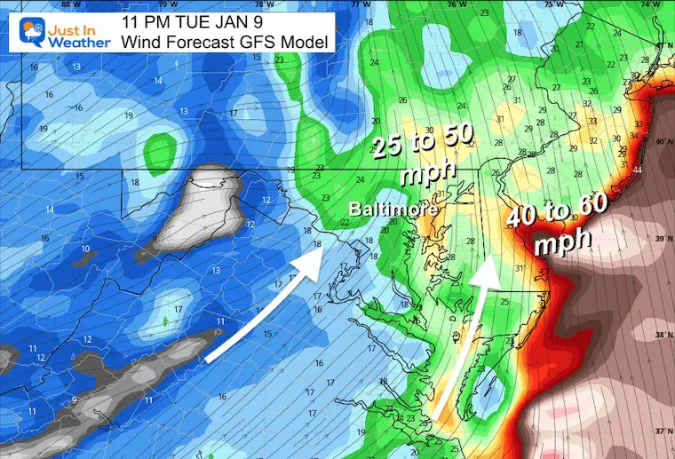
This region between Washington, Annapolis, and Baltimore is for the expectation of wind gusts to 60 mph. Inland areas and northern Delmarva can still expect winds gusting to 50 mph… Or Higher?
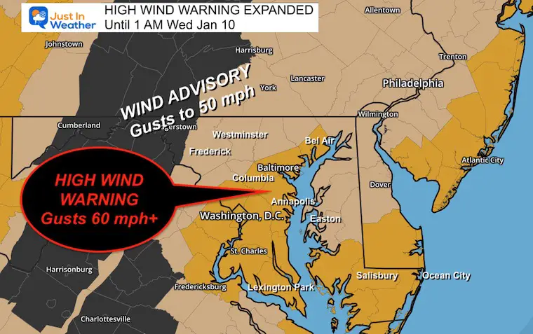
I have been curious about the computer guidance high numbers, but they have been consistent… So, it is worth considering the chance that some areas might push 70 mph wind gusts as the squall line moves through this evening.
The worst conditions will be between 7 PM and Midnight. See the timeline below.
NOTE: Maryland DOT has suggested the area bridges may be subject to closure if conditions get worse.
Key Timeframes Below
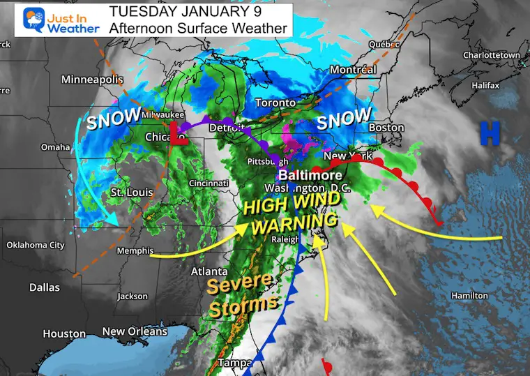
The storm is cranking at full force. The original Low is over Chicago, with the cold air locked up, producing snow across the Central Plains and also Northern PA into New York.
The energy is being transferred to the ‘triple point’ west of Baltimore. This is what is giving the new charge and rise to a squall line along the trailing cold front.
Winds will increase in conjunction with this storm, the cold front, and High Pressure off the coast.
High Wind Warning is for gusts to 60 mph, but computer guidance continues to support over 70 mph near the Chesapeake Bay and Delmarva tonight.
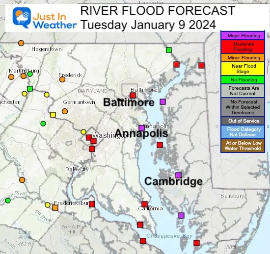
Moderate Risk for heavy rain may instigate Flash Flooding.
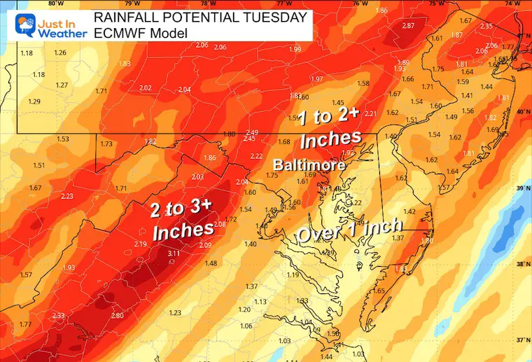
Using the European Model for a different perspective but the same general 1 to 3 inches is expected.
Click here or see the image for all Bay forecast maps
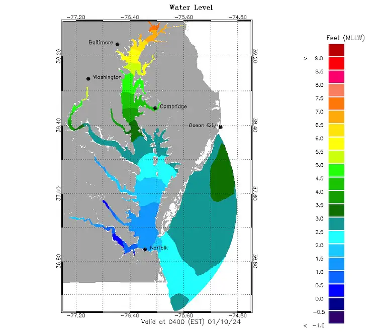
Click here to: Choose your location and timeframe for most locations around the Chesapeake Bay.


Computer Models Support East Coast Storm Track

The latest NOAA report is confident in a Very Strong event. Possibly HISTORIC! This refers to the temperatures in the Pacific, with impacts on the US Winter Storm Track.

Winter Weather Folklore: Top 20 and more signals from nature for snow.
Winter Outlook 2024 From Two Farmers Almanacs Return to Cold and Snow


Click to see more and ‘Book’ a visit to your school

I am aware there are some spelling and grammar typos and occasional other glitches. I take responsibility for my mistakes and even the computer glitches I may miss. I have made a few public statements over the years, but if you are new here, you may have missed it: I have dyslexia and found out during my second year at Cornell University. It didn’t stop me from getting my meteorology degree and being the first to get the AMS CBM in the Baltimore/Washington region. One of my professors told me that I had made it that far without knowing and to not let it be a crutch going forward. That was Mark Wysocki, and he was absolutely correct! I do miss my mistakes in my own proofreading. The autocorrect spell check on my computer sometimes does an injustice to make it worse. I also can make mistakes in forecasting. No one is perfect at predicting the future. All of the maps and information are accurate. The ‘wordy’ stuff can get sticky. There has been no editor who can check my work when I need it and have it ready to send out in a newsworthy timeline. Barbara Werner is a member of the web team that helps me maintain this site. She has taken it upon herself to edit typos when she is available. That could be AFTER you read this. I accept this and perhaps proves what you read is really from me… It’s part of my charm.
#FITF